
Long Beach Peninsula Surf Guide
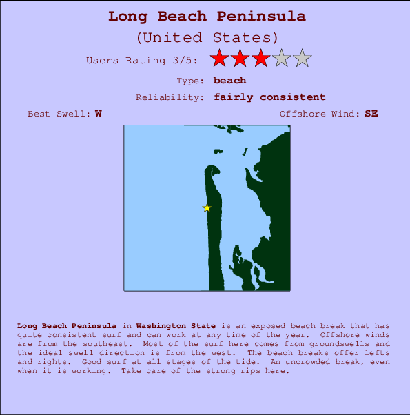
Long Beach Peninsula in Washington is an exposed beach break that has reasonably consistent surf and can work at any time of the year. The best wind direction is from the southeast. Windswells and groundswells in equal measure and the best swell direction is from the west. The beach breaks offer lefts and rights. Good surf at all stages of the tide. The location means that it never gets crowded. Dangerous rips are a hazard of surfing here.
Long Beach Peninsula Spot Info
| Type: | Rating: | Reliability: | Todays Sea Temp*: |
|---|---|---|---|
| fairly consistent | 17.4°C*ocean temperature recorded from satellite |
Surfing Long Beach Peninsula:
The best conditions reported for surf at Long Beach Peninsula occur when a West swell combines with an offshore wind direction from the Southeast.
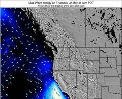
Voorspelde Golfenergie (Kracht): 12 uur


Long Beach Peninsula Surf:
Sunday, 2 August 2026, 08:17 Local time| Sunday 02 | ||||
| 8AM | 11AM | 2PM | 5PM | |
| Wave (m) | ||||
| Periode (s) | 8 | 9 | 9 | 9 |
| Wind (km/h) | ||||
| Wind | on | on | on | on |
- /breaks/Long-Beach-Peninsula/forecasts/latest
Long Beach Peninsula Surf Guide
Long Beach Peninsula in Washington is an exposed beach break that has reasonably consistent surf and can work at any time of the year. The best wind direction is from the southeast. Windswells and groundswells in equal measure and the best swell direction is from the west. The beach breaks offer lefts and rights. Good surf at all stages of the tide. The location means that it never gets crowded. Dangerous rips are a hazard of surfing here.
Long Beach Peninsula Spot Info
Type: Rating: Reliability: Todays Sea Temp*:  Beach
Beach 3
3fairly consistent 17.4°C*ocean temperature recorded from satelliteSurfing Long Beach Peninsula:
The best conditions reported for surf at Long Beach Peninsula occur when a West swell combines with an offshore wind direction from the Southeast.
Voorspelde Golfenergie (Kracht): 12 uur
Gebruik de tabbladen hierboven om de zeewatertemperatuur bij Long Beach Peninsula te bekijken, foto's van Long Beach Peninsula, Long Beach Peninsula gedetailleerde golfvoorspellingen, wind- en weersvoorspellingen, Long Beach Peninsula webcams, actuele wind in Washington live weerstations en Long Beach Peninsula getijdenvoorspellingen. De link van United States golfkaarten opent een grote afbeelding van United States en de omliggende zeeën. Deze golfkaarten kunnen worden dynamisch gemaakt worden met de verschillende golfcomponenten, golfenergie, golfperiode, golfhoogte, samen met de wind en weersvoorspellingen, het actuele weer en de zeetoestand volgens golfboeien uit United States, langskomende schepen en weerstations op de kust. Elk voorspelling pagina's voor dit surfstrand zijn voorzien van een wereldwijde en regionale golfzoeker om de beste surfsomstandigheden in het gebied rond Long Beach Peninsula te vinden.
Long Beach Peninsula Surf:
Sunday, 2 August 2026, 08:17 Local timeSunday 02 8AM 11AM 2PM 5PM Wave (m) Periode (s) 8 9 9 9 Wind (km/h) Wind on on on on - /breaks/Long-Beach-Peninsula/forecasts/latest
- /breaks/Long-Beach-Peninsula/forecasts/latest/six_day
Long Beach Peninsula Surf Guide
Long Beach Peninsula in Washington is an exposed beach break that has reasonably consistent surf and can work at any time of the year. The best wind direction is from the southeast. Windswells and groundswells in equal measure and the best swell direction is from the west. The beach breaks offer lefts and rights. Good surf at all stages of the tide. The location means that it never gets crowded. Dangerous rips are a hazard of surfing here.
Long Beach Peninsula Spot Info
Type: Rating: Reliability: Todays Sea Temp*: Beach3fairly consistent 17.4°C*ocean temperature recorded from satelliteSurfing Long Beach Peninsula:
The best conditions reported for surf at Long Beach Peninsula occur when a West swell combines with an offshore wind direction from the Southeast.
Voorspelde Golfenergie (Kracht): 12 uur
Gebruik de tabbladen hierboven om de zeewatertemperatuur bij Long Beach Peninsula te bekijken, foto's van Long Beach Peninsula, Long Beach Peninsula gedetailleerde golfvoorspellingen, wind- en weersvoorspellingen, Long Beach Peninsula webcams, actuele wind in Washington live weerstations en Long Beach Peninsula getijdenvoorspellingen. De link van United States golfkaarten opent een grote afbeelding van United States en de omliggende zeeën. Deze golfkaarten kunnen worden dynamisch gemaakt worden met de verschillende golfcomponenten, golfenergie, golfperiode, golfhoogte, samen met de wind en weersvoorspellingen, het actuele weer en de zeetoestand volgens golfboeien uit United States, langskomende schepen en weerstations op de kust. Elk voorspelling pagina's voor dit surfstrand zijn voorzien van een wereldwijde en regionale golfzoeker om de beste surfsomstandigheden in het gebied rond Long Beach Peninsula te vinden.
Long Beach Peninsula Surf:
Sunday, 2 August 2026, 08:17 Local timeSunday 02 8AM 11AM 2PM 5PM Wave (m) Periode (s) 8 9 9 9 Wind (km/h) Wind on on on on - /breaks/Long-Beach-Peninsula/forecasts/latest
Long Beach Peninsula Surf Guide
Long Beach Peninsula in Washington is an exposed beach break that has reasonably consistent surf and can work at any time of the year. The best wind direction is from the southeast. Windswells and groundswells in equal measure and the best swell direction is from the west. The beach breaks offer lefts and rights. Good surf at all stages of the tide. The location means that it never gets crowded. Dangerous rips are a hazard of surfing here.
Long Beach Peninsula Spot Info
Type: Rating: Reliability: Todays Sea Temp*: Beach3fairly consistent 17.4°C*ocean temperature recorded from satelliteSurfing Long Beach Peninsula:
The best conditions reported for surf at Long Beach Peninsula occur when a West swell combines with an offshore wind direction from the Southeast.
Voorspelde Golfenergie (Kracht): 12 uur
Gebruik de tabbladen hierboven om de zeewatertemperatuur bij Long Beach Peninsula te bekijken, foto's van Long Beach Peninsula, Long Beach Peninsula gedetailleerde golfvoorspellingen, wind- en weersvoorspellingen, Long Beach Peninsula webcams, actuele wind in Washington live weerstations en Long Beach Peninsula getijdenvoorspellingen. De link van United States golfkaarten opent een grote afbeelding van United States en de omliggende zeeën. Deze golfkaarten kunnen worden dynamisch gemaakt worden met de verschillende golfcomponenten, golfenergie, golfperiode, golfhoogte, samen met de wind en weersvoorspellingen, het actuele weer en de zeetoestand volgens golfboeien uit United States, langskomende schepen en weerstations op de kust. Elk voorspelling pagina's voor dit surfstrand zijn voorzien van een wereldwijde en regionale golfzoeker om de beste surfsomstandigheden in het gebied rond Long Beach Peninsula te vinden.
Long Beach Peninsula Surf:
Sunday, 2 August 2026, 08:17 Local timeSunday 02 8AM 11AM 2PM 5PM Wave (m) Periode (s) 8 9 9 9 Wind (km/h) Wind on on on on Tide Times:
Voor Nahcotta, Willipa Bay, Washington, %{dist} %{km} van %{location}.
VOLGENDE IS OM (lokale tijd) resterende tijd hoog water laag water Long Beach Peninsula Tide Times and Tide Chart
Live Weather:
At BUOY-TOKW1, 18 km from Long Beach Peninsula.
light winds from the E
(km/h)Air temperature
15.0°CCurrent weather near Long Beach Peninsula
Buoy Data:
At Grays Harbor, WA , 22 miles from Long Beach Peninsula.
2AM 3AM 4AM 5AM Gegevens Leeftijd 5 hr 4 hr 3 hr 2 hr Golfhoogte (m) 

Dominante Periode (s) 8 8 9 9 Overall Long Beach Peninsula Surf Consistency and Wind Distribution in August


Wind stats for Long Beach Peninsula: see the variation in direction and stength by month.
surffoto's uit
de galerijContourlijnen: Wegen & Rivieren: Kies een surflokatie uit het menu 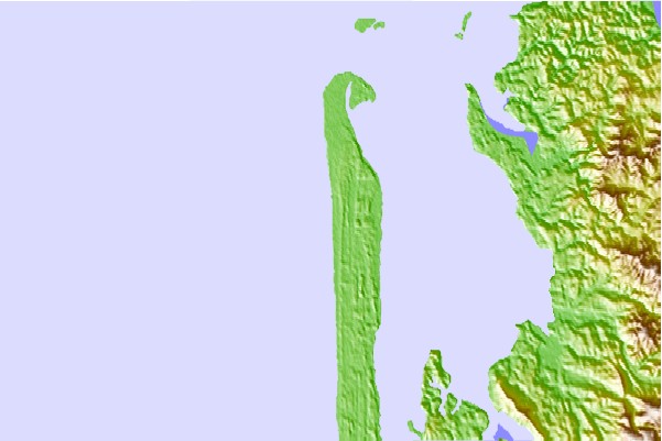
Gebruik deze reliëfkaart om naar de surfspots en de getijdenstations van Washington toe te gaan, in de buurt van Long Beach Peninsula.
Andere Dichtbijzijnde Surflocaties van Long Beach Peninsula:
(klik op locatienaam voor meer informatie)- Closest Locatie5 mi
- Second closest Locatie20 mi
- Third closest Locatie21 mi
- Fourth closest Locatie21 mi
- Fifth closest Locatie24 mi
Dichtstbijzijnde golfboeien bij Long Beach Peninsula:
- Closest golfboei22 mi
- Second closest golfboei24 mi
- Third closest golfboei36 mi
- Fourth closest golfboei41 mi
- Fifth closest golfboei63 mi
Getijdenstations in de buurt van Long Beach Peninsula:
- Closest getijdenstationNahcotta, Willipa Bay5 mi
- Second closest getijdenstationBay Center, Palix River, Willapa Bay7 mi
- Third closest getijdenstationPalix River, south fork, Willapa Bay7 mi
- Fourth closest getijdenstationParadise Point, Long Island, Willapa Bay9 mi
- Fifth closest getijdenstationToke Point, Willapa Bay11 mi
Airports
- The closest passenger airport to Long Beach Peninsula is Gray Aaf (Fort Lewis) Airport (GRF) in USA, 126 km (78 miles) away (directly).
- The second nearest airport to Long Beach Peninsula is Scappoose Industrial Airpark (San Luis) Airport (SPB), also in USA, 128 km (80 miles) away.
- Third is Mc Chord Afb (Tacoma) Airport (TCM) in USA, 136 km (84 miles) away.
- Portland International Airport (PDX) in USA is 157 km (98 miles) away.
- Seattle Tacoma International Airport (SEA), also in USA is the fifth nearest airport to Long Beach Peninsula and is 165 km (102 miles) away.
- /breaks/Long-Beach-Peninsula/forecasts/latest

 Nearest