
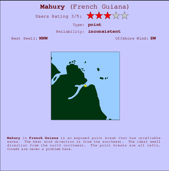
Mahury Surf Guide
Mahury in French Guiana is an exposed point break that does not work very often. The best wind direction is from the southwest. The best swell direction is from the north northwest. The point breaks are all lefts. The location means that it never gets crowded.
Mahury Spot Info
| Type: | Rating: | Reliability: | Todays Sea Temp*: |
|---|---|---|---|
| inconsistent | 28.3°C*ocean temperature recorded from satellite |
Surfing Mahury:
The best conditions reported for surf at Mahury occur when a North-northwest swell combines with an offshore wind direction from the Southwest.
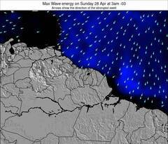
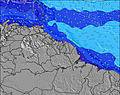
Voorspelde Golfenergie (Kracht): 12 uur
Mahury Surf:
Friday, 17 July 2026, 04:21 Local time| Friday 17 | ||||
| 0AM | 3AM | 6AM | 9AM | |
| Wave (m) | ||||
| Periode (s) | 7 | 7 | 7 | 7 |
| Wind (km/h) | ||||
| Wind | cross | cross | cross | cross- on |
- /breaks/Mahury/forecasts/latest

Mahury Surf Guide
Mahury in French Guiana is an exposed point break that does not work very often. The best wind direction is from the southwest. The best swell direction is from the north northwest. The point breaks are all lefts. The location means that it never gets crowded.
Mahury Spot Info
Type: Rating: Reliability: Todays Sea Temp*:  Point
Point 3
3inconsistent 28.3°C*ocean temperature recorded from satelliteSurfing Mahury:
The best conditions reported for surf at Mahury occur when a North-northwest swell combines with an offshore wind direction from the Southwest.
Voorspelde Golfenergie (Kracht): 12 uur
Gebruik de tabbladen hierboven om de zeewatertemperatuur bij Mahury te bekijken, foto's van Mahury, Mahury gedetailleerde golfvoorspellingen, wind- en weersvoorspellingen, Mahury webcams, actuele wind in French Guiana live weerstations en Mahury getijdenvoorspellingen. De link van French Guiana golfkaarten opent een grote afbeelding van French Guiana en de omliggende zeeën. Deze golfkaarten kunnen worden dynamisch gemaakt worden met de verschillende golfcomponenten, golfenergie, golfperiode, golfhoogte, samen met de wind en weersvoorspellingen, het actuele weer en de zeetoestand volgens golfboeien uit French Guiana, langskomende schepen en weerstations op de kust. Elk voorspelling pagina's voor dit surfstrand zijn voorzien van een wereldwijde en regionale golfzoeker om de beste surfsomstandigheden in het gebied rond Mahury te vinden.
Mahury Surf:
Friday, 17 July 2026, 04:21 Local timeFriday 17 0AM 3AM 6AM 9AM Wave (m) Periode (s) 7 7 7 7 Wind (km/h) Wind cross cross cross cross-
on- /breaks/Mahury/forecasts/latest
- /breaks/Mahury/forecasts/latest/six_day
Mahury Surf Guide
Mahury in French Guiana is an exposed point break that does not work very often. The best wind direction is from the southwest. The best swell direction is from the north northwest. The point breaks are all lefts. The location means that it never gets crowded.
Mahury Spot Info
Type: Rating: Reliability: Todays Sea Temp*: Point3inconsistent 28.3°C*ocean temperature recorded from satelliteSurfing Mahury:
The best conditions reported for surf at Mahury occur when a North-northwest swell combines with an offshore wind direction from the Southwest.
Voorspelde Golfenergie (Kracht): 12 uur
Gebruik de tabbladen hierboven om de zeewatertemperatuur bij Mahury te bekijken, foto's van Mahury, Mahury gedetailleerde golfvoorspellingen, wind- en weersvoorspellingen, Mahury webcams, actuele wind in French Guiana live weerstations en Mahury getijdenvoorspellingen. De link van French Guiana golfkaarten opent een grote afbeelding van French Guiana en de omliggende zeeën. Deze golfkaarten kunnen worden dynamisch gemaakt worden met de verschillende golfcomponenten, golfenergie, golfperiode, golfhoogte, samen met de wind en weersvoorspellingen, het actuele weer en de zeetoestand volgens golfboeien uit French Guiana, langskomende schepen en weerstations op de kust. Elk voorspelling pagina's voor dit surfstrand zijn voorzien van een wereldwijde en regionale golfzoeker om de beste surfsomstandigheden in het gebied rond Mahury te vinden.
Mahury Surf:
Friday, 17 July 2026, 04:21 Local timeFriday 17 0AM 3AM 6AM 9AM Wave (m) Periode (s) 7 7 7 7 Wind (km/h) Wind cross cross cross cross-
on- /breaks/Mahury/forecasts/latest
Mahury Surf Guide
Mahury in French Guiana is an exposed point break that does not work very often. The best wind direction is from the southwest. The best swell direction is from the north northwest. The point breaks are all lefts. The location means that it never gets crowded.
Mahury Spot Info
Type: Rating: Reliability: Todays Sea Temp*: Point3inconsistent 28.3°C*ocean temperature recorded from satelliteSurfing Mahury:
The best conditions reported for surf at Mahury occur when a North-northwest swell combines with an offshore wind direction from the Southwest.
Voorspelde Golfenergie (Kracht): 12 uur
Gebruik de tabbladen hierboven om de zeewatertemperatuur bij Mahury te bekijken, foto's van Mahury, Mahury gedetailleerde golfvoorspellingen, wind- en weersvoorspellingen, Mahury webcams, actuele wind in French Guiana live weerstations en Mahury getijdenvoorspellingen. De link van French Guiana golfkaarten opent een grote afbeelding van French Guiana en de omliggende zeeën. Deze golfkaarten kunnen worden dynamisch gemaakt worden met de verschillende golfcomponenten, golfenergie, golfperiode, golfhoogte, samen met de wind en weersvoorspellingen, het actuele weer en de zeetoestand volgens golfboeien uit French Guiana, langskomende schepen en weerstations op de kust. Elk voorspelling pagina's voor dit surfstrand zijn voorzien van een wereldwijde en regionale golfzoeker om de beste surfsomstandigheden in het gebied rond Mahury te vinden.
Mahury Surf:
Friday, 17 July 2026, 04:21 Local timeFriday 17 0AM 3AM 6AM 9AM Wave (m) Periode (s) 7 7 7 7 Wind (km/h) Wind cross cross cross cross-
onTide Times:
Voor Remire-Montjoly, %{dist} %{km} van %{location}.
VOLGENDE IS OM (lokale tijd) resterende tijd hoog water laag water Mahury Tide Times and Tide Chart
Live Weather:
At St Hilaire du Rorota, 3 km from Mahury.
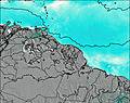
fresh winds from the SE
(km/h)Air temperature
25.1°COverall Mahury Surf Consistency and Wind Distribution in July
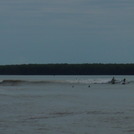
surffoto's uit
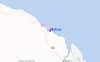
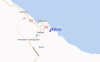
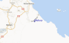
de galerijContourlijnen: Wegen & Rivieren: Kies een surflokatie uit het menu 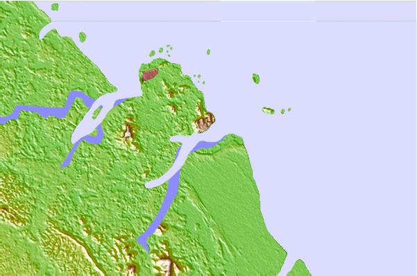
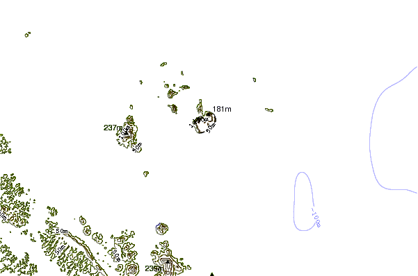
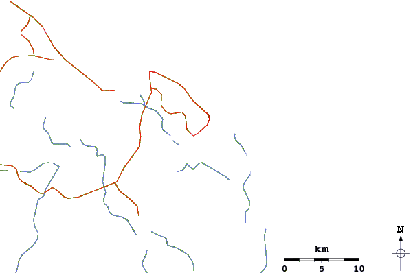
Gebruik deze reliëfkaart om naar de surfspots en de getijdenstations van French Guiana toe te gaan, in de buurt van Mahury.
Andere Dichtbijzijnde Surflocaties van Mahury:
(klik op locatienaam voor meer informatie)- Closest Locatie2 mi
- Second closest Locatie6 mi
- Third closest Locatie7 mi
- Fourth closest Locatie37 mi
- Fifth closest Locatie464 mi
Dichtstbijzijnde golfboeien bij Mahury:
- Closest golfboei667 mi
- Second closest golfboei725 mi
- Third closest golfboei782 mi
- Fourth closest golfboei1109 mi
- Fifth closest golfboei1239 mi
Getijdenstations in de buurt van Mahury:
- Closest getijdenstationRemire-Montjoly4 mi
- Second closest getijdenstationMatoury6 mi
- Third closest getijdenstationCayenne7 mi
- Fourth closest getijdenstationMacouria9 mi
- Fifth closest getijdenstationIles du Salut37 mi
Airports
- The nearest passenger airport to Mahury is Rochambeau (Cayenne) Airport (CAY) in French Guyana, which is 12 km (7 miles) away (directly).
- The second closest airport to Mahury is Johan A Pengel International (Zandery) Airport (PBM) in Surinam, 331 km (206 miles) away.
- /breaks/Mahury/forecasts/latest


 Nearest