
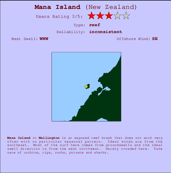
Mana Island Surf Guide
Mana Island in Wellington is an exposed reef break that does not work very often with no particular seasonal pattern. Works best in offshore winds from the southeast. Most of the surf here comes from groundswells and the optimum swell angle is from the west northwest.. Even when there are waves, it's not likley to be crowded. Beware of urchins, rips, rocks, private and sharks.
Mana Island Spot Info
| Type: | Rating: | Reliability: | Todays Sea Temp*: |
|---|---|---|---|
| inconsistent | 12.8°C*ocean temperature recorded from satellite |
Surfing Mana Island:
The best conditions reported for surf at Mana Island occur when a West-northwest swell combines with an offshore wind direction from the Southeast.

Voorspelde Golfenergie (Kracht): 12 uur


Mana Island Surf:
Wednesday, 22 July 2026, 13:10 Local time| Wednesday 22 | ||||
| 9AM | 12PM | 3PM | 6PM | |
| Wave (m) | ||||
| Periode (s) | 12 | 12 | 4 | 5 |
| Wind (km/h) | ||||
| Wind | cross | cross | glass | off |
- /breaks/Mana-Island/forecasts/latest
Mana Island Surf Guide
Mana Island in Wellington is an exposed reef break that does not work very often with no particular seasonal pattern. Works best in offshore winds from the southeast. Most of the surf here comes from groundswells and the optimum swell angle is from the west northwest.. Even when there are waves, it's not likley to be crowded. Beware of urchins, rips, rocks, private and sharks.
Mana Island Spot Info
Type: Rating: Reliability: Todays Sea Temp*:  Reef
Reef 3
3inconsistent 12.8°C*ocean temperature recorded from satelliteSurfing Mana Island:
The best conditions reported for surf at Mana Island occur when a West-northwest swell combines with an offshore wind direction from the Southeast.
Voorspelde Golfenergie (Kracht): 12 uur
Gebruik de tabbladen hierboven om de zeewatertemperatuur bij Mana Island te bekijken, foto's van Mana Island, Mana Island gedetailleerde golfvoorspellingen, wind- en weersvoorspellingen, Mana Island webcams, actuele wind in Wellington live weerstations en Mana Island getijdenvoorspellingen. De link van New Zealand golfkaarten opent een grote afbeelding van New Zealand en de omliggende zeeën. Deze golfkaarten kunnen worden dynamisch gemaakt worden met de verschillende golfcomponenten, golfenergie, golfperiode, golfhoogte, samen met de wind en weersvoorspellingen, het actuele weer en de zeetoestand volgens golfboeien uit New Zealand, langskomende schepen en weerstations op de kust. Elk voorspelling pagina's voor dit surfstrand zijn voorzien van een wereldwijde en regionale golfzoeker om de beste surfsomstandigheden in het gebied rond Mana Island te vinden.
Mana Island Surf:
Wednesday, 22 July 2026, 13:10 Local timeWednesday 22 9AM 12PM 3PM 6PM Wave (m) Periode (s) 12 12 4 5 Wind (km/h) Wind cross cross glass off - /breaks/Mana-Island/forecasts/latest
- /breaks/Mana-Island/forecasts/latest/six_day
Mana Island Surf Guide
Mana Island in Wellington is an exposed reef break that does not work very often with no particular seasonal pattern. Works best in offshore winds from the southeast. Most of the surf here comes from groundswells and the optimum swell angle is from the west northwest.. Even when there are waves, it's not likley to be crowded. Beware of urchins, rips, rocks, private and sharks.
Mana Island Spot Info
Type: Rating: Reliability: Todays Sea Temp*: Reef3inconsistent 12.8°C*ocean temperature recorded from satelliteSurfing Mana Island:
The best conditions reported for surf at Mana Island occur when a West-northwest swell combines with an offshore wind direction from the Southeast.
Voorspelde Golfenergie (Kracht): 12 uur
Gebruik de tabbladen hierboven om de zeewatertemperatuur bij Mana Island te bekijken, foto's van Mana Island, Mana Island gedetailleerde golfvoorspellingen, wind- en weersvoorspellingen, Mana Island webcams, actuele wind in Wellington live weerstations en Mana Island getijdenvoorspellingen. De link van New Zealand golfkaarten opent een grote afbeelding van New Zealand en de omliggende zeeën. Deze golfkaarten kunnen worden dynamisch gemaakt worden met de verschillende golfcomponenten, golfenergie, golfperiode, golfhoogte, samen met de wind en weersvoorspellingen, het actuele weer en de zeetoestand volgens golfboeien uit New Zealand, langskomende schepen en weerstations op de kust. Elk voorspelling pagina's voor dit surfstrand zijn voorzien van een wereldwijde en regionale golfzoeker om de beste surfsomstandigheden in het gebied rond Mana Island te vinden.
Mana Island Surf:
Wednesday, 22 July 2026, 13:10 Local timeWednesday 22 9AM 12PM 3PM 6PM Wave (m) Periode (s) 12 12 4 5 Wind (km/h) Wind cross cross glass off - /breaks/Mana-Island/forecasts/latest
Mana Island Surf Guide
Mana Island in Wellington is an exposed reef break that does not work very often with no particular seasonal pattern. Works best in offshore winds from the southeast. Most of the surf here comes from groundswells and the optimum swell angle is from the west northwest.. Even when there are waves, it's not likley to be crowded. Beware of urchins, rips, rocks, private and sharks.
Mana Island Spot Info
Type: Rating: Reliability: Todays Sea Temp*: Reef3inconsistent 12.8°C*ocean temperature recorded from satelliteSurfing Mana Island:
The best conditions reported for surf at Mana Island occur when a West-northwest swell combines with an offshore wind direction from the Southeast.
Voorspelde Golfenergie (Kracht): 12 uur
Gebruik de tabbladen hierboven om de zeewatertemperatuur bij Mana Island te bekijken, foto's van Mana Island, Mana Island gedetailleerde golfvoorspellingen, wind- en weersvoorspellingen, Mana Island webcams, actuele wind in Wellington live weerstations en Mana Island getijdenvoorspellingen. De link van New Zealand golfkaarten opent een grote afbeelding van New Zealand en de omliggende zeeën. Deze golfkaarten kunnen worden dynamisch gemaakt worden met de verschillende golfcomponenten, golfenergie, golfperiode, golfhoogte, samen met de wind en weersvoorspellingen, het actuele weer en de zeetoestand volgens golfboeien uit New Zealand, langskomende schepen en weerstations op de kust. Elk voorspelling pagina's voor dit surfstrand zijn voorzien van een wereldwijde en regionale golfzoeker om de beste surfsomstandigheden in het gebied rond Mana Island te vinden.
Mana Island Surf:
Wednesday, 22 July 2026, 13:10 Local timeWednesday 22 9AM 12PM 3PM 6PM Wave (m) Periode (s) 12 12 4 5 Wind (km/h) Wind cross cross glass off Tide Times:
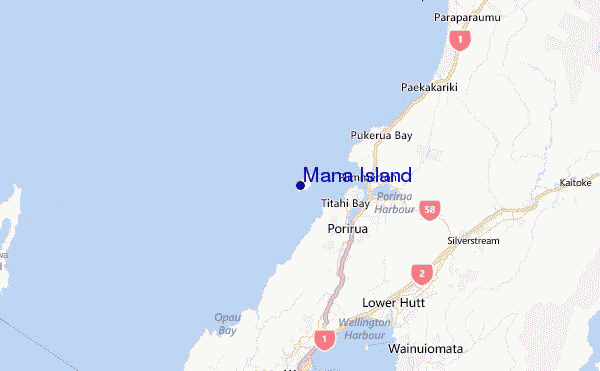
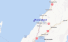
Voor Porirua Harbour (Plimmerton), New Zealand, %{dist} %{km} van %{location}.
VOLGENDE IS OM (lokale tijd) resterende tijd hoog water laag water Mana Island Tide Times and Tide Chart
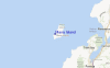
Live Weather:
At Porirua City Automatic Weather Station, 7 km from Mana Island.
light winds from the NW
(km/h)
DryAir temperature
14.2°COverall Mana Island Surf Consistency and Wind Distribution in July


Wind stats for Mana Island: see the variation in direction and stength by month.
surffoto's uit
de galerijContourlijnen: Wegen & Rivieren: Kies een surflokatie uit het menu 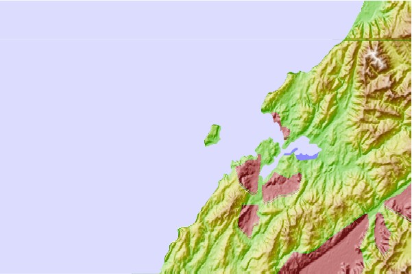
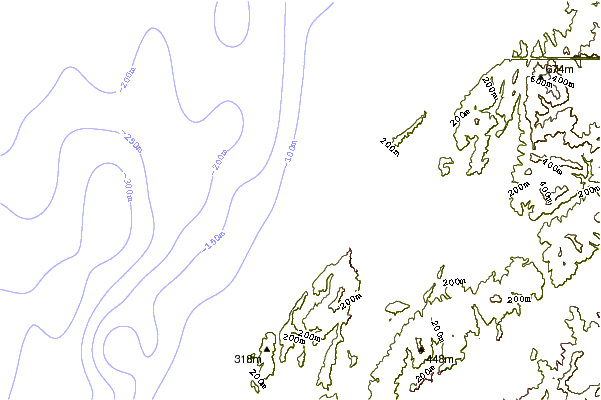

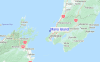
Gebruik deze reliëfkaart om naar de surfspots en de getijdenstations van Wellington toe te gaan, in de buurt van Mana Island.
Andere Dichtbijzijnde Surflocaties van Mana Island:
(klik op locatienaam voor meer informatie)- Closest Locatie3 mi
- Second closest Locatie4 mi
- Third closest Locatie5 mi
- Fourth closest Locatie7 mi
- Fifth closest Locatie12 mi
Dichtstbijzijnde golfboeien bij Mana Island:
- Closest golfboei25 mi
- Second closest golfboei80 mi
- Third closest golfboei101 mi
- Fourth closest golfboei254 mi
- Fifth closest golfboei360 mi
Getijdenstations in de buurt van Mana Island:
- Closest getijdenstationPorirua Harbour (Plimmerton)4 mi
- Second closest getijdenstationFishermans Rock9 mi
- Third closest getijdenstationMakara Bay9 mi
- Fourth closest getijdenstationLower Hutt12 mi
- Fifth closest getijdenstationWellington14 mi
Airports
- The closest passenger airport to Mana Island is Paraparaumu Airport (PPQ) in New Zealand, 27 km (17 miles) away (directly).
- The second nearest airport to Mana Island is Wellington International Airport (WLG), also in New Zealand, 27 km (17 miles) away.
- Third is Masterton Airport (MRO) in New Zealand, 73 km (45 miles) away.
- Woodbourne Airport (BHE) in New Zealand is 89 km (55 miles) away.
- Palmerston North Airport (PMR), also in New Zealand is the fifth nearest airport to Mana Island and is 111 km (69 miles) away.
- /breaks/Mana-Island/forecasts/latest

 Nearest