

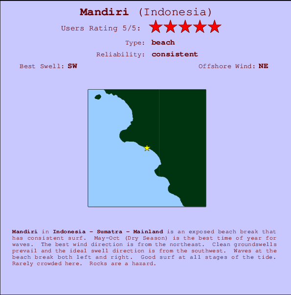
Mandiri Surf Guide
Mandiri in Sumatra is an exposed beach break that has consistent surf. May-Oct (Dry Season) is the best time of year for waves. Offshore winds blow from the northeast. Groundswells more frequent than windswells and the ideal swell direction is from the southwest. Waves at the beach break both left and right. Unlikely to be too crowded, even when the surf is up. Take care to avoid the rocks.
Mandiri Spot Info
| Type: | Rating: | Reliability: | Todays Sea Temp*: |
|---|---|---|---|
| consistent | 29.1°C*ocean temperature recorded from satellite |
Surfing Mandiri:
The best conditions reported for surf at Mandiri occur when a Southwest swell combines with an offshore wind direction from the Northeast.

Voorspelde Golfenergie (Kracht): 12 uur


Mandiri Surf:
Thursday, 16 July 2026, 09:27 Local time| Thursday 16 | ||||
| 4AM | 7AM | 10AM | 1PM | |
| Wave (m) | ||||
| Periode (s) | 15 | 15 | 15 | 15 |
| Wind (km/h) | ||||
| Wind | cross- off |
cross- off |
cross- on |
cross- on |
- /breaks/Mandiri/forecasts/latest
Mandiri Surf Guide
Mandiri in Sumatra is an exposed beach break that has consistent surf. May-Oct (Dry Season) is the best time of year for waves. Offshore winds blow from the northeast. Groundswells more frequent than windswells and the ideal swell direction is from the southwest. Waves at the beach break both left and right. Unlikely to be too crowded, even when the surf is up. Take care to avoid the rocks.
Mandiri Spot Info
Type: Rating: Reliability: Todays Sea Temp*:  Beach
Beach 5
5consistent 29.1°C*ocean temperature recorded from satelliteSurfing Mandiri:
The best conditions reported for surf at Mandiri occur when a Southwest swell combines with an offshore wind direction from the Northeast.
Voorspelde Golfenergie (Kracht): 12 uur
Gebruik de tabbladen hierboven om de zeewatertemperatuur bij Mandiri te bekijken, foto's van Mandiri, Mandiri gedetailleerde golfvoorspellingen, wind- en weersvoorspellingen, Mandiri webcams, actuele wind in Sumatra - Mainland live weerstations en Mandiri getijdenvoorspellingen. De link van Indonesia golfkaarten opent een grote afbeelding van Indonesia en de omliggende zeeën. Deze golfkaarten kunnen worden dynamisch gemaakt worden met de verschillende golfcomponenten, golfenergie, golfperiode, golfhoogte, samen met de wind en weersvoorspellingen, het actuele weer en de zeetoestand volgens golfboeien uit Indonesia, langskomende schepen en weerstations op de kust. Elk voorspelling pagina's voor dit surfstrand zijn voorzien van een wereldwijde en regionale golfzoeker om de beste surfsomstandigheden in het gebied rond Mandiri te vinden.
Mandiri Surf:
Thursday, 16 July 2026, 09:27 Local timeThursday 16 4AM 7AM 10AM 1PM Wave (m) Periode (s) 15 15 15 15 Wind (km/h) Wind cross-
offcross-
offcross-
oncross-
on- /breaks/Mandiri/forecasts/latest
- /breaks/Mandiri/forecasts/latest/six_day
Mandiri Surf Guide
Mandiri in Sumatra is an exposed beach break that has consistent surf. May-Oct (Dry Season) is the best time of year for waves. Offshore winds blow from the northeast. Groundswells more frequent than windswells and the ideal swell direction is from the southwest. Waves at the beach break both left and right. Unlikely to be too crowded, even when the surf is up. Take care to avoid the rocks.
Mandiri Spot Info
Type: Rating: Reliability: Todays Sea Temp*: Beach5consistent 29.1°C*ocean temperature recorded from satelliteSurfing Mandiri:
The best conditions reported for surf at Mandiri occur when a Southwest swell combines with an offshore wind direction from the Northeast.
Voorspelde Golfenergie (Kracht): 12 uur
Gebruik de tabbladen hierboven om de zeewatertemperatuur bij Mandiri te bekijken, foto's van Mandiri, Mandiri gedetailleerde golfvoorspellingen, wind- en weersvoorspellingen, Mandiri webcams, actuele wind in Sumatra - Mainland live weerstations en Mandiri getijdenvoorspellingen. De link van Indonesia golfkaarten opent een grote afbeelding van Indonesia en de omliggende zeeën. Deze golfkaarten kunnen worden dynamisch gemaakt worden met de verschillende golfcomponenten, golfenergie, golfperiode, golfhoogte, samen met de wind en weersvoorspellingen, het actuele weer en de zeetoestand volgens golfboeien uit Indonesia, langskomende schepen en weerstations op de kust. Elk voorspelling pagina's voor dit surfstrand zijn voorzien van een wereldwijde en regionale golfzoeker om de beste surfsomstandigheden in het gebied rond Mandiri te vinden.
Mandiri Surf:
Thursday, 16 July 2026, 09:27 Local timeThursday 16 4AM 7AM 10AM 1PM Wave (m) Periode (s) 15 15 15 15 Wind (km/h) Wind cross-
offcross-
offcross-
oncross-
on- /breaks/Mandiri/forecasts/latest
Mandiri Surf Guide
Mandiri in Sumatra is an exposed beach break that has consistent surf. May-Oct (Dry Season) is the best time of year for waves. Offshore winds blow from the northeast. Groundswells more frequent than windswells and the ideal swell direction is from the southwest. Waves at the beach break both left and right. Unlikely to be too crowded, even when the surf is up. Take care to avoid the rocks.
Mandiri Spot Info
Type: Rating: Reliability: Todays Sea Temp*: Beach5consistent 29.1°C*ocean temperature recorded from satelliteSurfing Mandiri:
The best conditions reported for surf at Mandiri occur when a Southwest swell combines with an offshore wind direction from the Northeast.
Voorspelde Golfenergie (Kracht): 12 uur
Gebruik de tabbladen hierboven om de zeewatertemperatuur bij Mandiri te bekijken, foto's van Mandiri, Mandiri gedetailleerde golfvoorspellingen, wind- en weersvoorspellingen, Mandiri webcams, actuele wind in Sumatra - Mainland live weerstations en Mandiri getijdenvoorspellingen. De link van Indonesia golfkaarten opent een grote afbeelding van Indonesia en de omliggende zeeën. Deze golfkaarten kunnen worden dynamisch gemaakt worden met de verschillende golfcomponenten, golfenergie, golfperiode, golfhoogte, samen met de wind en weersvoorspellingen, het actuele weer en de zeetoestand volgens golfboeien uit Indonesia, langskomende schepen en weerstations op de kust. Elk voorspelling pagina's voor dit surfstrand zijn voorzien van een wereldwijde en regionale golfzoeker om de beste surfsomstandigheden in het gebied rond Mandiri te vinden.
Mandiri Surf:
Thursday, 16 July 2026, 09:27 Local timeThursday 16 4AM 7AM 10AM 1PM Wave (m) Periode (s) 15 15 15 15 Wind (km/h) Wind cross-
offcross-
offcross-
oncross-
onTide Times:
Voor Karang Nyimbor, %{dist} %{km} van %{location}.
VOLGENDE IS OM (lokale tijd) resterende tijd hoog water laag water Mandiri Tide Times and Tide Chart
Live Weather:
At Palembang/Sultan Mahmud Badaruddin II Airport, 274 km from Mandiri.
light winds from the S.(Wind varies from 150 to 210 degs)
(km/h)Air temperature
25°COverall Mandiri Surf Consistency and Wind Distribution in July
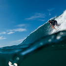
surffoto's uit
de galerijContourlijnen: Wegen & Rivieren: Kies een surflokatie uit het menu 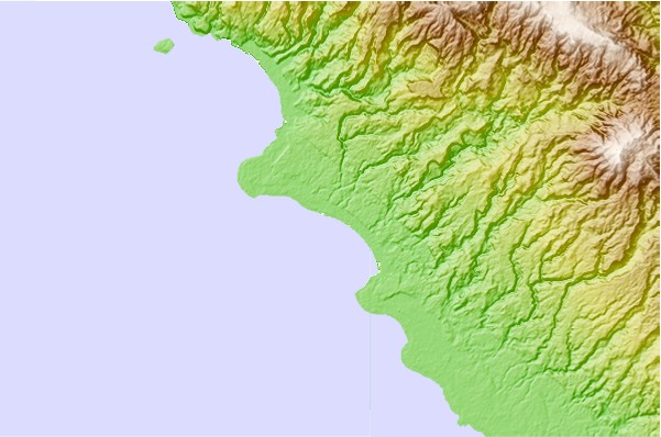
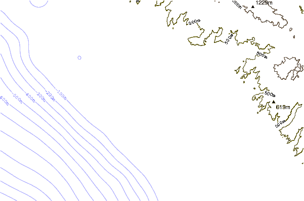
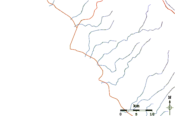
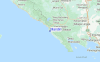
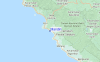
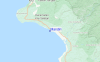
Gebruik deze reliëfkaart om naar de surfspots en de getijdenstations van Sumatra - Mainland toe te gaan, in de buurt van Mandiri.
Andere Dichtbijzijnde Surflocaties van Mandiri:
(klik op locatienaam voor meer informatie)- Closest Locatie4 mi
- Second closest Locatie6 mi
- Third closest Locatie6 mi
- Fourth closest Locatie8 mi
- Fifth closest Locatie10 mi
Dichtstbijzijnde golfboeien bij Mandiri:
- Closest golfboei2456 mi
- Second closest golfboei2525 mi
- Third closest golfboei2623 mi
- Fourth closest golfboei2695 mi
- Fifth closest golfboei2707 mi
Getijdenstations in de buurt van Mandiri:
- Closest getijdenstationBandar Lampung93 mi
- Second closest getijdenstationLabuhan150 mi
- Third closest getijdenstationBengkulu154 mi
- Fourth closest getijdenstationJakarta201 mi
- Fifth closest getijdenstationTanjung Priok208 mi
Airports
- The nearest passenger airport to Mandiri is Padang Kemiling (Bengkulu) Airport (BKS) in Indonesia, which is 238 km (148 miles) away (directly).
- The second closest airport to Mandiri is Sultan Mahmud Badaruddin Ii (Palembang) Airport (PLM), also in Indonesia, 274 km (170 miles) away.
- /breaks/Mandiri/forecasts/latest


 Nearest