
Manuel Antonio Surf Guide
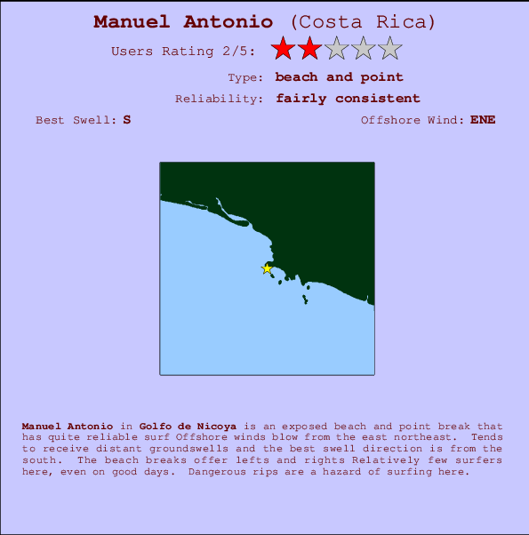
Manuel Antonio in Golfo de Nicoya is an exposed beach and point break that has quite reliable surf Works best in offshore winds from the east northeast. Groundswells more frequent than windswells and the best swell direction is from the south. Waves at the beach break both left and right Unlikely to be too crowded, even when the surf is up. Be wary of rips - they make surfing here dangerous.
Manuel Antonio Spot Info
| Type: | Rating: | Reliability: | Todays Sea Temp*: |
|---|---|---|---|
| fairly consistent | 30.2°C*ocean temperature recorded from satellite |
Surfing Manuel Antonio:
The best conditions reported for surf at Manuel Antonio occur when a South swell combines with an offshore wind direction from the East-northeast.

Voorspelde Golfenergie (Kracht): 12 uur


Manuel Antonio Surf:
Tuesday, 21 July 2026, 07:19 Local time| Tuesday 21 | ||||
| 3AM | 6AM | 9AM | 12PM | |
| Wave (m) | ||||
| Periode (s) | 15 | 15 | 15 | 15 |
| Wind (km/h) | ||||
| Wind | glass | glass | glass | cross- on |
- /breaks/Manuel-Antonio/forecasts/latest
Manuel Antonio Surf Guide
Manuel Antonio in Golfo de Nicoya is an exposed beach and point break that has quite reliable surf Works best in offshore winds from the east northeast. Groundswells more frequent than windswells and the best swell direction is from the south. Waves at the beach break both left and right Unlikely to be too crowded, even when the surf is up. Be wary of rips - they make surfing here dangerous.
Manuel Antonio Spot Info
Type: Rating: Reliability: Todays Sea Temp*:  Beach and point
 2
2fairly consistent 30.2°C*ocean temperature recorded from satelliteSurfing Manuel Antonio:
The best conditions reported for surf at Manuel Antonio occur when a South swell combines with an offshore wind direction from the East-northeast.
Voorspelde Golfenergie (Kracht): 12 uur
Gebruik de tabbladen hierboven om de zeewatertemperatuur bij Manuel Antonio te bekijken, foto's van Manuel Antonio, Manuel Antonio gedetailleerde golfvoorspellingen, wind- en weersvoorspellingen, Manuel Antonio webcams, actuele wind in Golfo de Nicoya live weerstations en Manuel Antonio getijdenvoorspellingen. De link van Costa Rica golfkaarten opent een grote afbeelding van Costa Rica en de omliggende zeeën. Deze golfkaarten kunnen worden dynamisch gemaakt worden met de verschillende golfcomponenten, golfenergie, golfperiode, golfhoogte, samen met de wind en weersvoorspellingen, het actuele weer en de zeetoestand volgens golfboeien uit Costa Rica, langskomende schepen en weerstations op de kust. Elk voorspelling pagina's voor dit surfstrand zijn voorzien van een wereldwijde en regionale golfzoeker om de beste surfsomstandigheden in het gebied rond Manuel Antonio te vinden.
Manuel Antonio Surf:
Tuesday, 21 July 2026, 07:19 Local timeTuesday 21 3AM 6AM 9AM 12PM Wave (m) Periode (s) 15 15 15 15 Wind (km/h) Wind glass glass glass cross-
on- /breaks/Manuel-Antonio/forecasts/latest
- /breaks/Manuel-Antonio/forecasts/latest/six_day
Manuel Antonio Surf Guide
Manuel Antonio in Golfo de Nicoya is an exposed beach and point break that has quite reliable surf Works best in offshore winds from the east northeast. Groundswells more frequent than windswells and the best swell direction is from the south. Waves at the beach break both left and right Unlikely to be too crowded, even when the surf is up. Be wary of rips - they make surfing here dangerous.
Manuel Antonio Spot Info
Type: Rating: Reliability: Todays Sea Temp*: Beach and point2fairly consistent 30.2°C*ocean temperature recorded from satelliteSurfing Manuel Antonio:
The best conditions reported for surf at Manuel Antonio occur when a South swell combines with an offshore wind direction from the East-northeast.
Voorspelde Golfenergie (Kracht): 12 uur
Gebruik de tabbladen hierboven om de zeewatertemperatuur bij Manuel Antonio te bekijken, foto's van Manuel Antonio, Manuel Antonio gedetailleerde golfvoorspellingen, wind- en weersvoorspellingen, Manuel Antonio webcams, actuele wind in Golfo de Nicoya live weerstations en Manuel Antonio getijdenvoorspellingen. De link van Costa Rica golfkaarten opent een grote afbeelding van Costa Rica en de omliggende zeeën. Deze golfkaarten kunnen worden dynamisch gemaakt worden met de verschillende golfcomponenten, golfenergie, golfperiode, golfhoogte, samen met de wind en weersvoorspellingen, het actuele weer en de zeetoestand volgens golfboeien uit Costa Rica, langskomende schepen en weerstations op de kust. Elk voorspelling pagina's voor dit surfstrand zijn voorzien van een wereldwijde en regionale golfzoeker om de beste surfsomstandigheden in het gebied rond Manuel Antonio te vinden.
Manuel Antonio Surf:
Tuesday, 21 July 2026, 07:19 Local timeTuesday 21 3AM 6AM 9AM 12PM Wave (m) Periode (s) 15 15 15 15 Wind (km/h) Wind glass glass glass cross-
on- /breaks/Manuel-Antonio/forecasts/latest
Manuel Antonio Surf Guide
Manuel Antonio in Golfo de Nicoya is an exposed beach and point break that has quite reliable surf Works best in offshore winds from the east northeast. Groundswells more frequent than windswells and the best swell direction is from the south. Waves at the beach break both left and right Unlikely to be too crowded, even when the surf is up. Be wary of rips - they make surfing here dangerous.
Manuel Antonio Spot Info
Type: Rating: Reliability: Todays Sea Temp*: Beach and point2fairly consistent 30.2°C*ocean temperature recorded from satelliteSurfing Manuel Antonio:
The best conditions reported for surf at Manuel Antonio occur when a South swell combines with an offshore wind direction from the East-northeast.
Voorspelde Golfenergie (Kracht): 12 uur
Gebruik de tabbladen hierboven om de zeewatertemperatuur bij Manuel Antonio te bekijken, foto's van Manuel Antonio, Manuel Antonio gedetailleerde golfvoorspellingen, wind- en weersvoorspellingen, Manuel Antonio webcams, actuele wind in Golfo de Nicoya live weerstations en Manuel Antonio getijdenvoorspellingen. De link van Costa Rica golfkaarten opent een grote afbeelding van Costa Rica en de omliggende zeeën. Deze golfkaarten kunnen worden dynamisch gemaakt worden met de verschillende golfcomponenten, golfenergie, golfperiode, golfhoogte, samen met de wind en weersvoorspellingen, het actuele weer en de zeetoestand volgens golfboeien uit Costa Rica, langskomende schepen en weerstations op de kust. Elk voorspelling pagina's voor dit surfstrand zijn voorzien van een wereldwijde en regionale golfzoeker om de beste surfsomstandigheden in het gebied rond Manuel Antonio te vinden.
Manuel Antonio Surf:
Tuesday, 21 July 2026, 07:19 Local timeTuesday 21 3AM 6AM 9AM 12PM Wave (m) Periode (s) 15 15 15 15 Wind (km/h) Wind glass glass glass cross-
onTide Times:
Voor Cutters Right, %{dist} %{km} van %{location}.
VOLGENDE IS OM (lokale tijd) resterende tijd hoog water laag water Manuel Antonio Tide Times and Tide Chart
Live Weather:
At San Jose, 61 km from Manuel Antonio.
light winds from the E
(km/h)
dryAir temperature
21°COverall Manuel Antonio Surf Consistency and Wind Distribution in July


Wind stats for Manuel Antonio: see the variation in direction and stength by month.
surffoto's uit
de galerijContourlijnen: Wegen & Rivieren: Kies een surflokatie uit het menu 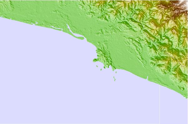
Gebruik deze reliëfkaart om naar de surfspots en de getijdenstations van Golfo de Nicoya toe te gaan, in de buurt van Manuel Antonio.
Andere Dichtbijzijnde Surflocaties van Manuel Antonio:
(klik op locatienaam voor meer informatie)- Closest Locatie1 mi
- Second closest Locatie2 mi
- Third closest Locatie5 mi
- Fourth closest Locatie12 mi
- Fifth closest Locatie13 mi
Dichtstbijzijnde golfboeien bij Manuel Antonio:
- Closest golfboei544 mi
- Second closest golfboei727 mi
- Third closest golfboei1091 mi
- Fourth closest golfboei1128 mi
- Fifth closest golfboei1150 mi
Getijdenstations in de buurt van Manuel Antonio:
- Closest getijdenstationChacarita58 mi
- Second closest getijdenstationPunta Arenas60 mi
- Third closest getijdenstationGolfito86 mi
- Fourth closest getijdenstationLimon88 mi
- Fifth closest getijdenstationSan Juan del Norte (Greytown)110 mi
Airports
- The closest passenger airport to Manuel Antonio is Quepos Managua Airport (XQP) in Costa Rica, 7 km (4 miles) away (directly).
- The second nearest airport to Manuel Antonio is Juan Santamaria International Airport (SJO), also in Costa Rica, 67 km (42 miles) away.
- Third is Palmar Sur Airport (PMZ) in Costa Rica, 92 km (57 miles) away.
- Golfito Airport (GLF) in Costa Rica is 137 km (85 miles) away.
- Limon International Airport (LIO), also in Costa Rica is the fifth nearest airport to Manuel Antonio and is 141 km (88 miles) away.
- /breaks/Manuel-Antonio/forecasts/latest

 Nearest