
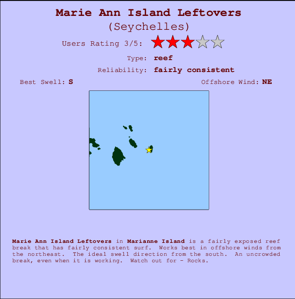
Marie Ann Island Leftovers Surf Guide
Marie Ann Island Leftovers in Marianne Island is a reasonably exposed reef break that has pretty consitent surf. Offshore winds blow from the northeast. The best swell direction is from the south. Even when the surf is up, crowds are unknown. Beware of - Rocks.
Marie Ann Island Leftovers Spot Info
| Type: | Rating: | Reliability: | Todays Sea Temp*: |
|---|---|---|---|
| fairly consistent | 27.2°C*ocean temperature recorded from satellite |
Surfing Marie Ann Island Leftovers:
The best conditions reported for surf at Marie Ann Island Leftovers occur when a South swell combines with an offshore wind direction from the Northeast.
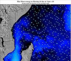
Voorspelde Golfenergie (Kracht): 12 uur
Marie Ann Island Leftovers Surf:
Friday, 17 July 2026, 19:35 Local time| Fri | Sat | |||
| 7PM | 10PM | 1AM | 4AM | |
| Wave (m) | ||||
| Periode (s) | 9 | 8 | 9 | 9 |
| Wind (km/h) | ||||
| Wind | cross | cross | cross | cross |
- /breaks/Marianne-Island-Leftovers/forecasts/latest
Marie Ann Island Leftovers Surf Guide
Marie Ann Island Leftovers in Marianne Island is a reasonably exposed reef break that has pretty consitent surf. Offshore winds blow from the northeast. The best swell direction is from the south. Even when the surf is up, crowds are unknown. Beware of - Rocks.
Marie Ann Island Leftovers Spot Info
Type: Rating: Reliability: Todays Sea Temp*:  Reef
Reef 3
3fairly consistent 27.2°C*ocean temperature recorded from satelliteSurfing Marie Ann Island Leftovers:
The best conditions reported for surf at Marie Ann Island Leftovers occur when a South swell combines with an offshore wind direction from the Northeast.
Voorspelde Golfenergie (Kracht): 12 uur
Gebruik de tabbladen hierboven om de zeewatertemperatuur bij Marie Ann Island Leftovers te bekijken, foto's van Marie Ann Island Leftovers, Marie Ann Island Leftovers gedetailleerde golfvoorspellingen, wind- en weersvoorspellingen, Marie Ann Island Leftovers webcams, actuele wind in Marianne Island live weerstations en Marie Ann Island Leftovers getijdenvoorspellingen. De link van Seychelles golfkaarten opent een grote afbeelding van Seychelles en de omliggende zeeën. Deze golfkaarten kunnen worden dynamisch gemaakt worden met de verschillende golfcomponenten, golfenergie, golfperiode, golfhoogte, samen met de wind en weersvoorspellingen, het actuele weer en de zeetoestand volgens golfboeien uit Seychelles, langskomende schepen en weerstations op de kust. Elk voorspelling pagina's voor dit surfstrand zijn voorzien van een wereldwijde en regionale golfzoeker om de beste surfsomstandigheden in het gebied rond Marie Ann Island Leftovers te vinden.
Marie Ann Island Leftovers Surf:
Friday, 17 July 2026, 19:35 Local timeFri Sat 7PM 10PM 1AM 4AM Wave (m) Periode (s) 9 8 9 9 Wind (km/h) Wind cross cross cross cross - /breaks/Marianne-Island-Leftovers/forecasts/latest
- /breaks/Marianne-Island-Leftovers/forecasts/latest/six_day
Marie Ann Island Leftovers Surf Guide
Marie Ann Island Leftovers in Marianne Island is a reasonably exposed reef break that has pretty consitent surf. Offshore winds blow from the northeast. The best swell direction is from the south. Even when the surf is up, crowds are unknown. Beware of - Rocks.
Marie Ann Island Leftovers Spot Info
Type: Rating: Reliability: Todays Sea Temp*: Reef3fairly consistent 27.2°C*ocean temperature recorded from satelliteSurfing Marie Ann Island Leftovers:
The best conditions reported for surf at Marie Ann Island Leftovers occur when a South swell combines with an offshore wind direction from the Northeast.
Voorspelde Golfenergie (Kracht): 12 uur
Gebruik de tabbladen hierboven om de zeewatertemperatuur bij Marie Ann Island Leftovers te bekijken, foto's van Marie Ann Island Leftovers, Marie Ann Island Leftovers gedetailleerde golfvoorspellingen, wind- en weersvoorspellingen, Marie Ann Island Leftovers webcams, actuele wind in Marianne Island live weerstations en Marie Ann Island Leftovers getijdenvoorspellingen. De link van Seychelles golfkaarten opent een grote afbeelding van Seychelles en de omliggende zeeën. Deze golfkaarten kunnen worden dynamisch gemaakt worden met de verschillende golfcomponenten, golfenergie, golfperiode, golfhoogte, samen met de wind en weersvoorspellingen, het actuele weer en de zeetoestand volgens golfboeien uit Seychelles, langskomende schepen en weerstations op de kust. Elk voorspelling pagina's voor dit surfstrand zijn voorzien van een wereldwijde en regionale golfzoeker om de beste surfsomstandigheden in het gebied rond Marie Ann Island Leftovers te vinden.
Marie Ann Island Leftovers Surf:
Friday, 17 July 2026, 19:35 Local timeFri Sat 7PM 10PM 1AM 4AM Wave (m) Periode (s) 9 8 9 9 Wind (km/h) Wind cross cross cross cross - /breaks/Marianne-Island-Leftovers/forecasts/latest
Marie Ann Island Leftovers Surf Guide
Marie Ann Island Leftovers in Marianne Island is a reasonably exposed reef break that has pretty consitent surf. Offshore winds blow from the northeast. The best swell direction is from the south. Even when the surf is up, crowds are unknown. Beware of - Rocks.
Marie Ann Island Leftovers Spot Info
Type: Rating: Reliability: Todays Sea Temp*: Reef3fairly consistent 27.2°C*ocean temperature recorded from satelliteSurfing Marie Ann Island Leftovers:
The best conditions reported for surf at Marie Ann Island Leftovers occur when a South swell combines with an offshore wind direction from the Northeast.
Voorspelde Golfenergie (Kracht): 12 uur
Gebruik de tabbladen hierboven om de zeewatertemperatuur bij Marie Ann Island Leftovers te bekijken, foto's van Marie Ann Island Leftovers, Marie Ann Island Leftovers gedetailleerde golfvoorspellingen, wind- en weersvoorspellingen, Marie Ann Island Leftovers webcams, actuele wind in Marianne Island live weerstations en Marie Ann Island Leftovers getijdenvoorspellingen. De link van Seychelles golfkaarten opent een grote afbeelding van Seychelles en de omliggende zeeën. Deze golfkaarten kunnen worden dynamisch gemaakt worden met de verschillende golfcomponenten, golfenergie, golfperiode, golfhoogte, samen met de wind en weersvoorspellingen, het actuele weer en de zeetoestand volgens golfboeien uit Seychelles, langskomende schepen en weerstations op de kust. Elk voorspelling pagina's voor dit surfstrand zijn voorzien van een wereldwijde en regionale golfzoeker om de beste surfsomstandigheden in het gebied rond Marie Ann Island Leftovers te vinden.
Marie Ann Island Leftovers Surf:
Friday, 17 July 2026, 19:35 Local timeFri Sat 7PM 10PM 1AM 4AM Wave (m) Periode (s) 9 8 9 9 Wind (km/h) Wind cross cross cross cross Tide Times:
Voor Anse Banane, %{dist} %{km} van %{location}.
VOLGENDE IS OM (lokale tijd) resterende tijd hoog water laag water Marie Ann Island Leftovers Tide Times and Tide Chart
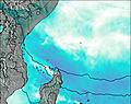
Live Weather:
At Seychelles International Airport, 57 km from Marie Ann Island Leftovers.
moderate winds from the ESE.(Wind varies from 080 to 190 degs)
(km/h)Air temperature
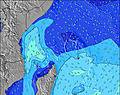
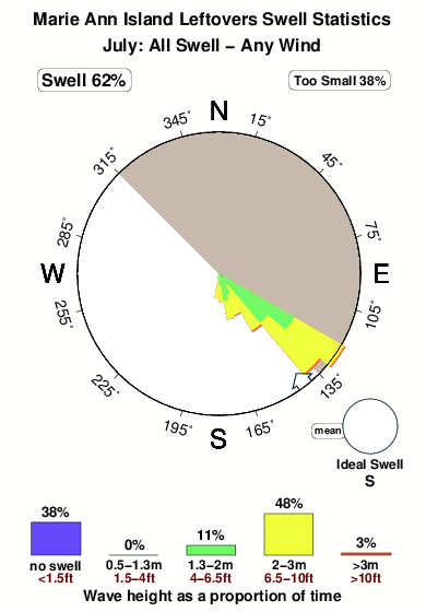
27°COverall Marie Ann Island Leftovers Surf Consistency and Wind Distribution in July
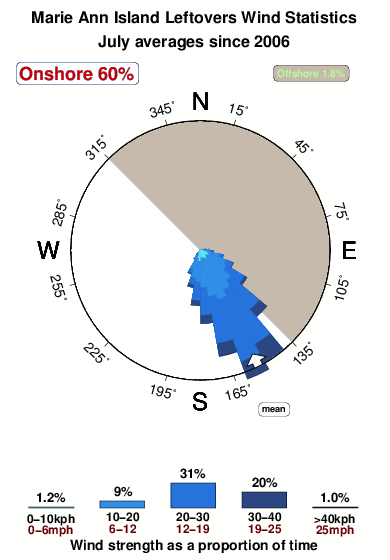

Wind stats for Marie Ann Island Leftovers: see the variation in direction and stength by month.
surffoto's uit
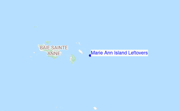
de galerijContourlijnen: Wegen & Rivieren: Kies een surflokatie uit het menu 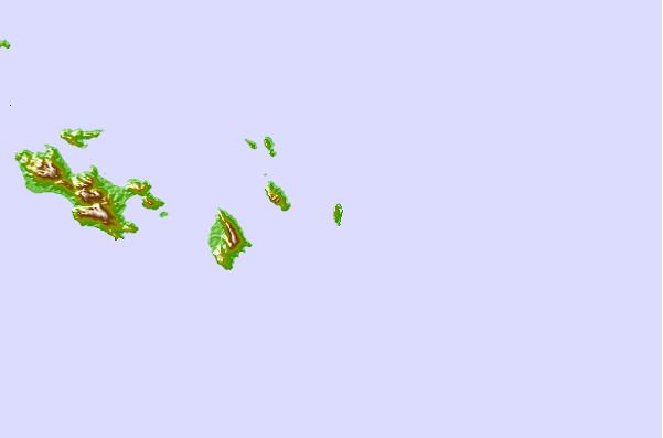
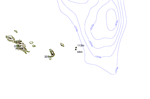

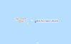
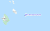
Gebruik deze reliëfkaart om naar de surfspots en de getijdenstations van Marianne Island toe te gaan, in de buurt van Marie Ann Island Leftovers.
Andere Dichtbijzijnde Surflocaties van Marie Ann Island Leftovers:
(klik op locatienaam voor meer informatie)- Closest Locatie0 mi
- Second closest Locatie5 mi
- Third closest Locatie5 mi
- Fourth closest Locatie5 mi
- Fifth closest Locatie6 mi
Dichtstbijzijnde golfboeien bij Marie Ann Island Leftovers:
- Closest golfboei3873 mi
- Second closest golfboei4473 mi
- Third closest golfboei4559 mi
- Fourth closest golfboei5007 mi
- Fifth closest golfboei5018 mi
Getijdenstations in de buurt van Marie Ann Island Leftovers:
- Closest getijdenstationVictoria38 mi
- Second closest getijdenstationDiego Suarez711 mi
- Third closest getijdenstationAntsohimbondrona773 mi
- Fourth closest getijdenstationSambava790 mi
- Fifth closest getijdenstationHell Ville814 mi
Airports
- The nearest passenger airport to Marie Ann Island Leftovers is Praslin Airport (PRI) in Seychelles, which is 25 km (16 miles) away (directly).
- The second closest airport to Marie Ann Island Leftovers is Seychelles International (Mahe) Airport (SEZ), also in Seychelles, 57 km (35 miles) away.
- /breaks/Marianne-Island-Leftovers/forecasts/latest
 Nearest