
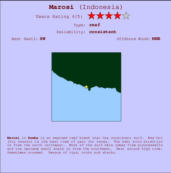
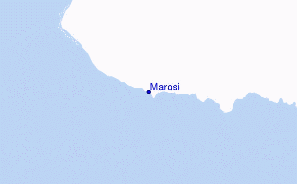
Marosi Surf Guide
Marosi in Sumba is an exposed reef break that has reliable surf. May-Oct (Dry Season) is the optimum time of year for waves. Offshore winds blow from the north northeast. Clean groundswells prevail and the ideal swell direction is from the southwest. The reef provides both left and right breaks. Best around high tide. Sometimes crowded. Hazards include rips, rocks and sharks.
Marosi Spot Info
| Type: | Rating: | Reliability: | Todays Sea Temp*: |
|---|---|---|---|
| consistent | 26.5°C*ocean temperature recorded from satellite |
Surfing Marosi:
The best conditions reported for surf at Marosi occur when a Southwest swell combines with an offshore wind direction from the North-northeast.

Voorspelde Golfenergie (Kracht): 12 uur


Marosi Surf:
Wednesday, 15 July 2026, 19:06 Local time| Wednesday 15 | Thu | |||
| 5PM | 8PM | 11PM | 2AM | |
| Wave (m) | ||||
| Periode (s) | 16 | 16 | 16 | 16 |
| Wind (km/h) | ||||
| Wind | cross | glass | cross- off |
cross- off |
- /breaks/Marosi/forecasts/latest
Marosi Surf Guide
Marosi in Sumba is an exposed reef break that has reliable surf. May-Oct (Dry Season) is the optimum time of year for waves. Offshore winds blow from the north northeast. Clean groundswells prevail and the ideal swell direction is from the southwest. The reef provides both left and right breaks. Best around high tide. Sometimes crowded. Hazards include rips, rocks and sharks.
Marosi Spot Info
Type: Rating: Reliability: Todays Sea Temp*:  Reef
Reef 4
4consistent 26.5°C*ocean temperature recorded from satelliteSurfing Marosi:
The best conditions reported for surf at Marosi occur when a Southwest swell combines with an offshore wind direction from the North-northeast.
Voorspelde Golfenergie (Kracht): 12 uur
Gebruik de tabbladen hierboven om de zeewatertemperatuur bij Marosi te bekijken, foto's van Marosi, Marosi gedetailleerde golfvoorspellingen, wind- en weersvoorspellingen, Marosi webcams, actuele wind in Sumba live weerstations en Marosi getijdenvoorspellingen. De link van Indonesia golfkaarten opent een grote afbeelding van Indonesia en de omliggende zeeën. Deze golfkaarten kunnen worden dynamisch gemaakt worden met de verschillende golfcomponenten, golfenergie, golfperiode, golfhoogte, samen met de wind en weersvoorspellingen, het actuele weer en de zeetoestand volgens golfboeien uit Indonesia, langskomende schepen en weerstations op de kust. Elk voorspelling pagina's voor dit surfstrand zijn voorzien van een wereldwijde en regionale golfzoeker om de beste surfsomstandigheden in het gebied rond Marosi te vinden.
Marosi Surf:
Wednesday, 15 July 2026, 19:06 Local timeWednesday 15 Thu 5PM 8PM 11PM 2AM Wave (m) Periode (s) 16 16 16 16 Wind (km/h) Wind cross glass cross-
offcross-
off- /breaks/Marosi/forecasts/latest
- /breaks/Marosi/forecasts/latest/six_day
Marosi Surf Guide
Marosi in Sumba is an exposed reef break that has reliable surf. May-Oct (Dry Season) is the optimum time of year for waves. Offshore winds blow from the north northeast. Clean groundswells prevail and the ideal swell direction is from the southwest. The reef provides both left and right breaks. Best around high tide. Sometimes crowded. Hazards include rips, rocks and sharks.
Marosi Spot Info
Type: Rating: Reliability: Todays Sea Temp*: Reef4consistent 26.5°C*ocean temperature recorded from satelliteSurfing Marosi:
The best conditions reported for surf at Marosi occur when a Southwest swell combines with an offshore wind direction from the North-northeast.
Voorspelde Golfenergie (Kracht): 12 uur
Gebruik de tabbladen hierboven om de zeewatertemperatuur bij Marosi te bekijken, foto's van Marosi, Marosi gedetailleerde golfvoorspellingen, wind- en weersvoorspellingen, Marosi webcams, actuele wind in Sumba live weerstations en Marosi getijdenvoorspellingen. De link van Indonesia golfkaarten opent een grote afbeelding van Indonesia en de omliggende zeeën. Deze golfkaarten kunnen worden dynamisch gemaakt worden met de verschillende golfcomponenten, golfenergie, golfperiode, golfhoogte, samen met de wind en weersvoorspellingen, het actuele weer en de zeetoestand volgens golfboeien uit Indonesia, langskomende schepen en weerstations op de kust. Elk voorspelling pagina's voor dit surfstrand zijn voorzien van een wereldwijde en regionale golfzoeker om de beste surfsomstandigheden in het gebied rond Marosi te vinden.
Marosi Surf:
Wednesday, 15 July 2026, 19:06 Local timeWednesday 15 Thu 5PM 8PM 11PM 2AM Wave (m) Periode (s) 16 16 16 16 Wind (km/h) Wind cross glass cross-
offcross-
off- /breaks/Marosi/forecasts/latest
Marosi Surf Guide
Marosi in Sumba is an exposed reef break that has reliable surf. May-Oct (Dry Season) is the optimum time of year for waves. Offshore winds blow from the north northeast. Clean groundswells prevail and the ideal swell direction is from the southwest. The reef provides both left and right breaks. Best around high tide. Sometimes crowded. Hazards include rips, rocks and sharks.
Marosi Spot Info
Type: Rating: Reliability: Todays Sea Temp*: Reef4consistent 26.5°C*ocean temperature recorded from satelliteSurfing Marosi:
The best conditions reported for surf at Marosi occur when a Southwest swell combines with an offshore wind direction from the North-northeast.
Voorspelde Golfenergie (Kracht): 12 uur
Gebruik de tabbladen hierboven om de zeewatertemperatuur bij Marosi te bekijken, foto's van Marosi, Marosi gedetailleerde golfvoorspellingen, wind- en weersvoorspellingen, Marosi webcams, actuele wind in Sumba live weerstations en Marosi getijdenvoorspellingen. De link van Indonesia golfkaarten opent een grote afbeelding van Indonesia en de omliggende zeeën. Deze golfkaarten kunnen worden dynamisch gemaakt worden met de verschillende golfcomponenten, golfenergie, golfperiode, golfhoogte, samen met de wind en weersvoorspellingen, het actuele weer en de zeetoestand volgens golfboeien uit Indonesia, langskomende schepen en weerstations op de kust. Elk voorspelling pagina's voor dit surfstrand zijn voorzien van een wereldwijde en regionale golfzoeker om de beste surfsomstandigheden in het gebied rond Marosi te vinden.
Marosi Surf:
Wednesday, 15 July 2026, 19:06 Local timeWednesday 15 Thu 5PM 8PM 11PM 2AM Wave (m) Periode (s) 16 16 16 16 Wind (km/h) Wind cross glass cross-
offcross-
offTide Times:
Op Marosi (0 km).
VOLGENDE IS OM (lokale tijd) resterende tijd hoog water laag water Marosi Tide Times and Tide Chart
Live Weather:
At Bandara Airport, 336 km from Marosi.
light winds from the SE
(km/h)
Dry and partly cloudyAir temperature
27°COverall Marosi Surf Consistency and Wind Distribution in July
surffoto's uit
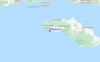
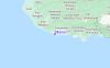
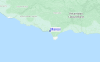
de galerijContourlijnen: Wegen & Rivieren: Kies een surflokatie uit het menu 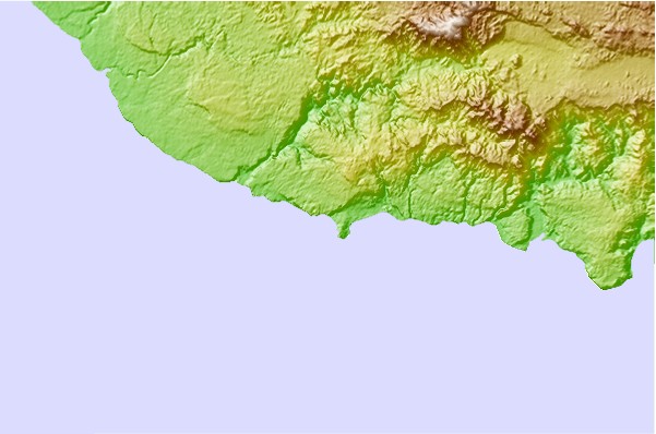
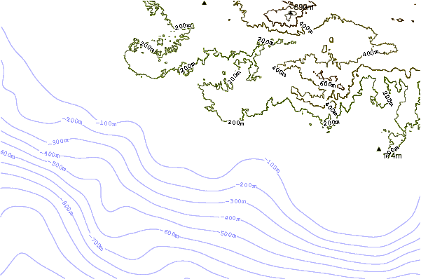
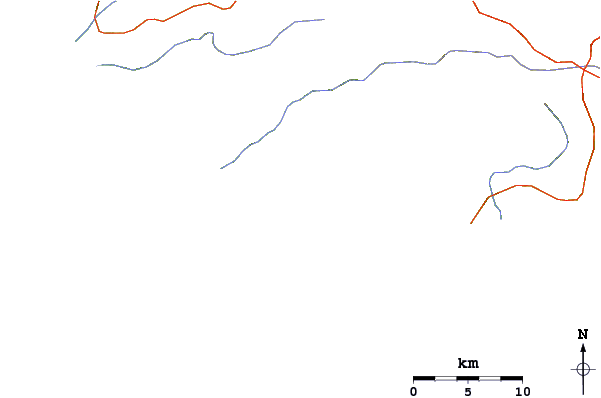
Gebruik deze reliëfkaart om naar de surfspots en de getijdenstations van Sumba toe te gaan, in de buurt van Marosi.
Andere Dichtbijzijnde Surflocaties van Marosi:
(klik op locatienaam voor meer informatie)- Closest Locatie1 mi
- Second closest Locatie8 mi
- Third closest Locatie12 mi
- Fourth closest Locatie14 mi
- Fifth closest Locatie55 mi
Dichtstbijzijnde golfboeien bij Marosi:
- Closest golfboei1539 mi
- Second closest golfboei1848 mi
- Third closest golfboei1973 mi
- Fourth closest golfboei2052 mi
- Fifth closest golfboei2124 mi
Getijdenstations in de buurt van Marosi:
- Closest getijdenstationWaingapu75 mi
- Second closest getijdenstationBima93 mi
- Third closest getijdenstationLabuhanbajo100 mi
- Fourth closest getijdenstationSumbawa Besar147 mi
- Fifth closest getijdenstationEndeh181 mi
Airports
- The closest passenger airport to Marosi is Mau Hau (Waingapu) Airport (WGP) in Indonesia, 124 km (77 miles) away (directly).
- The second nearest airport to Marosi is Muhammad Salahuddin (Bima) Airport (BMU), also in Indonesia, 144 km (89 miles) away.
- Third is Mutiara Ii (Labuhan Bajo) Airport (LBJ) in Indonesia, 160 km (99 miles) away.
- Satar Tacik (Ruteng) Airport (RTG) in Indonesia is 191 km (119 miles) away.
- Sumbawa Besar Airport (SWG), also in Indonesia is the fifth nearest airport to Marosi and is 239 km (148 miles) away.
- /breaks/Marosi/forecasts/latest


 Nearest