

Monterrico Surf Guide
Monterrico in Pacific Coast is an exposed beach break that has fairly consistent surf The best wind direction is from the north northeast. Most of the surf here comes from groundswells and the ideal swell angle is from the south southwest. The beach break provides left and right handers. Good surf at all stages of the tide. Relatively few surfers here, even on good days. Dangerous rips are a hazard of surfing here.
Monterrico Spot Info
| Type: | Rating: | Reliability: | Todays Sea Temp*: |
|---|---|---|---|
| fairly consistent | 30.2°C*ocean temperature recorded from satellite |
Surfing Monterrico:
The best conditions reported for surf at Monterrico occur when a South-southwest swell combines with an offshore wind direction from the North-northeast.

Voorspelde Golfenergie (Kracht): 12 uur


Monterrico Surf:
Wednesday, 15 July 2026, 23:46 Local time| Wednesday 15 | Thu | |||
| 3PM | 6PM | 9PM | 0AM | |
| Wave (m) | ||||
| Periode (s) | 13 | 13 | 16 | 16 |
| Wind (km/h) | ||||
| Wind | cross- on |
glass | cross- off |
glass |
- /breaks/Monterrico/forecasts/latest
Monterrico Surf Guide
Monterrico in Pacific Coast is an exposed beach break that has fairly consistent surf The best wind direction is from the north northeast. Most of the surf here comes from groundswells and the ideal swell angle is from the south southwest. The beach break provides left and right handers. Good surf at all stages of the tide. Relatively few surfers here, even on good days. Dangerous rips are a hazard of surfing here.
Monterrico Spot Info
Type: Rating: Reliability: Todays Sea Temp*:  Beach
Beach 3
3fairly consistent 30.2°C*ocean temperature recorded from satelliteSurfing Monterrico:
The best conditions reported for surf at Monterrico occur when a South-southwest swell combines with an offshore wind direction from the North-northeast.
Voorspelde Golfenergie (Kracht): 12 uur
Gebruik de tabbladen hierboven om de zeewatertemperatuur bij Monterrico te bekijken, foto's van Monterrico, Monterrico gedetailleerde golfvoorspellingen, wind- en weersvoorspellingen, Monterrico webcams, actuele wind in Pacific Coast live weerstations en Monterrico getijdenvoorspellingen. De link van Guatemala golfkaarten opent een grote afbeelding van Guatemala en de omliggende zeeën. Deze golfkaarten kunnen worden dynamisch gemaakt worden met de verschillende golfcomponenten, golfenergie, golfperiode, golfhoogte, samen met de wind en weersvoorspellingen, het actuele weer en de zeetoestand volgens golfboeien uit Guatemala, langskomende schepen en weerstations op de kust. Elk voorspelling pagina's voor dit surfstrand zijn voorzien van een wereldwijde en regionale golfzoeker om de beste surfsomstandigheden in het gebied rond Monterrico te vinden.
Monterrico Surf:
Wednesday, 15 July 2026, 23:46 Local timeWednesday 15 Thu 3PM 6PM 9PM 0AM Wave (m) Periode (s) 13 13 16 16 Wind (km/h) Wind cross-
onglass cross-
offglass - /breaks/Monterrico/forecasts/latest
- /breaks/Monterrico/forecasts/latest/six_day
Monterrico Surf Guide
Monterrico in Pacific Coast is an exposed beach break that has fairly consistent surf The best wind direction is from the north northeast. Most of the surf here comes from groundswells and the ideal swell angle is from the south southwest. The beach break provides left and right handers. Good surf at all stages of the tide. Relatively few surfers here, even on good days. Dangerous rips are a hazard of surfing here.
Monterrico Spot Info
Type: Rating: Reliability: Todays Sea Temp*: Beach3fairly consistent 30.2°C*ocean temperature recorded from satelliteSurfing Monterrico:
The best conditions reported for surf at Monterrico occur when a South-southwest swell combines with an offshore wind direction from the North-northeast.
Voorspelde Golfenergie (Kracht): 12 uur
Gebruik de tabbladen hierboven om de zeewatertemperatuur bij Monterrico te bekijken, foto's van Monterrico, Monterrico gedetailleerde golfvoorspellingen, wind- en weersvoorspellingen, Monterrico webcams, actuele wind in Pacific Coast live weerstations en Monterrico getijdenvoorspellingen. De link van Guatemala golfkaarten opent een grote afbeelding van Guatemala en de omliggende zeeën. Deze golfkaarten kunnen worden dynamisch gemaakt worden met de verschillende golfcomponenten, golfenergie, golfperiode, golfhoogte, samen met de wind en weersvoorspellingen, het actuele weer en de zeetoestand volgens golfboeien uit Guatemala, langskomende schepen en weerstations op de kust. Elk voorspelling pagina's voor dit surfstrand zijn voorzien van een wereldwijde en regionale golfzoeker om de beste surfsomstandigheden in het gebied rond Monterrico te vinden.
Monterrico Surf:
Wednesday, 15 July 2026, 23:46 Local timeWednesday 15 Thu 3PM 6PM 9PM 0AM Wave (m) Periode (s) 13 13 16 16 Wind (km/h) Wind cross-
onglass cross-
offglass - /breaks/Monterrico/forecasts/latest
Monterrico Surf Guide
Monterrico in Pacific Coast is an exposed beach break that has fairly consistent surf The best wind direction is from the north northeast. Most of the surf here comes from groundswells and the ideal swell angle is from the south southwest. The beach break provides left and right handers. Good surf at all stages of the tide. Relatively few surfers here, even on good days. Dangerous rips are a hazard of surfing here.
Monterrico Spot Info
Type: Rating: Reliability: Todays Sea Temp*: Beach3fairly consistent 30.2°C*ocean temperature recorded from satelliteSurfing Monterrico:
The best conditions reported for surf at Monterrico occur when a South-southwest swell combines with an offshore wind direction from the North-northeast.
Voorspelde Golfenergie (Kracht): 12 uur
Gebruik de tabbladen hierboven om de zeewatertemperatuur bij Monterrico te bekijken, foto's van Monterrico, Monterrico gedetailleerde golfvoorspellingen, wind- en weersvoorspellingen, Monterrico webcams, actuele wind in Pacific Coast live weerstations en Monterrico getijdenvoorspellingen. De link van Guatemala golfkaarten opent een grote afbeelding van Guatemala en de omliggende zeeën. Deze golfkaarten kunnen worden dynamisch gemaakt worden met de verschillende golfcomponenten, golfenergie, golfperiode, golfhoogte, samen met de wind en weersvoorspellingen, het actuele weer en de zeetoestand volgens golfboeien uit Guatemala, langskomende schepen en weerstations op de kust. Elk voorspelling pagina's voor dit surfstrand zijn voorzien van een wereldwijde en regionale golfzoeker om de beste surfsomstandigheden in het gebied rond Monterrico te vinden.
Monterrico Surf:
Wednesday, 15 July 2026, 23:46 Local timeWednesday 15 Thu 3PM 6PM 9PM 0AM Wave (m) Periode (s) 13 13 16 16 Wind (km/h) Wind cross-
onglass cross-
offglass Tide Times:
Op Monterrico (0 km).
VOLGENDE IS OM (lokale tijd) resterende tijd hoog water laag water Monterrico Tide Times and Tide Chart
Live Weather:
At Guatemala/La Aurora Airport, 73 km from Monterrico.
moderate winds from the NNE
(km/h)
Dry and partly cloudyAir temperature
18°COverall Monterrico Surf Consistency and Wind Distribution in July
surffoto's uit
de galerijContourlijnen: Wegen & Rivieren: Kies een surflokatie uit het menu 


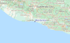
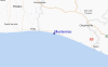
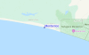
Gebruik deze reliëfkaart om naar de surfspots en de getijdenstations van Pacific Coast toe te gaan, in de buurt van Monterrico.
Andere Dichtbijzijnde Surflocaties van Monterrico:
(klik op locatienaam voor meer informatie)- Closest Locatie11 mi
- Second closest Locatie12 mi
- Third closest Locatie18 mi
- Fourth closest Locatie19 mi
- Fifth closest Locatie22 mi
Dichtstbijzijnde golfboeien bij Monterrico:
- Closest golfboei549 mi
- Second closest golfboei606 mi
- Third closest golfboei636 mi
- Fourth closest golfboei831 mi
- Fifth closest golfboei846 mi
Getijdenstations in de buurt van Monterrico:
- Closest getijdenstationSan Jose18 mi
- Second closest getijdenstationAcajutla53 mi
- Third closest getijdenstationLa Libertad87 mi
- Fourth closest getijdenstationChamperico95 mi
- Fifth closest getijdenstationOcos118 mi
Airports
- The closest passenger airport to Monterrico is La Aurora (Guatemala City) Airport (GUA) in Guatemala, which is 75 km (47 miles) away (directly).
- The second nearest airport to Monterrico is El Salvador International (San Salvador) Airport (SAL) in El Salvador, 169 km (105 miles) away.
- The third closest airport is Coban Airport (CBV) in Guatemala, 174 km (108 miles) away.

- /breaks/Monterrico/forecasts/latest


 Nearest