
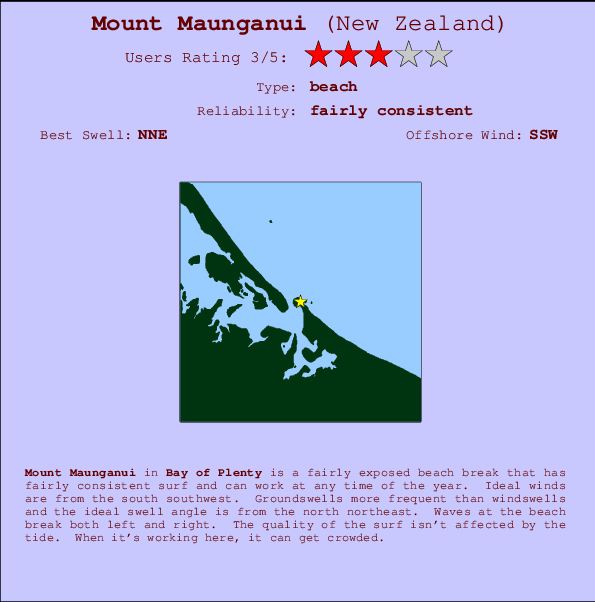
Mount Maunganui Surf Guide
Mount Maunguni in Bay of Plenty is a reasonably exposed beach break that has fairly consistent surf and can work at any time of the year. Offshore winds blow from the south southwest. Tends to receive distant groundswells and the best swell direction is from the north northeast. The beach break provides left and right handers. The quality of the surf isn't affected by the tide. When it's working here, it can get crowded. Take care of .
Mount Maunganui Spot Info
| Type: | Rating: | Reliability: | Todays Sea Temp*: |
|---|---|---|---|
| fairly consistent | 14.1°C*ocean temperature recorded from satellite |
Surfing Mount Maunganui:
The best conditions reported for surf at Mount Maunganui occur when a North-northeast swell combines with an offshore wind direction from the South-southwest.

Voorspelde Golfenergie (Kracht): 12 uur


Mount Maunganui Surf:
Thursday, 16 July 2026, 12:40 Local time| Thursday 16 | ||||
| 9AM | 12PM | 3PM | 6PM | |
| Wave (m) | ||||
| Periode (s) | 12 | 12 | 12 | 13 |
| Wind (km/h) | ||||
| Wind | cross- off |
cross- off |
cross- off |
cross- off |
- /breaks/Mount-Maunguni/forecasts/latest

Mount Maunganui Surf Guide
Mount Maunguni in Bay of Plenty is a reasonably exposed beach break that has fairly consistent surf and can work at any time of the year. Offshore winds blow from the south southwest. Tends to receive distant groundswells and the best swell direction is from the north northeast. The beach break provides left and right handers. The quality of the surf isn't affected by the tide. When it's working here, it can get crowded. Take care of .
Mount Maunganui Spot Info
Type: Rating: Reliability: Todays Sea Temp*:  Beach
Beach 3
3fairly consistent 14.1°C*ocean temperature recorded from satelliteSurfing Mount Maunganui:
The best conditions reported for surf at Mount Maunganui occur when a North-northeast swell combines with an offshore wind direction from the South-southwest.
Voorspelde Golfenergie (Kracht): 12 uur
Gebruik de tabbladen hierboven om de zeewatertemperatuur bij Mount Maunganui te bekijken, foto's van Mount Maunganui, Mount Maunganui gedetailleerde golfvoorspellingen, wind- en weersvoorspellingen, Mount Maunganui webcams, actuele wind in Bay of Plenty live weerstations en Mount Maunganui getijdenvoorspellingen. De link van New Zealand golfkaarten opent een grote afbeelding van New Zealand en de omliggende zeeën. Deze golfkaarten kunnen worden dynamisch gemaakt worden met de verschillende golfcomponenten, golfenergie, golfperiode, golfhoogte, samen met de wind en weersvoorspellingen, het actuele weer en de zeetoestand volgens golfboeien uit New Zealand, langskomende schepen en weerstations op de kust. Elk voorspelling pagina's voor dit surfstrand zijn voorzien van een wereldwijde en regionale golfzoeker om de beste surfsomstandigheden in het gebied rond Mount Maunganui te vinden.
Mount Maunganui Surf:
Thursday, 16 July 2026, 12:40 Local timeThursday 16 9AM 12PM 3PM 6PM Wave (m) Periode (s) 12 12 12 13 Wind (km/h) Wind cross-
offcross-
offcross-
offcross-
off- /breaks/Mount-Maunguni/forecasts/latest
- /breaks/Mount-Maunguni/forecasts/latest/six_day
Mount Maunganui Surf Guide
Mount Maunguni in Bay of Plenty is a reasonably exposed beach break that has fairly consistent surf and can work at any time of the year. Offshore winds blow from the south southwest. Tends to receive distant groundswells and the best swell direction is from the north northeast. The beach break provides left and right handers. The quality of the surf isn't affected by the tide. When it's working here, it can get crowded. Take care of .
Mount Maunganui Spot Info
Type: Rating: Reliability: Todays Sea Temp*: Beach3fairly consistent 14.1°C*ocean temperature recorded from satelliteSurfing Mount Maunganui:
The best conditions reported for surf at Mount Maunganui occur when a North-northeast swell combines with an offshore wind direction from the South-southwest.
Voorspelde Golfenergie (Kracht): 12 uur
Gebruik de tabbladen hierboven om de zeewatertemperatuur bij Mount Maunganui te bekijken, foto's van Mount Maunganui, Mount Maunganui gedetailleerde golfvoorspellingen, wind- en weersvoorspellingen, Mount Maunganui webcams, actuele wind in Bay of Plenty live weerstations en Mount Maunganui getijdenvoorspellingen. De link van New Zealand golfkaarten opent een grote afbeelding van New Zealand en de omliggende zeeën. Deze golfkaarten kunnen worden dynamisch gemaakt worden met de verschillende golfcomponenten, golfenergie, golfperiode, golfhoogte, samen met de wind en weersvoorspellingen, het actuele weer en de zeetoestand volgens golfboeien uit New Zealand, langskomende schepen en weerstations op de kust. Elk voorspelling pagina's voor dit surfstrand zijn voorzien van een wereldwijde en regionale golfzoeker om de beste surfsomstandigheden in het gebied rond Mount Maunganui te vinden.
Mount Maunganui Surf:
Thursday, 16 July 2026, 12:40 Local timeThursday 16 9AM 12PM 3PM 6PM Wave (m) Periode (s) 12 12 12 13 Wind (km/h) Wind cross-
offcross-
offcross-
offcross-
off- /breaks/Mount-Maunguni/forecasts/latest
Mount Maunganui Surf Guide
Mount Maunguni in Bay of Plenty is a reasonably exposed beach break that has fairly consistent surf and can work at any time of the year. Offshore winds blow from the south southwest. Tends to receive distant groundswells and the best swell direction is from the north northeast. The beach break provides left and right handers. The quality of the surf isn't affected by the tide. When it's working here, it can get crowded. Take care of .
Mount Maunganui Spot Info
Type: Rating: Reliability: Todays Sea Temp*: Beach3fairly consistent 14.1°C*ocean temperature recorded from satelliteSurfing Mount Maunganui:
The best conditions reported for surf at Mount Maunganui occur when a North-northeast swell combines with an offshore wind direction from the South-southwest.
Voorspelde Golfenergie (Kracht): 12 uur
Gebruik de tabbladen hierboven om de zeewatertemperatuur bij Mount Maunganui te bekijken, foto's van Mount Maunganui, Mount Maunganui gedetailleerde golfvoorspellingen, wind- en weersvoorspellingen, Mount Maunganui webcams, actuele wind in Bay of Plenty live weerstations en Mount Maunganui getijdenvoorspellingen. De link van New Zealand golfkaarten opent een grote afbeelding van New Zealand en de omliggende zeeën. Deze golfkaarten kunnen worden dynamisch gemaakt worden met de verschillende golfcomponenten, golfenergie, golfperiode, golfhoogte, samen met de wind en weersvoorspellingen, het actuele weer en de zeetoestand volgens golfboeien uit New Zealand, langskomende schepen en weerstations op de kust. Elk voorspelling pagina's voor dit surfstrand zijn voorzien van een wereldwijde en regionale golfzoeker om de beste surfsomstandigheden in het gebied rond Mount Maunganui te vinden.
Mount Maunganui Surf:
Thursday, 16 July 2026, 12:40 Local timeThursday 16 9AM 12PM 3PM 6PM Wave (m) Periode (s) 12 12 12 13 Wind (km/h) Wind cross-
offcross-
offcross-
offcross-
offTide Times:
Voor Tauranga, New Zealand, %{dist} %{km} van %{location}.
VOLGENDE IS OM (lokale tijd) resterende tijd hoog water laag water Mount Maunganui Tide Times and Tide Chart
Live Weather:
At Pilot Bay, 1 km from Mount Maunganui.
light winds from the SW
(km/h)
DryAir temperature
15.9°COverall Mount Maunganui Surf Consistency and Wind Distribution in July


Wind stats for Mount Maunganui: see the variation in direction and stength by month.
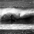
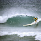
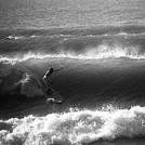
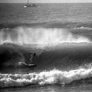
surffoto's uit
de galerijContourlijnen: Wegen & Rivieren: Kies een surflokatie uit het menu 

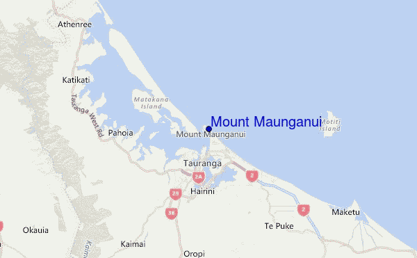
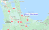
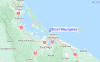
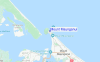
Gebruik deze reliëfkaart om naar de surfspots en de getijdenstations van Bay of Plenty toe te gaan, in de buurt van Mount Maunganui.
Andere Dichtbijzijnde Surflocaties van Mount Maunganui:
(klik op locatienaam voor meer informatie)- Closest Locatie0 mi
- Second closest Locatie2 mi
- Third closest Locatie2 mi
- Fourth closest Locatie7 mi
- Fifth closest Locatie7 mi
Dichtstbijzijnde golfboeien bij Mount Maunganui:
- Closest golfboei24 mi
- Second closest golfboei151 mi
- Third closest golfboei267 mi
- Fourth closest golfboei274 mi
- Fifth closest golfboei295 mi
Getijdenstations in de buurt van Mount Maunganui:
- Closest getijdenstationTauranga1 mi
- Second closest getijdenstationSlipper Island42 mi
- Third closest getijdenstationMoutohora (Whale) Island47 mi
- Fourth closest getijdenstationTairua47 mi
- Fifth closest getijdenstationWhakatane50 mi
Airports
- The closest passenger airport to Mount Maunganui is Tauranga Airport (TRG) in New Zealand, 5 km (3 miles) away (directly).
- The second nearest airport to Mount Maunganui is Rotorua Airport (ROT), also in New Zealand, 55 km (34 miles) away.
- Third is Whakatane Airport (WHK) in New Zealand, 72 km (45 miles) away.
- Hamilton Airport (HLZ) in New Zealand is 79 km (49 miles) away.
- Taupo Airport (TUO), also in New Zealand is the fifth nearest airport to Mount Maunganui and is 124 km (77 miles) away.
- /breaks/Mount-Maunguni/forecasts/latest

 Nearest