
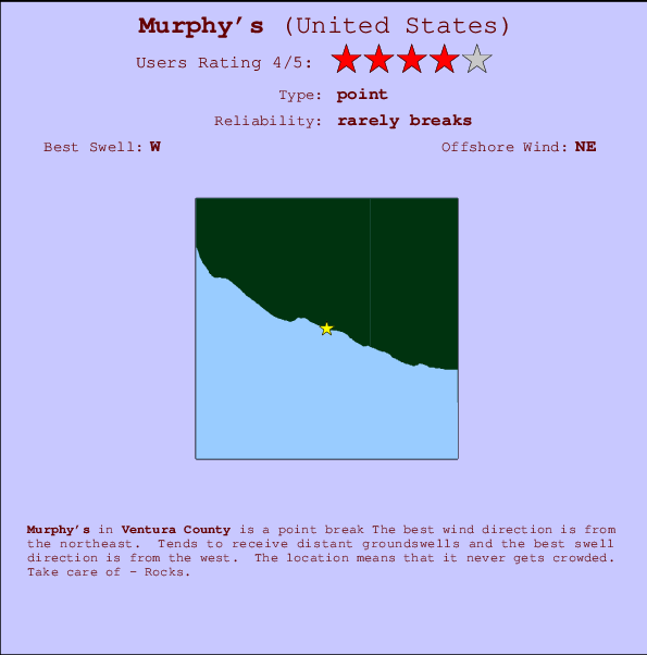
Murphy's Surf Guide
Murphy's in Ventura County is a fairly exposed point break Offshore winds are from the northeast. Tends to receive distant groundswells and the best swell direction is from the west. Even when the surf is up, crowds are unknown. Hazards include - Rocks.
Murphy's Spot Info
| Type: | Rating: | Reliability: | Todays Sea Temp*: |
|---|---|---|---|
| rarely breaks | 19.3°C*ocean temperature recorded from satellite |
Surfing Murphy's:
The best conditions reported for surf at Murphy's occur when a West swell combines with an offshore wind direction from the Northeast.

Voorspelde Golfenergie (Kracht): 12 uur


Murphy's Surf:
Wednesday, 15 July 2026, 12:55 Local time| Wednesday 15 | ||||
| 2PM | 5PM | 8PM | 11PM | |
| Wave (m) | ||||
| Periode (s) | 17 | 16 | 16 | 6 |
| Wind (km/h) | ||||
| Wind | cross- on |
cross- on |
cross | cross- off |
- /breaks/Murphy-s/forecasts/latest
Murphy's Surf Guide
Murphy's in Ventura County is a fairly exposed point break Offshore winds are from the northeast. Tends to receive distant groundswells and the best swell direction is from the west. Even when the surf is up, crowds are unknown. Hazards include - Rocks.
Murphy's Spot Info
Type: Rating: Reliability: Todays Sea Temp*:  Point
Point 4
4rarely breaks 19.3°C*ocean temperature recorded from satelliteSurfing Murphy's:
The best conditions reported for surf at Murphy's occur when a West swell combines with an offshore wind direction from the Northeast.
Voorspelde Golfenergie (Kracht): 12 uur
Gebruik de tabbladen hierboven om de zeewatertemperatuur bij Murphy's te bekijken, foto's van Murphy's, Murphy's gedetailleerde golfvoorspellingen, wind- en weersvoorspellingen, Murphy's webcams, actuele wind in CAL - Ventura live weerstations en Murphy's getijdenvoorspellingen. De link van United States golfkaarten opent een grote afbeelding van United States en de omliggende zeeën. Deze golfkaarten kunnen worden dynamisch gemaakt worden met de verschillende golfcomponenten, golfenergie, golfperiode, golfhoogte, samen met de wind en weersvoorspellingen, het actuele weer en de zeetoestand volgens golfboeien uit United States, langskomende schepen en weerstations op de kust. Elk voorspelling pagina's voor dit surfstrand zijn voorzien van een wereldwijde en regionale golfzoeker om de beste surfsomstandigheden in het gebied rond Murphy's te vinden.
Murphy's Surf:
Wednesday, 15 July 2026, 12:55 Local timeWednesday 15 2PM 5PM 8PM 11PM Wave (m) Periode (s) 17 16 16 6 Wind (km/h) Wind cross-
oncross-
oncross cross-
off- /breaks/Murphy-s/forecasts/latest
- /breaks/Murphy-s/forecasts/latest/six_day
Murphy's Surf Guide
Murphy's in Ventura County is a fairly exposed point break Offshore winds are from the northeast. Tends to receive distant groundswells and the best swell direction is from the west. Even when the surf is up, crowds are unknown. Hazards include - Rocks.
Murphy's Spot Info
Type: Rating: Reliability: Todays Sea Temp*: Point4rarely breaks 19.3°C*ocean temperature recorded from satelliteSurfing Murphy's:
The best conditions reported for surf at Murphy's occur when a West swell combines with an offshore wind direction from the Northeast.
Voorspelde Golfenergie (Kracht): 12 uur
Gebruik de tabbladen hierboven om de zeewatertemperatuur bij Murphy's te bekijken, foto's van Murphy's, Murphy's gedetailleerde golfvoorspellingen, wind- en weersvoorspellingen, Murphy's webcams, actuele wind in CAL - Ventura live weerstations en Murphy's getijdenvoorspellingen. De link van United States golfkaarten opent een grote afbeelding van United States en de omliggende zeeën. Deze golfkaarten kunnen worden dynamisch gemaakt worden met de verschillende golfcomponenten, golfenergie, golfperiode, golfhoogte, samen met de wind en weersvoorspellingen, het actuele weer en de zeetoestand volgens golfboeien uit United States, langskomende schepen en weerstations op de kust. Elk voorspelling pagina's voor dit surfstrand zijn voorzien van een wereldwijde en regionale golfzoeker om de beste surfsomstandigheden in het gebied rond Murphy's te vinden.
Murphy's Surf:
Wednesday, 15 July 2026, 12:55 Local timeWednesday 15 2PM 5PM 8PM 11PM Wave (m) Periode (s) 17 16 16 6 Wind (km/h) Wind cross-
oncross-
oncross cross-
off- /breaks/Murphy-s/forecasts/latest
Murphy's Surf Guide
Murphy's in Ventura County is a fairly exposed point break Offshore winds are from the northeast. Tends to receive distant groundswells and the best swell direction is from the west. Even when the surf is up, crowds are unknown. Hazards include - Rocks.
Murphy's Spot Info
Type: Rating: Reliability: Todays Sea Temp*: Point4rarely breaks 19.3°C*ocean temperature recorded from satelliteSurfing Murphy's:
The best conditions reported for surf at Murphy's occur when a West swell combines with an offshore wind direction from the Northeast.
Voorspelde Golfenergie (Kracht): 12 uur
Gebruik de tabbladen hierboven om de zeewatertemperatuur bij Murphy's te bekijken, foto's van Murphy's, Murphy's gedetailleerde golfvoorspellingen, wind- en weersvoorspellingen, Murphy's webcams, actuele wind in CAL - Ventura live weerstations en Murphy's getijdenvoorspellingen. De link van United States golfkaarten opent een grote afbeelding van United States en de omliggende zeeën. Deze golfkaarten kunnen worden dynamisch gemaakt worden met de verschillende golfcomponenten, golfenergie, golfperiode, golfhoogte, samen met de wind en weersvoorspellingen, het actuele weer en de zeetoestand volgens golfboeien uit United States, langskomende schepen en weerstations op de kust. Elk voorspelling pagina's voor dit surfstrand zijn voorzien van een wereldwijde en regionale golfzoeker om de beste surfsomstandigheden in het gebied rond Murphy's te vinden.
Murphy's Surf:
Wednesday, 15 July 2026, 12:55 Local timeWednesday 15 2PM 5PM 8PM 11PM Wave (m) Periode (s) 17 16 16 6 Wind (km/h) Wind cross-
oncross-
oncross cross-
offTide Times:
Voor Mugu Lagoon (ocean pier), California, %{dist} %{km} van %{location}.
VOLGENDE IS OM (lokale tijd) resterende tijd hoog water laag water Murphy's Tide Times and Tide Chart
Live Weather:
At Point Mugu Naval Air Station Airport, 6 km from Murphy's.
light winds from the S
(km/h)Air temperature
25.0°COverall Murphy's Surf Consistency and Wind Distribution in July
surffoto's uit
de galerijContourlijnen: Wegen & Rivieren: Kies een surflokatie uit het menu 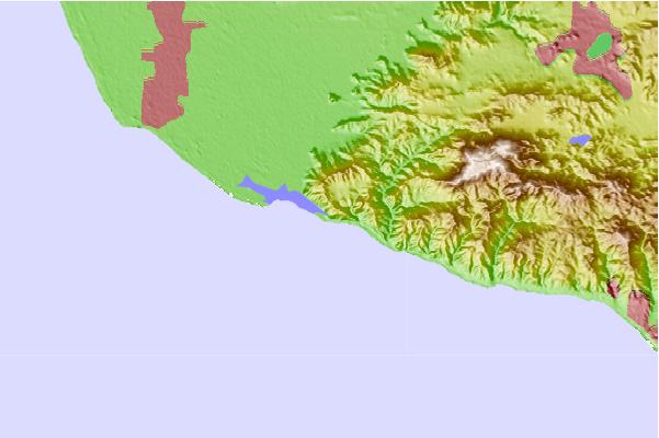
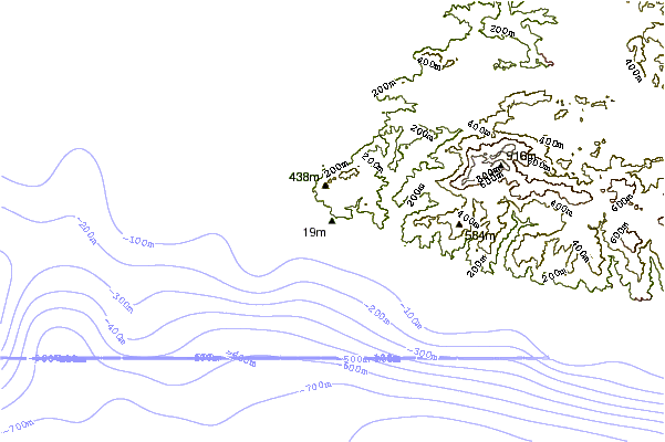
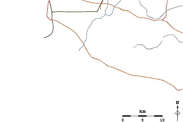
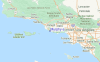
Gebruik deze reliëfkaart om naar de surfspots en de getijdenstations van CAL - Ventura toe te gaan, in de buurt van Murphy's.
Andere Dichtbijzijnde Surflocaties van Murphy's:
(klik op locatienaam voor meer informatie)- Closest Locatie1 mi
- Second closest Locatie3 mi
- Third closest Locatie3 mi
- Fourth closest Locatie3 mi
- Fifth closest Locatie4 mi
Dichtstbijzijnde golfboeien bij Murphy's:
- Closest golfboei22 mi
- Second closest golfboei24 mi
- Third closest golfboei27 mi
- Fourth closest golfboei29 mi
- Fifth closest golfboei36 mi
Getijdenstations in de buurt van Murphy's:
- Closest getijdenstationMugu Lagoon (ocean pier)2 mi
- Second closest getijdenstationOxnard9 mi
- Third closest getijdenstationPort Hueneme9 mi
- Fourth closest getijdenstationOxnard Shores12 mi
- Fifth closest getijdenstationMalibu16 mi
Airports
- The closest passenger airport to Murphy's is Point Mugu Nas Airport (NTD) in USA, 7 km (4 miles) away (directly).
- The second nearest airport to Murphy's is Los Angeles International Airport (LAX), also in USA, 62 km (39 miles) away.
- Third is Burbank Glendale Pasadena Airport (BUR) in USA, 66 km (41 miles) away.
- Jack Northrop Fld Hawthorne Muni Airport (HHR) in USA is 69 km (43 miles) away.
- Long Beach Airport (LGB), also in USA is the fifth nearest airport to Murphy's and is 89 km (55 miles) away.
- /breaks/Murphy-s/forecasts/latest


 Nearest