
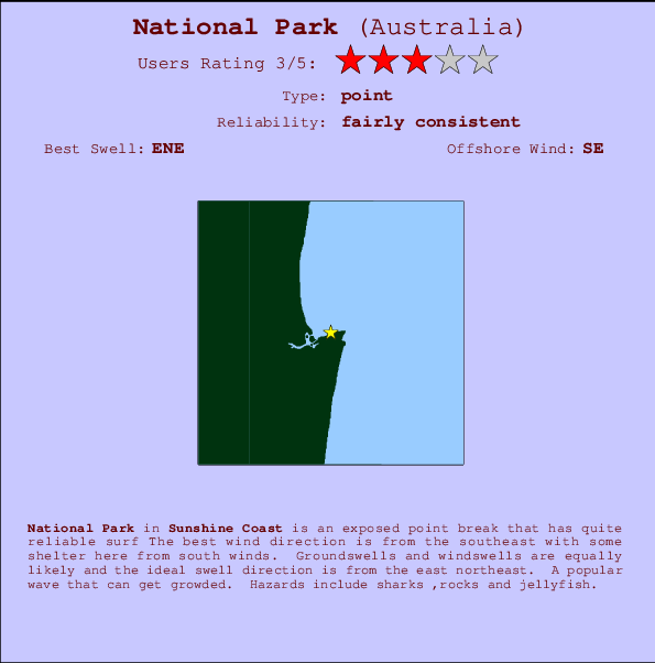
National Park Surf Guide
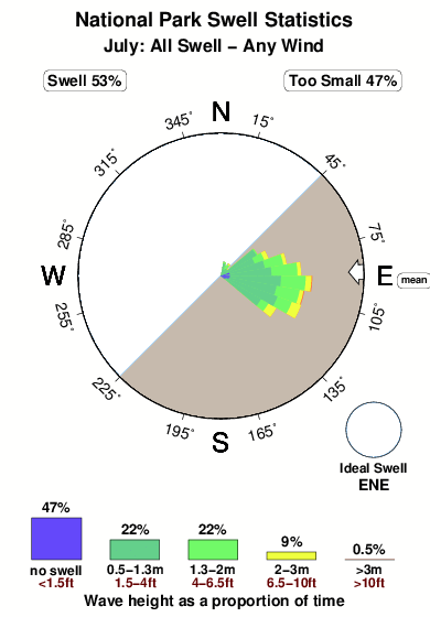
National Park in Sunshine Coast is an exposed point break that has pretty consitent surf Offshore winds blow from the southeast with some shelter here from south winds. Groundswells and windswells are equally likely and the ideal swell direction is from the east northeast. When the surf is up, crowds are likely Hazards include sharks ,rocks and jellyfish.
National Park Spot Info
| Type: | Rating: | Reliability: | Todays Sea Temp*: |
|---|---|---|---|
| fairly consistent | 20.8°C*ocean temperature recorded from satellite |
Surfing National Park:
The best conditions reported for surf at National Park occur when a East-northeast swell combines with an offshore wind direction from the Southeast.
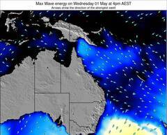
Voorspelde Golfenergie (Kracht): 12 uur

National Park Surf:
Thursday, 16 July 2026, 20:03 Local time| Thu | Fri | |||
| 7PM | 10PM | 1AM | 4AM | |
| Wave (m) | ||||
| Periode (s) | 8 | 7 | 7 | 7 |
| Wind (km/h) | ||||
| Wind | cross- off |
cross- off |
off | off |
- /breaks/National-Park/forecasts/latest
National Park Surf Guide
National Park in Sunshine Coast is an exposed point break that has pretty consitent surf Offshore winds blow from the southeast with some shelter here from south winds. Groundswells and windswells are equally likely and the ideal swell direction is from the east northeast. When the surf is up, crowds are likely Hazards include sharks ,rocks and jellyfish.
National Park Spot Info
Type: Rating: Reliability: Todays Sea Temp*:  Point
Point 3
3fairly consistent 20.8°C*ocean temperature recorded from satelliteSurfing National Park:
The best conditions reported for surf at National Park occur when a East-northeast swell combines with an offshore wind direction from the Southeast.
Voorspelde Golfenergie (Kracht): 12 uur
Gebruik de tabbladen hierboven om de zeewatertemperatuur bij National Park te bekijken, foto's van National Park, National Park gedetailleerde golfvoorspellingen, wind- en weersvoorspellingen, National Park webcams, actuele wind in QLD - Sunshine Coast live weerstations en National Park getijdenvoorspellingen. De link van Australia golfkaarten opent een grote afbeelding van Australia en de omliggende zeeën. Deze golfkaarten kunnen worden dynamisch gemaakt worden met de verschillende golfcomponenten, golfenergie, golfperiode, golfhoogte, samen met de wind en weersvoorspellingen, het actuele weer en de zeetoestand volgens golfboeien uit Australia, langskomende schepen en weerstations op de kust. Elk voorspelling pagina's voor dit surfstrand zijn voorzien van een wereldwijde en regionale golfzoeker om de beste surfsomstandigheden in het gebied rond National Park te vinden.
National Park Surf:
Thursday, 16 July 2026, 20:03 Local timeThu Fri 7PM 10PM 1AM 4AM Wave (m) Periode (s) 8 7 7 7 Wind (km/h) Wind cross-
offcross-
offoff off - /breaks/National-Park/forecasts/latest
- /breaks/National-Park/forecasts/latest/six_day
National Park Surf Guide
National Park in Sunshine Coast is an exposed point break that has pretty consitent surf Offshore winds blow from the southeast with some shelter here from south winds. Groundswells and windswells are equally likely and the ideal swell direction is from the east northeast. When the surf is up, crowds are likely Hazards include sharks ,rocks and jellyfish.
National Park Spot Info
Type: Rating: Reliability: Todays Sea Temp*: Point3fairly consistent 20.8°C*ocean temperature recorded from satelliteSurfing National Park:
The best conditions reported for surf at National Park occur when a East-northeast swell combines with an offshore wind direction from the Southeast.
Voorspelde Golfenergie (Kracht): 12 uur
Gebruik de tabbladen hierboven om de zeewatertemperatuur bij National Park te bekijken, foto's van National Park, National Park gedetailleerde golfvoorspellingen, wind- en weersvoorspellingen, National Park webcams, actuele wind in QLD - Sunshine Coast live weerstations en National Park getijdenvoorspellingen. De link van Australia golfkaarten opent een grote afbeelding van Australia en de omliggende zeeën. Deze golfkaarten kunnen worden dynamisch gemaakt worden met de verschillende golfcomponenten, golfenergie, golfperiode, golfhoogte, samen met de wind en weersvoorspellingen, het actuele weer en de zeetoestand volgens golfboeien uit Australia, langskomende schepen en weerstations op de kust. Elk voorspelling pagina's voor dit surfstrand zijn voorzien van een wereldwijde en regionale golfzoeker om de beste surfsomstandigheden in het gebied rond National Park te vinden.
National Park Surf:
Thursday, 16 July 2026, 20:03 Local timeThu Fri 7PM 10PM 1AM 4AM Wave (m) Periode (s) 8 7 7 7 Wind (km/h) Wind cross-
offcross-
offoff off - /breaks/National-Park/forecasts/latest
National Park Surf Guide
National Park in Sunshine Coast is an exposed point break that has pretty consitent surf Offshore winds blow from the southeast with some shelter here from south winds. Groundswells and windswells are equally likely and the ideal swell direction is from the east northeast. When the surf is up, crowds are likely Hazards include sharks ,rocks and jellyfish.
National Park Spot Info
Type: Rating: Reliability: Todays Sea Temp*: Point3fairly consistent 20.8°C*ocean temperature recorded from satelliteSurfing National Park:
The best conditions reported for surf at National Park occur when a East-northeast swell combines with an offshore wind direction from the Southeast.
Voorspelde Golfenergie (Kracht): 12 uur
Gebruik de tabbladen hierboven om de zeewatertemperatuur bij National Park te bekijken, foto's van National Park, National Park gedetailleerde golfvoorspellingen, wind- en weersvoorspellingen, National Park webcams, actuele wind in QLD - Sunshine Coast live weerstations en National Park getijdenvoorspellingen. De link van Australia golfkaarten opent een grote afbeelding van Australia en de omliggende zeeën. Deze golfkaarten kunnen worden dynamisch gemaakt worden met de verschillende golfcomponenten, golfenergie, golfperiode, golfhoogte, samen met de wind en weersvoorspellingen, het actuele weer en de zeetoestand volgens golfboeien uit Australia, langskomende schepen en weerstations op de kust. Elk voorspelling pagina's voor dit surfstrand zijn voorzien van een wereldwijde en regionale golfzoeker om de beste surfsomstandigheden in het gebied rond National Park te vinden.
National Park Surf:
Thursday, 16 July 2026, 20:03 Local timeThu Fri 7PM 10PM 1AM 4AM Wave (m) Periode (s) 8 7 7 7 Wind (km/h) Wind cross-
offcross-
offoff off Tide Times:
Voor Noosa Head, Australia, %{dist} %{km} van %{location}.
VOLGENDE IS OM (lokale tijd) resterende tijd hoog water laag water National Park Tide Times and Tide Chart
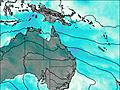
Live Weather:
At Sunrise Beach, 4 km from National Park.
moderate winds from the WSW
(km/h)Air temperature
14.6°COverall National Park Surf Consistency and Wind Distribution in July
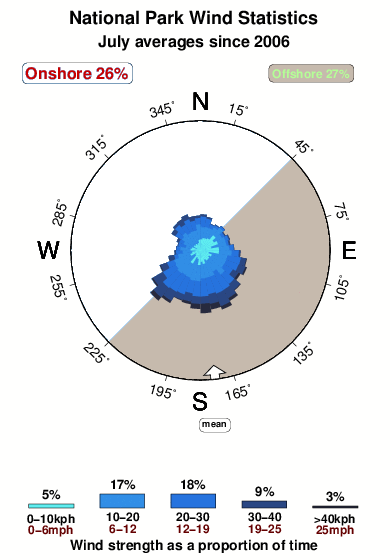


Wind stats for National Park: see the variation in direction and stength by month.
surffoto's uit
de galerijContourlijnen: Wegen & Rivieren: Kies een surflokatie uit het menu 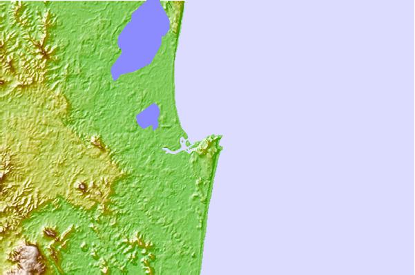
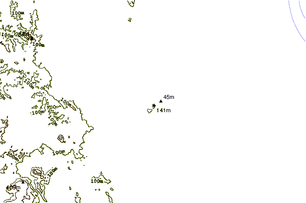
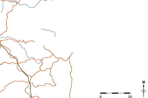
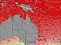
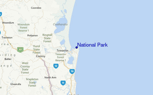
Gebruik deze reliëfkaart om naar de surfspots en de getijdenstations van QLD - Sunshine Coast toe te gaan, in de buurt van National Park.
Andere Dichtbijzijnde Surflocaties van National Park:
(klik op locatienaam voor meer informatie)- Closest Locatie0 mi
- Second closest Locatie0 mi
- Third closest Locatie1 mi
- Fourth closest Locatie1 mi
- Fifth closest Locatie1 mi
Dichtstbijzijnde golfboeien bij National Park:
- Closest golfboei14 mi
- Second closest golfboei33 mi
- Third closest golfboei38 mi
- Fourth closest golfboei83 mi
- Fifth closest golfboei112 mi
Getijdenstations in de buurt van National Park:
- Closest getijdenstationNoosa Head1 mi
- Second closest getijdenstationNoosa Heads3 mi
- Third closest getijdenstationTewantin4 mi
- Fourth closest getijdenstationCoolum Beach11 mi
- Fifth closest getijdenstationMooloolaba21 mi
Airports
- The nearest passenger airport to National Park is Maroochydore Sunshine Coast Airport (MCY) in Australia, which is 25 km (16 miles) away (directly).
- The second closest airport to National Park is Brisbane International Airport (BNE), also in Australia, 112 km (70 miles) away.
- /breaks/National-Park/forecasts/latest

 Nearest