

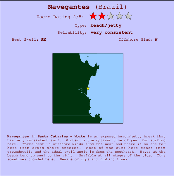
Navegantes Surf Guide
Navegantes in Santa Caterina is an exposed beach/jetty break that is often working. Winter is the optimum time of year for surfing here. Works best in offshore winds from the west. Groundswells more frequent than windswells and the best swell direction is from the southeast. The beach breaks favour rights. It's sometimes crowded here. Beware of rips and fishing lines.
Navegantes Spot Info
| Type: | Rating: | Reliability: | Todays Sea Temp*: |
|---|---|---|---|
| very consistent | 18.8°C*ocean temperature recorded from satellite |
Surfing Navegantes:
The best conditions reported for surf at Navegantes occur when a Southeast swell combines with an offshore wind direction from the West.
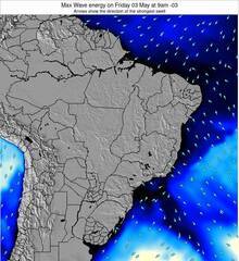
Voorspelde Golfenergie (Kracht): 12 uur


Navegantes Surf:
Thursday, 30 July 2026, 01:00 Local time| Thursday 30 | ||||
| 0AM | 3AM | 6AM | 9AM | |
| Wave (m) | ||||
| Periode (s) | 6 | 6 | 6 | 7 |
| Wind (km/h) | ||||
| Wind | cross | glass | glass | glass |
- /breaks/Navegantes/forecasts/latest
Navegantes Surf Guide
Navegantes in Santa Caterina is an exposed beach/jetty break that is often working. Winter is the optimum time of year for surfing here. Works best in offshore winds from the west. Groundswells more frequent than windswells and the best swell direction is from the southeast. The beach breaks favour rights. It's sometimes crowded here. Beware of rips and fishing lines.
Navegantes Spot Info
Type: Rating: Reliability: Todays Sea Temp*:  Beach/jetty
 2
2very consistent 18.8°C*ocean temperature recorded from satelliteSurfing Navegantes:
The best conditions reported for surf at Navegantes occur when a Southeast swell combines with an offshore wind direction from the West.
Voorspelde Golfenergie (Kracht): 12 uur
Gebruik de tabbladen hierboven om de zeewatertemperatuur bij Navegantes te bekijken, foto's van Navegantes, Navegantes gedetailleerde golfvoorspellingen, wind- en weersvoorspellingen, Navegantes webcams, actuele wind in Santa Catarina - Norte live weerstations en Navegantes getijdenvoorspellingen. De link van Brazil golfkaarten opent een grote afbeelding van Brazil en de omliggende zeeën. Deze golfkaarten kunnen worden dynamisch gemaakt worden met de verschillende golfcomponenten, golfenergie, golfperiode, golfhoogte, samen met de wind en weersvoorspellingen, het actuele weer en de zeetoestand volgens golfboeien uit Brazil, langskomende schepen en weerstations op de kust. Elk voorspelling pagina's voor dit surfstrand zijn voorzien van een wereldwijde en regionale golfzoeker om de beste surfsomstandigheden in het gebied rond Navegantes te vinden.
Navegantes Surf:
Thursday, 30 July 2026, 01:00 Local timeThursday 30 0AM 3AM 6AM 9AM Wave (m) Periode (s) 6 6 6 7 Wind (km/h) Wind cross glass glass glass - /breaks/Navegantes/forecasts/latest
- /breaks/Navegantes/forecasts/latest/six_day
Navegantes Surf Guide
Navegantes in Santa Caterina is an exposed beach/jetty break that is often working. Winter is the optimum time of year for surfing here. Works best in offshore winds from the west. Groundswells more frequent than windswells and the best swell direction is from the southeast. The beach breaks favour rights. It's sometimes crowded here. Beware of rips and fishing lines.
Navegantes Spot Info
Type: Rating: Reliability: Todays Sea Temp*: Beach/jetty2very consistent 18.8°C*ocean temperature recorded from satelliteSurfing Navegantes:
The best conditions reported for surf at Navegantes occur when a Southeast swell combines with an offshore wind direction from the West.
Voorspelde Golfenergie (Kracht): 12 uur
Gebruik de tabbladen hierboven om de zeewatertemperatuur bij Navegantes te bekijken, foto's van Navegantes, Navegantes gedetailleerde golfvoorspellingen, wind- en weersvoorspellingen, Navegantes webcams, actuele wind in Santa Catarina - Norte live weerstations en Navegantes getijdenvoorspellingen. De link van Brazil golfkaarten opent een grote afbeelding van Brazil en de omliggende zeeën. Deze golfkaarten kunnen worden dynamisch gemaakt worden met de verschillende golfcomponenten, golfenergie, golfperiode, golfhoogte, samen met de wind en weersvoorspellingen, het actuele weer en de zeetoestand volgens golfboeien uit Brazil, langskomende schepen en weerstations op de kust. Elk voorspelling pagina's voor dit surfstrand zijn voorzien van een wereldwijde en regionale golfzoeker om de beste surfsomstandigheden in het gebied rond Navegantes te vinden.
Navegantes Surf:
Thursday, 30 July 2026, 01:00 Local timeThursday 30 0AM 3AM 6AM 9AM Wave (m) Periode (s) 6 6 6 7 Wind (km/h) Wind cross glass glass glass - /breaks/Navegantes/forecasts/latest
Navegantes Surf Guide
Navegantes in Santa Caterina is an exposed beach/jetty break that is often working. Winter is the optimum time of year for surfing here. Works best in offshore winds from the west. Groundswells more frequent than windswells and the best swell direction is from the southeast. The beach breaks favour rights. It's sometimes crowded here. Beware of rips and fishing lines.
Navegantes Spot Info
Type: Rating: Reliability: Todays Sea Temp*: Beach/jetty2very consistent 18.8°C*ocean temperature recorded from satelliteSurfing Navegantes:
The best conditions reported for surf at Navegantes occur when a Southeast swell combines with an offshore wind direction from the West.
Voorspelde Golfenergie (Kracht): 12 uur
Gebruik de tabbladen hierboven om de zeewatertemperatuur bij Navegantes te bekijken, foto's van Navegantes, Navegantes gedetailleerde golfvoorspellingen, wind- en weersvoorspellingen, Navegantes webcams, actuele wind in Santa Catarina - Norte live weerstations en Navegantes getijdenvoorspellingen. De link van Brazil golfkaarten opent een grote afbeelding van Brazil en de omliggende zeeën. Deze golfkaarten kunnen worden dynamisch gemaakt worden met de verschillende golfcomponenten, golfenergie, golfperiode, golfhoogte, samen met de wind en weersvoorspellingen, het actuele weer en de zeetoestand volgens golfboeien uit Brazil, langskomende schepen en weerstations op de kust. Elk voorspelling pagina's voor dit surfstrand zijn voorzien van een wereldwijde en regionale golfzoeker om de beste surfsomstandigheden in het gebied rond Navegantes te vinden.
Navegantes Surf:
Thursday, 30 July 2026, 01:00 Local timeThursday 30 0AM 3AM 6AM 9AM Wave (m) Periode (s) 6 6 6 7 Wind (km/h) Wind cross glass glass glass Tide Times:
Voor Itajai, Brazil, %{dist} %{km} van %{location}.
VOLGENDE IS OM (lokale tijd) resterende tijd hoog water laag water Navegantes Tide Times and Tide Chart
Live Weather:
At Navegantes Airport, 1 km from Navegantes.
light winds from the WSW
(km/h)Air temperature
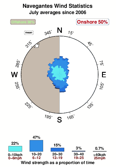
Q1018°COverall Navegantes Surf Consistency and Wind Distribution in July
surffoto's uit
de galerijContourlijnen: Wegen & Rivieren: Kies een surflokatie uit het menu 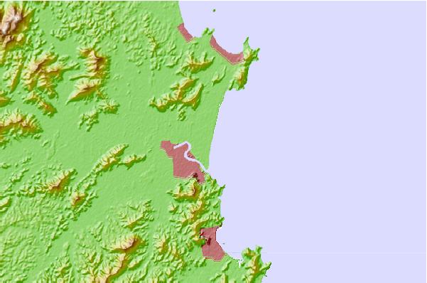
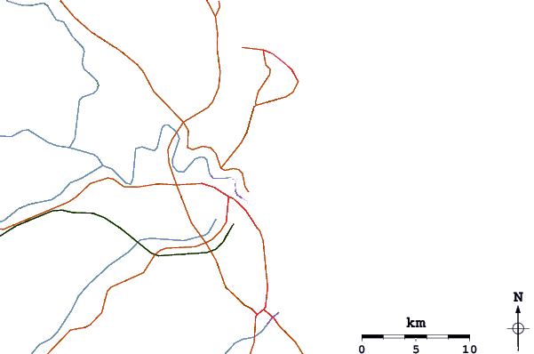
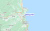
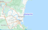
Gebruik deze reliëfkaart om naar de surfspots en de getijdenstations van Santa Catarina - Norte toe te gaan, in de buurt van Navegantes.
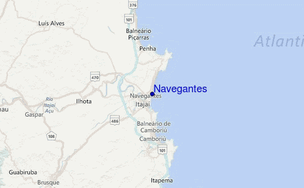
Andere Dichtbijzijnde Surflocaties van Navegantes:
(klik op locatienaam voor meer informatie)- Closest Locatie2 mi
- Second closest Locatie4 mi
- Third closest Locatie4 mi
- Fourth closest Locatie4 mi
- Fifth closest Locatie5 mi
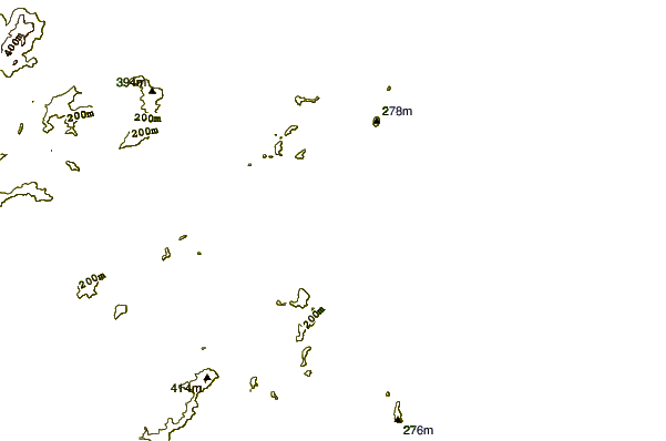
Dichtstbijzijnde golfboeien bij Navegantes:
- Closest golfboei328 mi
- Second closest golfboei2365 mi
- Third closest golfboei2856 mi
- Fourth closest golfboei2874 mi
- Fifth closest golfboei2912 mi
Getijdenstations in de buurt van Navegantes:
- Closest getijdenstationItajai1 mi
- Second closest getijdenstationBalneario Camboriu7 mi
- Third closest getijdenstationPenha8 mi
- Fourth closest getijdenstationBarra Velha17 mi
- Fifth closest getijdenstationPorto Belo19 mi
Airports
- The closest passenger airport to Navegantes is Navegantes Itajai Airport (NVT) in Brazil, 1 km (1 miles) away (directly).
- The second nearest airport to Navegantes is Joinville Airport (JOI), also in Brazil, 75 km (47 miles) away.
- Third is Hercilio Luz (Florianopolis) Airport (FLN) in Brazil, 88 km (55 miles) away.
- Afonso Pena (Curitiba) Airport (CWB) in Brazil is 160 km (99 miles) away.
- Bacacheri (Curitiba) Airport (BFH), also in Brazil is the fifth nearest airport to Navegantes and is 175 km (109 miles) away.
- /breaks/Navegantes/forecasts/latest


 Nearest