

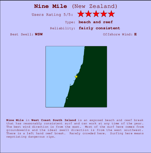
Nine Mile Surf Guide
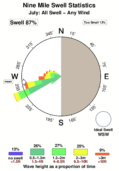
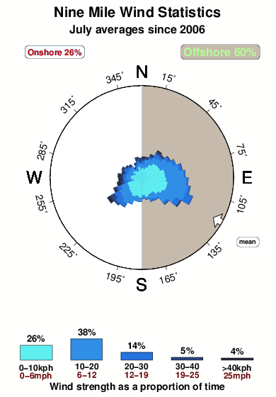
Nine Mile on the West Coast is an exposed beach and reef break that has quite reliable surf and can work at any time of the year. Offshore winds are from the east. Tends to receive a mix of groundswells and windswells and the ideal swell direction is from the west southwest. There is a left hand reef break. Even when there are waves, it's not likley to be crowded. Watch out for dangerous rips.
Nine Mile Spot Info
| Type: | Rating: | Reliability: | Todays Sea Temp*: |
|---|---|---|---|
| fairly consistent | 13.1°C*ocean temperature recorded from satellite |
Surfing Nine Mile:
The best conditions reported for surf at Nine Mile occur when a West-southwest swell combines with an offshore wind direction from the East.

Voorspelde Golfenergie (Kracht): 12 uur


Nine Mile Surf:
Friday, 17 July 2026, 01:54 Local time| Friday 17 | ||||
| 3AM | 6AM | 9AM | 12PM | |
| Wave (m) | ||||
| Periode (s) | 14 | 15 | 15 | 15 |
| Wind (km/h) | ||||
| Wind | cross | glass | cross | cross- on |
- /breaks/Nine-Mile/forecasts/latest
Nine Mile Surf Guide
Nine Mile on the West Coast is an exposed beach and reef break that has quite reliable surf and can work at any time of the year. Offshore winds are from the east. Tends to receive a mix of groundswells and windswells and the ideal swell direction is from the west southwest. There is a left hand reef break. Even when there are waves, it's not likley to be crowded. Watch out for dangerous rips.
Nine Mile Spot Info
Type: Rating: Reliability: Todays Sea Temp*:  Beach and reef
 5
5fairly consistent 13.1°C*ocean temperature recorded from satelliteSurfing Nine Mile:
The best conditions reported for surf at Nine Mile occur when a West-southwest swell combines with an offshore wind direction from the East.
Voorspelde Golfenergie (Kracht): 12 uur
Gebruik de tabbladen hierboven om de zeewatertemperatuur bij Nine Mile te bekijken, foto's van Nine Mile, Nine Mile gedetailleerde golfvoorspellingen, wind- en weersvoorspellingen, Nine Mile webcams, actuele wind in West Coast South Island live weerstations en Nine Mile getijdenvoorspellingen. De link van New Zealand golfkaarten opent een grote afbeelding van New Zealand en de omliggende zeeën. Deze golfkaarten kunnen worden dynamisch gemaakt worden met de verschillende golfcomponenten, golfenergie, golfperiode, golfhoogte, samen met de wind en weersvoorspellingen, het actuele weer en de zeetoestand volgens golfboeien uit New Zealand, langskomende schepen en weerstations op de kust. Elk voorspelling pagina's voor dit surfstrand zijn voorzien van een wereldwijde en regionale golfzoeker om de beste surfsomstandigheden in het gebied rond Nine Mile te vinden.
Nine Mile Surf:
Friday, 17 July 2026, 01:54 Local timeFriday 17 3AM 6AM 9AM 12PM Wave (m) Periode (s) 14 15 15 15 Wind (km/h) Wind cross glass cross cross-
on- /breaks/Nine-Mile/forecasts/latest
- /breaks/Nine-Mile/forecasts/latest/six_day
Nine Mile Surf Guide
Nine Mile on the West Coast is an exposed beach and reef break that has quite reliable surf and can work at any time of the year. Offshore winds are from the east. Tends to receive a mix of groundswells and windswells and the ideal swell direction is from the west southwest. There is a left hand reef break. Even when there are waves, it's not likley to be crowded. Watch out for dangerous rips.
Nine Mile Spot Info
Type: Rating: Reliability: Todays Sea Temp*: Beach and reef5fairly consistent 13.1°C*ocean temperature recorded from satelliteSurfing Nine Mile:
The best conditions reported for surf at Nine Mile occur when a West-southwest swell combines with an offshore wind direction from the East.
Voorspelde Golfenergie (Kracht): 12 uur
Gebruik de tabbladen hierboven om de zeewatertemperatuur bij Nine Mile te bekijken, foto's van Nine Mile, Nine Mile gedetailleerde golfvoorspellingen, wind- en weersvoorspellingen, Nine Mile webcams, actuele wind in West Coast South Island live weerstations en Nine Mile getijdenvoorspellingen. De link van New Zealand golfkaarten opent een grote afbeelding van New Zealand en de omliggende zeeën. Deze golfkaarten kunnen worden dynamisch gemaakt worden met de verschillende golfcomponenten, golfenergie, golfperiode, golfhoogte, samen met de wind en weersvoorspellingen, het actuele weer en de zeetoestand volgens golfboeien uit New Zealand, langskomende schepen en weerstations op de kust. Elk voorspelling pagina's voor dit surfstrand zijn voorzien van een wereldwijde en regionale golfzoeker om de beste surfsomstandigheden in het gebied rond Nine Mile te vinden.
Nine Mile Surf:
Friday, 17 July 2026, 01:54 Local timeFriday 17 3AM 6AM 9AM 12PM Wave (m) Periode (s) 14 15 15 15 Wind (km/h) Wind cross glass cross cross-
on- /breaks/Nine-Mile/forecasts/latest
Nine Mile Surf Guide
Nine Mile on the West Coast is an exposed beach and reef break that has quite reliable surf and can work at any time of the year. Offshore winds are from the east. Tends to receive a mix of groundswells and windswells and the ideal swell direction is from the west southwest. There is a left hand reef break. Even when there are waves, it's not likley to be crowded. Watch out for dangerous rips.
Nine Mile Spot Info
Type: Rating: Reliability: Todays Sea Temp*: Beach and reef5fairly consistent 13.1°C*ocean temperature recorded from satelliteSurfing Nine Mile:
The best conditions reported for surf at Nine Mile occur when a West-southwest swell combines with an offshore wind direction from the East.
Voorspelde Golfenergie (Kracht): 12 uur
Gebruik de tabbladen hierboven om de zeewatertemperatuur bij Nine Mile te bekijken, foto's van Nine Mile, Nine Mile gedetailleerde golfvoorspellingen, wind- en weersvoorspellingen, Nine Mile webcams, actuele wind in West Coast South Island live weerstations en Nine Mile getijdenvoorspellingen. De link van New Zealand golfkaarten opent een grote afbeelding van New Zealand en de omliggende zeeën. Deze golfkaarten kunnen worden dynamisch gemaakt worden met de verschillende golfcomponenten, golfenergie, golfperiode, golfhoogte, samen met de wind en weersvoorspellingen, het actuele weer en de zeetoestand volgens golfboeien uit New Zealand, langskomende schepen en weerstations op de kust. Elk voorspelling pagina's voor dit surfstrand zijn voorzien van een wereldwijde en regionale golfzoeker om de beste surfsomstandigheden in het gebied rond Nine Mile te vinden.
Nine Mile Surf:
Friday, 17 July 2026, 01:54 Local timeFriday 17 3AM 6AM 9AM 12PM Wave (m) Periode (s) 14 15 15 15 Wind (km/h) Wind cross glass cross cross-
onTide Times:
Op Nine Mile (0 km).
VOLGENDE IS OM (lokale tijd) resterende tijd hoog water laag water Nine Mile Tide Times and Tide Chart
Live Weather:
At Ratanui, 17 km from Nine Mile.
calm
(km/h)
DryAir temperature
11.9°COverall Nine Mile Surf Consistency and Wind Distribution in July
surffoto's uit
de galerijContourlijnen: Wegen & Rivieren: Kies een surflokatie uit het menu 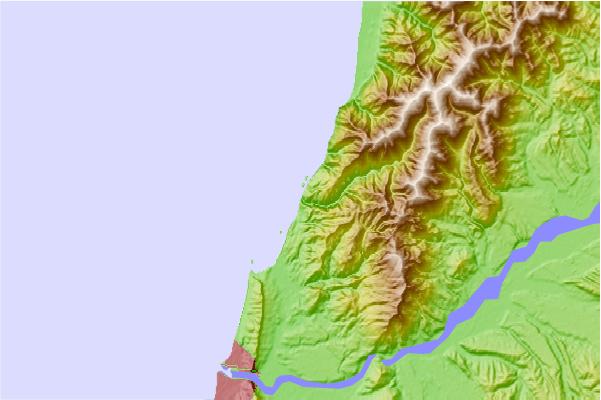
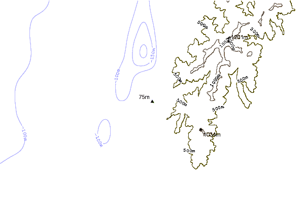
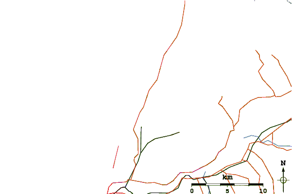
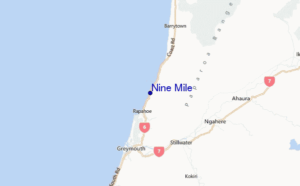
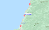
Gebruik deze reliëfkaart om naar de surfspots en de getijdenstations van West Coast South Island toe te gaan, in de buurt van Nine Mile.
Andere Dichtbijzijnde Surflocaties van Nine Mile:
(klik op locatienaam voor meer informatie)- Closest Locatie2 mi
- Second closest Locatie3 mi
- Third closest Locatie3 mi
- Fourth closest Locatie7 mi
- Fifth closest Locatie7 mi
Dichtstbijzijnde golfboeien bij Nine Mile:
- Closest golfboei127 mi
- Second closest golfboei143 mi
- Third closest golfboei176 mi
- Fourth closest golfboei428 mi
- Fifth closest golfboei480 mi
Getijdenstations in de buurt van Nine Mile:
- Closest getijdenstationGreymouth7 mi
- Second closest getijdenstationHokitika River Bar30 mi
- Third closest getijdenstationWestport44 mi
- Fourth closest getijdenstationOkarito82 mi
- Fifth closest getijdenstationKaiapoi100 mi
Airports
- The closest passenger airport to Nine Mile is Hokitika Airport (HKK) in New Zealand, 48 km (30 miles) away (directly).
- The second nearest airport to Nine Mile is Westport Airport (WSZ), also in New Zealand, 72 km (45 miles) away.
- Third is Christchurch International Airport (CHC) in New Zealand, 165 km (102 miles) away.
- Mount Cook Airport (GTN) in New Zealand is 183 km (114 miles) away.
- Glentanner Airport (MON), also in New Zealand is the fifth nearest airport to Nine Mile and is 197 km (122 miles) away.
- /breaks/Nine-Mile/forecasts/latest


 Nearest