
Niton Surf Guide
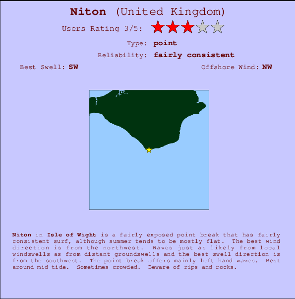
Niton in Isle of Wight is a reasonably exposed beach break that has reasonably consistent surf, although summer tends to be mostly flat. Works best in offshore winds from the northwest. Tends to receive a mix of groundswells and windswells and the ideal swell direction is from the southwest.. Best around mid tide. Beware of rips and rocks.
Niton Spot Info
| Type: | Rating: | Reliability: | Todays Sea Temp*: |
|---|---|---|---|
| fairly consistent | 20.3°C*ocean temperature recorded from satellite |
Surfing Niton:
The best conditions reported for surf at Niton occur when a Southwest swell combines with an offshore wind direction from the Northwest.
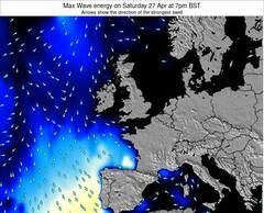
Voorspelde Golfenergie (Kracht): 12 uur


Niton Surf:
Monday, 20 July 2026, 04:23 Local time| Monday 20 | ||||
| 4AM | 7AM | 10AM | 1PM | |
| Wave (m) | ||||
| Periode (s) | 10 | 7 | 3 | 4 |
| Wind (km/h) | ||||
| Wind | cross | cross- off |
cross | on |
- /breaks/Niton/forecasts/latest

Niton Surf Guide
Niton in Isle of Wight is a reasonably exposed beach break that has reasonably consistent surf, although summer tends to be mostly flat. Works best in offshore winds from the northwest. Tends to receive a mix of groundswells and windswells and the ideal swell direction is from the southwest.. Best around mid tide. Beware of rips and rocks.
Niton Spot Info
Type: Rating: Reliability: Todays Sea Temp*:  Point
Point 3
3fairly consistent 20.3°C*ocean temperature recorded from satelliteSurfing Niton:
The best conditions reported for surf at Niton occur when a Southwest swell combines with an offshore wind direction from the Northwest.
Voorspelde Golfenergie (Kracht): 12 uur
Gebruik de tabbladen hierboven om de zeewatertemperatuur bij Niton te bekijken, foto's van Niton, Niton gedetailleerde golfvoorspellingen, wind- en weersvoorspellingen, Niton webcams, actuele wind in Isle of Wight live weerstations en Niton getijdenvoorspellingen. De link van United Kingdom golfkaarten opent een grote afbeelding van United Kingdom en de omliggende zeeën. Deze golfkaarten kunnen worden dynamisch gemaakt worden met de verschillende golfcomponenten, golfenergie, golfperiode, golfhoogte, samen met de wind en weersvoorspellingen, het actuele weer en de zeetoestand volgens golfboeien uit United Kingdom, langskomende schepen en weerstations op de kust. Elk voorspelling pagina's voor dit surfstrand zijn voorzien van een wereldwijde en regionale golfzoeker om de beste surfsomstandigheden in het gebied rond Niton te vinden.
Niton Surf:
Monday, 20 July 2026, 04:23 Local timeMonday 20 4AM 7AM 10AM 1PM Wave (m) Periode (s) 10 7 3 4 Wind (km/h) Wind cross cross-
offcross on - /breaks/Niton/forecasts/latest
- /breaks/Niton/forecasts/latest/six_day
Niton Surf Guide
Niton in Isle of Wight is a reasonably exposed beach break that has reasonably consistent surf, although summer tends to be mostly flat. Works best in offshore winds from the northwest. Tends to receive a mix of groundswells and windswells and the ideal swell direction is from the southwest.. Best around mid tide. Beware of rips and rocks.
Niton Spot Info
Type: Rating: Reliability: Todays Sea Temp*: Point3fairly consistent 20.3°C*ocean temperature recorded from satelliteSurfing Niton:
The best conditions reported for surf at Niton occur when a Southwest swell combines with an offshore wind direction from the Northwest.
Voorspelde Golfenergie (Kracht): 12 uur
Gebruik de tabbladen hierboven om de zeewatertemperatuur bij Niton te bekijken, foto's van Niton, Niton gedetailleerde golfvoorspellingen, wind- en weersvoorspellingen, Niton webcams, actuele wind in Isle of Wight live weerstations en Niton getijdenvoorspellingen. De link van United Kingdom golfkaarten opent een grote afbeelding van United Kingdom en de omliggende zeeën. Deze golfkaarten kunnen worden dynamisch gemaakt worden met de verschillende golfcomponenten, golfenergie, golfperiode, golfhoogte, samen met de wind en weersvoorspellingen, het actuele weer en de zeetoestand volgens golfboeien uit United Kingdom, langskomende schepen en weerstations op de kust. Elk voorspelling pagina's voor dit surfstrand zijn voorzien van een wereldwijde en regionale golfzoeker om de beste surfsomstandigheden in het gebied rond Niton te vinden.
Niton Surf:
Monday, 20 July 2026, 04:23 Local timeMonday 20 4AM 7AM 10AM 1PM Wave (m) Periode (s) 10 7 3 4 Wind (km/h) Wind cross cross-
offcross on - /breaks/Niton/forecasts/latest
Niton Surf Guide
Niton in Isle of Wight is a reasonably exposed beach break that has reasonably consistent surf, although summer tends to be mostly flat. Works best in offshore winds from the northwest. Tends to receive a mix of groundswells and windswells and the ideal swell direction is from the southwest.. Best around mid tide. Beware of rips and rocks.
Niton Spot Info
Type: Rating: Reliability: Todays Sea Temp*: Point3fairly consistent 20.3°C*ocean temperature recorded from satelliteSurfing Niton:
The best conditions reported for surf at Niton occur when a Southwest swell combines with an offshore wind direction from the Northwest.
Voorspelde Golfenergie (Kracht): 12 uur
Gebruik de tabbladen hierboven om de zeewatertemperatuur bij Niton te bekijken, foto's van Niton, Niton gedetailleerde golfvoorspellingen, wind- en weersvoorspellingen, Niton webcams, actuele wind in Isle of Wight live weerstations en Niton getijdenvoorspellingen. De link van United Kingdom golfkaarten opent een grote afbeelding van United Kingdom en de omliggende zeeën. Deze golfkaarten kunnen worden dynamisch gemaakt worden met de verschillende golfcomponenten, golfenergie, golfperiode, golfhoogte, samen met de wind en weersvoorspellingen, het actuele weer en de zeetoestand volgens golfboeien uit United Kingdom, langskomende schepen en weerstations op de kust. Elk voorspelling pagina's voor dit surfstrand zijn voorzien van een wereldwijde en regionale golfzoeker om de beste surfsomstandigheden in het gebied rond Niton te vinden.
Niton Surf:
Monday, 20 July 2026, 04:23 Local timeMonday 20 4AM 7AM 10AM 1PM Wave (m) Periode (s) 10 7 3 4 Wind (km/h) Wind cross cross-
offcross on Tide Times:
Voor Ventnor, %{dist} %{km} van %{location}.
VOLGENDE IS OM (lokale tijd) resterende tijd hoog water laag water Niton Tide Times and Tide Chart
Live Weather:
At SHIP2882, 21 km from Niton.
- Air temperature
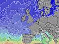
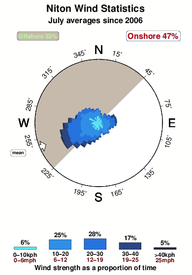
-°COverall Niton Surf Consistency and Wind Distribution in July
surffoto's uit
de galerijContourlijnen: Wegen & Rivieren: Kies een surflokatie uit het menu 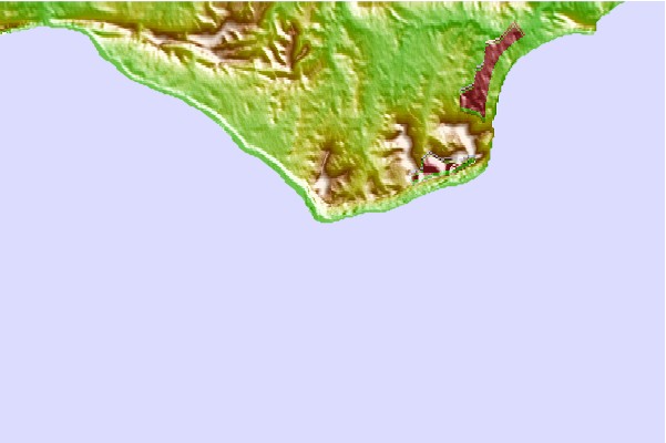
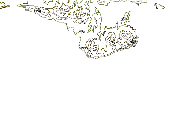
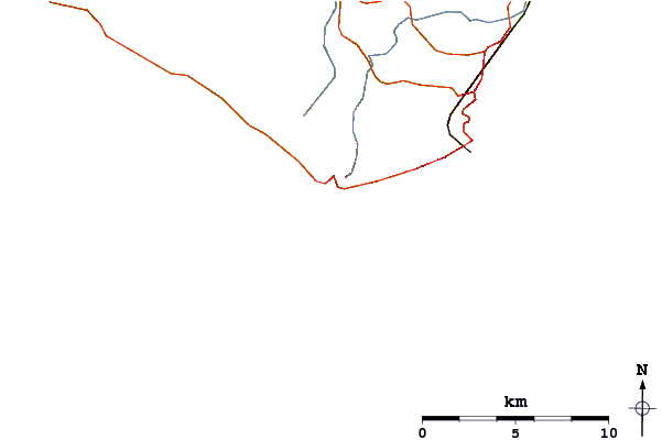
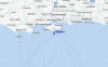
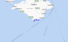
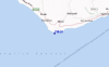
Gebruik deze reliëfkaart om naar de surfspots en de getijdenstations van Isle of Wight toe te gaan, in de buurt van Niton.
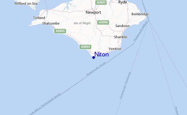
Andere Dichtbijzijnde Surflocaties van Niton:
(klik op locatienaam voor meer informatie)- Closest Locatie4 mi
- Second closest Locatie6 mi
- Third closest Locatie11 mi
- Fourth closest Locatie11 mi
- Fifth closest Locatie11 mi
Dichtstbijzijnde golfboeien bij Niton:
- Closest golfboei9 mi
- Second closest golfboei10 mi
- Third closest golfboei17 mi
- Fourth closest golfboei18 mi
- Fifth closest golfboei22 mi
Getijdenstations in de buurt van Niton:
- Closest getijdenstationVentnor6 mi
- Second closest getijdenstationRyde11 mi
- Third closest getijdenstationCowes12 mi
- Fourth closest getijdenstationFreshwater12 mi
- Fifth closest getijdenstationLee-on-the-Solent16 mi
Airports
- The closest passenger airport to Niton is Southampton Airport (SOU) in England, 42 km (26 miles) away (directly).
- The second nearest airport to Niton is Bournemouth Airport (BOH), also in England, 45 km (28 miles) away.
- Third is Gatwick (London) Airport (LGW) in England, 101 km (63 miles) away.
- Maupertus (Cherbourg) Airport (CER) in France is 103 km (64 miles) away.
- Yeovilton Airport (YEO) in U.k. is the fifth nearest airport to Niton and is 106 km (66 miles) away.
- /breaks/Niton/forecasts/latest


 Nearest