
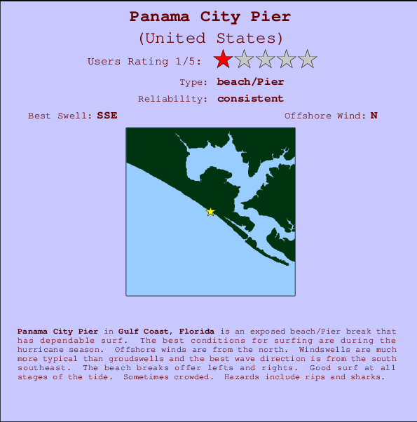
Panama City Pier Surf Guide
Panama City Pier in Florida is an exposed beach/Pier break that has reliable surf. The favoured conditions for surfing are during the hurricane season. Offshore winds blow from the north. Windswells are much more typical than groudswells and the optimum wave angle is from the south southeast. The beach break provides left and right handers. The quality of the surf isn't affected by the tide. When it's working here, it can get crowded. Beware of rips and sharks.
Panama City Pier Spot Info
| Type: | Rating: | Reliability: | Todays Sea Temp*: |
|---|---|---|---|
| consistent | 30.4°C*ocean temperature recorded from satellite |
Surfing Panama City Pier:
The best conditions reported for surf at Panama City Pier occur when a South-southeast swell combines with an offshore wind direction from the North.
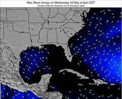
Voorspelde Golfenergie (Kracht): 12 uur

Panama City Pier Surf:
Wednesday, 15 July 2026, 17:59 Local time| Wednesday 15 | Thu | |||
| 4PM | 7PM | 10PM | 1AM | |
| Wave (m) | ||||
| Periode (s) | 3 | 4 | 4 | 4 |
| Wind (km/h) | ||||
| Wind | cross- on |
cross | cross | cross- off |
- /breaks/Panama-City-Pier/forecasts/latest
Panama City Pier Surf Guide
Panama City Pier in Florida is an exposed beach/Pier break that has reliable surf. The favoured conditions for surfing are during the hurricane season. Offshore winds blow from the north. Windswells are much more typical than groudswells and the optimum wave angle is from the south southeast. The beach break provides left and right handers. The quality of the surf isn't affected by the tide. When it's working here, it can get crowded. Beware of rips and sharks.
Panama City Pier Spot Info
Type: Rating: Reliability: Todays Sea Temp*:  Beach/pier
 1
1consistent 30.4°C*ocean temperature recorded from satelliteSurfing Panama City Pier:
The best conditions reported for surf at Panama City Pier occur when a South-southeast swell combines with an offshore wind direction from the North.
Voorspelde Golfenergie (Kracht): 12 uur
Gebruik de tabbladen hierboven om de zeewatertemperatuur bij Panama City Pier te bekijken, foto's van Panama City Pier, Panama City Pier gedetailleerde golfvoorspellingen, wind- en weersvoorspellingen, Panama City Pier webcams, actuele wind in Florida - Gulf live weerstations en Panama City Pier getijdenvoorspellingen. De link van United States golfkaarten opent een grote afbeelding van United States en de omliggende zeeën. Deze golfkaarten kunnen worden dynamisch gemaakt worden met de verschillende golfcomponenten, golfenergie, golfperiode, golfhoogte, samen met de wind en weersvoorspellingen, het actuele weer en de zeetoestand volgens golfboeien uit United States, langskomende schepen en weerstations op de kust. Elk voorspelling pagina's voor dit surfstrand zijn voorzien van een wereldwijde en regionale golfzoeker om de beste surfsomstandigheden in het gebied rond Panama City Pier te vinden.
Panama City Pier Surf:
Wednesday, 15 July 2026, 17:59 Local timeWednesday 15 Thu 4PM 7PM 10PM 1AM Wave (m) Periode (s) 3 4 4 4 Wind (km/h) Wind cross-
oncross cross cross-
off- /breaks/Panama-City-Pier/forecasts/latest
- /breaks/Panama-City-Pier/forecasts/latest/six_day
Panama City Pier Surf Guide
Panama City Pier in Florida is an exposed beach/Pier break that has reliable surf. The favoured conditions for surfing are during the hurricane season. Offshore winds blow from the north. Windswells are much more typical than groudswells and the optimum wave angle is from the south southeast. The beach break provides left and right handers. The quality of the surf isn't affected by the tide. When it's working here, it can get crowded. Beware of rips and sharks.
Panama City Pier Spot Info
Type: Rating: Reliability: Todays Sea Temp*: Beach/pier1consistent 30.4°C*ocean temperature recorded from satelliteSurfing Panama City Pier:
The best conditions reported for surf at Panama City Pier occur when a South-southeast swell combines with an offshore wind direction from the North.
Voorspelde Golfenergie (Kracht): 12 uur
Gebruik de tabbladen hierboven om de zeewatertemperatuur bij Panama City Pier te bekijken, foto's van Panama City Pier, Panama City Pier gedetailleerde golfvoorspellingen, wind- en weersvoorspellingen, Panama City Pier webcams, actuele wind in Florida - Gulf live weerstations en Panama City Pier getijdenvoorspellingen. De link van United States golfkaarten opent een grote afbeelding van United States en de omliggende zeeën. Deze golfkaarten kunnen worden dynamisch gemaakt worden met de verschillende golfcomponenten, golfenergie, golfperiode, golfhoogte, samen met de wind en weersvoorspellingen, het actuele weer en de zeetoestand volgens golfboeien uit United States, langskomende schepen en weerstations op de kust. Elk voorspelling pagina's voor dit surfstrand zijn voorzien van een wereldwijde en regionale golfzoeker om de beste surfsomstandigheden in het gebied rond Panama City Pier te vinden.
Panama City Pier Surf:
Wednesday, 15 July 2026, 17:59 Local timeWednesday 15 Thu 4PM 7PM 10PM 1AM Wave (m) Periode (s) 3 4 4 4 Wind (km/h) Wind cross-
oncross cross cross-
off- /breaks/Panama-City-Pier/forecasts/latest
Panama City Pier Surf Guide
Panama City Pier in Florida is an exposed beach/Pier break that has reliable surf. The favoured conditions for surfing are during the hurricane season. Offshore winds blow from the north. Windswells are much more typical than groudswells and the optimum wave angle is from the south southeast. The beach break provides left and right handers. The quality of the surf isn't affected by the tide. When it's working here, it can get crowded. Beware of rips and sharks.
Panama City Pier Spot Info
Type: Rating: Reliability: Todays Sea Temp*: Beach/pier1consistent 30.4°C*ocean temperature recorded from satelliteSurfing Panama City Pier:
The best conditions reported for surf at Panama City Pier occur when a South-southeast swell combines with an offshore wind direction from the North.
Voorspelde Golfenergie (Kracht): 12 uur
Gebruik de tabbladen hierboven om de zeewatertemperatuur bij Panama City Pier te bekijken, foto's van Panama City Pier, Panama City Pier gedetailleerde golfvoorspellingen, wind- en weersvoorspellingen, Panama City Pier webcams, actuele wind in Florida - Gulf live weerstations en Panama City Pier getijdenvoorspellingen. De link van United States golfkaarten opent een grote afbeelding van United States en de omliggende zeeën. Deze golfkaarten kunnen worden dynamisch gemaakt worden met de verschillende golfcomponenten, golfenergie, golfperiode, golfhoogte, samen met de wind en weersvoorspellingen, het actuele weer en de zeetoestand volgens golfboeien uit United States, langskomende schepen en weerstations op de kust. Elk voorspelling pagina's voor dit surfstrand zijn voorzien van een wereldwijde en regionale golfzoeker om de beste surfsomstandigheden in het gebied rond Panama City Pier te vinden.
Panama City Pier Surf:
Wednesday, 15 July 2026, 17:59 Local timeWednesday 15 Thu 4PM 7PM 10PM 1AM Wave (m) Periode (s) 3 4 4 4 Wind (km/h) Wind cross-
oncross cross cross-
offTide Times:
Voor Panama City Beach, %{dist} %{km} van %{location}.
VOLGENDE IS OM (lokale tijd) resterende tijd hoog water laag water Panama City Pier Tide Times and Tide Chart
Live Weather:
At Bayview wx, 6 km from Panama City Pier.
wind obs. (19 kph from 292 degs) was rejected
(km/h)
dryAir temperature
32°CCurrent weather near Panama City Pier
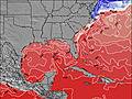
Buoy Data:
At Pensacola Buoy, 96 miles from Panama City Pier.
12PM 1PM 2PM 3PM Gegevens Leeftijd 4 hr 3 hr 2 hr 1 hr Golfhoogte (m) 

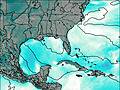
Dominante Periode (s) 9 - 6 6 Overall Panama City Pier Surf Consistency and Wind Distribution in July


Wind stats for Panama City Pier: see the variation in direction and stength by month.
surffoto's uit
de galerijContourlijnen: Wegen & Rivieren: Kies een surflokatie uit het menu 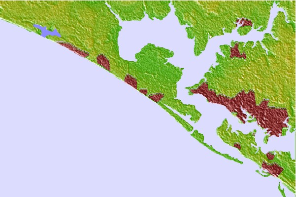

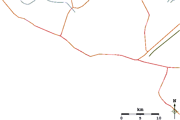
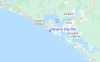
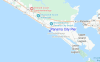
Gebruik deze reliëfkaart om naar de surfspots en de getijdenstations van Florida - Gulf toe te gaan, in de buurt van Panama City Pier.
Andere Dichtbijzijnde Surflocaties van Panama City Pier:
(klik op locatienaam voor meer informatie)- Closest Locatie2 mi
- Second closest Locatie4 mi
- Third closest Locatie6 mi
- Fourth closest Locatie7 mi
- Fifth closest Locatie41 mi
Dichtstbijzijnde golfboeien bij Panama City Pier:
- Closest golfboei96 mi
- Second closest golfboei105 mi
- Third closest golfboei139 mi
- Fourth closest golfboei178 mi
- Fifth closest golfboei213 mi
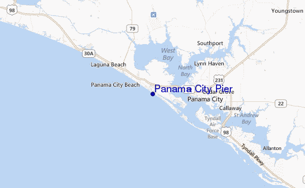
Getijdenstations in de buurt van Panama City Pier:
- Closest getijdenstationPanama City Beach1 mi
- Second closest getijdenstationAlligator Bayou, Saint Andrew Bay3 mi
- Third closest getijdenstationChannel entrance, Saint Andrew Bay6 mi
- Fourth closest getijdenstationPanama City Beach6 mi
- Fifth closest getijdenstationPanama City Beach (outside), Saint Andrew Bay6 mi
Airports
- The closest passenger airport to Panama City Pier is Tyndall Afb (Panama City) Airport (PAM) in USA, 25 km (16 miles) away (directly).
- The second nearest airport to Panama City Pier is Eglin Afb (Valparaiso) Airport (VPS) in Usa (florida, 78 km (48 miles) away.
- Third is Hurlburt Fld (Mary Esther) Airport (HRT) in USA, 90 km (56 miles) away.
- Bob Sikes (Crestview) Airport (CEW) in USA is 97 km (60 miles) away.
- Dothan Rgnl Airport (DHN), also in USA is the fifth nearest airport to Panama City Pier and is 132 km (82 miles) away.
- /breaks/Panama-City-Pier/forecasts/latest

 Nearest