
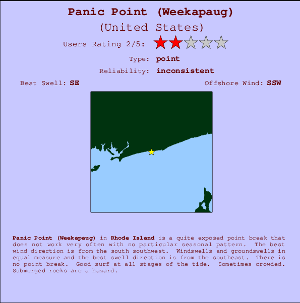
Panic Point (Weekapaug) Surf Guide
Panic Point (Weekapaug) in Rhode Island is a fairly exposed point break that has inconsistent surf with no particular seasonal pattern. Offshore winds blow from the south southwest. Windswells and groundswells in equal measure and the best swell direction is from the southeast. There is no point break. Good surf at all stages of the tide. Sometimes crowded. Submerged rocks are a hazard.
Panic Point (Weekapaug) Spot Info
| Type: | Rating: | Reliability: | Todays Sea Temp*: |
|---|---|---|---|
| inconsistent | 19.7°C*ocean temperature recorded from satellite |
Surfing Panic Point (Weekapaug):
The best conditions reported for surf at Panic Point (Weekapaug) occur when a Southeast swell combines with an offshore wind direction from the South-southwest.

Voorspelde Golfenergie (Kracht): 12 uur


Panic Point (Weekapaug) Surf:
Saturday, 18 July 2026, 05:05 Local time| Saturday 18 | ||||
| 5AM | 8AM | 11AM | 2PM | |
| Wave (m) | ||||
| Periode (s) | 5 | 14 | 14 | 13 |
| Wind (km/h) | ||||
| Wind | off | off | off | off |
- /breaks/Panic-Point-Weekapaug/forecasts/latest
Panic Point (Weekapaug) Surf Guide
Panic Point (Weekapaug) in Rhode Island is a fairly exposed point break that has inconsistent surf with no particular seasonal pattern. Offshore winds blow from the south southwest. Windswells and groundswells in equal measure and the best swell direction is from the southeast. There is no point break. Good surf at all stages of the tide. Sometimes crowded. Submerged rocks are a hazard.
Panic Point (Weekapaug) Spot Info
Type: Rating: Reliability: Todays Sea Temp*:  Point
Point 2
2inconsistent 19.7°C*ocean temperature recorded from satelliteSurfing Panic Point (Weekapaug):
The best conditions reported for surf at Panic Point (Weekapaug) occur when a Southeast swell combines with an offshore wind direction from the South-southwest.
Voorspelde Golfenergie (Kracht): 12 uur
Gebruik de tabbladen hierboven om de zeewatertemperatuur bij Panic Point (Weekapaug) te bekijken, foto's van Panic Point (Weekapaug), Panic Point (Weekapaug) gedetailleerde golfvoorspellingen, wind- en weersvoorspellingen, Panic Point (Weekapaug) webcams, actuele wind in Rhode Island live weerstations en Panic Point (Weekapaug) getijdenvoorspellingen. De link van United States golfkaarten opent een grote afbeelding van United States en de omliggende zeeën. Deze golfkaarten kunnen worden dynamisch gemaakt worden met de verschillende golfcomponenten, golfenergie, golfperiode, golfhoogte, samen met de wind en weersvoorspellingen, het actuele weer en de zeetoestand volgens golfboeien uit United States, langskomende schepen en weerstations op de kust. Elk voorspelling pagina's voor dit surfstrand zijn voorzien van een wereldwijde en regionale golfzoeker om de beste surfsomstandigheden in het gebied rond Panic Point (Weekapaug) te vinden.
Panic Point (Weekapaug) Surf:
Saturday, 18 July 2026, 05:05 Local timeSaturday 18 5AM 8AM 11AM 2PM Wave (m) Periode (s) 5 14 14 13 Wind (km/h) Wind off off off off - /breaks/Panic-Point-Weekapaug/forecasts/latest
- /breaks/Panic-Point-Weekapaug/forecasts/latest/six_day
Panic Point (Weekapaug) Surf Guide
Panic Point (Weekapaug) in Rhode Island is a fairly exposed point break that has inconsistent surf with no particular seasonal pattern. Offshore winds blow from the south southwest. Windswells and groundswells in equal measure and the best swell direction is from the southeast. There is no point break. Good surf at all stages of the tide. Sometimes crowded. Submerged rocks are a hazard.
Panic Point (Weekapaug) Spot Info
Type: Rating: Reliability: Todays Sea Temp*: Point2inconsistent 19.7°C*ocean temperature recorded from satelliteSurfing Panic Point (Weekapaug):
The best conditions reported for surf at Panic Point (Weekapaug) occur when a Southeast swell combines with an offshore wind direction from the South-southwest.
Voorspelde Golfenergie (Kracht): 12 uur
Gebruik de tabbladen hierboven om de zeewatertemperatuur bij Panic Point (Weekapaug) te bekijken, foto's van Panic Point (Weekapaug), Panic Point (Weekapaug) gedetailleerde golfvoorspellingen, wind- en weersvoorspellingen, Panic Point (Weekapaug) webcams, actuele wind in Rhode Island live weerstations en Panic Point (Weekapaug) getijdenvoorspellingen. De link van United States golfkaarten opent een grote afbeelding van United States en de omliggende zeeën. Deze golfkaarten kunnen worden dynamisch gemaakt worden met de verschillende golfcomponenten, golfenergie, golfperiode, golfhoogte, samen met de wind en weersvoorspellingen, het actuele weer en de zeetoestand volgens golfboeien uit United States, langskomende schepen en weerstations op de kust. Elk voorspelling pagina's voor dit surfstrand zijn voorzien van een wereldwijde en regionale golfzoeker om de beste surfsomstandigheden in het gebied rond Panic Point (Weekapaug) te vinden.
Panic Point (Weekapaug) Surf:
Saturday, 18 July 2026, 05:05 Local timeSaturday 18 5AM 8AM 11AM 2PM Wave (m) Periode (s) 5 14 14 13 Wind (km/h) Wind off off off off - /breaks/Panic-Point-Weekapaug/forecasts/latest
Panic Point (Weekapaug) Surf Guide
Panic Point (Weekapaug) in Rhode Island is a fairly exposed point break that has inconsistent surf with no particular seasonal pattern. Offshore winds blow from the south southwest. Windswells and groundswells in equal measure and the best swell direction is from the southeast. There is no point break. Good surf at all stages of the tide. Sometimes crowded. Submerged rocks are a hazard.
Panic Point (Weekapaug) Spot Info
Type: Rating: Reliability: Todays Sea Temp*: Point2inconsistent 19.7°C*ocean temperature recorded from satelliteSurfing Panic Point (Weekapaug):
The best conditions reported for surf at Panic Point (Weekapaug) occur when a Southeast swell combines with an offshore wind direction from the South-southwest.
Voorspelde Golfenergie (Kracht): 12 uur
Gebruik de tabbladen hierboven om de zeewatertemperatuur bij Panic Point (Weekapaug) te bekijken, foto's van Panic Point (Weekapaug), Panic Point (Weekapaug) gedetailleerde golfvoorspellingen, wind- en weersvoorspellingen, Panic Point (Weekapaug) webcams, actuele wind in Rhode Island live weerstations en Panic Point (Weekapaug) getijdenvoorspellingen. De link van United States golfkaarten opent een grote afbeelding van United States en de omliggende zeeën. Deze golfkaarten kunnen worden dynamisch gemaakt worden met de verschillende golfcomponenten, golfenergie, golfperiode, golfhoogte, samen met de wind en weersvoorspellingen, het actuele weer en de zeetoestand volgens golfboeien uit United States, langskomende schepen en weerstations op de kust. Elk voorspelling pagina's voor dit surfstrand zijn voorzien van een wereldwijde en regionale golfzoeker om de beste surfsomstandigheden in het gebied rond Panic Point (Weekapaug) te vinden.
Panic Point (Weekapaug) Surf:
Saturday, 18 July 2026, 05:05 Local timeSaturday 18 5AM 8AM 11AM 2PM Wave (m) Periode (s) 5 14 14 13 Wind (km/h) Wind off off off off Tide Times:
Voor Weekapaug Point, Block Island Sound, Rhode Island, %{dist} %{km} van %{location}.
VOLGENDE IS OM (lokale tijd) resterende tijd hoog water laag water Panic Point (Weekapaug) Tide Times and Tide Chart
Live Weather:
At Westerly Airport, 5 km from Panic Point (Weekapaug).
calm
(km/h)
ClearAir temperature
16.1°CCurrent weather near Panic Point (Weekapaug)
Buoy Data:
At Block Island, RI, 40 miles from Panic Point (Weekapaug).
11PM 12AM 1AM 2AM Gegevens Leeftijd 4 hr 3 hr 2 hr 1 hr Golfhoogte (m) 

Dominante Periode (s) 14 14 14 14 surffoto's uit
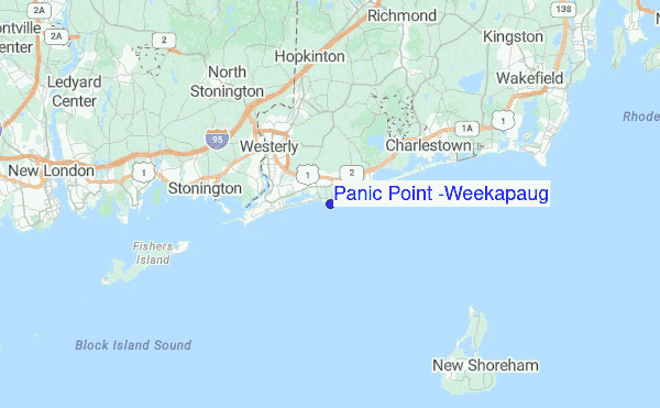
de galerijContourlijnen: Wegen & Rivieren: Kies een surflokatie uit het menu 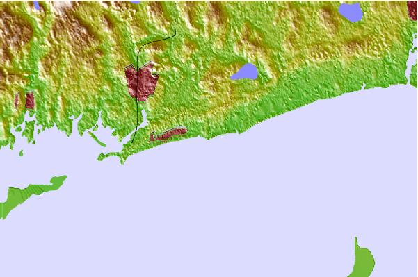
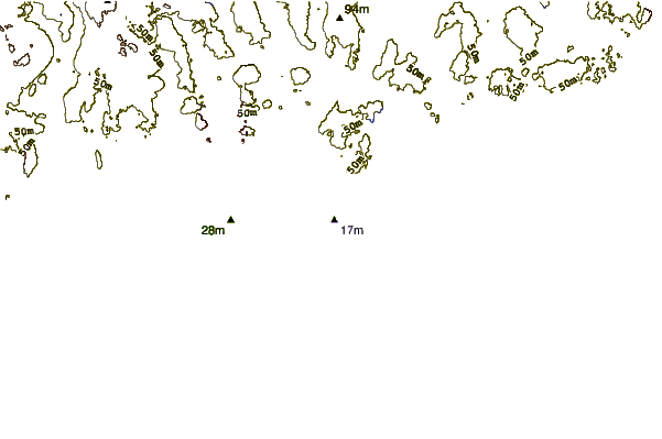
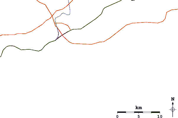
Gebruik deze reliëfkaart om naar de surfspots en de getijdenstations van Rhode Island toe te gaan, in de buurt van Panic Point (Weekapaug).
Andere Dichtbijzijnde Surflocaties van Panic Point (Weekapaug):
(klik op locatienaam voor meer informatie)- Closest Locatie1 mi
- Second closest Locatie2 mi
- Third closest Locatie6 mi
- Fourth closest Locatie6 mi
- Fifth closest Locatie6 mi
Dichtstbijzijnde golfboeien bij Panic Point (Weekapaug):
- Closest golfboei40 mi
- Second closest golfboei47 mi
- Third closest golfboei49 mi
- Fourth closest golfboei81 mi
- Fifth closest golfboei81 mi
Getijdenstations in de buurt van Panic Point (Weekapaug):
- Closest getijdenstationWeekapaug Point, Block Island Sound1 mi
- Second closest getijdenstationWatch Hill Point6 mi
- Third closest getijdenstationWesterly, Pawcatuck River6 mi
- Fourth closest getijdenstationCharlestown7 mi
- Fifth closest getijdenstationStonington, Fishers Island Sound7 mi
- /breaks/Panic-Point-Weekapaug/forecasts/latest


 Nearest