

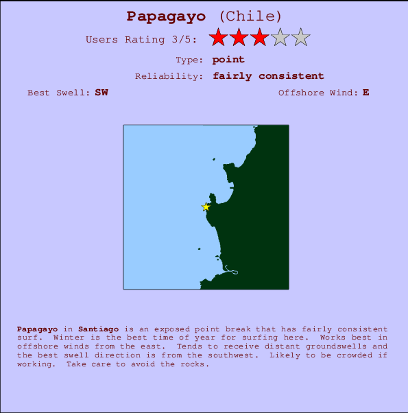
Papagayo Surf Guide
Papagayo in Santiago is an exposed point break that has quite reliable surf. Winter is the best time of year for surfing here. Works best in offshore winds from the east. Tends to receive distant groundswells and the ideal swell direction is from the southwest.The break here is a left hand point. Often Crowded. Watch out for rocks.
Papagayo Spot Info
| Type: | Rating: | Reliability: | Todays Sea Temp*: |
|---|---|---|---|
| fairly consistent | 14.3°C*ocean temperature recorded from satellite |
Surfing Papagayo:
The best conditions reported for surf at Papagayo occur when a Southwest swell combines with an offshore wind direction from the East.
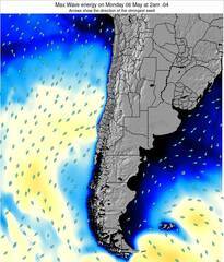
Voorspelde Golfenergie (Kracht): 12 uur

Papagayo Surf:
Monday, 3 August 2026, 07:59 Local time| Monday 03 | ||||
| 5AM | 8AM | 11AM | 2PM | |
| Wave (m) | ||||
| Periode (s) | 12 | 12 | 12 | 12 |
| Wind (km/h) | ||||
| Wind | cross- off |
glass | glass | glass |
- /breaks/Papagayo/forecasts/latest
Papagayo Surf Guide
Papagayo in Santiago is an exposed point break that has quite reliable surf. Winter is the best time of year for surfing here. Works best in offshore winds from the east. Tends to receive distant groundswells and the ideal swell direction is from the southwest.The break here is a left hand point. Often Crowded. Watch out for rocks.
Papagayo Spot Info
Type: Rating: Reliability: Todays Sea Temp*:  Point
Point 3
3fairly consistent 14.3°C*ocean temperature recorded from satelliteSurfing Papagayo:
The best conditions reported for surf at Papagayo occur when a Southwest swell combines with an offshore wind direction from the East.
Voorspelde Golfenergie (Kracht): 12 uur
Gebruik de tabbladen hierboven om de zeewatertemperatuur bij Papagayo te bekijken, foto's van Papagayo, Papagayo gedetailleerde golfvoorspellingen, wind- en weersvoorspellingen, Papagayo webcams, actuele wind in Santiago live weerstations en Papagayo getijdenvoorspellingen. De link van Chile golfkaarten opent een grote afbeelding van Chile en de omliggende zeeën. Deze golfkaarten kunnen worden dynamisch gemaakt worden met de verschillende golfcomponenten, golfenergie, golfperiode, golfhoogte, samen met de wind en weersvoorspellingen, het actuele weer en de zeetoestand volgens golfboeien uit Chile, langskomende schepen en weerstations op de kust. Elk voorspelling pagina's voor dit surfstrand zijn voorzien van een wereldwijde en regionale golfzoeker om de beste surfsomstandigheden in het gebied rond Papagayo te vinden.
Papagayo Surf:
Monday, 3 August 2026, 07:59 Local timeMonday 03 5AM 8AM 11AM 2PM Wave (m) Periode (s) 12 12 12 12 Wind (km/h) Wind cross-
offglass glass glass - /breaks/Papagayo/forecasts/latest
- /breaks/Papagayo/forecasts/latest/six_day
Papagayo Surf Guide
Papagayo in Santiago is an exposed point break that has quite reliable surf. Winter is the best time of year for surfing here. Works best in offshore winds from the east. Tends to receive distant groundswells and the ideal swell direction is from the southwest.The break here is a left hand point. Often Crowded. Watch out for rocks.
Papagayo Spot Info
Type: Rating: Reliability: Todays Sea Temp*: Point3fairly consistent 14.3°C*ocean temperature recorded from satelliteSurfing Papagayo:
The best conditions reported for surf at Papagayo occur when a Southwest swell combines with an offshore wind direction from the East.
Voorspelde Golfenergie (Kracht): 12 uur
Gebruik de tabbladen hierboven om de zeewatertemperatuur bij Papagayo te bekijken, foto's van Papagayo, Papagayo gedetailleerde golfvoorspellingen, wind- en weersvoorspellingen, Papagayo webcams, actuele wind in Santiago live weerstations en Papagayo getijdenvoorspellingen. De link van Chile golfkaarten opent een grote afbeelding van Chile en de omliggende zeeën. Deze golfkaarten kunnen worden dynamisch gemaakt worden met de verschillende golfcomponenten, golfenergie, golfperiode, golfhoogte, samen met de wind en weersvoorspellingen, het actuele weer en de zeetoestand volgens golfboeien uit Chile, langskomende schepen en weerstations op de kust. Elk voorspelling pagina's voor dit surfstrand zijn voorzien van een wereldwijde en regionale golfzoeker om de beste surfsomstandigheden in het gebied rond Papagayo te vinden.
Papagayo Surf:
Monday, 3 August 2026, 07:59 Local timeMonday 03 5AM 8AM 11AM 2PM Wave (m) Periode (s) 12 12 12 12 Wind (km/h) Wind cross-
offglass glass glass - /breaks/Papagayo/forecasts/latest
Papagayo Surf Guide
Papagayo in Santiago is an exposed point break that has quite reliable surf. Winter is the best time of year for surfing here. Works best in offshore winds from the east. Tends to receive distant groundswells and the ideal swell direction is from the southwest.The break here is a left hand point. Often Crowded. Watch out for rocks.
Papagayo Spot Info
Type: Rating: Reliability: Todays Sea Temp*: Point3fairly consistent 14.3°C*ocean temperature recorded from satelliteSurfing Papagayo:
The best conditions reported for surf at Papagayo occur when a Southwest swell combines with an offshore wind direction from the East.
Voorspelde Golfenergie (Kracht): 12 uur
Gebruik de tabbladen hierboven om de zeewatertemperatuur bij Papagayo te bekijken, foto's van Papagayo, Papagayo gedetailleerde golfvoorspellingen, wind- en weersvoorspellingen, Papagayo webcams, actuele wind in Santiago live weerstations en Papagayo getijdenvoorspellingen. De link van Chile golfkaarten opent een grote afbeelding van Chile en de omliggende zeeën. Deze golfkaarten kunnen worden dynamisch gemaakt worden met de verschillende golfcomponenten, golfenergie, golfperiode, golfhoogte, samen met de wind en weersvoorspellingen, het actuele weer en de zeetoestand volgens golfboeien uit Chile, langskomende schepen en weerstations op de kust. Elk voorspelling pagina's voor dit surfstrand zijn voorzien van een wereldwijde en regionale golfzoeker om de beste surfsomstandigheden in het gebied rond Papagayo te vinden.
Papagayo Surf:
Monday, 3 August 2026, 07:59 Local timeMonday 03 5AM 8AM 11AM 2PM Wave (m) Periode (s) 12 12 12 12 Wind (km/h) Wind cross-
offglass glass glass Tide Times:
Voor El Claron, %{dist} %{km} van %{location}.
VOLGENDE IS OM (lokale tijd) resterende tijd hoog water laag water Papagayo Tide Times and Tide Chart
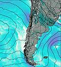
Live Weather:
At Vina Del Mar Airport, 19 km from Papagayo.
light winds from the NNE.(Wind varies from 340 to 050 degs)
(km/h)
Mist -Air temperature
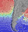
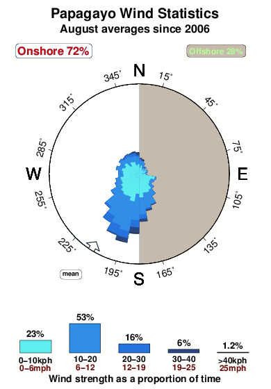
11°COverall Papagayo Surf Consistency and Wind Distribution in August
surffoto's uit
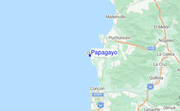
de galerijContourlijnen: Wegen & Rivieren: Kies een surflokatie uit het menu 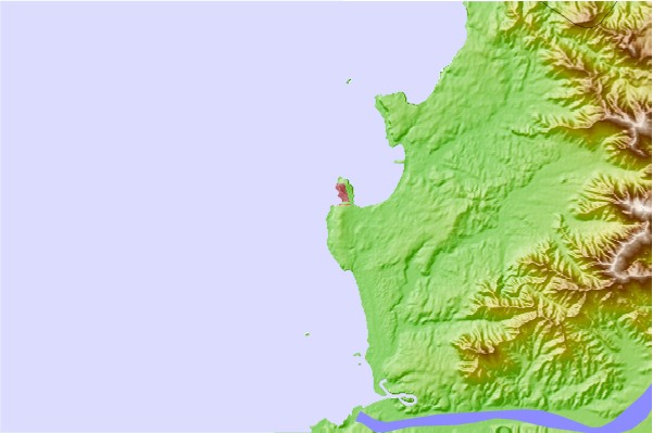
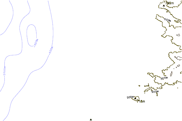
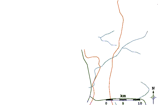
Gebruik deze reliëfkaart om naar de surfspots en de getijdenstations van Santiago toe te gaan, in de buurt van Papagayo.
Andere Dichtbijzijnde Surflocaties van Papagayo:
(klik op locatienaam voor meer informatie)- Closest Locatie3 mi
- Second closest Locatie6 mi
- Third closest Locatie8 mi
- Fourth closest Locatie9 mi
- Fifth closest Locatie9 mi
Dichtstbijzijnde golfboeien bij Papagayo:
- Closest golfboei1246 mi
- Second closest golfboei1268 mi
- Third closest golfboei3430 mi
- Fourth closest golfboei3449 mi
- Fifth closest golfboei3491 mi
Getijdenstations in de buurt van Papagayo:
- Closest getijdenstationValparaiso17 mi
- Second closest getijdenstationConstitucion183 mi
- Third closest getijdenstationCoquimbo198 mi
- Fourth closest getijdenstationTalcahuano283 mi
- Fifth closest getijdenstationPenco285 mi
Airports
- The nearest passenger airport to Papagayo is Arturo Merino Benitez International (Santiago) Airport (SCL) in Chile, which is 98 km (61 miles) away (directly).
- The second closest airport to Papagayo is Los Cerrillos (Santiago) Airport (ULC), also in Chile, 111 km (69 miles) away.
- /breaks/Papagayo/forecasts/latest


 Nearest