

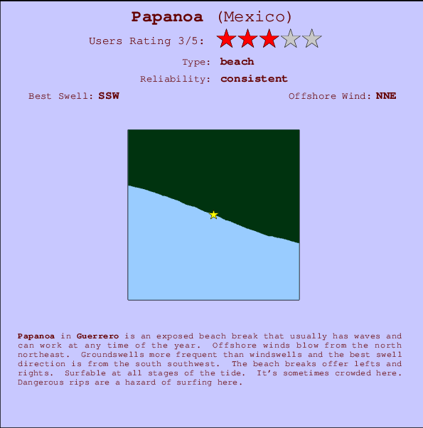
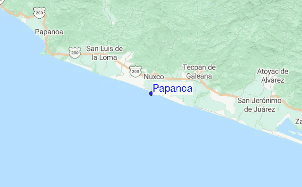
Papanoa Surf Guide
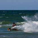
Papanoa in West Guerrero is an exposed beach break that has consistent surf and can work at any time of the year. The best wind direction is from the north northeast. Most of the surf here comes from groundswells and the best swell direction is from the south southwest. The beach break offers both left and right hand waves. Surfable at all stages of the tide. It's sometimes crowded here. Take care of the strong rips here.
Papanoa Spot Info
| Type: | Rating: | Reliability: | Todays Sea Temp*: |
|---|---|---|---|
| consistent | 31.2°C*ocean temperature recorded from satellite |
Surfing Papanoa:
The best conditions reported for surf at Papanoa occur when a South-southwest swell combines with an offshore wind direction from the North-northeast.
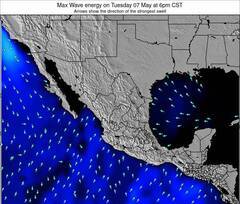
Voorspelde Golfenergie (Kracht): 12 uur


Papanoa Surf:
Friday, 17 July 2026, 20:10 Local time| Fri | Saturday 18 | |||
| 9PM | 0AM | 3AM | 6AM | |
| Wave (m) | ||||
| Periode (s) | 12 | 17 | 17 | 18 |
| Wind (km/h) | ||||
| Wind | cross- off |
cross- off |
off | glass |
- /breaks/Papanoa/forecasts/latest
Papanoa Surf Guide
Papanoa in West Guerrero is an exposed beach break that has consistent surf and can work at any time of the year. The best wind direction is from the north northeast. Most of the surf here comes from groundswells and the best swell direction is from the south southwest. The beach break offers both left and right hand waves. Surfable at all stages of the tide. It's sometimes crowded here. Take care of the strong rips here.
Papanoa Spot Info
Type: Rating: Reliability: Todays Sea Temp*:  Beach
Beach 3
3consistent 31.2°C*ocean temperature recorded from satelliteSurfing Papanoa:
The best conditions reported for surf at Papanoa occur when a South-southwest swell combines with an offshore wind direction from the North-northeast.
Voorspelde Golfenergie (Kracht): 12 uur
Gebruik de tabbladen hierboven om de zeewatertemperatuur bij Papanoa te bekijken, foto's van Papanoa, Papanoa gedetailleerde golfvoorspellingen, wind- en weersvoorspellingen, Papanoa webcams, actuele wind in Guerrero live weerstations en Papanoa getijdenvoorspellingen. De link van Mexico golfkaarten opent een grote afbeelding van Mexico en de omliggende zeeën. Deze golfkaarten kunnen worden dynamisch gemaakt worden met de verschillende golfcomponenten, golfenergie, golfperiode, golfhoogte, samen met de wind en weersvoorspellingen, het actuele weer en de zeetoestand volgens golfboeien uit Mexico, langskomende schepen en weerstations op de kust. Elk voorspelling pagina's voor dit surfstrand zijn voorzien van een wereldwijde en regionale golfzoeker om de beste surfsomstandigheden in het gebied rond Papanoa te vinden.
Papanoa Surf:
Friday, 17 July 2026, 20:10 Local timeFri Saturday 18 9PM 0AM 3AM 6AM Wave (m) Periode (s) 12 17 17 18 Wind (km/h) Wind cross-
offcross-
offoff glass - /breaks/Papanoa/forecasts/latest
- /breaks/Papanoa/forecasts/latest/six_day
Papanoa Surf Guide
Papanoa in West Guerrero is an exposed beach break that has consistent surf and can work at any time of the year. The best wind direction is from the north northeast. Most of the surf here comes from groundswells and the best swell direction is from the south southwest. The beach break offers both left and right hand waves. Surfable at all stages of the tide. It's sometimes crowded here. Take care of the strong rips here.
Papanoa Spot Info
Type: Rating: Reliability: Todays Sea Temp*: Beach3consistent 31.2°C*ocean temperature recorded from satelliteSurfing Papanoa:
The best conditions reported for surf at Papanoa occur when a South-southwest swell combines with an offshore wind direction from the North-northeast.
Voorspelde Golfenergie (Kracht): 12 uur
Gebruik de tabbladen hierboven om de zeewatertemperatuur bij Papanoa te bekijken, foto's van Papanoa, Papanoa gedetailleerde golfvoorspellingen, wind- en weersvoorspellingen, Papanoa webcams, actuele wind in Guerrero live weerstations en Papanoa getijdenvoorspellingen. De link van Mexico golfkaarten opent een grote afbeelding van Mexico en de omliggende zeeën. Deze golfkaarten kunnen worden dynamisch gemaakt worden met de verschillende golfcomponenten, golfenergie, golfperiode, golfhoogte, samen met de wind en weersvoorspellingen, het actuele weer en de zeetoestand volgens golfboeien uit Mexico, langskomende schepen en weerstations op de kust. Elk voorspelling pagina's voor dit surfstrand zijn voorzien van een wereldwijde en regionale golfzoeker om de beste surfsomstandigheden in het gebied rond Papanoa te vinden.
Papanoa Surf:
Friday, 17 July 2026, 20:10 Local timeFri Saturday 18 9PM 0AM 3AM 6AM Wave (m) Periode (s) 12 17 17 18 Wind (km/h) Wind cross-
offcross-
offoff glass - /breaks/Papanoa/forecasts/latest
Papanoa Surf Guide
Papanoa in West Guerrero is an exposed beach break that has consistent surf and can work at any time of the year. The best wind direction is from the north northeast. Most of the surf here comes from groundswells and the best swell direction is from the south southwest. The beach break offers both left and right hand waves. Surfable at all stages of the tide. It's sometimes crowded here. Take care of the strong rips here.
Papanoa Spot Info
Type: Rating: Reliability: Todays Sea Temp*: Beach3consistent 31.2°C*ocean temperature recorded from satelliteSurfing Papanoa:
The best conditions reported for surf at Papanoa occur when a South-southwest swell combines with an offshore wind direction from the North-northeast.
Voorspelde Golfenergie (Kracht): 12 uur
Gebruik de tabbladen hierboven om de zeewatertemperatuur bij Papanoa te bekijken, foto's van Papanoa, Papanoa gedetailleerde golfvoorspellingen, wind- en weersvoorspellingen, Papanoa webcams, actuele wind in Guerrero live weerstations en Papanoa getijdenvoorspellingen. De link van Mexico golfkaarten opent een grote afbeelding van Mexico en de omliggende zeeën. Deze golfkaarten kunnen worden dynamisch gemaakt worden met de verschillende golfcomponenten, golfenergie, golfperiode, golfhoogte, samen met de wind en weersvoorspellingen, het actuele weer en de zeetoestand volgens golfboeien uit Mexico, langskomende schepen en weerstations op de kust. Elk voorspelling pagina's voor dit surfstrand zijn voorzien van een wereldwijde en regionale golfzoeker om de beste surfsomstandigheden in het gebied rond Papanoa te vinden.
Papanoa Surf:
Friday, 17 July 2026, 20:10 Local timeFri Saturday 18 9PM 0AM 3AM 6AM Wave (m) Periode (s) 12 17 17 18 Wind (km/h) Wind cross-
offcross-
offoff glass Tide Times:
Voor Costa Sol, %{dist} %{km} van %{location}.
VOLGENDE IS OM (lokale tijd) resterende tijd hoog water laag water Papanoa Tide Times and Tide Chart
Live Weather:
At SHIP9696, 63 km from Papanoa.
light winds from the W
(km/h)Air temperature
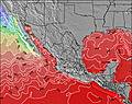
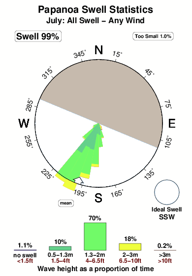
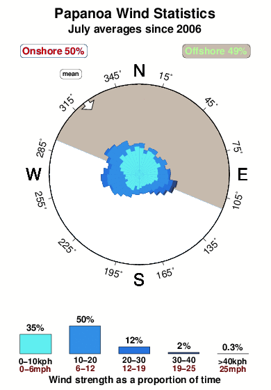
31.0°COverall Papanoa Surf Consistency and Wind Distribution in July
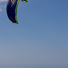
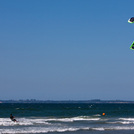
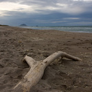
surffoto's uit
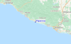
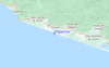
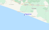
de galerijContourlijnen: Wegen & Rivieren: Kies een surflokatie uit het menu 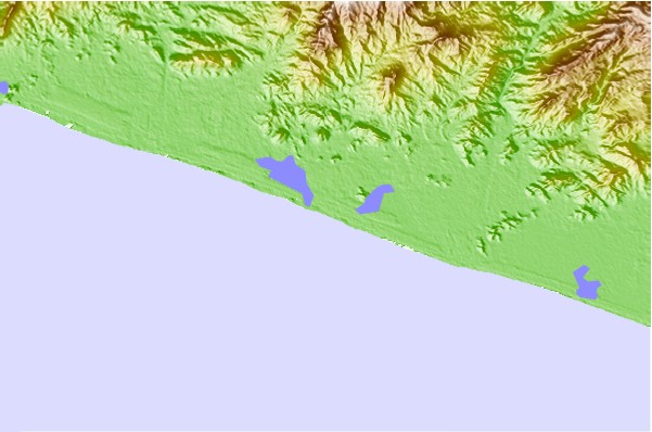
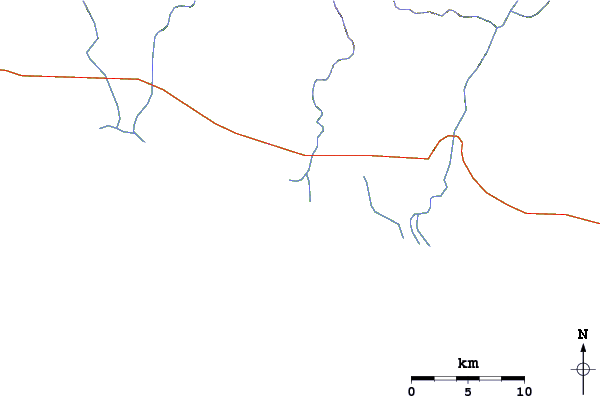
Gebruik deze reliëfkaart om naar de surfspots en de getijdenstations van Guerrero toe te gaan, in de buurt van Papanoa.
Andere Dichtbijzijnde Surflocaties van Papanoa:
(klik op locatienaam voor meer informatie)- Closest Locatie4 mi
- Second closest Locatie6 mi
- Third closest Locatie7 mi
- Fourth closest Locatie13 mi
- Fifth closest Locatie15 mi
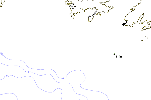
Dichtstbijzijnde golfboeien bij Papanoa:
- Closest golfboei551 mi
- Second closest golfboei726 mi
- Third closest golfboei750 mi
- Fourth closest golfboei819 mi
- Fifth closest golfboei903 mi
Getijdenstations in de buurt van Papanoa:
- Closest getijdenstationAcapulco61 mi
- Second closest getijdenstationZihuatanejo61 mi
- Third closest getijdenstationIxtapa67 mi
- Fourth closest getijdenstationLazaro Cardenas106 mi
- Fifth closest getijdenstationCardenas (Melchor Ocampo)106 mi
Airports
- The closest passenger airport to Papanoa is Ixtapa Zihuatanejo International Airport (ZIH) in Mexico, which is 88 km (55 miles) away (directly).
- The second nearest airport to Papanoa is General Juan N Alvarez International (Acapulco) Airport (ACA), also in Mexico, 117 km (73 miles) away.
- The third closest airport is Lazaro Cardenas (Lazard Cardenas) Airport (LZC), also in Mexico, 180 km (112 miles) away.
- /breaks/Papanoa/forecasts/latest


 Nearest