
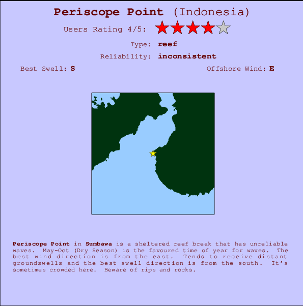
Periscope Point Surf Guide
Periscope Point in Sumbawa is a sheltered reef break that only works once in a while. May-Oct (Dry Season) is the best time of year for waves. Offshore winds are from the east. Groundswells are more common than windswells and the best swell direction is from the south. There is a right hand reef break. When the surf is up, it can get quite busy in the water. Take care of rips and rocks.
Periscope Point Spot Info
| Type: | Rating: | Reliability: | Todays Sea Temp*: |
|---|---|---|---|
| inconsistent | 27.2°C*ocean temperature recorded from satellite |
Surfing Periscope Point:
The best conditions reported for surf at Periscope Point occur when a South swell combines with an offshore wind direction from the East.

Voorspelde Golfenergie (Kracht): 12 uur


Periscope Point Surf:
Thursday, 16 July 2026, 08:20 Local time| Thursday 16 | ||||
| 5AM | 8AM | 11AM | 2PM | |
| Wave (m) | ||||
| Periode (s) | 16 | 15 | 15 | 15 |
| Wind (km/h) | ||||
| Wind | off | off | cross- off |
cross- off |
- /breaks/Periscope-Point/forecasts/latest

Periscope Point Surf Guide
Periscope Point in Sumbawa is a sheltered reef break that only works once in a while. May-Oct (Dry Season) is the best time of year for waves. Offshore winds are from the east. Groundswells are more common than windswells and the best swell direction is from the south. There is a right hand reef break. When the surf is up, it can get quite busy in the water. Take care of rips and rocks.
Periscope Point Spot Info
Type: Rating: Reliability: Todays Sea Temp*:  Reef
Reef 4
4inconsistent 27.2°C*ocean temperature recorded from satelliteSurfing Periscope Point:
The best conditions reported for surf at Periscope Point occur when a South swell combines with an offshore wind direction from the East.
Voorspelde Golfenergie (Kracht): 12 uur
Gebruik de tabbladen hierboven om de zeewatertemperatuur bij Periscope Point te bekijken, foto's van Periscope Point, Periscope Point gedetailleerde golfvoorspellingen, wind- en weersvoorspellingen, Periscope Point webcams, actuele wind in Sumbawa live weerstations en Periscope Point getijdenvoorspellingen. De link van Indonesia golfkaarten opent een grote afbeelding van Indonesia en de omliggende zeeën. Deze golfkaarten kunnen worden dynamisch gemaakt worden met de verschillende golfcomponenten, golfenergie, golfperiode, golfhoogte, samen met de wind en weersvoorspellingen, het actuele weer en de zeetoestand volgens golfboeien uit Indonesia, langskomende schepen en weerstations op de kust. Elk voorspelling pagina's voor dit surfstrand zijn voorzien van een wereldwijde en regionale golfzoeker om de beste surfsomstandigheden in het gebied rond Periscope Point te vinden.
Periscope Point Surf:
Thursday, 16 July 2026, 08:20 Local timeThursday 16 5AM 8AM 11AM 2PM Wave (m) Periode (s) 16 15 15 15 Wind (km/h) Wind off off cross-
offcross-
off- /breaks/Periscope-Point/forecasts/latest
- /breaks/Periscope-Point/forecasts/latest/six_day
Periscope Point Surf Guide
Periscope Point in Sumbawa is a sheltered reef break that only works once in a while. May-Oct (Dry Season) is the best time of year for waves. Offshore winds are from the east. Groundswells are more common than windswells and the best swell direction is from the south. There is a right hand reef break. When the surf is up, it can get quite busy in the water. Take care of rips and rocks.
Periscope Point Spot Info
Type: Rating: Reliability: Todays Sea Temp*: Reef4inconsistent 27.2°C*ocean temperature recorded from satelliteSurfing Periscope Point:
The best conditions reported for surf at Periscope Point occur when a South swell combines with an offshore wind direction from the East.
Voorspelde Golfenergie (Kracht): 12 uur
Gebruik de tabbladen hierboven om de zeewatertemperatuur bij Periscope Point te bekijken, foto's van Periscope Point, Periscope Point gedetailleerde golfvoorspellingen, wind- en weersvoorspellingen, Periscope Point webcams, actuele wind in Sumbawa live weerstations en Periscope Point getijdenvoorspellingen. De link van Indonesia golfkaarten opent een grote afbeelding van Indonesia en de omliggende zeeën. Deze golfkaarten kunnen worden dynamisch gemaakt worden met de verschillende golfcomponenten, golfenergie, golfperiode, golfhoogte, samen met de wind en weersvoorspellingen, het actuele weer en de zeetoestand volgens golfboeien uit Indonesia, langskomende schepen en weerstations op de kust. Elk voorspelling pagina's voor dit surfstrand zijn voorzien van een wereldwijde en regionale golfzoeker om de beste surfsomstandigheden in het gebied rond Periscope Point te vinden.
Periscope Point Surf:
Thursday, 16 July 2026, 08:20 Local timeThursday 16 5AM 8AM 11AM 2PM Wave (m) Periode (s) 16 15 15 15 Wind (km/h) Wind off off cross-
offcross-
off- /breaks/Periscope-Point/forecasts/latest
Periscope Point Surf Guide
Periscope Point in Sumbawa is a sheltered reef break that only works once in a while. May-Oct (Dry Season) is the best time of year for waves. Offshore winds are from the east. Groundswells are more common than windswells and the best swell direction is from the south. There is a right hand reef break. When the surf is up, it can get quite busy in the water. Take care of rips and rocks.
Periscope Point Spot Info
Type: Rating: Reliability: Todays Sea Temp*: Reef4inconsistent 27.2°C*ocean temperature recorded from satelliteSurfing Periscope Point:
The best conditions reported for surf at Periscope Point occur when a South swell combines with an offshore wind direction from the East.
Voorspelde Golfenergie (Kracht): 12 uur
Gebruik de tabbladen hierboven om de zeewatertemperatuur bij Periscope Point te bekijken, foto's van Periscope Point, Periscope Point gedetailleerde golfvoorspellingen, wind- en weersvoorspellingen, Periscope Point webcams, actuele wind in Sumbawa live weerstations en Periscope Point getijdenvoorspellingen. De link van Indonesia golfkaarten opent een grote afbeelding van Indonesia en de omliggende zeeën. Deze golfkaarten kunnen worden dynamisch gemaakt worden met de verschillende golfcomponenten, golfenergie, golfperiode, golfhoogte, samen met de wind en weersvoorspellingen, het actuele weer en de zeetoestand volgens golfboeien uit Indonesia, langskomende schepen en weerstations op de kust. Elk voorspelling pagina's voor dit surfstrand zijn voorzien van een wereldwijde en regionale golfzoeker om de beste surfsomstandigheden in het gebied rond Periscope Point te vinden.
Periscope Point Surf:
Thursday, 16 July 2026, 08:20 Local timeThursday 16 5AM 8AM 11AM 2PM Wave (m) Periode (s) 16 15 15 15 Wind (km/h) Wind off off cross-
offcross-
offTide Times:
Voor Cobblestones, %{dist} %{km} van %{location}.
VOLGENDE IS OM (lokale tijd) resterende tijd hoog water laag water Periscope Point Tide Times and Tide Chart
Live Weather:
At Bandara Airport, 230 km from Periscope Point.
calm
(km/h)Air temperature
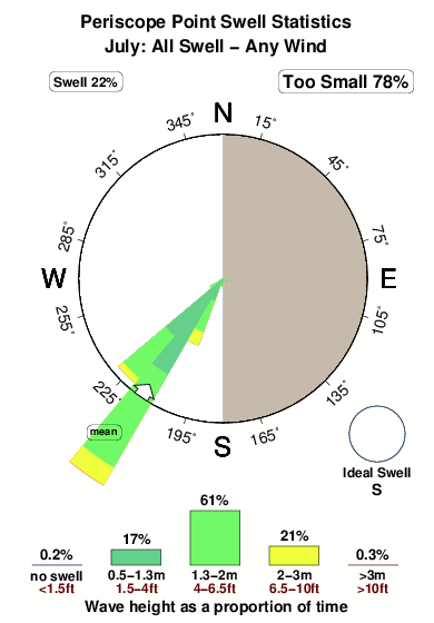
23°COverall Periscope Point Surf Consistency and Wind Distribution in July
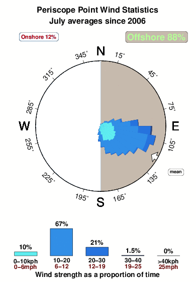


Wind stats for Periscope Point: see the variation in direction and stength by month.
surffoto's uit
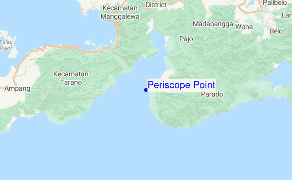
de galerijContourlijnen: Wegen & Rivieren: Kies een surflokatie uit het menu 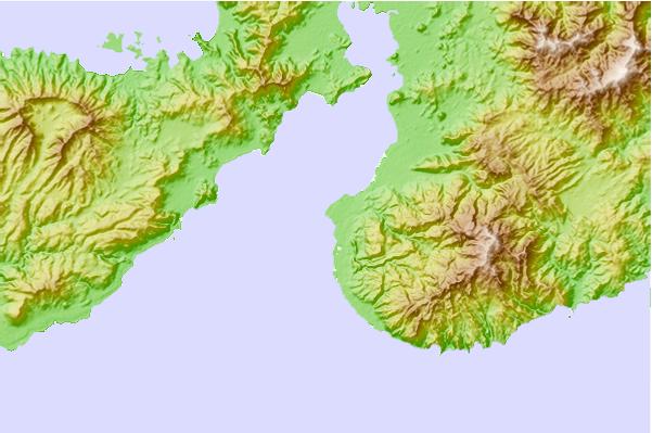
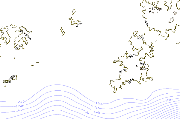
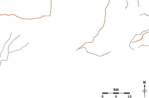
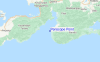
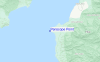
Gebruik deze reliëfkaart om naar de surfspots en de getijdenstations van Sumbawa toe te gaan, in de buurt van Periscope Point.
Andere Dichtbijzijnde Surflocaties van Periscope Point:
(klik op locatienaam voor meer informatie)- Closest Locatie1 mi
- Second closest Locatie1 mi
- Third closest Locatie1 mi
- Fourth closest Locatie3 mi
- Fifth closest Locatie73 mi
Dichtstbijzijnde golfboeien bij Periscope Point:
- Closest golfboei1606 mi
- Second closest golfboei1922 mi
- Third closest golfboei2050 mi
- Fourth closest golfboei2129 mi
- Fifth closest golfboei2209 mi
Getijdenstations in de buurt van Periscope Point:
- Closest getijdenstationBima32 mi
- Second closest getijdenstationSumbawa Besar67 mi
- Third closest getijdenstationLabuhanbajo107 mi
- Fourth closest getijdenstationWaingapu143 mi
- Fifth closest getijdenstationMataram154 mi
Airports
- The closest passenger airport to Periscope Point is Muhammad Salahuddin (Bima) Airport (BMU) in Indonesia, which is 44 km (27 miles) away (directly).
- The second nearest airport to Periscope Point is Sumbawa Besar Airport (SWG), also in Indonesia, 110 km (68 miles) away.
- The third closest airport is Mutiara Ii (Labuhan Bajo) Airport (LBJ), also in Indonesia, 170 km (106 miles) away.
- /breaks/Periscope-Point/forecasts/latest
 Nearest