Picnic Bay (Wilsons Promontory) Surf Guide
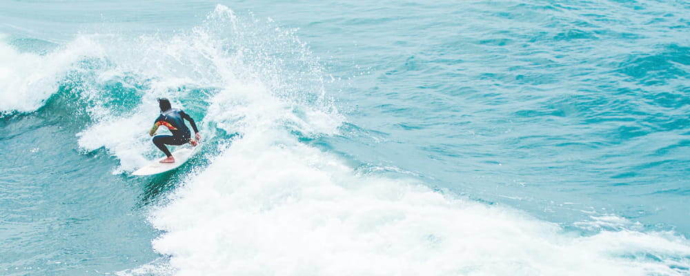
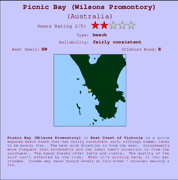
Picnic Bay in Wilson Promentary is a fairly exposed beach break that has reasonably consistent surf, although summer tends to be mostly flat. The best wind direction is from the east. Clean groundswells prevail and the optimum swell angle is from the southwest. The beach breaks offer lefts and rights. Surfable at all stages of the tide. It's sometimes crowded here. Crowds may reach hazard levels at this break - consider wearing a lid.
Picnic Bay (Wilsons Promontory) Spot Info
| Type: | Rating: | Reliability: | Todays Sea Temp*: |
|---|---|---|---|
 Beach Beach |  2 2 | fairly consistent | 16.4°C*ocean temperature recorded from satellite |
Surfing Picnic Bay (Wilsons Promontory):
The best conditions reported for surf at Picnic Bay (Wilsons Promontory) occur when a Southwest swell combines with an offshore wind direction from the East.

Voorspelde Golfenergie (Kracht): 12 uur
Picnic Bay (Wilsons Promontory) Surf:
Monday, 26 October 2026, 23:59 Local time| ma | di | |||
| 8PM | 11PM | 2AM | 5AM | |
| Wave (m) | ||||
| Periode (s) | 7 | 7 | 14 | 13 |
| Wind (km/h) | ||||
| Wind | on | cross- on |
on | on |
- /breaks/Picnic-Bay/forecasts/latest
Picnic Bay (Wilsons Promontory) Surf Guide
Picnic Bay in Wilson Promentary is a fairly exposed beach break that has reasonably consistent surf, although summer tends to be mostly flat. The best wind direction is from the east. Clean groundswells prevail and the optimum swell angle is from the southwest. The beach breaks offer lefts and rights. Surfable at all stages of the tide. It's sometimes crowded here. Crowds may reach hazard levels at this break - consider wearing a lid.
Picnic Bay (Wilsons Promontory) Spot Info
Type: Rating: Reliability: Todays Sea Temp*: Beach2fairly consistent 16.4°C*ocean temperature recorded from satelliteSurfing Picnic Bay (Wilsons Promontory):
The best conditions reported for surf at Picnic Bay (Wilsons Promontory) occur when a Southwest swell combines with an offshore wind direction from the East.
Voorspelde Golfenergie (Kracht): 12 uur
Gebruik de tabbladen hierboven om de zeewatertemperatuur bij Picnic Bay (Wilsons Promontory) te bekijken, foto's van Picnic Bay (Wilsons Promontory), Picnic Bay (Wilsons Promontory) gedetailleerde golfvoorspellingen, wind- en weersvoorspellingen, Picnic Bay (Wilsons Promontory) webcams, actuele wind in VIC - East Coast live weerstations en Picnic Bay (Wilsons Promontory) getijdenvoorspellingen. De link van Australia golfkaarten opent een grote afbeelding van Australia en de omliggende zeeën. Deze golfkaarten kunnen worden dynamisch gemaakt worden met de verschillende golfcomponenten, golfenergie, golfperiode, golfhoogte, samen met de wind en weersvoorspellingen, het actuele weer en de zeetoestand volgens golfboeien uit Australia, langskomende schepen en weerstations op de kust. Elk voorspelling pagina's voor dit surfstrand zijn voorzien van een wereldwijde en regionale golfzoeker om de beste surfsomstandigheden in het gebied rond Picnic Bay (Wilsons Promontory) te vinden.
Picnic Bay (Wilsons Promontory) Surf:
Monday, 26 October 2026, 23:59 Local timema di 8PM 11PM 2AM 5AM Wave (m) Periode (s) 7 7 14 13 Wind (km/h) Wind on cross-
onon on - /breaks/Picnic-Bay/forecasts/latest
- /breaks/Picnic-Bay/forecasts/latest/six_day
Picnic Bay (Wilsons Promontory) Surf Guide
Picnic Bay in Wilson Promentary is a fairly exposed beach break that has reasonably consistent surf, although summer tends to be mostly flat. The best wind direction is from the east. Clean groundswells prevail and the optimum swell angle is from the southwest. The beach breaks offer lefts and rights. Surfable at all stages of the tide. It's sometimes crowded here. Crowds may reach hazard levels at this break - consider wearing a lid.
Picnic Bay (Wilsons Promontory) Spot Info
Type: Rating: Reliability: Todays Sea Temp*: Beach2fairly consistent 16.4°C*ocean temperature recorded from satelliteSurfing Picnic Bay (Wilsons Promontory):
The best conditions reported for surf at Picnic Bay (Wilsons Promontory) occur when a Southwest swell combines with an offshore wind direction from the East.
Voorspelde Golfenergie (Kracht): 12 uur
Gebruik de tabbladen hierboven om de zeewatertemperatuur bij Picnic Bay (Wilsons Promontory) te bekijken, foto's van Picnic Bay (Wilsons Promontory), Picnic Bay (Wilsons Promontory) gedetailleerde golfvoorspellingen, wind- en weersvoorspellingen, Picnic Bay (Wilsons Promontory) webcams, actuele wind in VIC - East Coast live weerstations en Picnic Bay (Wilsons Promontory) getijdenvoorspellingen. De link van Australia golfkaarten opent een grote afbeelding van Australia en de omliggende zeeën. Deze golfkaarten kunnen worden dynamisch gemaakt worden met de verschillende golfcomponenten, golfenergie, golfperiode, golfhoogte, samen met de wind en weersvoorspellingen, het actuele weer en de zeetoestand volgens golfboeien uit Australia, langskomende schepen en weerstations op de kust. Elk voorspelling pagina's voor dit surfstrand zijn voorzien van een wereldwijde en regionale golfzoeker om de beste surfsomstandigheden in het gebied rond Picnic Bay (Wilsons Promontory) te vinden.
Picnic Bay (Wilsons Promontory) Surf:
Monday, 26 October 2026, 23:59 Local timema di 8PM 11PM 2AM 5AM Wave (m) Periode (s) 7 7 14 13 Wind (km/h) Wind on cross-
onon on - /breaks/Picnic-Bay/forecasts/latest
Picnic Bay (Wilsons Promontory) Surf Guide
Picnic Bay in Wilson Promentary is a fairly exposed beach break that has reasonably consistent surf, although summer tends to be mostly flat. The best wind direction is from the east. Clean groundswells prevail and the optimum swell angle is from the southwest. The beach breaks offer lefts and rights. Surfable at all stages of the tide. It's sometimes crowded here. Crowds may reach hazard levels at this break - consider wearing a lid.
Picnic Bay (Wilsons Promontory) Spot Info
Type: Rating: Reliability: Todays Sea Temp*: Beach2fairly consistent 16.4°C*ocean temperature recorded from satelliteSurfing Picnic Bay (Wilsons Promontory):
The best conditions reported for surf at Picnic Bay (Wilsons Promontory) occur when a Southwest swell combines with an offshore wind direction from the East.
Voorspelde Golfenergie (Kracht): 12 uur
Gebruik de tabbladen hierboven om de zeewatertemperatuur bij Picnic Bay (Wilsons Promontory) te bekijken, foto's van Picnic Bay (Wilsons Promontory), Picnic Bay (Wilsons Promontory) gedetailleerde golfvoorspellingen, wind- en weersvoorspellingen, Picnic Bay (Wilsons Promontory) webcams, actuele wind in VIC - East Coast live weerstations en Picnic Bay (Wilsons Promontory) getijdenvoorspellingen. De link van Australia golfkaarten opent een grote afbeelding van Australia en de omliggende zeeën. Deze golfkaarten kunnen worden dynamisch gemaakt worden met de verschillende golfcomponenten, golfenergie, golfperiode, golfhoogte, samen met de wind en weersvoorspellingen, het actuele weer en de zeetoestand volgens golfboeien uit Australia, langskomende schepen en weerstations op de kust. Elk voorspelling pagina's voor dit surfstrand zijn voorzien van een wereldwijde en regionale golfzoeker om de beste surfsomstandigheden in het gebied rond Picnic Bay (Wilsons Promontory) te vinden.
Picnic Bay (Wilsons Promontory) Surf:
Monday, 26 October 2026, 23:59 Local timema di 8PM 11PM 2AM 5AM Wave (m) Periode (s) 7 7 14 13 Wind (km/h) Wind on cross-
onon on Tide Times:
Voor Buckleys Reef (Wilsons Promontory), %{dist} %{km} van %{location}.
VOLGENDE IS OM (lokale tijd) resterende tijd hoog water laag water Picnic Bay (Wilsons Promontory) Tide Times and Tide Chart
Live Weather:
At WilsonsPromontoryLighthouse, 17 km from Picnic Bay (Wilsons Promontory).
near gales from the WSW
(km/h)Air temperature
10.6°COverall Picnic Bay (Wilsons Promontory) Surf Consistency and Wind Distribution in oktober



Surf stats for Picnic Bay (Wilsons Promontory): see the swell variation by month.

Wind stats for Picnic Bay (Wilsons Promontory): see the variation in direction and stength by month.
surffoto's uit
de galerijContourlijnen: Wegen & Rivieren: Kies een surflokatie uit het menu 


Gebruik deze reliëfkaart om naar de surfspots en de getijdenstations van VIC - East Coast toe te gaan, in de buurt van Picnic Bay (Wilsons Promontory).
Andere Dichtbijzijnde Surflocaties van Picnic Bay (Wilsons Promontory):
(klik op locatienaam voor meer informatie)- Closest Locatie1 mi
- Second closest Locatie2 mi
- Third closest Locatie2 mi
- Fourth closest Locatie3 mi
- Fifth closest Locatie4 mi
Dichtstbijzijnde golfboeien bij Picnic Bay (Wilsons Promontory):
- Closest golfboei224 mi
- Second closest golfboei244 mi
- Third closest golfboei319 mi
- Fourth closest golfboei409 mi
- Fifth closest golfboei461 mi
Getijdenstations in de buurt van Picnic Bay (Wilsons Promontory):
- Closest getijdenstationGreat Glennie Island6 mi
- Second closest getijdenstationRabbit Island14 mi
- Third closest getijdenstationWaratah Bay19 mi
- Fourth closest getijdenstationPort Welshpool24 mi
- Fifth closest getijdenstationPhillip Island68 mi
Airports
- The closest passenger airport to Picnic Bay (Wilsons Promontory) is Melbourne Moorabbin Airport (MBW) in Australia, 155 km (96 miles) away (directly).
- The second nearest airport to Picnic Bay (Wilsons Promontory) is Melbourne Essendon Airport (MEB), also in Australia, 188 km (117 miles) away.
- Third is Avalon Airport (AVV) in Australia, 192 km (119 miles) away.
- Melbourne International Airport (MEL) in Australia is 196 km (122 miles) away.
- Launceston Airport (LST), also in Australia is the fifth nearest airport to Picnic Bay (Wilsons Promontory) and is 292 km (181 miles) away.
- /breaks/Picnic-Bay/forecasts/latest

 Nearest