

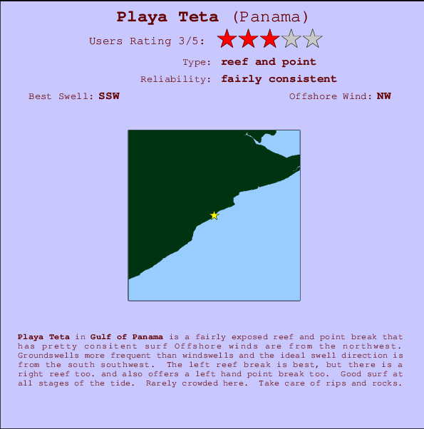
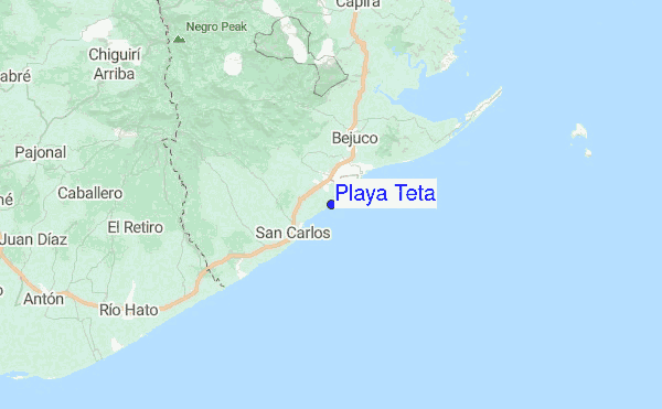
Playa Teta Surf Guide
Playa Teta in Golfo de Panama is a fairly exposed reef and point break that has quite consistent surf Ideal winds are from the northwest. Most of the surf here comes from groundswells and the best swell direction is from the south southwest. Right and better left hand reef breaks. and there is also a left hand point break. Surfable at all stages of the tide. It very rarely gets crowded here. Beware of rips and rocks.
Playa Teta Spot Info
| Type: | Rating: | Reliability: | Todays Sea Temp*: |
|---|---|---|---|
| fairly consistent | 29.3°C*ocean temperature recorded from satellite |
Surfing Playa Teta:
The best conditions reported for surf at Playa Teta occur when a South-southwest swell combines with an offshore wind direction from the Northwest.

Voorspelde Golfenergie (Kracht): 12 uur


Playa Teta Surf:
Wednesday, 15 July 2026, 16:38 Local time| Wednesday 15 | Thu | |||
| 4PM | 7PM | 10PM | 1AM | |
| Wave (m) | ||||
| Periode (s) | 14 | 15 | 15 | 16 |
| Wind (km/h) | ||||
| Wind | cross- off |
off | off | off |
- /breaks/Playa-Teta/forecasts/latest
Playa Teta Surf Guide
Playa Teta in Golfo de Panama is a fairly exposed reef and point break that has quite consistent surf Ideal winds are from the northwest. Most of the surf here comes from groundswells and the best swell direction is from the south southwest. Right and better left hand reef breaks. and there is also a left hand point break. Surfable at all stages of the tide. It very rarely gets crowded here. Beware of rips and rocks.
Playa Teta Spot Info
Type: Rating: Reliability: Todays Sea Temp*:  Reef and point
 3
3fairly consistent 29.3°C*ocean temperature recorded from satelliteSurfing Playa Teta:
The best conditions reported for surf at Playa Teta occur when a South-southwest swell combines with an offshore wind direction from the Northwest.
Voorspelde Golfenergie (Kracht): 12 uur
Gebruik de tabbladen hierboven om de zeewatertemperatuur bij Playa Teta te bekijken, foto's van Playa Teta, Playa Teta gedetailleerde golfvoorspellingen, wind- en weersvoorspellingen, Playa Teta webcams, actuele wind in Gulf of Panama live weerstations en Playa Teta getijdenvoorspellingen. De link van Panama golfkaarten opent een grote afbeelding van Panama en de omliggende zeeën. Deze golfkaarten kunnen worden dynamisch gemaakt worden met de verschillende golfcomponenten, golfenergie, golfperiode, golfhoogte, samen met de wind en weersvoorspellingen, het actuele weer en de zeetoestand volgens golfboeien uit Panama, langskomende schepen en weerstations op de kust. Elk voorspelling pagina's voor dit surfstrand zijn voorzien van een wereldwijde en regionale golfzoeker om de beste surfsomstandigheden in het gebied rond Playa Teta te vinden.
Playa Teta Surf:
Wednesday, 15 July 2026, 16:38 Local timeWednesday 15 Thu 4PM 7PM 10PM 1AM Wave (m) Periode (s) 14 15 15 16 Wind (km/h) Wind cross-
offoff off off - /breaks/Playa-Teta/forecasts/latest
- /breaks/Playa-Teta/forecasts/latest/six_day
Playa Teta Surf Guide
Playa Teta in Golfo de Panama is a fairly exposed reef and point break that has quite consistent surf Ideal winds are from the northwest. Most of the surf here comes from groundswells and the best swell direction is from the south southwest. Right and better left hand reef breaks. and there is also a left hand point break. Surfable at all stages of the tide. It very rarely gets crowded here. Beware of rips and rocks.
Playa Teta Spot Info
Type: Rating: Reliability: Todays Sea Temp*: Reef and point3fairly consistent 29.3°C*ocean temperature recorded from satelliteSurfing Playa Teta:
The best conditions reported for surf at Playa Teta occur when a South-southwest swell combines with an offshore wind direction from the Northwest.
Voorspelde Golfenergie (Kracht): 12 uur
Gebruik de tabbladen hierboven om de zeewatertemperatuur bij Playa Teta te bekijken, foto's van Playa Teta, Playa Teta gedetailleerde golfvoorspellingen, wind- en weersvoorspellingen, Playa Teta webcams, actuele wind in Gulf of Panama live weerstations en Playa Teta getijdenvoorspellingen. De link van Panama golfkaarten opent een grote afbeelding van Panama en de omliggende zeeën. Deze golfkaarten kunnen worden dynamisch gemaakt worden met de verschillende golfcomponenten, golfenergie, golfperiode, golfhoogte, samen met de wind en weersvoorspellingen, het actuele weer en de zeetoestand volgens golfboeien uit Panama, langskomende schepen en weerstations op de kust. Elk voorspelling pagina's voor dit surfstrand zijn voorzien van een wereldwijde en regionale golfzoeker om de beste surfsomstandigheden in het gebied rond Playa Teta te vinden.
Playa Teta Surf:
Wednesday, 15 July 2026, 16:38 Local timeWednesday 15 Thu 4PM 7PM 10PM 1AM Wave (m) Periode (s) 14 15 15 16 Wind (km/h) Wind cross-
offoff off off - /breaks/Playa-Teta/forecasts/latest
Playa Teta Surf Guide
Playa Teta in Golfo de Panama is a fairly exposed reef and point break that has quite consistent surf Ideal winds are from the northwest. Most of the surf here comes from groundswells and the best swell direction is from the south southwest. Right and better left hand reef breaks. and there is also a left hand point break. Surfable at all stages of the tide. It very rarely gets crowded here. Beware of rips and rocks.
Playa Teta Spot Info
Type: Rating: Reliability: Todays Sea Temp*: Reef and point3fairly consistent 29.3°C*ocean temperature recorded from satelliteSurfing Playa Teta:
The best conditions reported for surf at Playa Teta occur when a South-southwest swell combines with an offshore wind direction from the Northwest.
Voorspelde Golfenergie (Kracht): 12 uur
Gebruik de tabbladen hierboven om de zeewatertemperatuur bij Playa Teta te bekijken, foto's van Playa Teta, Playa Teta gedetailleerde golfvoorspellingen, wind- en weersvoorspellingen, Playa Teta webcams, actuele wind in Gulf of Panama live weerstations en Playa Teta getijdenvoorspellingen. De link van Panama golfkaarten opent een grote afbeelding van Panama en de omliggende zeeën. Deze golfkaarten kunnen worden dynamisch gemaakt worden met de verschillende golfcomponenten, golfenergie, golfperiode, golfhoogte, samen met de wind en weersvoorspellingen, het actuele weer en de zeetoestand volgens golfboeien uit Panama, langskomende schepen en weerstations op de kust. Elk voorspelling pagina's voor dit surfstrand zijn voorzien van een wereldwijde en regionale golfzoeker om de beste surfsomstandigheden in het gebied rond Playa Teta te vinden.
Playa Teta Surf:
Wednesday, 15 July 2026, 16:38 Local timeWednesday 15 Thu 4PM 7PM 10PM 1AM Wave (m) Periode (s) 14 15 15 16 Wind (km/h) Wind cross-
offoff off off Tide Times:
Voor Playa Malibu, %{dist} %{km} van %{location}.
VOLGENDE IS OM (lokale tijd) resterende tijd hoog water laag water Playa Teta Tide Times and Tide Chart
Live Weather:
At Scarlett Martínez International Airport (Río Hato), 30 km from Playa Teta.
moderate winds from the NNE.(Wind varies from 330 to 040 degs)
(km/h)Air temperature
34°COverall Playa Teta Surf Consistency and Wind Distribution in July
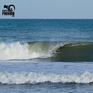
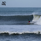
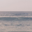
surffoto's uit
de galerijContourlijnen: Wegen & Rivieren: Kies een surflokatie uit het menu 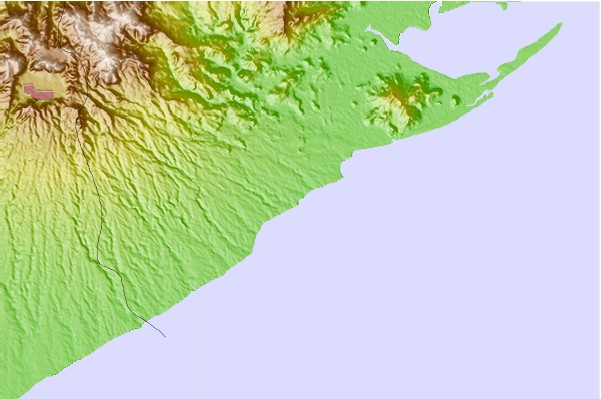
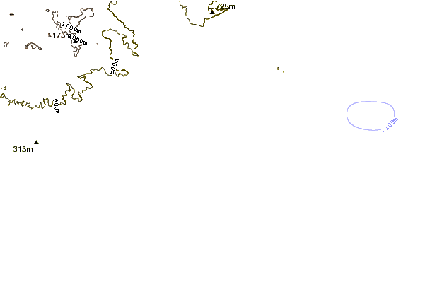
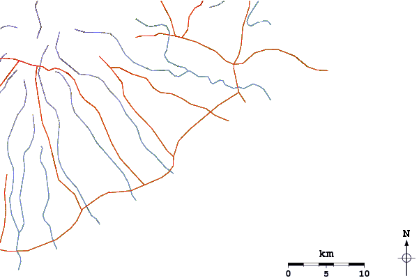
Gebruik deze reliëfkaart om naar de surfspots en de getijdenstations van Gulf of Panama toe te gaan, in de buurt van Playa Teta.
Andere Dichtbijzijnde Surflocaties van Playa Teta:
(klik op locatienaam voor meer informatie)- Closest Locatie0 mi
- Second closest Locatie1 mi
- Third closest Locatie2 mi
- Fourth closest Locatie2 mi
- Fifth closest Locatie2 mi
Dichtstbijzijnde golfboeien bij Playa Teta:
- Closest golfboei585 mi
- Second closest golfboei857 mi
- Third closest golfboei1088 mi
- Fourth closest golfboei1108 mi
- Fifth closest golfboei1155 mi
Getijdenstations in de buurt van Playa Teta:
- Closest getijdenstationVeracruz32 mi
- Second closest getijdenstationBalboa39 mi
- Third closest getijdenstationSan Miguelito45 mi
- Fourth closest getijdenstationPuerto Escondido48 mi
- Fifth closest getijdenstationCristobal58 mi
Airports
- The closest passenger airport to Playa Teta is Howard Afb Airport (HOW) in Panama, which is 56 km (35 miles) away (directly).
- The second nearest airport to Playa Teta is Marcos A Gelabert International (Panama) Airport (PAC), also in Panama, 65 km (40 miles) away.
- The third closest airport is Tocumen International (Panama City) Airport (PTY), also in Panama, 85 km (53 miles) away.
- /breaks/Playa-Teta/forecasts/latest


 Nearest