Playa de Levante Surf Guide
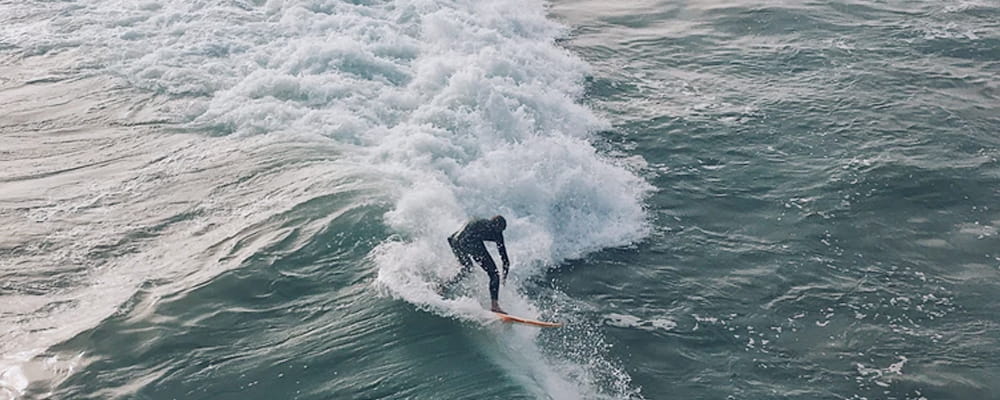
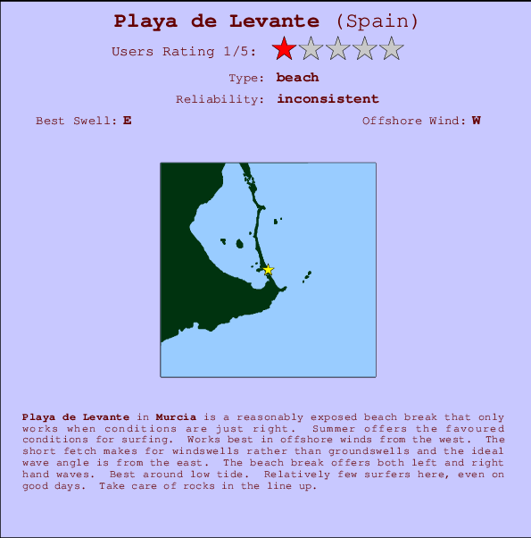
Playa de Levante in Andalucia is a fairly exposed beach break that has unreliable waves. Summer offers the best conditions for surfing. Offshore winds blow from the west. Short period wind swells are the rule and the best wave direction is from the east. The beach break offers both left and right hand waves. Best around low tide. It very rarely gets crowded here. Submerged rocks are a hazard.
Playa de Levante Spot Info
| Type: | Rating: | Reliability: | Todays Sea Temp*: |
|---|---|---|---|
| inconsistent | 27.3°C*ocean temperature recorded from satellite |
Surfing Playa de Levante:
The best conditions reported for surf at Playa de Levante occur when a East swell combines with an offshore wind direction from the West.
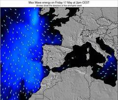
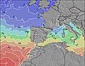
Voorspelde Golfenergie (Kracht): 12 uur


Playa de Levante Surf:
Sunday, 19 July 2026, 04:03 Local time| Sunday 19 | ||||
| 5AM | 8AM | 11AM | 2PM | |
| Wave (m) | ||||
| Periode (s) | 4 | 4 | - | 4 |
| Wind (km/h) | ||||
| Wind | cross | cross- off |
cross- on |
on |
- /breaks/Playade-Levante/forecasts/latest
Playa de Levante Surf Guide
Playa de Levante in Andalucia is a fairly exposed beach break that has unreliable waves. Summer offers the best conditions for surfing. Offshore winds blow from the west. Short period wind swells are the rule and the best wave direction is from the east. The beach break offers both left and right hand waves. Best around low tide. It very rarely gets crowded here. Submerged rocks are a hazard.
Playa de Levante Spot Info
Type: Rating: Reliability: Todays Sea Temp*:  Beach
Beach 1
1inconsistent 27.3°C*ocean temperature recorded from satelliteSurfing Playa de Levante:
The best conditions reported for surf at Playa de Levante occur when a East swell combines with an offshore wind direction from the West.
Voorspelde Golfenergie (Kracht): 12 uur
Gebruik de tabbladen hierboven om de zeewatertemperatuur bij Playa de Levante te bekijken, foto's van Playa de Levante, Playa de Levante gedetailleerde golfvoorspellingen, wind- en weersvoorspellingen, Playa de Levante webcams, actuele wind in Murcia live weerstations en Playa de Levante getijdenvoorspellingen. De link van Spain (Europe) golfkaarten opent een grote afbeelding van Spain (Europe) en de omliggende zeeën. Deze golfkaarten kunnen worden dynamisch gemaakt worden met de verschillende golfcomponenten, golfenergie, golfperiode, golfhoogte, samen met de wind en weersvoorspellingen, het actuele weer en de zeetoestand volgens golfboeien uit Spain (Europe), langskomende schepen en weerstations op de kust. Elk voorspelling pagina's voor dit surfstrand zijn voorzien van een wereldwijde en regionale golfzoeker om de beste surfsomstandigheden in het gebied rond Playa de Levante te vinden.
Playa de Levante Surf:
Sunday, 19 July 2026, 04:03 Local timeSunday 19 5AM 8AM 11AM 2PM Wave (m) Periode (s) 4 4 - 4 Wind (km/h) Wind cross cross-
offcross-
onon - /breaks/Playade-Levante/forecasts/latest
- /breaks/Playade-Levante/forecasts/latest/six_day
Playa de Levante Surf Guide
Playa de Levante in Andalucia is a fairly exposed beach break that has unreliable waves. Summer offers the best conditions for surfing. Offshore winds blow from the west. Short period wind swells are the rule and the best wave direction is from the east. The beach break offers both left and right hand waves. Best around low tide. It very rarely gets crowded here. Submerged rocks are a hazard.
Playa de Levante Spot Info
Type: Rating: Reliability: Todays Sea Temp*: Beach1inconsistent 27.3°C*ocean temperature recorded from satelliteSurfing Playa de Levante:
The best conditions reported for surf at Playa de Levante occur when a East swell combines with an offshore wind direction from the West.
Voorspelde Golfenergie (Kracht): 12 uur
Gebruik de tabbladen hierboven om de zeewatertemperatuur bij Playa de Levante te bekijken, foto's van Playa de Levante, Playa de Levante gedetailleerde golfvoorspellingen, wind- en weersvoorspellingen, Playa de Levante webcams, actuele wind in Murcia live weerstations en Playa de Levante getijdenvoorspellingen. De link van Spain (Europe) golfkaarten opent een grote afbeelding van Spain (Europe) en de omliggende zeeën. Deze golfkaarten kunnen worden dynamisch gemaakt worden met de verschillende golfcomponenten, golfenergie, golfperiode, golfhoogte, samen met de wind en weersvoorspellingen, het actuele weer en de zeetoestand volgens golfboeien uit Spain (Europe), langskomende schepen en weerstations op de kust. Elk voorspelling pagina's voor dit surfstrand zijn voorzien van een wereldwijde en regionale golfzoeker om de beste surfsomstandigheden in het gebied rond Playa de Levante te vinden.
Playa de Levante Surf:
Sunday, 19 July 2026, 04:03 Local timeSunday 19 5AM 8AM 11AM 2PM Wave (m) Periode (s) 4 4 - 4 Wind (km/h) Wind cross cross-
offcross-
onon - /breaks/Playade-Levante/forecasts/latest
Playa de Levante Surf Guide
Playa de Levante in Andalucia is a fairly exposed beach break that has unreliable waves. Summer offers the best conditions for surfing. Offshore winds blow from the west. Short period wind swells are the rule and the best wave direction is from the east. The beach break offers both left and right hand waves. Best around low tide. It very rarely gets crowded here. Submerged rocks are a hazard.
Playa de Levante Spot Info
Type: Rating: Reliability: Todays Sea Temp*: Beach1inconsistent 27.3°C*ocean temperature recorded from satelliteSurfing Playa de Levante:
The best conditions reported for surf at Playa de Levante occur when a East swell combines with an offshore wind direction from the West.
Voorspelde Golfenergie (Kracht): 12 uur
Gebruik de tabbladen hierboven om de zeewatertemperatuur bij Playa de Levante te bekijken, foto's van Playa de Levante, Playa de Levante gedetailleerde golfvoorspellingen, wind- en weersvoorspellingen, Playa de Levante webcams, actuele wind in Murcia live weerstations en Playa de Levante getijdenvoorspellingen. De link van Spain (Europe) golfkaarten opent een grote afbeelding van Spain (Europe) en de omliggende zeeën. Deze golfkaarten kunnen worden dynamisch gemaakt worden met de verschillende golfcomponenten, golfenergie, golfperiode, golfhoogte, samen met de wind en weersvoorspellingen, het actuele weer en de zeetoestand volgens golfboeien uit Spain (Europe), langskomende schepen en weerstations op de kust. Elk voorspelling pagina's voor dit surfstrand zijn voorzien van een wereldwijde en regionale golfzoeker om de beste surfsomstandigheden in het gebied rond Playa de Levante te vinden.
Playa de Levante Surf:
Sunday, 19 July 2026, 04:03 Local timeSunday 19 5AM 8AM 11AM 2PM Wave (m) Periode (s) 4 4 - 4 Wind (km/h) Wind cross cross-
offcross-
onon Tide Times:
Voor La Manga, %{dist} %{km} van %{location}.
VOLGENDE IS OM (lokale tijd) resterende tijd hoog water laag water Playa de Levante Tide Times and Tide Chart
Live Weather:
At Playa Honda wx, 4 km from Playa de Levante.
calm
(km/h)
dryAir temperature
27°Csurffoto's uit
de galerijContourlijnen: Wegen & Rivieren: Kies een surflokatie uit het menu 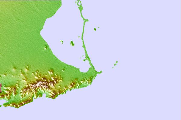

Gebruik deze reliëfkaart om naar de surfspots en de getijdenstations van Murcia toe te gaan, in de buurt van Playa de Levante.
Andere Dichtbijzijnde Surflocaties van Playa de Levante:
(klik op locatienaam voor meer informatie)- Closest Locatie2 mi
- Second closest Locatie3 mi
- Third closest Locatie6 mi
- Fourth closest Locatie6 mi
- Fifth closest Locatie7 mi
Dichtstbijzijnde golfboeien bij Playa de Levante:
- Closest golfboei398 mi
- Second closest golfboei421 mi
- Third closest golfboei449 mi
- Fourth closest golfboei508 mi
- Fifth closest golfboei566 mi
Getijdenstations in de buurt van Playa de Levante:
- Closest getijdenstationLa Union9 mi
- Second closest getijdenstationLos Alcazares9 mi
- Third closest getijdenstationSan Javier12 mi
- Fourth closest getijdenstationSan Pedro del Pinatar12 mi
- Fifth closest getijdenstationCartagena15 mi
Airports
- The closest passenger airport to Playa de Levante is Murcia San Javier Airport (MJV) in Spain, which is 15 km (9 miles) away (directly).
- The second nearest airport to Playa de Levante is Alicante Airport (ALC), also in Spain, 71 km (44 miles) away.
- The third closest airport is Almeria Airport (LEI), also in Spain, 172 km (107 miles) away.
- /breaks/Playade-Levante/forecasts/latest
 Nearest