
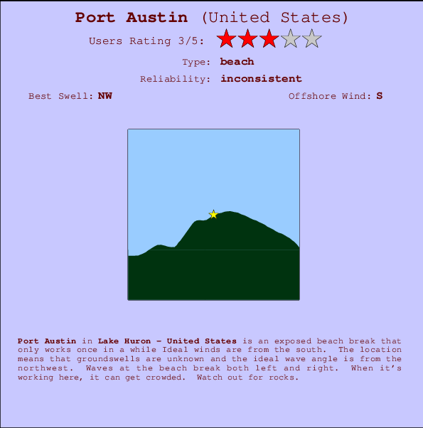
Port Austin Surf Guide
Port Austin in Lake Huron is an exposed beach break that has inconsistent surf Offshore winds are from the south. The short fetch makes for windswells rather than groundswells and the ideal wave direction is from the northwest. Waves at the beach are both lefts and rights. Sometimes crowded. Submerged rocks are a hazard.
Port Austin Spot Info
| Type: | Rating: | Reliability: | Todays Sea Temp*: |
|---|---|---|---|
| inconsistent | 23.3°C*ocean temperature recorded from satellite |
Surfing Port Austin:
The best conditions reported for surf at Port Austin occur when a Northwest swell combines with an offshore wind direction from the South.
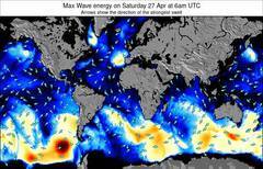
Voorspelde Golfenergie (Kracht): 12 uur

Port Austin Surf:
Thursday, 16 July 2026, 19:33 Local time| Thursday 16 | Fri | |||
| 5PM | 8PM | 11PM | 2AM | |
| Wave (m) | ||||
| Periode (s) | - | - | - | - |
| Wind (km/h) | ||||
| Wind | cross- on |
cross- off |
glass | cross- on |
- /breaks/Port-Austin/forecasts/latest
Port Austin Surf Guide
Port Austin in Lake Huron is an exposed beach break that has inconsistent surf Offshore winds are from the south. The short fetch makes for windswells rather than groundswells and the ideal wave direction is from the northwest. Waves at the beach are both lefts and rights. Sometimes crowded. Submerged rocks are a hazard.
Port Austin Spot Info
Type: Rating: Reliability: Todays Sea Temp*:  Beach
Beach 3
3inconsistent 23.3°C*ocean temperature recorded from satelliteSurfing Port Austin:
The best conditions reported for surf at Port Austin occur when a Northwest swell combines with an offshore wind direction from the South.
Voorspelde Golfenergie (Kracht): 12 uur
Gebruik de tabbladen hierboven om de zeewatertemperatuur bij Port Austin te bekijken, foto's van Port Austin, Port Austin gedetailleerde golfvoorspellingen, wind- en weersvoorspellingen, Port Austin webcams, actuele wind in Lake Huron live weerstations en Port Austin getijdenvoorspellingen. De link van United States golfkaarten opent een grote afbeelding van United States en de omliggende zeeën. Deze golfkaarten kunnen worden dynamisch gemaakt worden met de verschillende golfcomponenten, golfenergie, golfperiode, golfhoogte, samen met de wind en weersvoorspellingen, het actuele weer en de zeetoestand volgens golfboeien uit United States, langskomende schepen en weerstations op de kust. Elk voorspelling pagina's voor dit surfstrand zijn voorzien van een wereldwijde en regionale golfzoeker om de beste surfsomstandigheden in het gebied rond Port Austin te vinden.
Port Austin Surf:
Thursday, 16 July 2026, 19:33 Local timeThursday 16 Fri 5PM 8PM 11PM 2AM Wave (m) Periode (s) - - - - Wind (km/h) Wind cross-
oncross-
offglass cross-
on- /breaks/Port-Austin/forecasts/latest
- /breaks/Port-Austin/forecasts/latest/six_day
Port Austin Surf Guide
Port Austin in Lake Huron is an exposed beach break that has inconsistent surf Offshore winds are from the south. The short fetch makes for windswells rather than groundswells and the ideal wave direction is from the northwest. Waves at the beach are both lefts and rights. Sometimes crowded. Submerged rocks are a hazard.
Port Austin Spot Info
Type: Rating: Reliability: Todays Sea Temp*: Beach3inconsistent 23.3°C*ocean temperature recorded from satelliteSurfing Port Austin:
The best conditions reported for surf at Port Austin occur when a Northwest swell combines with an offshore wind direction from the South.
Voorspelde Golfenergie (Kracht): 12 uur
Gebruik de tabbladen hierboven om de zeewatertemperatuur bij Port Austin te bekijken, foto's van Port Austin, Port Austin gedetailleerde golfvoorspellingen, wind- en weersvoorspellingen, Port Austin webcams, actuele wind in Lake Huron live weerstations en Port Austin getijdenvoorspellingen. De link van United States golfkaarten opent een grote afbeelding van United States en de omliggende zeeën. Deze golfkaarten kunnen worden dynamisch gemaakt worden met de verschillende golfcomponenten, golfenergie, golfperiode, golfhoogte, samen met de wind en weersvoorspellingen, het actuele weer en de zeetoestand volgens golfboeien uit United States, langskomende schepen en weerstations op de kust. Elk voorspelling pagina's voor dit surfstrand zijn voorzien van een wereldwijde en regionale golfzoeker om de beste surfsomstandigheden in het gebied rond Port Austin te vinden.
Port Austin Surf:
Thursday, 16 July 2026, 19:33 Local timeThursday 16 Fri 5PM 8PM 11PM 2AM Wave (m) Periode (s) - - - - Wind (km/h) Wind cross-
oncross-
offglass cross-
on- /breaks/Port-Austin/forecasts/latest
Port Austin Surf Guide
Port Austin in Lake Huron is an exposed beach break that has inconsistent surf Offshore winds are from the south. The short fetch makes for windswells rather than groundswells and the ideal wave direction is from the northwest. Waves at the beach are both lefts and rights. Sometimes crowded. Submerged rocks are a hazard.
Port Austin Spot Info
Type: Rating: Reliability: Todays Sea Temp*: Beach3inconsistent 23.3°C*ocean temperature recorded from satelliteSurfing Port Austin:
The best conditions reported for surf at Port Austin occur when a Northwest swell combines with an offshore wind direction from the South.
Voorspelde Golfenergie (Kracht): 12 uur
Gebruik de tabbladen hierboven om de zeewatertemperatuur bij Port Austin te bekijken, foto's van Port Austin, Port Austin gedetailleerde golfvoorspellingen, wind- en weersvoorspellingen, Port Austin webcams, actuele wind in Lake Huron live weerstations en Port Austin getijdenvoorspellingen. De link van United States golfkaarten opent een grote afbeelding van United States en de omliggende zeeën. Deze golfkaarten kunnen worden dynamisch gemaakt worden met de verschillende golfcomponenten, golfenergie, golfperiode, golfhoogte, samen met de wind en weersvoorspellingen, het actuele weer en de zeetoestand volgens golfboeien uit United States, langskomende schepen en weerstations op de kust. Elk voorspelling pagina's voor dit surfstrand zijn voorzien van een wereldwijde en regionale golfzoeker om de beste surfsomstandigheden in het gebied rond Port Austin te vinden.
Port Austin Surf:
Thursday, 16 July 2026, 19:33 Local timeThursday 16 Fri 5PM 8PM 11PM 2AM Wave (m) Periode (s) - - - - Wind (km/h) Wind cross-
oncross-
offglass cross-
onTide Times:
Voor Chain Bridge, DC, %{dist} %{km} van %{location}.
VOLGENDE IS OM (lokale tijd) resterende tijd hoog water laag water Port Austin Tide Times and Tide Chart
Live Weather:
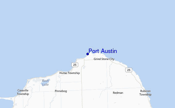
At Port Hope, 15 km from Port Austin.
light winds from the W
(km/h)Air temperature
23.9°Csurffoto's uit
de galerijContourlijnen: Wegen & Rivieren: Kies een surflokatie uit het menu 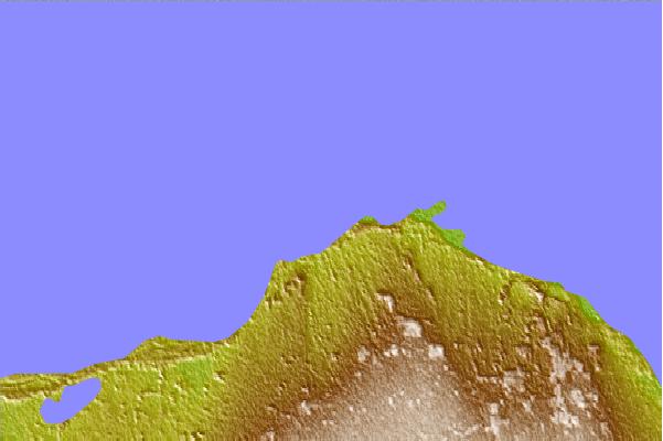
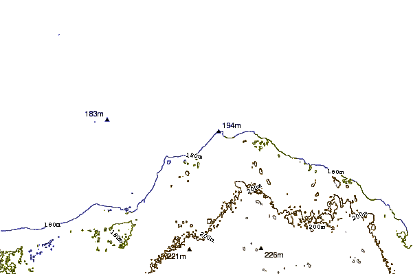
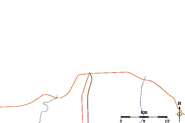
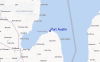
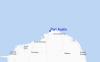
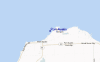
Gebruik deze reliëfkaart om naar de surfspots en de getijdenstations van Lake Huron toe te gaan, in de buurt van Port Austin.
Andere Dichtbijzijnde Surflocaties van Port Austin:
(klik op locatienaam voor meer informatie)- Closest Locatie53 mi
- Second closest Locatie93 mi
- Third closest Locatie118 mi
- Fourth closest Locatie127 mi
- Fifth closest Locatie128 mi
Dichtstbijzijnde golfboeien bij Port Austin:
- Closest golfboei31 mi
- Second closest golfboei32 mi
- Third closest golfboei66 mi
- Fourth closest golfboei66 mi
- Fifth closest golfboei89 mi
Getijdenstations in de buurt van Port Austin:
- Closest getijdenstationChain Bridge466 mi
- Second closest getijdenstationMiddle Branch, Baltimore Harbor466 mi
- Third closest getijdenstationFells Point, Baltimore Harbor467 mi
- Fourth closest getijdenstationRosedale467 mi
- Fifth closest getijdenstationBaltimore (Fort McHenry)468 mi
Airports
- The closest passenger airport to Port Austin is Chris Hadfield (Sarnia) Airport (YZR) in Canada, 130 km (81 miles) away (directly).
- The second nearest airport to Port Austin is St Clair Co International (Port Huron) Airport (PHN) in USA, 133 km (83 miles) away.
- Third is Roscommon Co (Houghton Lake) Airport (HTL) in USA, 139 km (86 miles) away.
- Selfridge Angb (Mount Clemens) Airport (MTC) in USA is 162 km (101 miles) away.
- Wiarton Airport (YVV) in Canada is the fifth nearest airport to Port Austin and is 167 km (104 miles) away.
- /breaks/Port-Austin/forecasts/latest
 Nearest