

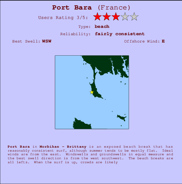
Port Bara Surf Guide
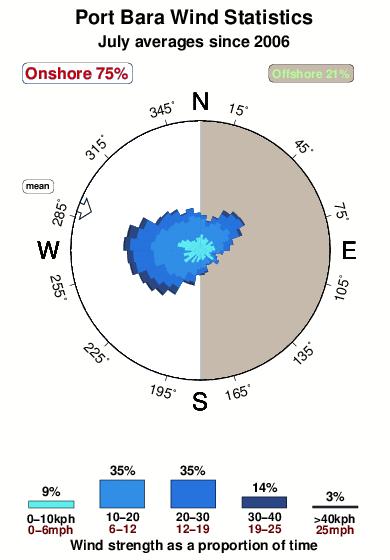
Port Bara in Brittany is an exposed beach break that has fairly consistent surf, although summer tends to be mostly flat. The best wind direction is from the east. Most of the surf here comes from groundswells and the ideal swell angle is from the west southwest. The beach breaks consists of lefts. It's often crowded here.
Port Bara Spot Info
| Type: | Rating: | Reliability: | Todays Sea Temp*: |
|---|---|---|---|
| fairly consistent | 21.6°C*ocean temperature recorded from satellite |
Surfing Port Bara:
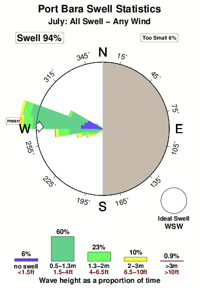
The best conditions reported for surf at Port Bara occur when a West-southwest swell combines with an offshore wind direction from the East.
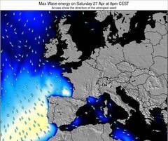
Voorspelde Golfenergie (Kracht): 12 uur


Port Bara Surf:
Thursday, 16 July 2026, 11:50 Local time| Thursday 16 | ||||
| 11AM | 2PM | 5PM | 8PM | |
| Wave (m) | ||||
| Periode (s) | 8 | 7 | 7 | 8 |
| Wind (km/h) | ||||
| Wind | off | cross- on |
on | on |
- /breaks/Port-Bara/forecasts/latest
Port Bara Surf Guide
Port Bara in Brittany is an exposed beach break that has fairly consistent surf, although summer tends to be mostly flat. The best wind direction is from the east. Most of the surf here comes from groundswells and the ideal swell angle is from the west southwest. The beach breaks consists of lefts. It's often crowded here.
Port Bara Spot Info
Type: Rating: Reliability: Todays Sea Temp*:  Beach
Beach 3
3fairly consistent 21.6°C*ocean temperature recorded from satelliteSurfing Port Bara:
The best conditions reported for surf at Port Bara occur when a West-southwest swell combines with an offshore wind direction from the East.
Voorspelde Golfenergie (Kracht): 12 uur
Gebruik de tabbladen hierboven om de zeewatertemperatuur bij Port Bara te bekijken, foto's van Port Bara, Port Bara gedetailleerde golfvoorspellingen, wind- en weersvoorspellingen, Port Bara webcams, actuele wind in Brittany - Morbihan live weerstations en Port Bara getijdenvoorspellingen. De link van France golfkaarten opent een grote afbeelding van France en de omliggende zeeën. Deze golfkaarten kunnen worden dynamisch gemaakt worden met de verschillende golfcomponenten, golfenergie, golfperiode, golfhoogte, samen met de wind en weersvoorspellingen, het actuele weer en de zeetoestand volgens golfboeien uit France, langskomende schepen en weerstations op de kust. Elk voorspelling pagina's voor dit surfstrand zijn voorzien van een wereldwijde en regionale golfzoeker om de beste surfsomstandigheden in het gebied rond Port Bara te vinden.
Port Bara Surf:
Thursday, 16 July 2026, 11:50 Local timeThursday 16 11AM 2PM 5PM 8PM Wave (m) Periode (s) 8 7 7 8 Wind (km/h) Wind off cross-
onon on - /breaks/Port-Bara/forecasts/latest
- /breaks/Port-Bara/forecasts/latest/six_day
Port Bara Surf Guide
Port Bara in Brittany is an exposed beach break that has fairly consistent surf, although summer tends to be mostly flat. The best wind direction is from the east. Most of the surf here comes from groundswells and the ideal swell angle is from the west southwest. The beach breaks consists of lefts. It's often crowded here.
Port Bara Spot Info
Type: Rating: Reliability: Todays Sea Temp*: Beach3fairly consistent 21.6°C*ocean temperature recorded from satelliteSurfing Port Bara:
The best conditions reported for surf at Port Bara occur when a West-southwest swell combines with an offshore wind direction from the East.
Voorspelde Golfenergie (Kracht): 12 uur
Gebruik de tabbladen hierboven om de zeewatertemperatuur bij Port Bara te bekijken, foto's van Port Bara, Port Bara gedetailleerde golfvoorspellingen, wind- en weersvoorspellingen, Port Bara webcams, actuele wind in Brittany - Morbihan live weerstations en Port Bara getijdenvoorspellingen. De link van France golfkaarten opent een grote afbeelding van France en de omliggende zeeën. Deze golfkaarten kunnen worden dynamisch gemaakt worden met de verschillende golfcomponenten, golfenergie, golfperiode, golfhoogte, samen met de wind en weersvoorspellingen, het actuele weer en de zeetoestand volgens golfboeien uit France, langskomende schepen en weerstations op de kust. Elk voorspelling pagina's voor dit surfstrand zijn voorzien van een wereldwijde en regionale golfzoeker om de beste surfsomstandigheden in het gebied rond Port Bara te vinden.
Port Bara Surf:
Thursday, 16 July 2026, 11:50 Local timeThursday 16 11AM 2PM 5PM 8PM Wave (m) Periode (s) 8 7 7 8 Wind (km/h) Wind off cross-
onon on - /breaks/Port-Bara/forecasts/latest
Port Bara Surf Guide
Port Bara in Brittany is an exposed beach break that has fairly consistent surf, although summer tends to be mostly flat. The best wind direction is from the east. Most of the surf here comes from groundswells and the ideal swell angle is from the west southwest. The beach breaks consists of lefts. It's often crowded here.
Port Bara Spot Info
Type: Rating: Reliability: Todays Sea Temp*: Beach3fairly consistent 21.6°C*ocean temperature recorded from satelliteSurfing Port Bara:
The best conditions reported for surf at Port Bara occur when a West-southwest swell combines with an offshore wind direction from the East.
Voorspelde Golfenergie (Kracht): 12 uur
Gebruik de tabbladen hierboven om de zeewatertemperatuur bij Port Bara te bekijken, foto's van Port Bara, Port Bara gedetailleerde golfvoorspellingen, wind- en weersvoorspellingen, Port Bara webcams, actuele wind in Brittany - Morbihan live weerstations en Port Bara getijdenvoorspellingen. De link van France golfkaarten opent een grote afbeelding van France en de omliggende zeeën. Deze golfkaarten kunnen worden dynamisch gemaakt worden met de verschillende golfcomponenten, golfenergie, golfperiode, golfhoogte, samen met de wind en weersvoorspellingen, het actuele weer en de zeetoestand volgens golfboeien uit France, langskomende schepen en weerstations op de kust. Elk voorspelling pagina's voor dit surfstrand zijn voorzien van een wereldwijde en regionale golfzoeker om de beste surfsomstandigheden in het gebied rond Port Bara te vinden.
Port Bara Surf:
Thursday, 16 July 2026, 11:50 Local timeThursday 16 11AM 2PM 5PM 8PM Wave (m) Periode (s) 8 7 7 8 Wind (km/h) Wind off cross-
onon on Tide Times:
Voor Quiberon, %{dist} %{km} van %{location}.
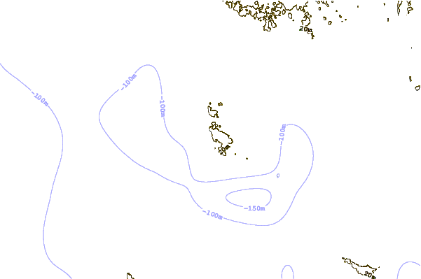
VOLGENDE IS OM (lokale tijd) resterende tijd hoog water laag water Port Bara Tide Times and Tide Chart
Live Weather:
At Quiberon, 3 km from Port Bara.
calm
(km/h)
dryAir temperature
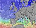
24°COverall Port Bara Surf Consistency and Wind Distribution in July
surffoto's uit
de galerijContourlijnen: Wegen & Rivieren: Kies een surflokatie uit het menu 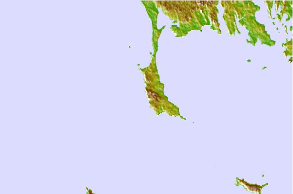
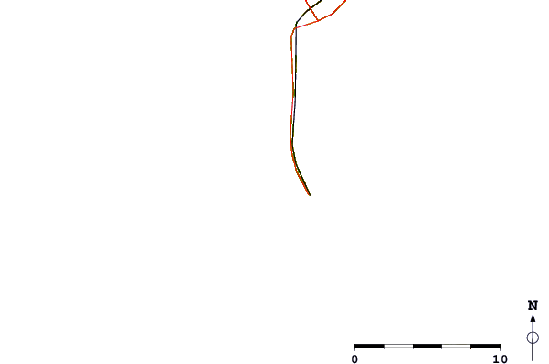
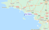
Gebruik deze reliëfkaart om naar de surfspots en de getijdenstations van Brittany - Morbihan toe te gaan, in de buurt van Port Bara.
Andere Dichtbijzijnde Surflocaties van Port Bara:
(klik op locatienaam voor meer informatie)- Closest Locatie1 mi
- Second closest Locatie1 mi
- Third closest Locatie5 mi
- Fourth closest Locatie6 mi
- Fifth closest Locatie7 mi
Dichtstbijzijnde golfboeien bij Port Bara:
- Closest golfboei167 mi
- Second closest golfboei181 mi
- Third closest golfboei182 mi
- Fourth closest golfboei195 mi
- Fifth closest golfboei202 mi
Getijdenstations in de buurt van Port Bara:
- Closest getijdenstationQuiberon2 mi
- Second closest getijdenstationAuray14 mi
- Third closest getijdenstationPort Tudy17 mi
- Fourth closest getijdenstationArradon17 mi
- Fifth closest getijdenstationLarmor-Plage18 mi
Airports
- The closest passenger airport to Port Bara is Lann Bihoue (Lorient) Airport (LRT) in France, 37 km (23 miles) away (directly).
- The second nearest airport to Port Bara is Meucon (Vannes) Airport (VNE), also in France, 41 km (25 miles) away.
- Third is Montoir (St.-nazaire) Airport (SNR) in France, 78 km (48 miles) away.
- Pluguffan (Quimper) Airport (UIP) in France is 93 km (58 miles) away.
- Armor (St.-brieuc Armor) Airport (SBK), also in France is the fifth nearest airport to Port Bara and is 118 km (73 miles) away.
- /breaks/Port-Bara/forecasts/latest


 Nearest