
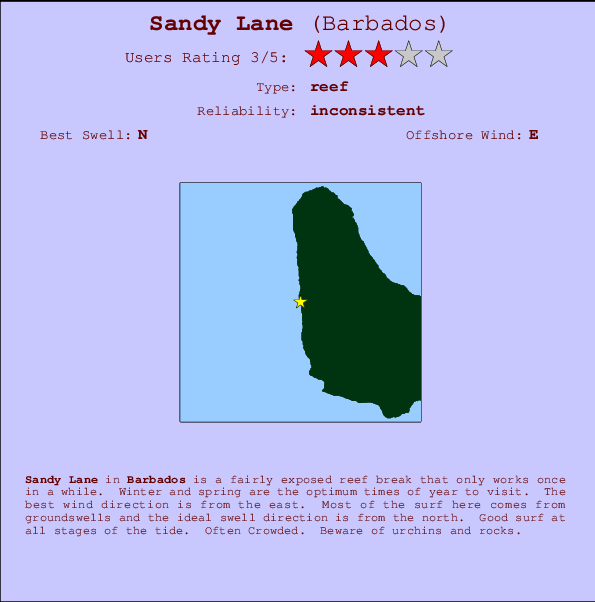
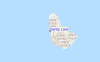
Sandy Lane Surf Guide
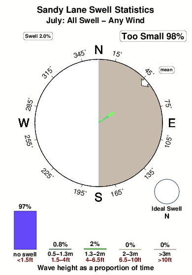
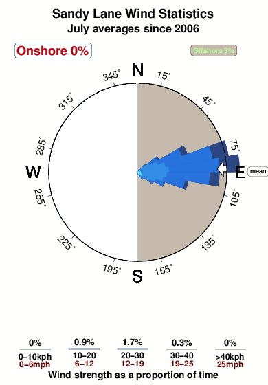
Sandy Lane on the West Coast is a fairly exposed reef break that has inconsistent surf. Winter and spring are the favoured times of year to visit. The best wind direction is from the east. Groundswells and windswells are equally likely and the best swell direction is from the north. A left hand reef break. Good surf at all stages of the tide. Often Crowded. Beware of urchins and rocks.
Sandy Lane Spot Info
| Type: | Rating: | Reliability: | Todays Sea Temp*: |
|---|---|---|---|
| inconsistent | 28.1°C*ocean temperature recorded from satellite |
Surfing Sandy Lane:
The best conditions reported for surf at Sandy Lane occur when a North swell combines with an offshore wind direction from the East.

Voorspelde Golfenergie (Kracht): 12 uur


Sandy Lane Surf:
Friday, 17 July 2026, 05:53 Local time| Friday 17 | ||||
| 5AM | 8AM | 11AM | 2PM | |
| Wave (m) | ||||
| Periode (s) | 8 | 8 | 8 | 9 |
| Wind (km/h) | ||||
| Wind | off | off | off | off |
- /breaks/Sandy-Lane/forecasts/latest
Sandy Lane Surf Guide
Sandy Lane on the West Coast is a fairly exposed reef break that has inconsistent surf. Winter and spring are the favoured times of year to visit. The best wind direction is from the east. Groundswells and windswells are equally likely and the best swell direction is from the north. A left hand reef break. Good surf at all stages of the tide. Often Crowded. Beware of urchins and rocks.
Sandy Lane Spot Info
Type: Rating: Reliability: Todays Sea Temp*:  Reef
Reef 3
3inconsistent 28.1°C*ocean temperature recorded from satelliteSurfing Sandy Lane:
The best conditions reported for surf at Sandy Lane occur when a North swell combines with an offshore wind direction from the East.
Voorspelde Golfenergie (Kracht): 12 uur
Gebruik de tabbladen hierboven om de zeewatertemperatuur bij Sandy Lane te bekijken, foto's van Sandy Lane, Sandy Lane gedetailleerde golfvoorspellingen, wind- en weersvoorspellingen, Sandy Lane webcams, actuele wind in Barbados live weerstations en Sandy Lane getijdenvoorspellingen. De link van Barbados golfkaarten opent een grote afbeelding van Barbados en de omliggende zeeën. Deze golfkaarten kunnen worden dynamisch gemaakt worden met de verschillende golfcomponenten, golfenergie, golfperiode, golfhoogte, samen met de wind en weersvoorspellingen, het actuele weer en de zeetoestand volgens golfboeien uit Barbados, langskomende schepen en weerstations op de kust. Elk voorspelling pagina's voor dit surfstrand zijn voorzien van een wereldwijde en regionale golfzoeker om de beste surfsomstandigheden in het gebied rond Sandy Lane te vinden.
Sandy Lane Surf:
Friday, 17 July 2026, 05:53 Local timeFriday 17 5AM 8AM 11AM 2PM Wave (m) Periode (s) 8 8 8 9 Wind (km/h) Wind off off off off - /breaks/Sandy-Lane/forecasts/latest
- /breaks/Sandy-Lane/forecasts/latest/six_day
Sandy Lane Surf Guide
Sandy Lane on the West Coast is a fairly exposed reef break that has inconsistent surf. Winter and spring are the favoured times of year to visit. The best wind direction is from the east. Groundswells and windswells are equally likely and the best swell direction is from the north. A left hand reef break. Good surf at all stages of the tide. Often Crowded. Beware of urchins and rocks.
Sandy Lane Spot Info
Type: Rating: Reliability: Todays Sea Temp*: Reef3inconsistent 28.1°C*ocean temperature recorded from satelliteSurfing Sandy Lane:
The best conditions reported for surf at Sandy Lane occur when a North swell combines with an offshore wind direction from the East.
Voorspelde Golfenergie (Kracht): 12 uur
Gebruik de tabbladen hierboven om de zeewatertemperatuur bij Sandy Lane te bekijken, foto's van Sandy Lane, Sandy Lane gedetailleerde golfvoorspellingen, wind- en weersvoorspellingen, Sandy Lane webcams, actuele wind in Barbados live weerstations en Sandy Lane getijdenvoorspellingen. De link van Barbados golfkaarten opent een grote afbeelding van Barbados en de omliggende zeeën. Deze golfkaarten kunnen worden dynamisch gemaakt worden met de verschillende golfcomponenten, golfenergie, golfperiode, golfhoogte, samen met de wind en weersvoorspellingen, het actuele weer en de zeetoestand volgens golfboeien uit Barbados, langskomende schepen en weerstations op de kust. Elk voorspelling pagina's voor dit surfstrand zijn voorzien van een wereldwijde en regionale golfzoeker om de beste surfsomstandigheden in het gebied rond Sandy Lane te vinden.
Sandy Lane Surf:
Friday, 17 July 2026, 05:53 Local timeFriday 17 5AM 8AM 11AM 2PM Wave (m) Periode (s) 8 8 8 9 Wind (km/h) Wind off off off off - /breaks/Sandy-Lane/forecasts/latest
Sandy Lane Surf Guide
Sandy Lane on the West Coast is a fairly exposed reef break that has inconsistent surf. Winter and spring are the favoured times of year to visit. The best wind direction is from the east. Groundswells and windswells are equally likely and the best swell direction is from the north. A left hand reef break. Good surf at all stages of the tide. Often Crowded. Beware of urchins and rocks.
Sandy Lane Spot Info
Type: Rating: Reliability: Todays Sea Temp*: Reef3inconsistent 28.1°C*ocean temperature recorded from satelliteSurfing Sandy Lane:
The best conditions reported for surf at Sandy Lane occur when a North swell combines with an offshore wind direction from the East.
Voorspelde Golfenergie (Kracht): 12 uur
Gebruik de tabbladen hierboven om de zeewatertemperatuur bij Sandy Lane te bekijken, foto's van Sandy Lane, Sandy Lane gedetailleerde golfvoorspellingen, wind- en weersvoorspellingen, Sandy Lane webcams, actuele wind in Barbados live weerstations en Sandy Lane getijdenvoorspellingen. De link van Barbados golfkaarten opent een grote afbeelding van Barbados en de omliggende zeeën. Deze golfkaarten kunnen worden dynamisch gemaakt worden met de verschillende golfcomponenten, golfenergie, golfperiode, golfhoogte, samen met de wind en weersvoorspellingen, het actuele weer en de zeetoestand volgens golfboeien uit Barbados, langskomende schepen en weerstations op de kust. Elk voorspelling pagina's voor dit surfstrand zijn voorzien van een wereldwijde en regionale golfzoeker om de beste surfsomstandigheden in het gebied rond Sandy Lane te vinden.
Sandy Lane Surf:
Friday, 17 July 2026, 05:53 Local timeFriday 17 5AM 8AM 11AM 2PM Wave (m) Periode (s) 8 8 8 9 Wind (km/h) Wind off off off off Tide Times:
Voor Church Point, %{dist} %{km} van %{location}.
VOLGENDE IS OM (lokale tijd) resterende tijd hoog water laag water Sandy Lane Tide Times and Tide Chart
Live Weather:
At Grantley Adams International Airport, 22 km from Sandy Lane.
strong winds from the E
(km/h)
Dry and partly cloudyAir temperature
27°COverall Sandy Lane Surf Consistency and Wind Distribution in July
surffoto's uit
de galerijContourlijnen: Wegen & Rivieren: Kies een surflokatie uit het menu 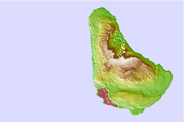
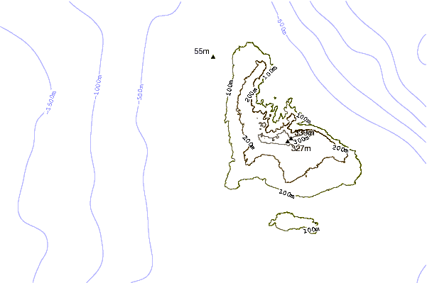
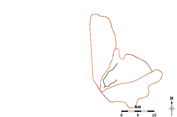
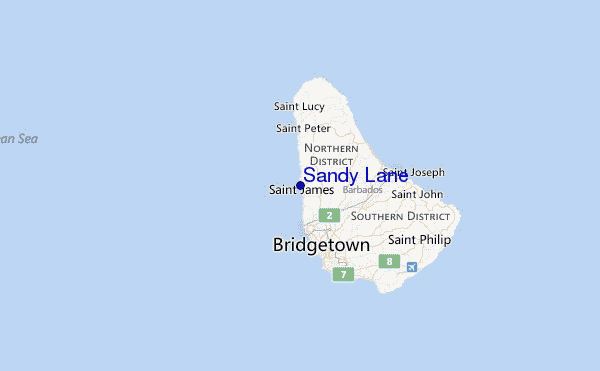
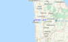
Gebruik deze reliëfkaart om naar de surfspots en de getijdenstations van Barbados toe te gaan, in de buurt van Sandy Lane.
Andere Dichtbijzijnde Surflocaties van Sandy Lane:
(klik op locatienaam voor meer informatie)- Closest Locatie1 mi
- Second closest Locatie2 mi
- Third closest Locatie3 mi
- Fourth closest Locatie3 mi
- Fifth closest Locatie3 mi
Dichtstbijzijnde golfboeien bij Sandy Lane:
- Closest golfboei250 mi
- Second closest golfboei345 mi
- Third closest golfboei454 mi
- Fourth closest golfboei488 mi
- Fifth closest golfboei522 mi
Getijdenstations in de buurt van Sandy Lane:
- Closest getijdenstationBridgetown, Barbados6 mi
- Second closest getijdenstationVieux Fort Bay96 mi
- Third closest getijdenstationBisee106 mi
- Fourth closest getijdenstationKingstown, Saint Vincent106 mi
- Fifth closest getijdenstationPort Castries108 mi
Airports
- The closest passenger airport to Sandy Lane is Grantley Adams International (Bridgetown) Airport (BGI) in Barbados, 21 km (13 miles) away (directly).
- The second nearest airport to Sandy Lane is Hewanorra International (Hewandorra) Airport (UVF) in St. Lucia Island, 154 km (96 miles) away.
- Third is Mustique Airport (MQS) in St.vincent/grenadines, 170 km (106 miles) away.
- E T Joshua (Kingstown) Airport (SVD) in St.vincent/grenadines is 170 km (106 miles) away.
- George F L Charles (Castries) Airport (SLU) in St. Lucia Island is the fifth nearest airport to Sandy Lane and is 173 km (107 miles) away.
- /breaks/Sandy-Lane/forecasts/latest


 Nearest