
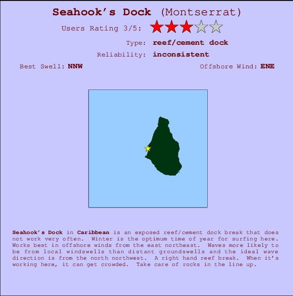
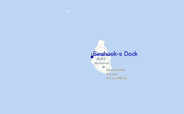
Seahook's Dock Surf Guide
Seahook's Dock in - is an exposed reef/cement dock break that has inconsistent surf. Winter is the optimum time of year for surfing here. The best wind direction is from the east northeast. Waves more likely to be from local windswells than distant groundswells and the ideal wave direction is from the north northwest. There is a right hand reef break. Sometimes crowded. Take care of rocks in the line up.
Seahook's Dock Spot Info
| Type: | Rating: | Reliability: | Todays Sea Temp*: |
|---|---|---|---|
| inconsistent | 27.9°C*ocean temperature recorded from satellite |
Surfing Seahook's Dock:
The best conditions reported for surf at Seahook's Dock occur when a North-northwest swell combines with an offshore wind direction from the East-northeast.

Voorspelde Golfenergie (Kracht): 12 uur


Seahook's Dock Surf:
Thursday, 16 July 2026, 21:41 Local time| Thursday 16 | Fri | |||
| 5PM | 8PM | 11PM | 2AM | |
| Wave (m) | ||||
| Periode (s) | 8 | 8 | 8 | 8 |
| Wind (km/h) | ||||
| Wind | off | off | off | off |
- /breaks/Seahooks-Dock/forecasts/latest
Seahook's Dock Surf Guide
Seahook's Dock in - is an exposed reef/cement dock break that has inconsistent surf. Winter is the optimum time of year for surfing here. The best wind direction is from the east northeast. Waves more likely to be from local windswells than distant groundswells and the ideal wave direction is from the north northwest. There is a right hand reef break. Sometimes crowded. Take care of rocks in the line up.
Seahook's Dock Spot Info
Type: Rating: Reliability: Todays Sea Temp*:  Reef/cement dock
 3
3inconsistent 27.9°C*ocean temperature recorded from satelliteSurfing Seahook's Dock:
The best conditions reported for surf at Seahook's Dock occur when a North-northwest swell combines with an offshore wind direction from the East-northeast.
Voorspelde Golfenergie (Kracht): 12 uur
Gebruik de tabbladen hierboven om de zeewatertemperatuur bij Seahook's Dock te bekijken, foto's van Seahook's Dock, Seahook's Dock gedetailleerde golfvoorspellingen, wind- en weersvoorspellingen, Seahook's Dock webcams, actuele wind in Caribbean live weerstations en Seahook's Dock getijdenvoorspellingen. De link van Montserrat golfkaarten opent een grote afbeelding van Montserrat en de omliggende zeeën. Deze golfkaarten kunnen worden dynamisch gemaakt worden met de verschillende golfcomponenten, golfenergie, golfperiode, golfhoogte, samen met de wind en weersvoorspellingen, het actuele weer en de zeetoestand volgens golfboeien uit Montserrat, langskomende schepen en weerstations op de kust. Elk voorspelling pagina's voor dit surfstrand zijn voorzien van een wereldwijde en regionale golfzoeker om de beste surfsomstandigheden in het gebied rond Seahook's Dock te vinden.
Seahook's Dock Surf:
Thursday, 16 July 2026, 21:41 Local timeThursday 16 Fri 5PM 8PM 11PM 2AM Wave (m) Periode (s) 8 8 8 8 Wind (km/h) Wind off off off off - /breaks/Seahooks-Dock/forecasts/latest
- /breaks/Seahooks-Dock/forecasts/latest/six_day
Seahook's Dock Surf Guide
Seahook's Dock in - is an exposed reef/cement dock break that has inconsistent surf. Winter is the optimum time of year for surfing here. The best wind direction is from the east northeast. Waves more likely to be from local windswells than distant groundswells and the ideal wave direction is from the north northwest. There is a right hand reef break. Sometimes crowded. Take care of rocks in the line up.
Seahook's Dock Spot Info
Type: Rating: Reliability: Todays Sea Temp*: Reef/cement dock3inconsistent 27.9°C*ocean temperature recorded from satelliteSurfing Seahook's Dock:
The best conditions reported for surf at Seahook's Dock occur when a North-northwest swell combines with an offshore wind direction from the East-northeast.
Voorspelde Golfenergie (Kracht): 12 uur
Gebruik de tabbladen hierboven om de zeewatertemperatuur bij Seahook's Dock te bekijken, foto's van Seahook's Dock, Seahook's Dock gedetailleerde golfvoorspellingen, wind- en weersvoorspellingen, Seahook's Dock webcams, actuele wind in Caribbean live weerstations en Seahook's Dock getijdenvoorspellingen. De link van Montserrat golfkaarten opent een grote afbeelding van Montserrat en de omliggende zeeën. Deze golfkaarten kunnen worden dynamisch gemaakt worden met de verschillende golfcomponenten, golfenergie, golfperiode, golfhoogte, samen met de wind en weersvoorspellingen, het actuele weer en de zeetoestand volgens golfboeien uit Montserrat, langskomende schepen en weerstations op de kust. Elk voorspelling pagina's voor dit surfstrand zijn voorzien van een wereldwijde en regionale golfzoeker om de beste surfsomstandigheden in het gebied rond Seahook's Dock te vinden.
Seahook's Dock Surf:
Thursday, 16 July 2026, 21:41 Local timeThursday 16 Fri 5PM 8PM 11PM 2AM Wave (m) Periode (s) 8 8 8 8 Wind (km/h) Wind off off off off - /breaks/Seahooks-Dock/forecasts/latest
Seahook's Dock Surf Guide
Seahook's Dock in - is an exposed reef/cement dock break that has inconsistent surf. Winter is the optimum time of year for surfing here. The best wind direction is from the east northeast. Waves more likely to be from local windswells than distant groundswells and the ideal wave direction is from the north northwest. There is a right hand reef break. Sometimes crowded. Take care of rocks in the line up.
Seahook's Dock Spot Info
Type: Rating: Reliability: Todays Sea Temp*: Reef/cement dock3inconsistent 27.9°C*ocean temperature recorded from satelliteSurfing Seahook's Dock:
The best conditions reported for surf at Seahook's Dock occur when a North-northwest swell combines with an offshore wind direction from the East-northeast.
Voorspelde Golfenergie (Kracht): 12 uur
Gebruik de tabbladen hierboven om de zeewatertemperatuur bij Seahook's Dock te bekijken, foto's van Seahook's Dock, Seahook's Dock gedetailleerde golfvoorspellingen, wind- en weersvoorspellingen, Seahook's Dock webcams, actuele wind in Caribbean live weerstations en Seahook's Dock getijdenvoorspellingen. De link van Montserrat golfkaarten opent een grote afbeelding van Montserrat en de omliggende zeeën. Deze golfkaarten kunnen worden dynamisch gemaakt worden met de verschillende golfcomponenten, golfenergie, golfperiode, golfhoogte, samen met de wind en weersvoorspellingen, het actuele weer en de zeetoestand volgens golfboeien uit Montserrat, langskomende schepen en weerstations op de kust. Elk voorspelling pagina's voor dit surfstrand zijn voorzien van een wereldwijde en regionale golfzoeker om de beste surfsomstandigheden in het gebied rond Seahook's Dock te vinden.
Seahook's Dock Surf:
Thursday, 16 July 2026, 21:41 Local timeThursday 16 Fri 5PM 8PM 11PM 2AM Wave (m) Periode (s) 8 8 8 8 Wind (km/h) Wind off off off off Tide Times:
Voor Belham Valley Rivermouth, %{dist} %{km} van %{location}.
VOLGENDE IS OM (lokale tijd) resterende tijd hoog water laag water Seahook's Dock Tide Times and Tide Chart
Live Weather:
At Renfrew, 59 km from Seahook's Dock.
calm
(km/h)
dryAir temperature
27°CCurrent weather near Seahook's Dock
Buoy Data:
At Eastern Caribbean Buoy, 85 miles from Seahook's Dock.
5PM 6PM 7PM 8PM Gegevens Leeftijd 4 hr 3 hr 2 hr 1 hr Golfhoogte (m) 


Dominante Periode (s) 5 5 6 5 Overall Seahook's Dock Surf Consistency and Wind Distribution in July


Wind stats for Seahook's Dock: see the variation in direction and stength by month.
surffoto's uit
de galerijContourlijnen: Wegen & Rivieren: Kies een surflokatie uit het menu 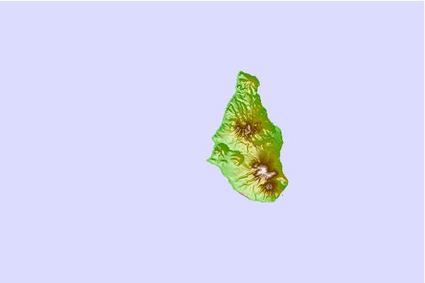
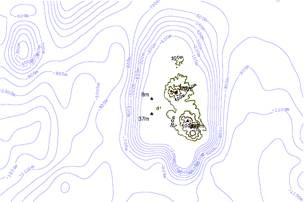
Gebruik deze reliëfkaart om naar de surfspots en de getijdenstations van Caribbean toe te gaan, in de buurt van Seahook's Dock.
Andere Dichtbijzijnde Surflocaties van Seahook's Dock:
(klik op locatienaam voor meer informatie)- Closest Locatie0 mi
- Second closest Locatie1 mi
- Third closest Locatie1 mi
- Fourth closest Locatie1 mi
- Fifth closest Locatie2 mi
Dichtstbijzijnde golfboeien bij Seahook's Dock:
- Closest golfboei85 mi
- Second closest golfboei196 mi
- Third closest golfboei237 mi
- Fourth closest golfboei281 mi
- Fifth closest golfboei293 mi
Getijdenstations in de buurt van Seahook's Dock:
- Closest getijdenstationSaint Johns, Antigua37 mi
- Second closest getijdenstationSainte-Rose47 mi
- Third closest getijdenstationPointe-Noire47 mi
- Fourth closest getijdenstationBasseterre50 mi
- Fifth closest getijdenstationAnse-Bertrand52 mi
Airports
- The closest passenger airport to Seahook's Dock is V C Bird International (Antigua) Airport (ANU) in Leeward Islands, 64 km (40 miles) away (directly).
- The second nearest airport to Seahook's Dock is Robert L Bradshaw (Basse Terre) Airport (SKB) in St. Kitts & Nevis, 81 km (50 miles) away.
- Third is Le Raizet (Pointe-a-pitre) Airport (PTP) in Antilles, 92 km (57 miles) away.
- F D Roosevelt (Oranjestad) Airport (EUX) in Antilles is 115 km (71 miles) away.
- Gustavia/st.barthel (St.-barthelemy) Airport (SBH), also in Antilles is the fifth nearest airport to Seahook's Dock and is 144 km (89 miles) away.
- /breaks/Seahooks-Dock/forecasts/latest

 Nearest