
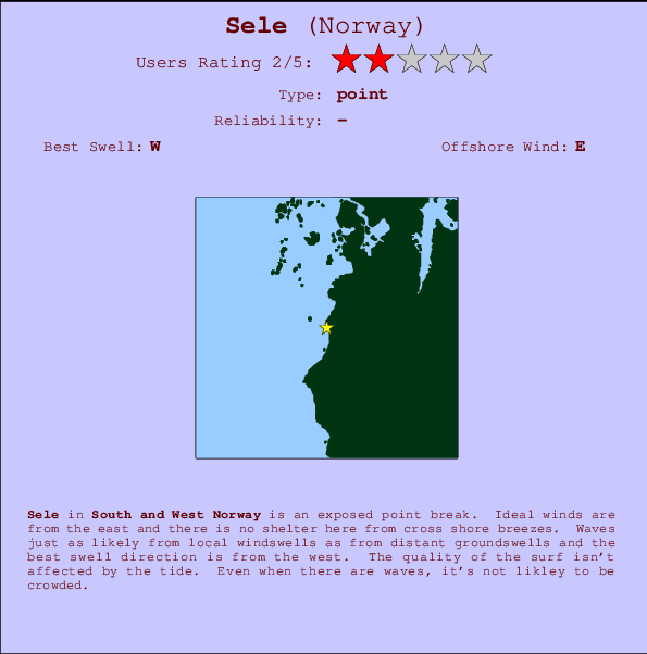
Sele Surf Guide
Sele in South and West Norway is an exposed point break that has fairly consistent surf. Offshore winds are from the east and there is no shelter here from cross shore breezes. Tends to receive a mix of groundswells and windswells and the ideal swell angle is from the west. Good surf at all stages of the tide. Unlikely to be too crowded, even when the surf is up.
Sele Spot Info
| Type: | Rating: | Reliability: | Todays Sea Temp*: |
|---|---|---|---|
| fairly consistent | 15.9°C*ocean temperature recorded from satellite |
Surfing Sele:
The best conditions reported for surf at Sele occur when a West swell combines with an offshore wind direction from the East.
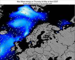
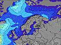
Voorspelde Golfenergie (Kracht): 12 uur
Sele Surf:
Monday, 20 July 2026, 05:23 Local time| Monday 20 | ||||
| 5AM | 8AM | 11AM | 2PM | |
| Wave (m) | ||||
| Periode (s) | 7 | 7 | 6 | 6 |
| Wind (km/h) | ||||
| Wind | cross | cross | cross- on |
cross- on |
- /breaks/Sele/forecasts/latest
Sele Surf Guide
Sele in South and West Norway is an exposed point break that has fairly consistent surf. Offshore winds are from the east and there is no shelter here from cross shore breezes. Tends to receive a mix of groundswells and windswells and the ideal swell angle is from the west. Good surf at all stages of the tide. Unlikely to be too crowded, even when the surf is up.
Sele Spot Info
Type: Rating: Reliability: Todays Sea Temp*:  Point
Point 2
2fairly consistent 15.9°C*ocean temperature recorded from satelliteSurfing Sele:
The best conditions reported for surf at Sele occur when a West swell combines with an offshore wind direction from the East.
Voorspelde Golfenergie (Kracht): 12 uur
Gebruik de tabbladen hierboven om de zeewatertemperatuur bij Sele te bekijken, foto's van Sele, Sele gedetailleerde golfvoorspellingen, wind- en weersvoorspellingen, Sele webcams, actuele wind in South and West live weerstations en Sele getijdenvoorspellingen. De link van Norway golfkaarten opent een grote afbeelding van Norway en de omliggende zeeën. Deze golfkaarten kunnen worden dynamisch gemaakt worden met de verschillende golfcomponenten, golfenergie, golfperiode, golfhoogte, samen met de wind en weersvoorspellingen, het actuele weer en de zeetoestand volgens golfboeien uit Norway, langskomende schepen en weerstations op de kust. Elk voorspelling pagina's voor dit surfstrand zijn voorzien van een wereldwijde en regionale golfzoeker om de beste surfsomstandigheden in het gebied rond Sele te vinden.
Sele Surf:
Monday, 20 July 2026, 05:23 Local timeMonday 20 5AM 8AM 11AM 2PM Wave (m) Periode (s) 7 7 6 6 Wind (km/h) Wind cross cross cross-
oncross-
on- /breaks/Sele/forecasts/latest
- /breaks/Sele/forecasts/latest/six_day
Sele Surf Guide
Sele in South and West Norway is an exposed point break that has fairly consistent surf. Offshore winds are from the east and there is no shelter here from cross shore breezes. Tends to receive a mix of groundswells and windswells and the ideal swell angle is from the west. Good surf at all stages of the tide. Unlikely to be too crowded, even when the surf is up.
Sele Spot Info
Type: Rating: Reliability: Todays Sea Temp*: Point2fairly consistent 15.9°C*ocean temperature recorded from satelliteSurfing Sele:
The best conditions reported for surf at Sele occur when a West swell combines with an offshore wind direction from the East.
Voorspelde Golfenergie (Kracht): 12 uur
Gebruik de tabbladen hierboven om de zeewatertemperatuur bij Sele te bekijken, foto's van Sele, Sele gedetailleerde golfvoorspellingen, wind- en weersvoorspellingen, Sele webcams, actuele wind in South and West live weerstations en Sele getijdenvoorspellingen. De link van Norway golfkaarten opent een grote afbeelding van Norway en de omliggende zeeën. Deze golfkaarten kunnen worden dynamisch gemaakt worden met de verschillende golfcomponenten, golfenergie, golfperiode, golfhoogte, samen met de wind en weersvoorspellingen, het actuele weer en de zeetoestand volgens golfboeien uit Norway, langskomende schepen en weerstations op de kust. Elk voorspelling pagina's voor dit surfstrand zijn voorzien van een wereldwijde en regionale golfzoeker om de beste surfsomstandigheden in het gebied rond Sele te vinden.
Sele Surf:
Monday, 20 July 2026, 05:23 Local timeMonday 20 5AM 8AM 11AM 2PM Wave (m) Periode (s) 7 7 6 6 Wind (km/h) Wind cross cross cross-
oncross-
on- /breaks/Sele/forecasts/latest
Sele Surf Guide
Sele in South and West Norway is an exposed point break that has fairly consistent surf. Offshore winds are from the east and there is no shelter here from cross shore breezes. Tends to receive a mix of groundswells and windswells and the ideal swell angle is from the west. Good surf at all stages of the tide. Unlikely to be too crowded, even when the surf is up.
Sele Spot Info
Type: Rating: Reliability: Todays Sea Temp*: Point2fairly consistent 15.9°C*ocean temperature recorded from satelliteSurfing Sele:
The best conditions reported for surf at Sele occur when a West swell combines with an offshore wind direction from the East.
Voorspelde Golfenergie (Kracht): 12 uur
Gebruik de tabbladen hierboven om de zeewatertemperatuur bij Sele te bekijken, foto's van Sele, Sele gedetailleerde golfvoorspellingen, wind- en weersvoorspellingen, Sele webcams, actuele wind in South and West live weerstations en Sele getijdenvoorspellingen. De link van Norway golfkaarten opent een grote afbeelding van Norway en de omliggende zeeën. Deze golfkaarten kunnen worden dynamisch gemaakt worden met de verschillende golfcomponenten, golfenergie, golfperiode, golfhoogte, samen met de wind en weersvoorspellingen, het actuele weer en de zeetoestand volgens golfboeien uit Norway, langskomende schepen en weerstations op de kust. Elk voorspelling pagina's voor dit surfstrand zijn voorzien van een wereldwijde en regionale golfzoeker om de beste surfsomstandigheden in het gebied rond Sele te vinden.
Sele Surf:
Monday, 20 July 2026, 05:23 Local timeMonday 20 5AM 8AM 11AM 2PM Wave (m) Periode (s) 7 7 6 6 Wind (km/h) Wind cross cross cross-
oncross-
onTide Times:
Voor Bore, %{dist} %{km} van %{location}.
VOLGENDE IS OM (lokale tijd) resterende tijd hoog water laag water Sele Tide Times and Tide Chart
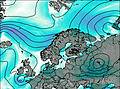
Live Weather:
At JHPGK Reve havn, 4 km from Sele.
wind obs. (76 kph from 323 degs) was rejected
(km/h)Air temperature
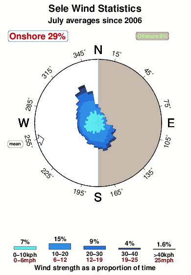
11.3°COverall Sele Surf Consistency and Wind Distribution in July
surffoto's uit
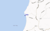
de galerijContourlijnen: Wegen & Rivieren: Kies een surflokatie uit het menu 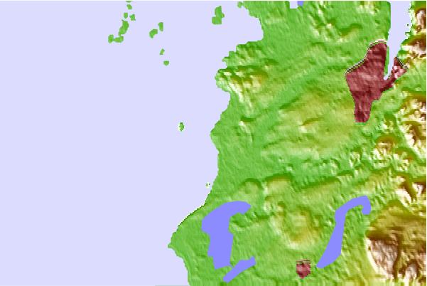
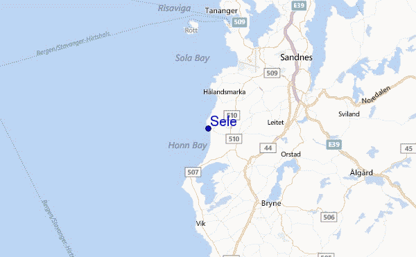
Gebruik deze reliëfkaart om naar de surfspots en de getijdenstations van South and West toe te gaan, in de buurt van Sele.
Andere Dichtbijzijnde Surflocaties van Sele:
(klik op locatienaam voor meer informatie)- Closest Locatie1 mi
- Second closest Locatie1 mi
- Third closest Locatie2 mi
- Fourth closest Locatie63 mi
- Fifth closest Locatie67 mi
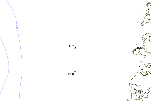
Dichtstbijzijnde golfboeien bij Sele:
- Closest golfboei146 mi
- Second closest golfboei149 mi
- Third closest golfboei151 mi
- Fourth closest golfboei152 mi
- Fifth closest golfboei160 mi
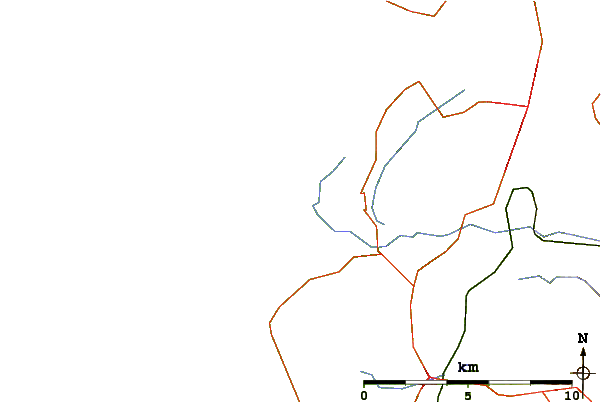
Getijdenstations in de buurt van Sele:
- Closest getijdenstationSandnes7 mi
- Second closest getijdenstationTananger9 mi
- Third closest getijdenstationStavanger14 mi
- Fourth closest getijdenstationHommersak14 mi
- Fifth closest getijdenstationRandaberg14 mi
Airports
- The closest passenger airport to Sele is Stavanger Sola Airport (SVG) in Norway, 9 km (6 miles) away (directly).
- The second nearest airport to Sele is Haugesund Karmoy Airport (HAU), also in Norway, 62 km (39 miles) away.
- Third is Lista Airport (FAN) in Norway, 101 km (63 miles) away.
- Soerstokken (Stord) Airport (SRP) in Norway is 109 km (68 miles) away.
- Kristiansand Kjevik Airport (KRS), also in Norway is the fifth nearest airport to Sele and is 163 km (101 miles) away.
- /breaks/Sele/forecasts/latest


 Nearest