
Shag Rock Surf Guide
Shag Rock in West Coast Auckland is an exposed beach break that does not work very often. Spring and Summer provide the best conditions. Works best in offshore winds from the east with some shelter here from east winds. Waves just as likely from local windswells as from distant groundswells and the best swell direction is from the southwest. The beach breaks consists of lefts. Best around low tide when the tide is rising. Rarely crowded here. Watch out for rips, rocks and sharks.
Shag Rock Spot Info
| Type: | Rating: | Reliability: | Todays Sea Temp*: |
|---|---|---|---|
| inconsistent | 14.3°C*ocean temperature recorded from satellite |
Surfing Shag Rock:
The best conditions reported for surf at Shag Rock occur when a Southwest swell combines with an offshore wind direction from the East.

Voorspelde Golfenergie (Kracht): 12 uur


Shag Rock Surf:
Tuesday, 28 July 2026, 14:20 Local time| Tuesday 28 | Wed | |||
| 3PM | 6PM | 9PM | 0AM | |
| Wave (m) | ||||
| Periode (s) | 12 | 11 | 11 | 11 |
| Wind (km/h) | ||||
| Wind | cross | cross- off |
off | cross- off |
- /breaks/Shag-Rock/forecasts/latest
Shag Rock Surf Guide
Shag Rock in West Coast Auckland is an exposed beach break that does not work very often. Spring and Summer provide the best conditions. Works best in offshore winds from the east with some shelter here from east winds. Waves just as likely from local windswells as from distant groundswells and the best swell direction is from the southwest. The beach breaks consists of lefts. Best around low tide when the tide is rising. Rarely crowded here. Watch out for rips, rocks and sharks.
Shag Rock Spot Info
Type: Rating: Reliability: Todays Sea Temp*:  Beach
Beach 3
3inconsistent 14.3°C*ocean temperature recorded from satelliteSurfing Shag Rock:
The best conditions reported for surf at Shag Rock occur when a Southwest swell combines with an offshore wind direction from the East.
Voorspelde Golfenergie (Kracht): 12 uur
Gebruik de tabbladen hierboven om de zeewatertemperatuur bij Shag Rock te bekijken, foto's van Shag Rock, Shag Rock gedetailleerde golfvoorspellingen, wind- en weersvoorspellingen, Shag Rock webcams, actuele wind in Auckland live weerstations en Shag Rock getijdenvoorspellingen. De link van New Zealand golfkaarten opent een grote afbeelding van New Zealand en de omliggende zeeën. Deze golfkaarten kunnen worden dynamisch gemaakt worden met de verschillende golfcomponenten, golfenergie, golfperiode, golfhoogte, samen met de wind en weersvoorspellingen, het actuele weer en de zeetoestand volgens golfboeien uit New Zealand, langskomende schepen en weerstations op de kust. Elk voorspelling pagina's voor dit surfstrand zijn voorzien van een wereldwijde en regionale golfzoeker om de beste surfsomstandigheden in het gebied rond Shag Rock te vinden.
Shag Rock Surf:
Tuesday, 28 July 2026, 14:20 Local timeTuesday 28 Wed 3PM 6PM 9PM 0AM Wave (m) Periode (s) 12 11 11 11 Wind (km/h) Wind cross cross-
offoff cross-
off- /breaks/Shag-Rock/forecasts/latest
- /breaks/Shag-Rock/forecasts/latest/six_day
Shag Rock Surf Guide
Shag Rock in West Coast Auckland is an exposed beach break that does not work very often. Spring and Summer provide the best conditions. Works best in offshore winds from the east with some shelter here from east winds. Waves just as likely from local windswells as from distant groundswells and the best swell direction is from the southwest. The beach breaks consists of lefts. Best around low tide when the tide is rising. Rarely crowded here. Watch out for rips, rocks and sharks.
Shag Rock Spot Info
Type: Rating: Reliability: Todays Sea Temp*: Beach3inconsistent 14.3°C*ocean temperature recorded from satelliteSurfing Shag Rock:
The best conditions reported for surf at Shag Rock occur when a Southwest swell combines with an offshore wind direction from the East.
Voorspelde Golfenergie (Kracht): 12 uur
Gebruik de tabbladen hierboven om de zeewatertemperatuur bij Shag Rock te bekijken, foto's van Shag Rock, Shag Rock gedetailleerde golfvoorspellingen, wind- en weersvoorspellingen, Shag Rock webcams, actuele wind in Auckland live weerstations en Shag Rock getijdenvoorspellingen. De link van New Zealand golfkaarten opent een grote afbeelding van New Zealand en de omliggende zeeën. Deze golfkaarten kunnen worden dynamisch gemaakt worden met de verschillende golfcomponenten, golfenergie, golfperiode, golfhoogte, samen met de wind en weersvoorspellingen, het actuele weer en de zeetoestand volgens golfboeien uit New Zealand, langskomende schepen en weerstations op de kust. Elk voorspelling pagina's voor dit surfstrand zijn voorzien van een wereldwijde en regionale golfzoeker om de beste surfsomstandigheden in het gebied rond Shag Rock te vinden.
Shag Rock Surf:
Tuesday, 28 July 2026, 14:20 Local timeTuesday 28 Wed 3PM 6PM 9PM 0AM Wave (m) Periode (s) 12 11 11 11 Wind (km/h) Wind cross cross-
offoff cross-
off- /breaks/Shag-Rock/forecasts/latest
Shag Rock Surf Guide
Shag Rock in West Coast Auckland is an exposed beach break that does not work very often. Spring and Summer provide the best conditions. Works best in offshore winds from the east with some shelter here from east winds. Waves just as likely from local windswells as from distant groundswells and the best swell direction is from the southwest. The beach breaks consists of lefts. Best around low tide when the tide is rising. Rarely crowded here. Watch out for rips, rocks and sharks.
Shag Rock Spot Info
Type: Rating: Reliability: Todays Sea Temp*: Beach3inconsistent 14.3°C*ocean temperature recorded from satelliteSurfing Shag Rock:
The best conditions reported for surf at Shag Rock occur when a Southwest swell combines with an offshore wind direction from the East.
Voorspelde Golfenergie (Kracht): 12 uur
Gebruik de tabbladen hierboven om de zeewatertemperatuur bij Shag Rock te bekijken, foto's van Shag Rock, Shag Rock gedetailleerde golfvoorspellingen, wind- en weersvoorspellingen, Shag Rock webcams, actuele wind in Auckland live weerstations en Shag Rock getijdenvoorspellingen. De link van New Zealand golfkaarten opent een grote afbeelding van New Zealand en de omliggende zeeën. Deze golfkaarten kunnen worden dynamisch gemaakt worden met de verschillende golfcomponenten, golfenergie, golfperiode, golfhoogte, samen met de wind en weersvoorspellingen, het actuele weer en de zeetoestand volgens golfboeien uit New Zealand, langskomende schepen en weerstations op de kust. Elk voorspelling pagina's voor dit surfstrand zijn voorzien van een wereldwijde en regionale golfzoeker om de beste surfsomstandigheden in het gebied rond Shag Rock te vinden.
Shag Rock Surf:
Tuesday, 28 July 2026, 14:20 Local timeTuesday 28 Wed 3PM 6PM 9PM 0AM Wave (m) Periode (s) 12 11 11 11 Wind (km/h) Wind cross cross-
offoff cross-
offTide Times:
Voor O'Neills Bay, %{dist} %{km} van %{location}.
VOLGENDE IS OM (lokale tijd) resterende tijd hoog water laag water Shag Rock Tide Times and Tide Chart
Live Weather:
At Maukatia (Maori Bay) GlidePro, 3 km from Shag Rock.
moderate winds from the S
(km/h)
No weather reportAir temperature
11.6°COverall Shag Rock Surf Consistency and Wind Distribution in July
surffoto's uit
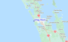
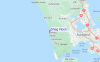
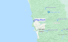
de galerijContourlijnen: Wegen & Rivieren: Kies een surflokatie uit het menu 


Gebruik deze reliëfkaart om naar de surfspots en de getijdenstations van Auckland toe te gaan, in de buurt van Shag Rock.
Andere Dichtbijzijnde Surflocaties van Shag Rock:
(klik op locatienaam voor meer informatie)- Closest Locatie0 mi
- Second closest Locatie0 mi
- Third closest Locatie1 mi
- Fourth closest Locatie1 mi
- Fifth closest Locatie2 mi
Dichtstbijzijnde golfboeien bij Shag Rock:
- Closest golfboei68 mi
- Second closest golfboei133 mi
- Third closest golfboei277 mi
- Fourth closest golfboei301 mi
- Fifth closest golfboei310 mi
Getijdenstations in de buurt van Shag Rock:
- Closest getijdenstationAuckland10 mi
- Second closest getijdenstationCornwallis13 mi
- Third closest getijdenstationParatutae Island14 mi
- Fourth closest getijdenstationOnetaunga Bay15 mi
- Fifth closest getijdenstationAuckland18 mi
Airports
- The closest passenger airport to Shag Rock is Auckland International Airport (AKL) in New Zealand, 35 km (22 miles) away (directly).
- The second nearest airport to Shag Rock is Whangarei Airport (WRE), also in New Zealand, 122 km (76 miles) away.
- Third is Hamilton Airport (HLZ) in New Zealand, 137 km (85 miles) away.
- Tauranga Airport (TRG) in New Zealand is 180 km (112 miles) away.
- Kerikeri Airport (KKE), also in New Zealand is the fifth nearest airport to Shag Rock and is 184 km (114 miles) away.

- /breaks/Shag-Rock/forecasts/latest


 Nearest