
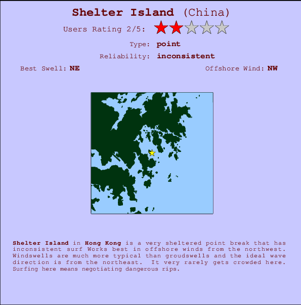
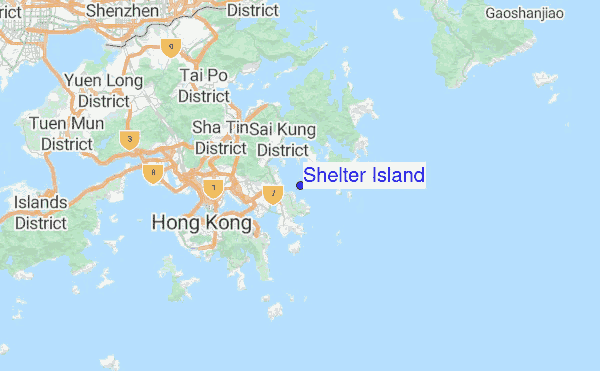
Shelter Island Surf Guide
Shelter Island in - is a very sheltered point break that only works when conditions are just right Offshore winds blow from the northwest. Waves more likely to be from local windswells than distant groundswells and the optimum wave angle is from the northeast. Even when there are waves, it's not likley to be crowded. Surfing here means negotiating dangerous rips.
Shelter Island Spot Info
| Type: | Rating: | Reliability: | Todays Sea Temp*: |
|---|---|---|---|
| inconsistent | 29.4°C*ocean temperature recorded from satellite |
Surfing Shelter Island:
The best conditions reported for surf at Shelter Island occur when a Northeast swell combines with an offshore wind direction from the Northwest.
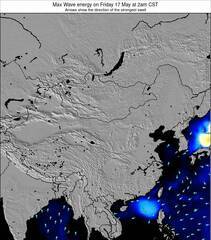
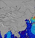
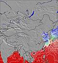
Voorspelde Golfenergie (Kracht): 12 uur

Shelter Island Surf:
Saturday, 18 July 2026, 05:06 Local time| Saturday 18 | ||||
| 5AM | 8AM | 11AM | 2PM | |
| Wave (m) | ||||
| Periode (s) | 9 | 8 | 8 | 8 |
| Wind (km/h) | ||||
| Wind | cross | cross- on |
cross | cross- off |
- /breaks/Shelter-Island_1/forecasts/latest
Shelter Island Surf Guide
Shelter Island in - is a very sheltered point break that only works when conditions are just right Offshore winds blow from the northwest. Waves more likely to be from local windswells than distant groundswells and the optimum wave angle is from the northeast. Even when there are waves, it's not likley to be crowded. Surfing here means negotiating dangerous rips.
Shelter Island Spot Info
Type: Rating: Reliability: Todays Sea Temp*:  Point
Point 2
2inconsistent 29.4°C*ocean temperature recorded from satelliteSurfing Shelter Island:
The best conditions reported for surf at Shelter Island occur when a Northeast swell combines with an offshore wind direction from the Northwest.
Voorspelde Golfenergie (Kracht): 12 uur
Gebruik de tabbladen hierboven om de zeewatertemperatuur bij Shelter Island te bekijken, foto's van Shelter Island, Shelter Island gedetailleerde golfvoorspellingen, wind- en weersvoorspellingen, Shelter Island webcams, actuele wind in Hong Kong live weerstations en Shelter Island getijdenvoorspellingen. De link van China golfkaarten opent een grote afbeelding van China en de omliggende zeeën. Deze golfkaarten kunnen worden dynamisch gemaakt worden met de verschillende golfcomponenten, golfenergie, golfperiode, golfhoogte, samen met de wind en weersvoorspellingen, het actuele weer en de zeetoestand volgens golfboeien uit China, langskomende schepen en weerstations op de kust. Elk voorspelling pagina's voor dit surfstrand zijn voorzien van een wereldwijde en regionale golfzoeker om de beste surfsomstandigheden in het gebied rond Shelter Island te vinden.
Shelter Island Surf:
Saturday, 18 July 2026, 05:06 Local timeSaturday 18 5AM 8AM 11AM 2PM Wave (m) Periode (s) 9 8 8 8 Wind (km/h) Wind cross cross-
oncross cross-
off- /breaks/Shelter-Island_1/forecasts/latest
- /breaks/Shelter-Island_1/forecasts/latest/six_day
Shelter Island Surf Guide
Shelter Island in - is a very sheltered point break that only works when conditions are just right Offshore winds blow from the northwest. Waves more likely to be from local windswells than distant groundswells and the optimum wave angle is from the northeast. Even when there are waves, it's not likley to be crowded. Surfing here means negotiating dangerous rips.
Shelter Island Spot Info
Type: Rating: Reliability: Todays Sea Temp*: Point2inconsistent 29.4°C*ocean temperature recorded from satelliteSurfing Shelter Island:
The best conditions reported for surf at Shelter Island occur when a Northeast swell combines with an offshore wind direction from the Northwest.
Voorspelde Golfenergie (Kracht): 12 uur
Gebruik de tabbladen hierboven om de zeewatertemperatuur bij Shelter Island te bekijken, foto's van Shelter Island, Shelter Island gedetailleerde golfvoorspellingen, wind- en weersvoorspellingen, Shelter Island webcams, actuele wind in Hong Kong live weerstations en Shelter Island getijdenvoorspellingen. De link van China golfkaarten opent een grote afbeelding van China en de omliggende zeeën. Deze golfkaarten kunnen worden dynamisch gemaakt worden met de verschillende golfcomponenten, golfenergie, golfperiode, golfhoogte, samen met de wind en weersvoorspellingen, het actuele weer en de zeetoestand volgens golfboeien uit China, langskomende schepen en weerstations op de kust. Elk voorspelling pagina's voor dit surfstrand zijn voorzien van een wereldwijde en regionale golfzoeker om de beste surfsomstandigheden in het gebied rond Shelter Island te vinden.
Shelter Island Surf:
Saturday, 18 July 2026, 05:06 Local timeSaturday 18 5AM 8AM 11AM 2PM Wave (m) Periode (s) 9 8 8 8 Wind (km/h) Wind cross cross-
oncross cross-
off- /breaks/Shelter-Island_1/forecasts/latest
Shelter Island Surf Guide
Shelter Island in - is a very sheltered point break that only works when conditions are just right Offshore winds blow from the northwest. Waves more likely to be from local windswells than distant groundswells and the optimum wave angle is from the northeast. Even when there are waves, it's not likley to be crowded. Surfing here means negotiating dangerous rips.
Shelter Island Spot Info
Type: Rating: Reliability: Todays Sea Temp*: Point2inconsistent 29.4°C*ocean temperature recorded from satelliteSurfing Shelter Island:
The best conditions reported for surf at Shelter Island occur when a Northeast swell combines with an offshore wind direction from the Northwest.
Voorspelde Golfenergie (Kracht): 12 uur
Gebruik de tabbladen hierboven om de zeewatertemperatuur bij Shelter Island te bekijken, foto's van Shelter Island, Shelter Island gedetailleerde golfvoorspellingen, wind- en weersvoorspellingen, Shelter Island webcams, actuele wind in Hong Kong live weerstations en Shelter Island getijdenvoorspellingen. De link van China golfkaarten opent een grote afbeelding van China en de omliggende zeeën. Deze golfkaarten kunnen worden dynamisch gemaakt worden met de verschillende golfcomponenten, golfenergie, golfperiode, golfhoogte, samen met de wind en weersvoorspellingen, het actuele weer en de zeetoestand volgens golfboeien uit China, langskomende schepen en weerstations op de kust. Elk voorspelling pagina's voor dit surfstrand zijn voorzien van een wereldwijde en regionale golfzoeker om de beste surfsomstandigheden in het gebied rond Shelter Island te vinden.
Shelter Island Surf:
Saturday, 18 July 2026, 05:06 Local timeSaturday 18 5AM 8AM 11AM 2PM Wave (m) Periode (s) 9 8 8 8 Wind (km/h) Wind cross cross-
oncross cross-
offTide Times:
Voor Clubhouse Point, %{dist} %{km} van %{location}.
VOLGENDE IS OM (lokale tijd) resterende tijd hoog water laag water Shelter Island Tide Times and Tide Chart
Live Weather:
At Cha Kwo Ling wx, 8 km from Shelter Island.
calm
(km/h)
dryAir temperature
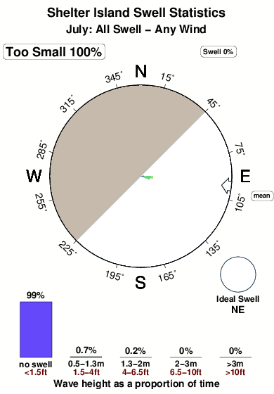
29°COverall Shelter Island Surf Consistency and Wind Distribution in July
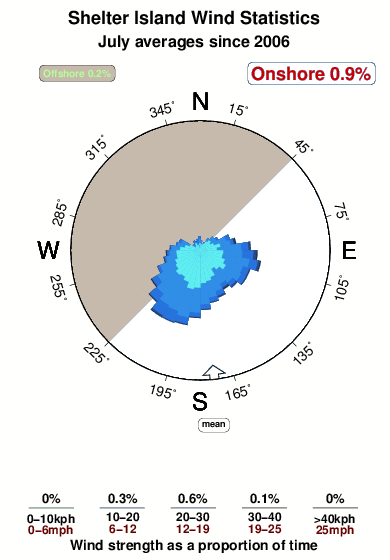


Wind stats for Shelter Island: see the variation in direction and stength by month.
surffoto's uit
de galerijContourlijnen: Wegen & Rivieren: Kies een surflokatie uit het menu 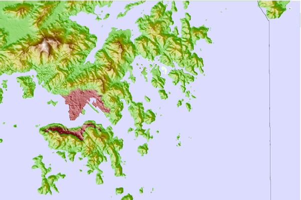
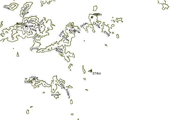

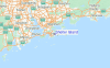
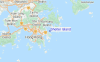
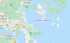
Gebruik deze reliëfkaart om naar de surfspots en de getijdenstations van Hong Kong toe te gaan, in de buurt van Shelter Island.
Andere Dichtbijzijnde Surflocaties van Shelter Island:
(klik op locatienaam voor meer informatie)- Closest Locatie4 mi
- Second closest Locatie6 mi
- Third closest Locatie7 mi
- Fourth closest Locatie8 mi
- Fifth closest Locatie8 mi
Dichtstbijzijnde golfboeien bij Shelter Island:
- Closest golfboei638 mi
- Second closest golfboei716 mi
- Third closest golfboei883 mi
- Fourth closest golfboei902 mi
- Fifth closest golfboei1032 mi
Getijdenstations in de buurt van Shelter Island:
- Closest getijdenstationHong Kong8 mi
- Second closest getijdenstationYung Shue Wan14 mi
- Third closest getijdenstationShenzhen18 mi
- Fourth closest getijdenstationZhuhai47 mi
- Fifth closest getijdenstationMacau49 mi
Airports
- The closest passenger airport to Shelter Island is Hong Kong International Airport (HKG) in Hong Kong, 40 km (25 miles) away (directly).
- The second nearest airport to Shelter Island is Baoan (Shenzhen) Airport (SZX) in China, 61 km (38 miles) away.
- Third is Macau International Airport (MFM) in Macau, 76 km (47 miles) away.
- Baiyun (Guangzhou) Airport (CAN) in China is 143 km (89 miles) away.
- Wai Sha Airport (Shantou) Airport (SWA), also in China is the fifth nearest airport to Shelter Island and is 272 km (169 miles) away.
- /breaks/Shelter-Island_1/forecasts/latest
 Nearest