

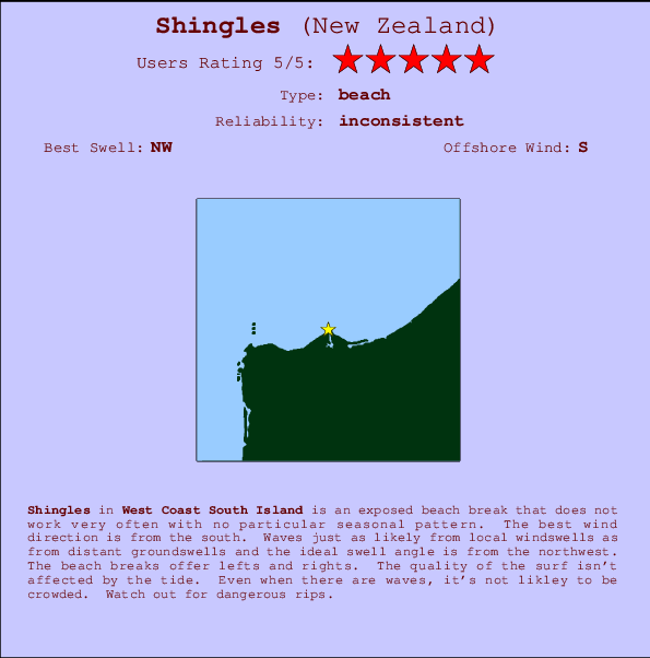
Shingles Surf Guide
Shingles on the West Coast is an exposed beach break that has inconsistent surf with no particular seasonal pattern. Works best in offshore winds from the south. Most of the surf here comes from groundswells and the ideal swell direction is from the northwest. The beach break provides left and right handers. The quality of the surf isn't affected by the tide. Even when there are waves, it's not likley to be crowded. Dangerous rips are a hazard of surfing here.
Shingles Spot Info
| Type: | Rating: | Reliability: | Todays Sea Temp*: |
|---|---|---|---|
| inconsistent | 13.8°C*ocean temperature recorded from satellite |
Surfing Shingles:
The best conditions reported for surf at Shingles occur when a Northwest swell combines with an offshore wind direction from the South.

Voorspelde Golfenergie (Kracht): 12 uur


Shingles Surf:
Friday, 17 July 2026, 23:36 Local time| Fri | Saturday 18 | |||
| 9PM | 0AM | 3AM | 6AM | |
| Wave (m) | ||||
| Periode (s) | 15 | 15 | 15 | 15 |
| Wind (km/h) | ||||
| Wind | off | off | off | off |
- /breaks/Shingles/forecasts/latest
Shingles Surf Guide
Shingles on the West Coast is an exposed beach break that has inconsistent surf with no particular seasonal pattern. Works best in offshore winds from the south. Most of the surf here comes from groundswells and the ideal swell direction is from the northwest. The beach break provides left and right handers. The quality of the surf isn't affected by the tide. Even when there are waves, it's not likley to be crowded. Dangerous rips are a hazard of surfing here.
Shingles Spot Info
Type: Rating: Reliability: Todays Sea Temp*:  Beach
Beach 5
5inconsistent 13.8°C*ocean temperature recorded from satelliteSurfing Shingles:
The best conditions reported for surf at Shingles occur when a Northwest swell combines with an offshore wind direction from the South.
Voorspelde Golfenergie (Kracht): 12 uur
Gebruik de tabbladen hierboven om de zeewatertemperatuur bij Shingles te bekijken, foto's van Shingles, Shingles gedetailleerde golfvoorspellingen, wind- en weersvoorspellingen, Shingles webcams, actuele wind in West Coast South Island live weerstations en Shingles getijdenvoorspellingen. De link van New Zealand golfkaarten opent een grote afbeelding van New Zealand en de omliggende zeeën. Deze golfkaarten kunnen worden dynamisch gemaakt worden met de verschillende golfcomponenten, golfenergie, golfperiode, golfhoogte, samen met de wind en weersvoorspellingen, het actuele weer en de zeetoestand volgens golfboeien uit New Zealand, langskomende schepen en weerstations op de kust. Elk voorspelling pagina's voor dit surfstrand zijn voorzien van een wereldwijde en regionale golfzoeker om de beste surfsomstandigheden in het gebied rond Shingles te vinden.
Shingles Surf:
Friday, 17 July 2026, 23:36 Local timeFri Saturday 18 9PM 0AM 3AM 6AM Wave (m) Periode (s) 15 15 15 15 Wind (km/h) Wind off off off off - /breaks/Shingles/forecasts/latest
- /breaks/Shingles/forecasts/latest/six_day
Shingles Surf Guide
Shingles on the West Coast is an exposed beach break that has inconsistent surf with no particular seasonal pattern. Works best in offshore winds from the south. Most of the surf here comes from groundswells and the ideal swell direction is from the northwest. The beach break provides left and right handers. The quality of the surf isn't affected by the tide. Even when there are waves, it's not likley to be crowded. Dangerous rips are a hazard of surfing here.
Shingles Spot Info
Type: Rating: Reliability: Todays Sea Temp*: Beach5inconsistent 13.8°C*ocean temperature recorded from satelliteSurfing Shingles:
The best conditions reported for surf at Shingles occur when a Northwest swell combines with an offshore wind direction from the South.
Voorspelde Golfenergie (Kracht): 12 uur
Gebruik de tabbladen hierboven om de zeewatertemperatuur bij Shingles te bekijken, foto's van Shingles, Shingles gedetailleerde golfvoorspellingen, wind- en weersvoorspellingen, Shingles webcams, actuele wind in West Coast South Island live weerstations en Shingles getijdenvoorspellingen. De link van New Zealand golfkaarten opent een grote afbeelding van New Zealand en de omliggende zeeën. Deze golfkaarten kunnen worden dynamisch gemaakt worden met de verschillende golfcomponenten, golfenergie, golfperiode, golfhoogte, samen met de wind en weersvoorspellingen, het actuele weer en de zeetoestand volgens golfboeien uit New Zealand, langskomende schepen en weerstations op de kust. Elk voorspelling pagina's voor dit surfstrand zijn voorzien van een wereldwijde en regionale golfzoeker om de beste surfsomstandigheden in het gebied rond Shingles te vinden.
Shingles Surf:
Friday, 17 July 2026, 23:36 Local timeFri Saturday 18 9PM 0AM 3AM 6AM Wave (m) Periode (s) 15 15 15 15 Wind (km/h) Wind off off off off - /breaks/Shingles/forecasts/latest
Shingles Surf Guide
Shingles on the West Coast is an exposed beach break that has inconsistent surf with no particular seasonal pattern. Works best in offshore winds from the south. Most of the surf here comes from groundswells and the ideal swell direction is from the northwest. The beach break provides left and right handers. The quality of the surf isn't affected by the tide. Even when there are waves, it's not likley to be crowded. Dangerous rips are a hazard of surfing here.
Shingles Spot Info
Type: Rating: Reliability: Todays Sea Temp*: Beach5inconsistent 13.8°C*ocean temperature recorded from satelliteSurfing Shingles:
The best conditions reported for surf at Shingles occur when a Northwest swell combines with an offshore wind direction from the South.
Voorspelde Golfenergie (Kracht): 12 uur
Gebruik de tabbladen hierboven om de zeewatertemperatuur bij Shingles te bekijken, foto's van Shingles, Shingles gedetailleerde golfvoorspellingen, wind- en weersvoorspellingen, Shingles webcams, actuele wind in West Coast South Island live weerstations en Shingles getijdenvoorspellingen. De link van New Zealand golfkaarten opent een grote afbeelding van New Zealand en de omliggende zeeën. Deze golfkaarten kunnen worden dynamisch gemaakt worden met de verschillende golfcomponenten, golfenergie, golfperiode, golfhoogte, samen met de wind en weersvoorspellingen, het actuele weer en de zeetoestand volgens golfboeien uit New Zealand, langskomende schepen en weerstations op de kust. Elk voorspelling pagina's voor dit surfstrand zijn voorzien van een wereldwijde en regionale golfzoeker om de beste surfsomstandigheden in het gebied rond Shingles te vinden.
Shingles Surf:
Friday, 17 July 2026, 23:36 Local timeFri Saturday 18 9PM 0AM 3AM 6AM Wave (m) Periode (s) 15 15 15 15 Wind (km/h) Wind off off off off Tide Times:
Voor Westport, New Zealand, %{dist} %{km} van %{location}.
VOLGENDE IS OM (lokale tijd) resterende tijd hoog water laag water Shingles Tide Times and Tide Chart
Live Weather:
At Carters Beach, 4 km from Shingles.
calm
(km/h)
DryAir temperature
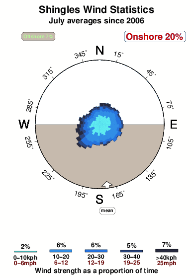
8.6°COverall Shingles Surf Consistency and Wind Distribution in July
surffoto's uit
de galerijContourlijnen: Wegen & Rivieren: Kies een surflokatie uit het menu 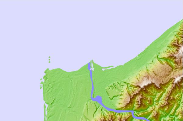
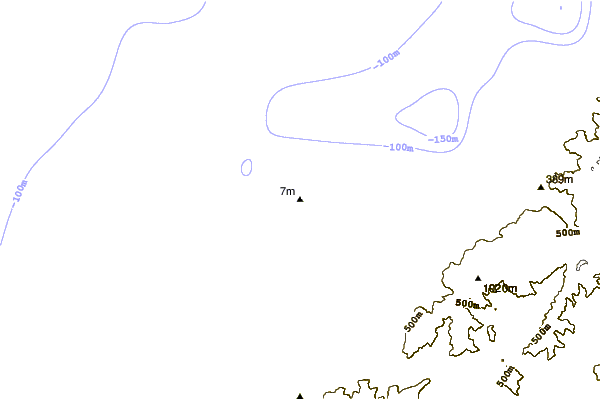
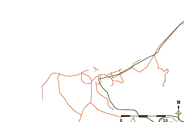
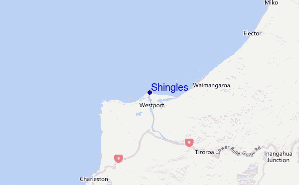
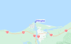
Gebruik deze reliëfkaart om naar de surfspots en de getijdenstations van West Coast South Island toe te gaan, in de buurt van Shingles.
Andere Dichtbijzijnde Surflocaties van Shingles:
(klik op locatienaam voor meer informatie)- Closest Locatie2 mi
- Second closest Locatie6 mi
- Third closest Locatie7 mi
- Fourth closest Locatie14 mi
- Fifth closest Locatie24 mi
Dichtstbijzijnde golfboeien bij Shingles:
- Closest golfboei92 mi
- Second closest golfboei100 mi
- Third closest golfboei146 mi
- Fourth closest golfboei386 mi
- Fifth closest golfboei434 mi
Getijdenstations in de buurt van Shingles:
- Closest getijdenstationWestport1 mi
- Second closest getijdenstationGreymouth52 mi
- Third closest getijdenstationHokitika River Bar75 mi
- Fourth closest getijdenstationMotueka85 mi
- Fifth closest getijdenstationMapua85 mi
Airports
- The closest passenger airport to Shingles is Westport Airport (WSZ) in New Zealand, 1 km (1 miles) away (directly).
- The second nearest airport to Shingles is Hokitika Airport (HKK), also in New Zealand, 120 km (75 miles) away.
- Third is Nelson Airport (NSN) in New Zealand, 144 km (89 miles) away.
- Woodbourne Airport (BHE) in New Zealand is 191 km (119 miles) away.
- Christchurch International Airport (CHC), also in New Zealand is the fifth nearest airport to Shingles and is 210 km (130 miles) away.
- /breaks/Shingles/forecasts/latest


 Nearest