
Shipwreck Surf Guide
Shipwreck in Lagos and West is an exposed sandbar break that has very consistent waves. The best wind direction is from the north. The ideal swell direction from the south. The sandbar breaks favour lefts. Good surf at all stages of the tide. Rarely crowded here. Beware of obstacles,.
Shipwreck Spot Info
| Type: | Rating: | Reliability: | Todays Sea Temp*: |
|---|---|---|---|
| very consistent | 27.3°C*ocean temperature recorded from satellite |
Surfing Shipwreck:
The best conditions reported for surf at Shipwreck occur when a South swell combines with an offshore wind direction from the North.
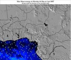
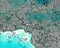
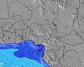
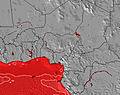
Voorspelde Golfenergie (Kracht): 12 uur
Shipwreck Surf:
Saturday, 18 July 2026, 01:52 Local time| Fri | Saturday 18 | |||
| 10PM | 1AM | 4AM | 7AM | |
| Wave (m) | ||||
| Periode (s) | 16 | 16 | 16 | 16 |
| Wind (km/h) | ||||
| Wind | cross- on |
cross- on |
cross- on |
cross- on |
- /breaks/Shipwreck_2/forecasts/latest
Shipwreck Surf Guide
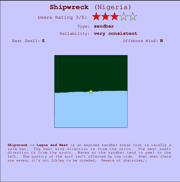
Shipwreck in Lagos and West is an exposed sandbar break that has very consistent waves. The best wind direction is from the north. The ideal swell direction from the south. The sandbar breaks favour lefts. Good surf at all stages of the tide. Rarely crowded here. Beware of obstacles,.
Shipwreck Spot Info
Type: Rating: Reliability: Todays Sea Temp*:  Sandbar
 3
3very consistent 27.3°C*ocean temperature recorded from satelliteSurfing Shipwreck:
The best conditions reported for surf at Shipwreck occur when a South swell combines with an offshore wind direction from the North.
Voorspelde Golfenergie (Kracht): 12 uur
Gebruik de tabbladen hierboven om de zeewatertemperatuur bij Shipwreck te bekijken, foto's van Shipwreck, Shipwreck gedetailleerde golfvoorspellingen, wind- en weersvoorspellingen, Shipwreck webcams, actuele wind in Lagos and West live weerstations en Shipwreck getijdenvoorspellingen. De link van Nigeria golfkaarten opent een grote afbeelding van Nigeria en de omliggende zeeën. Deze golfkaarten kunnen worden dynamisch gemaakt worden met de verschillende golfcomponenten, golfenergie, golfperiode, golfhoogte, samen met de wind en weersvoorspellingen, het actuele weer en de zeetoestand volgens golfboeien uit Nigeria, langskomende schepen en weerstations op de kust. Elk voorspelling pagina's voor dit surfstrand zijn voorzien van een wereldwijde en regionale golfzoeker om de beste surfsomstandigheden in het gebied rond Shipwreck te vinden.
Shipwreck Surf:
Saturday, 18 July 2026, 01:52 Local timeFri Saturday 18 10PM 1AM 4AM 7AM Wave (m) Periode (s) 16 16 16 16 Wind (km/h) Wind cross-
oncross-
oncross-
oncross-
on- /breaks/Shipwreck_2/forecasts/latest
- /breaks/Shipwreck_2/forecasts/latest/six_day
Shipwreck Surf Guide
Shipwreck in Lagos and West is an exposed sandbar break that has very consistent waves. The best wind direction is from the north. The ideal swell direction from the south. The sandbar breaks favour lefts. Good surf at all stages of the tide. Rarely crowded here. Beware of obstacles,.
Shipwreck Spot Info
Type: Rating: Reliability: Todays Sea Temp*: Sandbar3very consistent 27.3°C*ocean temperature recorded from satelliteSurfing Shipwreck:
The best conditions reported for surf at Shipwreck occur when a South swell combines with an offshore wind direction from the North.
Voorspelde Golfenergie (Kracht): 12 uur
Gebruik de tabbladen hierboven om de zeewatertemperatuur bij Shipwreck te bekijken, foto's van Shipwreck, Shipwreck gedetailleerde golfvoorspellingen, wind- en weersvoorspellingen, Shipwreck webcams, actuele wind in Lagos and West live weerstations en Shipwreck getijdenvoorspellingen. De link van Nigeria golfkaarten opent een grote afbeelding van Nigeria en de omliggende zeeën. Deze golfkaarten kunnen worden dynamisch gemaakt worden met de verschillende golfcomponenten, golfenergie, golfperiode, golfhoogte, samen met de wind en weersvoorspellingen, het actuele weer en de zeetoestand volgens golfboeien uit Nigeria, langskomende schepen en weerstations op de kust. Elk voorspelling pagina's voor dit surfstrand zijn voorzien van een wereldwijde en regionale golfzoeker om de beste surfsomstandigheden in het gebied rond Shipwreck te vinden.
Shipwreck Surf:
Saturday, 18 July 2026, 01:52 Local timeFri Saturday 18 10PM 1AM 4AM 7AM Wave (m) Periode (s) 16 16 16 16 Wind (km/h) Wind cross-
oncross-
oncross-
oncross-
on- /breaks/Shipwreck_2/forecasts/latest
Shipwreck Surf Guide
Shipwreck in Lagos and West is an exposed sandbar break that has very consistent waves. The best wind direction is from the north. The ideal swell direction from the south. The sandbar breaks favour lefts. Good surf at all stages of the tide. Rarely crowded here. Beware of obstacles,.
Shipwreck Spot Info
Type: Rating: Reliability: Todays Sea Temp*: Sandbar3very consistent 27.3°C*ocean temperature recorded from satelliteSurfing Shipwreck:
The best conditions reported for surf at Shipwreck occur when a South swell combines with an offshore wind direction from the North.
Voorspelde Golfenergie (Kracht): 12 uur
Gebruik de tabbladen hierboven om de zeewatertemperatuur bij Shipwreck te bekijken, foto's van Shipwreck, Shipwreck gedetailleerde golfvoorspellingen, wind- en weersvoorspellingen, Shipwreck webcams, actuele wind in Lagos and West live weerstations en Shipwreck getijdenvoorspellingen. De link van Nigeria golfkaarten opent een grote afbeelding van Nigeria en de omliggende zeeën. Deze golfkaarten kunnen worden dynamisch gemaakt worden met de verschillende golfcomponenten, golfenergie, golfperiode, golfhoogte, samen met de wind en weersvoorspellingen, het actuele weer en de zeetoestand volgens golfboeien uit Nigeria, langskomende schepen en weerstations op de kust. Elk voorspelling pagina's voor dit surfstrand zijn voorzien van een wereldwijde en regionale golfzoeker om de beste surfsomstandigheden in het gebied rond Shipwreck te vinden.
Shipwreck Surf:
Saturday, 18 July 2026, 01:52 Local timeFri Saturday 18 10PM 1AM 4AM 7AM Wave (m) Periode (s) 16 16 16 16 Wind (km/h) Wind cross-
oncross-
oncross-
oncross-
onTide Times:
Op Shipwreck (0 km).
VOLGENDE IS OM (lokale tijd) resterende tijd hoog water laag water Shipwreck Tide Times and Tide Chart
Live Weather:
At Lagos/ikeja Airport, 27 km from Shipwreck.
light winds from the SW
(km/h)
Dry and partly cloudyAir temperature
26°COverall Shipwreck Surf Consistency and Wind Distribution in July
surffoto's uit
de galerijContourlijnen: Wegen & Rivieren: Kies een surflokatie uit het menu 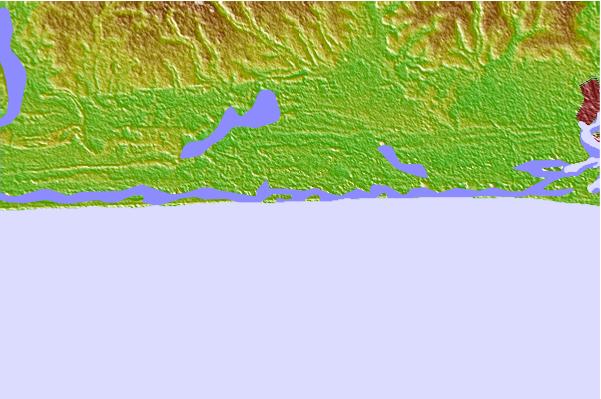
Gebruik deze reliëfkaart om naar de surfspots en de getijdenstations van Lagos and West toe te gaan, in de buurt van Shipwreck.
Andere Dichtbijzijnde Surflocaties van Shipwreck:
(klik op locatienaam voor meer informatie)- Closest Locatie17 mi
- Second closest Locatie17 mi
- Third closest Locatie48 mi
- Fourth closest Locatie55 mi
- Fifth closest Locatie62 mi
Dichtstbijzijnde golfboeien bij Shipwreck:
- Closest golfboei493 mi
- Second closest golfboei2177 mi
- Third closest golfboei2221 mi
- Fourth closest golfboei2223 mi
- Fifth closest golfboei2307 mi
Getijdenstations in de buurt van Shipwreck:
- Closest getijdenstationBadagry17 mi
- Second closest getijdenstationLagos Bar18 mi
- Third closest getijdenstationMushin18 mi
- Fourth closest getijdenstationEbute Ikorodu28 mi
- Fifth closest getijdenstationEjirin55 mi
Airports
- The closest passenger airport to Shipwreck is Lagos Murtala Muhammed Airport (LOS) in Nigeria, which is 28 km (17 miles) away (directly).
- The second nearest airport to Shipwreck is Cotonou Cadjehoun Airport (COO) in Benin, 83 km (52 miles) away.
- The third closest airport is Ibadan Airport (IBA) in Nigeria, 142 km (88 miles) away.
- /breaks/Shipwreck_2/forecasts/latest


 Nearest