
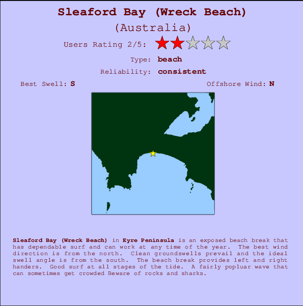
Sleaford Bay (Wreck Beach) Surf Guide
Sleaford Bay on the West Coast is an exposed beach break that usually has waves and can work at any time of the year. Offshore winds are from the north northeast. Most of the surf here comes from groundswells and the ideal swell direction is from the south. The beach breaks offer lefts and rights. Good surf at all stages of the tide. A fairly popluar wave that can sometimes get crowded Beware of rocks and sharks.
Sleaford Bay (Wreck Beach) Spot Info
| Type: | Rating: | Reliability: | Todays Sea Temp*: |
|---|---|---|---|
| consistent | 15.3°C*ocean temperature recorded from satellite |
Surfing Sleaford Bay (Wreck Beach):
The best conditions reported for surf at Sleaford Bay (Wreck Beach) occur when a South swell combines with an offshore wind direction from the North.
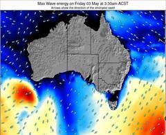
Voorspelde Golfenergie (Kracht): 12 uur

Sleaford Bay (Wreck Beach) Surf:
Wednesday, 15 July 2026, 20:37 Local time| Wed | Thu | |||
| 6:30PM | 9:30PM | 0:30AM | 3:30AM | |
| Wave (m) | ||||
| Periode (s) | 14 | 14 | 14 | 15 |
| Wind (km/h) | ||||
| Wind | cross- off |
cross- off |
cross- off |
cross- off |
- /breaks/Sleaford-Bay/forecasts/latest
Sleaford Bay (Wreck Beach) Surf Guide
Sleaford Bay on the West Coast is an exposed beach break that usually has waves and can work at any time of the year. Offshore winds are from the north northeast. Most of the surf here comes from groundswells and the ideal swell direction is from the south. The beach breaks offer lefts and rights. Good surf at all stages of the tide. A fairly popluar wave that can sometimes get crowded Beware of rocks and sharks.
Sleaford Bay (Wreck Beach) Spot Info
Type: Rating: Reliability: Todays Sea Temp*:  Beach
Beach 2
2consistent 15.3°C*ocean temperature recorded from satelliteSurfing Sleaford Bay (Wreck Beach):
The best conditions reported for surf at Sleaford Bay (Wreck Beach) occur when a South swell combines with an offshore wind direction from the North.
Voorspelde Golfenergie (Kracht): 12 uur
Gebruik de tabbladen hierboven om de zeewatertemperatuur bij Sleaford Bay (Wreck Beach) te bekijken, foto's van Sleaford Bay (Wreck Beach), Sleaford Bay (Wreck Beach) gedetailleerde golfvoorspellingen, wind- en weersvoorspellingen, Sleaford Bay (Wreck Beach) webcams, actuele wind in SA - Eyre Peninsula live weerstations en Sleaford Bay (Wreck Beach) getijdenvoorspellingen. De link van Australia golfkaarten opent een grote afbeelding van Australia en de omliggende zeeën. Deze golfkaarten kunnen worden dynamisch gemaakt worden met de verschillende golfcomponenten, golfenergie, golfperiode, golfhoogte, samen met de wind en weersvoorspellingen, het actuele weer en de zeetoestand volgens golfboeien uit Australia, langskomende schepen en weerstations op de kust. Elk voorspelling pagina's voor dit surfstrand zijn voorzien van een wereldwijde en regionale golfzoeker om de beste surfsomstandigheden in het gebied rond Sleaford Bay (Wreck Beach) te vinden.
Sleaford Bay (Wreck Beach) Surf:
Wednesday, 15 July 2026, 20:37 Local timeWed Thu 6:30PM 9:30PM 0:30AM 3:30AM Wave (m) Periode (s) 14 14 14 15 Wind (km/h) Wind cross-
offcross-
offcross-
offcross-
off- /breaks/Sleaford-Bay/forecasts/latest
- /breaks/Sleaford-Bay/forecasts/latest/six_day
Sleaford Bay (Wreck Beach) Surf Guide
Sleaford Bay on the West Coast is an exposed beach break that usually has waves and can work at any time of the year. Offshore winds are from the north northeast. Most of the surf here comes from groundswells and the ideal swell direction is from the south. The beach breaks offer lefts and rights. Good surf at all stages of the tide. A fairly popluar wave that can sometimes get crowded Beware of rocks and sharks.
Sleaford Bay (Wreck Beach) Spot Info
Type: Rating: Reliability: Todays Sea Temp*: Beach2consistent 15.3°C*ocean temperature recorded from satelliteSurfing Sleaford Bay (Wreck Beach):
The best conditions reported for surf at Sleaford Bay (Wreck Beach) occur when a South swell combines with an offshore wind direction from the North.
Voorspelde Golfenergie (Kracht): 12 uur
Gebruik de tabbladen hierboven om de zeewatertemperatuur bij Sleaford Bay (Wreck Beach) te bekijken, foto's van Sleaford Bay (Wreck Beach), Sleaford Bay (Wreck Beach) gedetailleerde golfvoorspellingen, wind- en weersvoorspellingen, Sleaford Bay (Wreck Beach) webcams, actuele wind in SA - Eyre Peninsula live weerstations en Sleaford Bay (Wreck Beach) getijdenvoorspellingen. De link van Australia golfkaarten opent een grote afbeelding van Australia en de omliggende zeeën. Deze golfkaarten kunnen worden dynamisch gemaakt worden met de verschillende golfcomponenten, golfenergie, golfperiode, golfhoogte, samen met de wind en weersvoorspellingen, het actuele weer en de zeetoestand volgens golfboeien uit Australia, langskomende schepen en weerstations op de kust. Elk voorspelling pagina's voor dit surfstrand zijn voorzien van een wereldwijde en regionale golfzoeker om de beste surfsomstandigheden in het gebied rond Sleaford Bay (Wreck Beach) te vinden.
Sleaford Bay (Wreck Beach) Surf:
Wednesday, 15 July 2026, 20:37 Local timeWed Thu 6:30PM 9:30PM 0:30AM 3:30AM Wave (m) Periode (s) 14 14 14 15 Wind (km/h) Wind cross-
offcross-
offcross-
offcross-
off- /breaks/Sleaford-Bay/forecasts/latest
Sleaford Bay (Wreck Beach) Surf Guide
Sleaford Bay on the West Coast is an exposed beach break that usually has waves and can work at any time of the year. Offshore winds are from the north northeast. Most of the surf here comes from groundswells and the ideal swell direction is from the south. The beach breaks offer lefts and rights. Good surf at all stages of the tide. A fairly popluar wave that can sometimes get crowded Beware of rocks and sharks.
Sleaford Bay (Wreck Beach) Spot Info
Type: Rating: Reliability: Todays Sea Temp*: Beach2consistent 15.3°C*ocean temperature recorded from satelliteSurfing Sleaford Bay (Wreck Beach):
The best conditions reported for surf at Sleaford Bay (Wreck Beach) occur when a South swell combines with an offshore wind direction from the North.
Voorspelde Golfenergie (Kracht): 12 uur
Gebruik de tabbladen hierboven om de zeewatertemperatuur bij Sleaford Bay (Wreck Beach) te bekijken, foto's van Sleaford Bay (Wreck Beach), Sleaford Bay (Wreck Beach) gedetailleerde golfvoorspellingen, wind- en weersvoorspellingen, Sleaford Bay (Wreck Beach) webcams, actuele wind in SA - Eyre Peninsula live weerstations en Sleaford Bay (Wreck Beach) getijdenvoorspellingen. De link van Australia golfkaarten opent een grote afbeelding van Australia en de omliggende zeeën. Deze golfkaarten kunnen worden dynamisch gemaakt worden met de verschillende golfcomponenten, golfenergie, golfperiode, golfhoogte, samen met de wind en weersvoorspellingen, het actuele weer en de zeetoestand volgens golfboeien uit Australia, langskomende schepen en weerstations op de kust. Elk voorspelling pagina's voor dit surfstrand zijn voorzien van een wereldwijde en regionale golfzoeker om de beste surfsomstandigheden in het gebied rond Sleaford Bay (Wreck Beach) te vinden.
Sleaford Bay (Wreck Beach) Surf:
Wednesday, 15 July 2026, 20:37 Local timeWed Thu 6:30PM 9:30PM 0:30AM 3:30AM Wave (m) Periode (s) 14 14 14 15 Wind (km/h) Wind cross-
offcross-
offcross-
offcross-
offTide Times:
Voor Fishery Bay, %{dist} %{km} van %{location}.
VOLGENDE IS OM (lokale tijd) resterende tijd hoog water laag water Sleaford Bay (Wreck Beach) Tide Times and Tide Chart
Live Weather:
At Port Lincoln, 31 km from Sleaford Bay (Wreck Beach).
wind obs. (7 kph from 200 degs) was rejected
(km/h)
no reportAir temperature
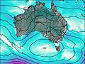
12.5°COverall Sleaford Bay (Wreck Beach) Surf Consistency and Wind Distribution in July


Wind stats for Sleaford Bay (Wreck Beach): see the variation in direction and stength by month.
surffoto's uit
de galerijContourlijnen: Wegen & Rivieren: Kies een surflokatie uit het menu 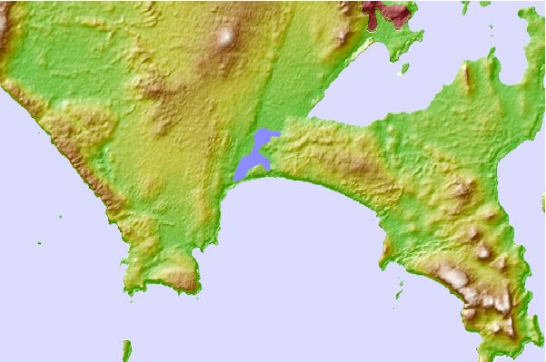
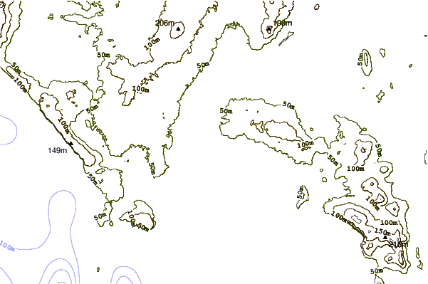
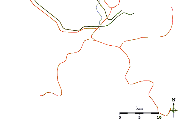
Gebruik deze reliëfkaart om naar de surfspots en de getijdenstations van SA - Eyre Peninsula toe te gaan, in de buurt van Sleaford Bay (Wreck Beach).
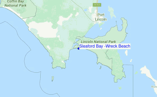
Andere Dichtbijzijnde Surflocaties van Sleaford Bay (Wreck Beach):
(klik op locatienaam voor meer informatie)- Closest Locatie6 mi
- Second closest Locatie21 mi
- Third closest Locatie27 mi
- Fourth closest Locatie42 mi
- Fifth closest Locatie42 mi
Dichtstbijzijnde golfboeien bij Sleaford Bay (Wreck Beach):
- Closest golfboei97 mi
- Second closest golfboei709 mi
- Third closest golfboei823 mi
- Fourth closest golfboei825 mi
- Fifth closest golfboei868 mi
Getijdenstations in de buurt van Sleaford Bay (Wreck Beach):
- Closest getijdenstationTaylors Landing11 mi
- Second closest getijdenstationPort Lincoln12 mi
- Third closest getijdenstationThistle Island34 mi
- Fourth closest getijdenstationWedge Island50 mi
- Fifth closest getijdenstationGreenly Island57 mi
Airports
- The nearest passenger airport to Sleaford Bay is Adelaide International Airport (ADL) in Australia, which is 258 km (160 miles) away (directly).
- The second closest airport to Sleaford Bay is Woomera Airport (UMR), also in Australia, 432 km (268 miles) away.
- /breaks/Sleaford-Bay/forecasts/latest


 Nearest