

Slip Point (Clallam Bay) Surf Guide
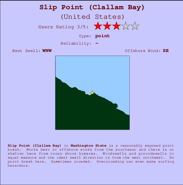
Slip Point (Clallam Bay) in Washington State is a fairly exposed point break. The best wind direction is from the southeast and there is no shelter here from cross shore breezes. Most of the surf here comes from groundswells and the best swell direction is from the west northwest. There is no point break. When the surf is up, it can get quite busy in the water. Crowds may reach hazard levels at this break - consider wearing a lid.
Slip Point (Clallam Bay) Spot Info
| Type: | Rating: | Reliability: | Todays Sea Temp*: |
|---|---|---|---|
11.2°C*ocean temperature recorded from satellite |
Surfing Slip Point (Clallam Bay):
The best conditions reported for surf at Slip Point (Clallam Bay) occur when a West-northwest swell combines with an offshore wind direction from the Southeast.
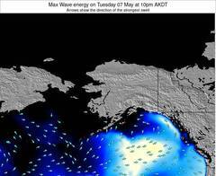
Voorspelde Golfenergie (Kracht): 12 uur
Slip Point (Clallam Bay) Surf:
Sunday, 12 July 2026, 13:58 Local time| Sunday 12 | ||||
| 2PM | 5PM | 8PM | 11PM | |
| Wave (m) | ||||
| Periode (s) | 9 | - | - | - |
| Wind (km/h) | ||||
| Wind | on | on | cross- on |
cross- on |
- /breaks/Slip-Point-Clallam-Bay/forecasts/latest
Slip Point (Clallam Bay) Surf Guide
Slip Point (Clallam Bay) in Washington State is a fairly exposed point break. The best wind direction is from the southeast and there is no shelter here from cross shore breezes. Most of the surf here comes from groundswells and the best swell direction is from the west northwest. There is no point break. When the surf is up, it can get quite busy in the water. Crowds may reach hazard levels at this break - consider wearing a lid.
Slip Point (Clallam Bay) Spot Info
Type: Rating: Reliability: Todays Sea Temp*:  Point
Point 311.2°C*ocean temperature recorded from satellite
Surfing Slip Point (Clallam Bay):
The best conditions reported for surf at Slip Point (Clallam Bay) occur when a West-northwest swell combines with an offshore wind direction from the Southeast.
Voorspelde Golfenergie (Kracht): 12 uur
Gebruik de tabbladen hierboven om de zeewatertemperatuur bij Slip Point (Clallam Bay) te bekijken, foto's van Slip Point (Clallam Bay), Slip Point (Clallam Bay) gedetailleerde golfvoorspellingen, wind- en weersvoorspellingen, Slip Point (Clallam Bay) webcams, actuele wind in Washington live weerstations en Slip Point (Clallam Bay) getijdenvoorspellingen. De link van United States golfkaarten opent een grote afbeelding van United States en de omliggende zeeën. Deze golfkaarten kunnen worden dynamisch gemaakt worden met de verschillende golfcomponenten, golfenergie, golfperiode, golfhoogte, samen met de wind en weersvoorspellingen, het actuele weer en de zeetoestand volgens golfboeien uit United States, langskomende schepen en weerstations op de kust. Elk voorspelling pagina's voor dit surfstrand zijn voorzien van een wereldwijde en regionale golfzoeker om de beste surfsomstandigheden in het gebied rond Slip Point (Clallam Bay) te vinden.
Slip Point (Clallam Bay) Surf:
Sunday, 12 July 2026, 13:58 Local timeSunday 12 2PM 5PM 8PM 11PM Wave (m) Periode (s) 9 - - - Wind (km/h) Wind on on cross-
oncross-
on- /breaks/Slip-Point-Clallam-Bay/forecasts/latest
- /breaks/Slip-Point-Clallam-Bay/forecasts/latest/six_day
Slip Point (Clallam Bay) Surf Guide
Slip Point (Clallam Bay) in Washington State is a fairly exposed point break. The best wind direction is from the southeast and there is no shelter here from cross shore breezes. Most of the surf here comes from groundswells and the best swell direction is from the west northwest. There is no point break. When the surf is up, it can get quite busy in the water. Crowds may reach hazard levels at this break - consider wearing a lid.
Slip Point (Clallam Bay) Spot Info
Type: Rating: Reliability: Todays Sea Temp*: Point311.2°C*ocean temperature recorded from satelliteSurfing Slip Point (Clallam Bay):
The best conditions reported for surf at Slip Point (Clallam Bay) occur when a West-northwest swell combines with an offshore wind direction from the Southeast.
Voorspelde Golfenergie (Kracht): 12 uur
Gebruik de tabbladen hierboven om de zeewatertemperatuur bij Slip Point (Clallam Bay) te bekijken, foto's van Slip Point (Clallam Bay), Slip Point (Clallam Bay) gedetailleerde golfvoorspellingen, wind- en weersvoorspellingen, Slip Point (Clallam Bay) webcams, actuele wind in Washington live weerstations en Slip Point (Clallam Bay) getijdenvoorspellingen. De link van United States golfkaarten opent een grote afbeelding van United States en de omliggende zeeën. Deze golfkaarten kunnen worden dynamisch gemaakt worden met de verschillende golfcomponenten, golfenergie, golfperiode, golfhoogte, samen met de wind en weersvoorspellingen, het actuele weer en de zeetoestand volgens golfboeien uit United States, langskomende schepen en weerstations op de kust. Elk voorspelling pagina's voor dit surfstrand zijn voorzien van een wereldwijde en regionale golfzoeker om de beste surfsomstandigheden in het gebied rond Slip Point (Clallam Bay) te vinden.
Slip Point (Clallam Bay) Surf:
Sunday, 12 July 2026, 13:58 Local timeSunday 12 2PM 5PM 8PM 11PM Wave (m) Periode (s) 9 - - - Wind (km/h) Wind on on cross-
oncross-
on- /breaks/Slip-Point-Clallam-Bay/forecasts/latest
Slip Point (Clallam Bay) Surf Guide
Slip Point (Clallam Bay) in Washington State is a fairly exposed point break. The best wind direction is from the southeast and there is no shelter here from cross shore breezes. Most of the surf here comes from groundswells and the best swell direction is from the west northwest. There is no point break. When the surf is up, it can get quite busy in the water. Crowds may reach hazard levels at this break - consider wearing a lid.
Slip Point (Clallam Bay) Spot Info
Type: Rating: Reliability: Todays Sea Temp*: Point311.2°C*ocean temperature recorded from satelliteSurfing Slip Point (Clallam Bay):
The best conditions reported for surf at Slip Point (Clallam Bay) occur when a West-northwest swell combines with an offshore wind direction from the Southeast.
Voorspelde Golfenergie (Kracht): 12 uur
Gebruik de tabbladen hierboven om de zeewatertemperatuur bij Slip Point (Clallam Bay) te bekijken, foto's van Slip Point (Clallam Bay), Slip Point (Clallam Bay) gedetailleerde golfvoorspellingen, wind- en weersvoorspellingen, Slip Point (Clallam Bay) webcams, actuele wind in Washington live weerstations en Slip Point (Clallam Bay) getijdenvoorspellingen. De link van United States golfkaarten opent een grote afbeelding van United States en de omliggende zeeën. Deze golfkaarten kunnen worden dynamisch gemaakt worden met de verschillende golfcomponenten, golfenergie, golfperiode, golfhoogte, samen met de wind en weersvoorspellingen, het actuele weer en de zeetoestand volgens golfboeien uit United States, langskomende schepen en weerstations op de kust. Elk voorspelling pagina's voor dit surfstrand zijn voorzien van een wereldwijde en regionale golfzoeker om de beste surfsomstandigheden in het gebied rond Slip Point (Clallam Bay) te vinden.
Slip Point (Clallam Bay) Surf:
Sunday, 12 July 2026, 13:58 Local timeSunday 12 2PM 5PM 8PM 11PM Wave (m) Periode (s) 9 - - - Wind (km/h) Wind on on cross-
oncross-
onTide Times:
Voor Sekiu, Washington, %{dist} %{km} van %{location}.
VOLGENDE IS OM (lokale tijd) resterende tijd hoog water laag water Slip Point (Clallam Bay) Tide Times and Tide Chart
Live Weather:
At Sheringham Point- BC, 28 km from Slip Point (Clallam Bay).
calm
(km/h)
no reportAir temperature
11.0°CCurrent weather near Slip Point (Clallam Bay)
Buoy Data:
At Neah Bay Buoy, 27 miles from Slip Point (Clallam Bay).
8AM 9AM 10AM 11AM Gegevens Leeftijd 4 hr 3 hr 2 hr 1 hr Golfhoogte (m) 


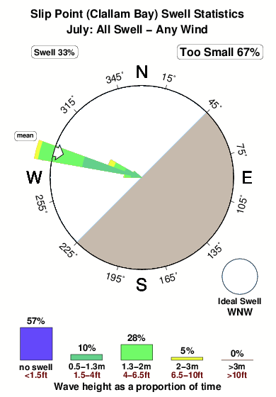
Dominante Periode (s) 8 8 8 9 Overall Slip Point (Clallam Bay) Surf Consistency and Wind Distribution in July
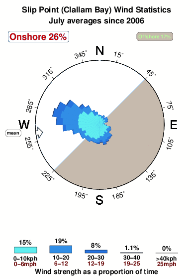


Wind stats for Slip Point (Clallam Bay): see the variation in direction and stength by month.
surffoto's uit
de galerijContourlijnen: Wegen & Rivieren: Kies een surflokatie uit het menu 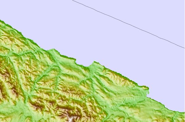
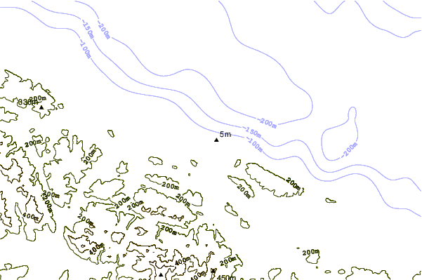
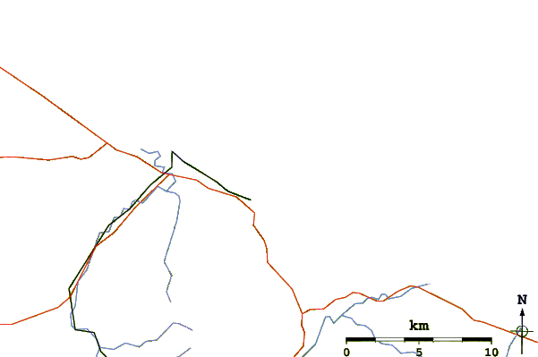
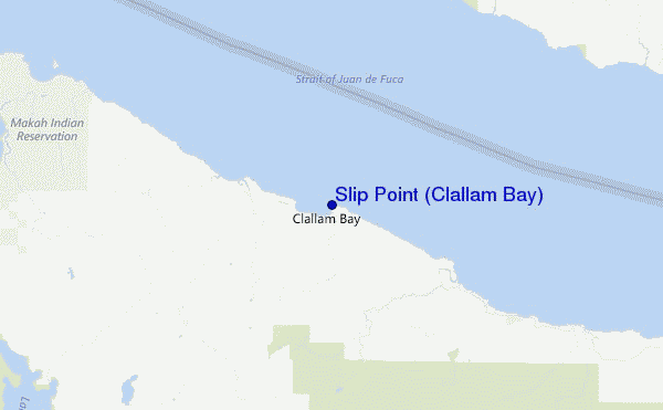
Gebruik deze reliëfkaart om naar de surfspots en de getijdenstations van Washington toe te gaan, in de buurt van Slip Point (Clallam Bay).
Andere Dichtbijzijnde Surflocaties van Slip Point (Clallam Bay):
(klik op locatienaam voor meer informatie)- Closest Locatie1 mi
- Second closest Locatie9 mi
- Third closest Locatie11 mi
- Fourth closest Locatie12 mi
- Fifth closest Locatie14 mi
Dichtstbijzijnde golfboeien bij Slip Point (Clallam Bay):
- Closest golfboei27 mi
- Second closest golfboei50 mi
- Third closest golfboei67 mi
- Fourth closest golfboei78 mi
- Fifth closest golfboei89 mi
Getijdenstations in de buurt van Slip Point (Clallam Bay):
- Closest getijdenstationSekiu2 mi
- Second closest getijdenstationTwin Rivers, Strait of Juan de Fuca16 mi
- Third closest getijdenstationPoint No Point16 mi
- Fourth closest getijdenstationNeah Bay18 mi
- Fifth closest getijdenstationMakah Bay19 mi
- /breaks/Slip-Point-Clallam-Bay/forecasts/latest
 Nearest