
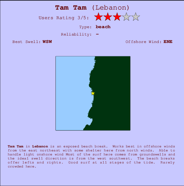
Tam Tam Surf Guide
Tam Tam in Lebanon is an exposed beach break. Ideal winds are from the east northeast with some shelter here from north winds. Surfable in an onshore breeze Waves just as likely from local windswells as from distant groundswells and the best swell direction is from the west southwest. The beach break provides left and right handers. Good surf at all stages of the tide. Rarely crowded here.
Tam Tam Spot Info
| Type: | Rating: | Reliability: | Todays Sea Temp*: |
|---|---|---|---|
29.0°C*ocean temperature recorded from satellite |
Surfing Tam Tam:
The best conditions reported for surf at Tam Tam occur when a West-southwest swell combines with an offshore wind direction from the East-northeast.
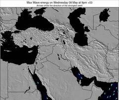
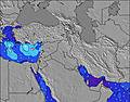
Voorspelde Golfenergie (Kracht): 12 uur

Tam Tam Surf:
Sunday, 26 July 2026, 13:51 Local time| Sunday 26 | ||||
| 12PM | 3PM | 6PM | 9PM | |
| Wave (m) | ||||
| Periode (s) | 6 | 6 | 8 | 8 |
| Wind (km/h) | ||||
| Wind | on | cross- on |
cross- on |
glass |
- /breaks/Tam-Tam/forecasts/latest
Tam Tam Surf Guide
Tam Tam in Lebanon is an exposed beach break. Ideal winds are from the east northeast with some shelter here from north winds. Surfable in an onshore breeze Waves just as likely from local windswells as from distant groundswells and the best swell direction is from the west southwest. The beach break provides left and right handers. Good surf at all stages of the tide. Rarely crowded here.
Tam Tam Spot Info
Type: Rating: Reliability: Todays Sea Temp*:  Beach
Beach 329.0°C*ocean temperature recorded from satellite
Surfing Tam Tam:
The best conditions reported for surf at Tam Tam occur when a West-southwest swell combines with an offshore wind direction from the East-northeast.
Voorspelde Golfenergie (Kracht): 12 uur
Gebruik de tabbladen hierboven om de zeewatertemperatuur bij Tam Tam te bekijken, foto's van Tam Tam, Tam Tam gedetailleerde golfvoorspellingen, wind- en weersvoorspellingen, Tam Tam webcams, actuele wind in Lebanon live weerstations en Tam Tam getijdenvoorspellingen. De link van Lebanon golfkaarten opent een grote afbeelding van Lebanon en de omliggende zeeën. Deze golfkaarten kunnen worden dynamisch gemaakt worden met de verschillende golfcomponenten, golfenergie, golfperiode, golfhoogte, samen met de wind en weersvoorspellingen, het actuele weer en de zeetoestand volgens golfboeien uit Lebanon, langskomende schepen en weerstations op de kust. Elk voorspelling pagina's voor dit surfstrand zijn voorzien van een wereldwijde en regionale golfzoeker om de beste surfsomstandigheden in het gebied rond Tam Tam te vinden.
Tam Tam Surf:
Sunday, 26 July 2026, 13:51 Local timeSunday 26 12PM 3PM 6PM 9PM Wave (m) Periode (s) 6 6 8 8 Wind (km/h) Wind on cross-
oncross-
onglass - /breaks/Tam-Tam/forecasts/latest
- /breaks/Tam-Tam/forecasts/latest/six_day
Tam Tam Surf Guide
Tam Tam in Lebanon is an exposed beach break. Ideal winds are from the east northeast with some shelter here from north winds. Surfable in an onshore breeze Waves just as likely from local windswells as from distant groundswells and the best swell direction is from the west southwest. The beach break provides left and right handers. Good surf at all stages of the tide. Rarely crowded here.
Tam Tam Spot Info
Type: Rating: Reliability: Todays Sea Temp*: Beach329.0°C*ocean temperature recorded from satelliteSurfing Tam Tam:
The best conditions reported for surf at Tam Tam occur when a West-southwest swell combines with an offshore wind direction from the East-northeast.
Voorspelde Golfenergie (Kracht): 12 uur
Gebruik de tabbladen hierboven om de zeewatertemperatuur bij Tam Tam te bekijken, foto's van Tam Tam, Tam Tam gedetailleerde golfvoorspellingen, wind- en weersvoorspellingen, Tam Tam webcams, actuele wind in Lebanon live weerstations en Tam Tam getijdenvoorspellingen. De link van Lebanon golfkaarten opent een grote afbeelding van Lebanon en de omliggende zeeën. Deze golfkaarten kunnen worden dynamisch gemaakt worden met de verschillende golfcomponenten, golfenergie, golfperiode, golfhoogte, samen met de wind en weersvoorspellingen, het actuele weer en de zeetoestand volgens golfboeien uit Lebanon, langskomende schepen en weerstations op de kust. Elk voorspelling pagina's voor dit surfstrand zijn voorzien van een wereldwijde en regionale golfzoeker om de beste surfsomstandigheden in het gebied rond Tam Tam te vinden.
Tam Tam Surf:
Sunday, 26 July 2026, 13:51 Local timeSunday 26 12PM 3PM 6PM 9PM Wave (m) Periode (s) 6 6 8 8 Wind (km/h) Wind on cross-
oncross-
onglass - /breaks/Tam-Tam/forecasts/latest
Tam Tam Surf Guide
Tam Tam in Lebanon is an exposed beach break. Ideal winds are from the east northeast with some shelter here from north winds. Surfable in an onshore breeze Waves just as likely from local windswells as from distant groundswells and the best swell direction is from the west southwest. The beach break provides left and right handers. Good surf at all stages of the tide. Rarely crowded here.
Tam Tam Spot Info
Type: Rating: Reliability: Todays Sea Temp*: Beach329.0°C*ocean temperature recorded from satelliteSurfing Tam Tam:
The best conditions reported for surf at Tam Tam occur when a West-southwest swell combines with an offshore wind direction from the East-northeast.
Voorspelde Golfenergie (Kracht): 12 uur
Gebruik de tabbladen hierboven om de zeewatertemperatuur bij Tam Tam te bekijken, foto's van Tam Tam, Tam Tam gedetailleerde golfvoorspellingen, wind- en weersvoorspellingen, Tam Tam webcams, actuele wind in Lebanon live weerstations en Tam Tam getijdenvoorspellingen. De link van Lebanon golfkaarten opent een grote afbeelding van Lebanon en de omliggende zeeën. Deze golfkaarten kunnen worden dynamisch gemaakt worden met de verschillende golfcomponenten, golfenergie, golfperiode, golfhoogte, samen met de wind en weersvoorspellingen, het actuele weer en de zeetoestand volgens golfboeien uit Lebanon, langskomende schepen en weerstations op de kust. Elk voorspelling pagina's voor dit surfstrand zijn voorzien van een wereldwijde en regionale golfzoeker om de beste surfsomstandigheden in het gebied rond Tam Tam te vinden.
Tam Tam Surf:
Sunday, 26 July 2026, 13:51 Local timeSunday 26 12PM 3PM 6PM 9PM Wave (m) Periode (s) 6 6 8 8 Wind (km/h) Wind on cross-
oncross-
onglass Tide Times:
Voor Jbail, %{dist} %{km} van %{location}.
VOLGENDE IS OM (lokale tijd) resterende tijd hoog water laag water Tam Tam Tide Times and Tide Chart
Live Weather:
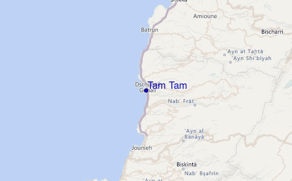
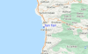
At Bkerkacha, 35 km from Tam Tam.
light winds from the NNW
(km/h)
dryAir temperature
20°Csurffoto's uit
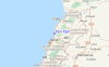
de galerijContourlijnen: Wegen & Rivieren: Kies een surflokatie uit het menu 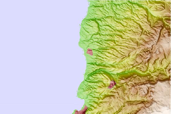
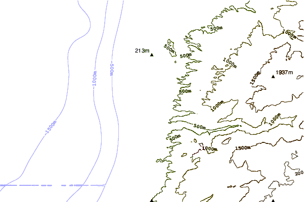
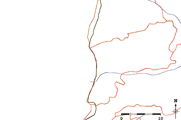
Gebruik deze reliëfkaart om naar de surfspots en de getijdenstations van Lebanon toe te gaan, in de buurt van Tam Tam.
Andere Dichtbijzijnde Surflocaties van Tam Tam:
(klik op locatienaam voor meer informatie)- Closest Locatie4 mi
- Second closest Locatie9 mi
- Third closest Locatie14 mi
- Fourth closest Locatie34 mi
- Fifth closest Locatie34 mi
Dichtstbijzijnde golfboeien bij Tam Tam:
- Closest golfboei1623 mi
- Second closest golfboei1761 mi
- Third closest golfboei2053 mi
- Fourth closest golfboei2057 mi
- Fifth closest golfboei2068 mi
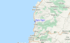
Getijdenstations in de buurt van Tam Tam:
- Closest getijdenstationJbail1 mi
- Second closest getijdenstationBatroun10 mi
- Third closest getijdenstationRa's Bayrut17 mi
- Fourth closest getijdenstationBeirut19 mi
- Fifth closest getijdenstationTripoli25 mi
Airports
- The closest passenger airport to Tam Tam is Beirut International Airport (BEY) in Lebanon, 37 km (23 miles) away (directly).
- The second nearest airport to Tam Tam is Damascus International Airport (DAM) in Syria, 112 km (70 miles) away.
- Third is Mahanaim I Ben Yaakov (Rosh Pina) Airport (RPN) in Israel, 126 km (78 miles) away.
- Bassel Al Assad International (Latakia) Airport (LTK) in Syria is 146 km (91 miles) away.
- Haifa Airport (HFA) in Israel is the fifth nearest airport to Tam Tam and is 155 km (96 miles) away.
- /breaks/Tam-Tam/forecasts/latest
 Nearest