

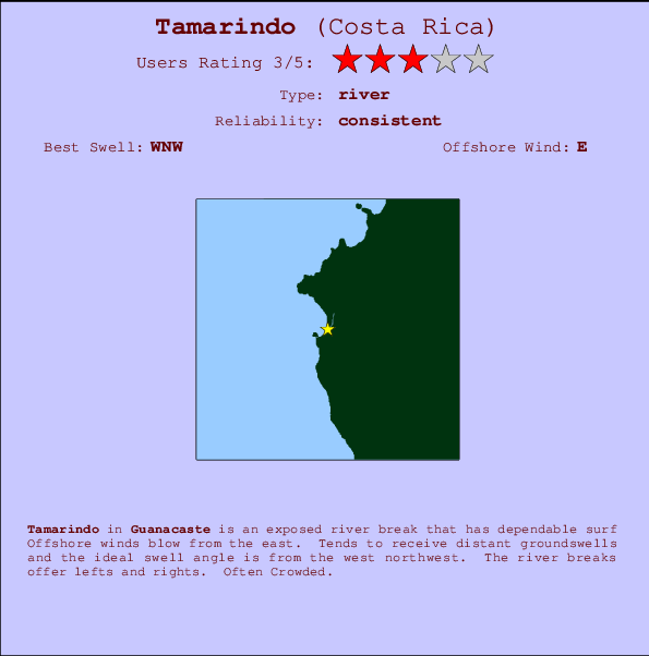
Tamarindo Surf Guide
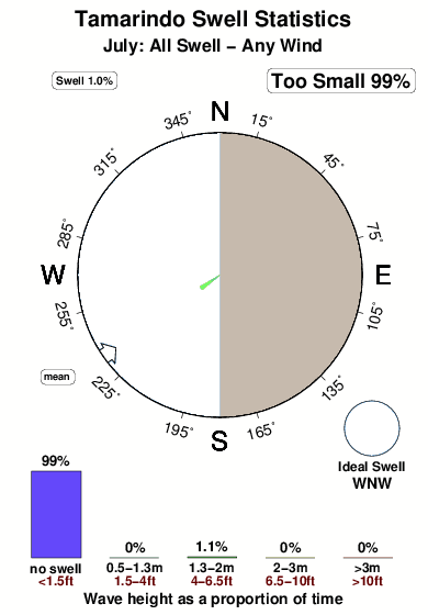
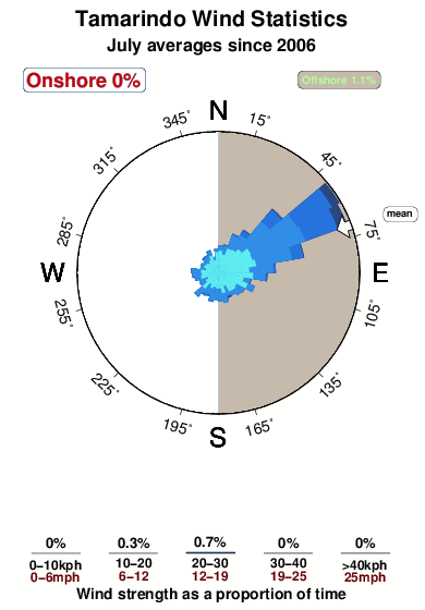
Tamarindo in Guanacaste is an exposed beach break that has consistent surf Offshore winds are from the east. Most of the surf here comes from groundswells and the optimum swell angle is from the west northwest. The beach breaks offer lefts and rights. It's often crowded here. Beware of .
Tamarindo Spot Info
| Type: | Rating: | Reliability: | Todays Sea Temp*: |
|---|---|---|---|
| consistent | 30.1°C*ocean temperature recorded from satellite |
Surfing Tamarindo:
The best conditions reported for surf at Tamarindo occur when a West-northwest swell combines with an offshore wind direction from the East.

Voorspelde Golfenergie (Kracht): 12 uur


Tamarindo Surf:
Saturday, 18 July 2026, 01:08 Local time| Fri | Saturday 18 | |||
| 9PM | 0AM | 3AM | 6AM | |
| Wave (m) | ||||
| Periode (s) | 13 | 13 | 13 | 13 |
| Wind (km/h) | ||||
| Wind | cross- off |
cross- off |
cross- off |
cross- off |
- /breaks/Tamarindo/forecasts/latest
Tamarindo Surf Guide
Tamarindo in Guanacaste is an exposed beach break that has consistent surf Offshore winds are from the east. Most of the surf here comes from groundswells and the optimum swell angle is from the west northwest. The beach breaks offer lefts and rights. It's often crowded here. Beware of .
Tamarindo Spot Info
Type: Rating: Reliability: Todays Sea Temp*:  River
River 3
3consistent 30.1°C*ocean temperature recorded from satelliteSurfing Tamarindo:
The best conditions reported for surf at Tamarindo occur when a West-northwest swell combines with an offshore wind direction from the East.
Voorspelde Golfenergie (Kracht): 12 uur
Gebruik de tabbladen hierboven om de zeewatertemperatuur bij Tamarindo te bekijken, foto's van Tamarindo, Tamarindo gedetailleerde golfvoorspellingen, wind- en weersvoorspellingen, Tamarindo webcams, actuele wind in Guanacaste live weerstations en Tamarindo getijdenvoorspellingen. De link van Costa Rica golfkaarten opent een grote afbeelding van Costa Rica en de omliggende zeeën. Deze golfkaarten kunnen worden dynamisch gemaakt worden met de verschillende golfcomponenten, golfenergie, golfperiode, golfhoogte, samen met de wind en weersvoorspellingen, het actuele weer en de zeetoestand volgens golfboeien uit Costa Rica, langskomende schepen en weerstations op de kust. Elk voorspelling pagina's voor dit surfstrand zijn voorzien van een wereldwijde en regionale golfzoeker om de beste surfsomstandigheden in het gebied rond Tamarindo te vinden.
Tamarindo Surf:
Saturday, 18 July 2026, 01:08 Local timeFri Saturday 18 9PM 0AM 3AM 6AM Wave (m) Periode (s) 13 13 13 13 Wind (km/h) Wind cross-
offcross-
offcross-
offcross-
off- /breaks/Tamarindo/forecasts/latest
- /breaks/Tamarindo/forecasts/latest/six_day
Tamarindo Surf Guide
Tamarindo in Guanacaste is an exposed beach break that has consistent surf Offshore winds are from the east. Most of the surf here comes from groundswells and the optimum swell angle is from the west northwest. The beach breaks offer lefts and rights. It's often crowded here. Beware of .
Tamarindo Spot Info
Type: Rating: Reliability: Todays Sea Temp*: River3consistent 30.1°C*ocean temperature recorded from satelliteSurfing Tamarindo:
The best conditions reported for surf at Tamarindo occur when a West-northwest swell combines with an offshore wind direction from the East.
Voorspelde Golfenergie (Kracht): 12 uur
Gebruik de tabbladen hierboven om de zeewatertemperatuur bij Tamarindo te bekijken, foto's van Tamarindo, Tamarindo gedetailleerde golfvoorspellingen, wind- en weersvoorspellingen, Tamarindo webcams, actuele wind in Guanacaste live weerstations en Tamarindo getijdenvoorspellingen. De link van Costa Rica golfkaarten opent een grote afbeelding van Costa Rica en de omliggende zeeën. Deze golfkaarten kunnen worden dynamisch gemaakt worden met de verschillende golfcomponenten, golfenergie, golfperiode, golfhoogte, samen met de wind en weersvoorspellingen, het actuele weer en de zeetoestand volgens golfboeien uit Costa Rica, langskomende schepen en weerstations op de kust. Elk voorspelling pagina's voor dit surfstrand zijn voorzien van een wereldwijde en regionale golfzoeker om de beste surfsomstandigheden in het gebied rond Tamarindo te vinden.
Tamarindo Surf:
Saturday, 18 July 2026, 01:08 Local timeFri Saturday 18 9PM 0AM 3AM 6AM Wave (m) Periode (s) 13 13 13 13 Wind (km/h) Wind cross-
offcross-
offcross-
offcross-
off- /breaks/Tamarindo/forecasts/latest
Tamarindo Surf Guide
Tamarindo in Guanacaste is an exposed beach break that has consistent surf Offshore winds are from the east. Most of the surf here comes from groundswells and the optimum swell angle is from the west northwest. The beach breaks offer lefts and rights. It's often crowded here. Beware of .
Tamarindo Spot Info
Type: Rating: Reliability: Todays Sea Temp*: River3consistent 30.1°C*ocean temperature recorded from satelliteSurfing Tamarindo:
The best conditions reported for surf at Tamarindo occur when a West-northwest swell combines with an offshore wind direction from the East.
Voorspelde Golfenergie (Kracht): 12 uur
Gebruik de tabbladen hierboven om de zeewatertemperatuur bij Tamarindo te bekijken, foto's van Tamarindo, Tamarindo gedetailleerde golfvoorspellingen, wind- en weersvoorspellingen, Tamarindo webcams, actuele wind in Guanacaste live weerstations en Tamarindo getijdenvoorspellingen. De link van Costa Rica golfkaarten opent een grote afbeelding van Costa Rica en de omliggende zeeën. Deze golfkaarten kunnen worden dynamisch gemaakt worden met de verschillende golfcomponenten, golfenergie, golfperiode, golfhoogte, samen met de wind en weersvoorspellingen, het actuele weer en de zeetoestand volgens golfboeien uit Costa Rica, langskomende schepen en weerstations op de kust. Elk voorspelling pagina's voor dit surfstrand zijn voorzien van een wereldwijde en regionale golfzoeker om de beste surfsomstandigheden in het gebied rond Tamarindo te vinden.
Tamarindo Surf:
Saturday, 18 July 2026, 01:08 Local timeFri Saturday 18 9PM 0AM 3AM 6AM Wave (m) Periode (s) 13 13 13 13 Wind (km/h) Wind cross-
offcross-
offcross-
offcross-
offTide Times:
Voor Diria, %{dist} %{km} van %{location}.
VOLGENDE IS OM (lokale tijd) resterende tijd hoog water laag water Tamarindo Tide Times and Tide Chart
Live Weather:
At Liberia/Tomas Guardia Airport, 45 km from Tamarindo.
moderate winds from the E
(km/h)
Dry and partly cloudyAir temperature
A2986°COverall Tamarindo Surf Consistency and Wind Distribution in July
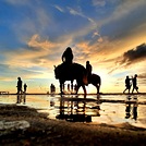
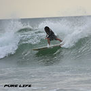
surffoto's uit
de galerijContourlijnen: Wegen & Rivieren: Kies een surflokatie uit het menu 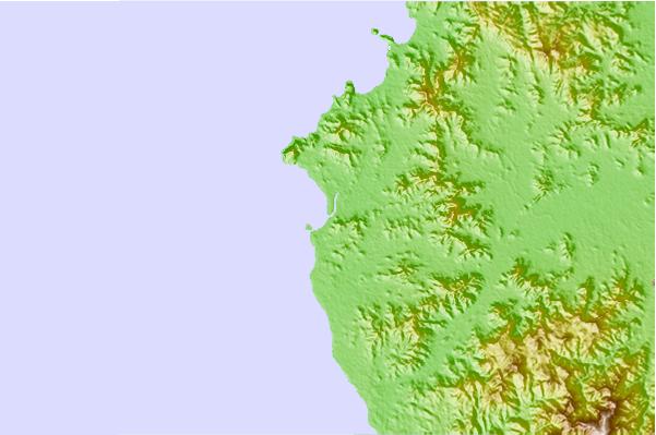
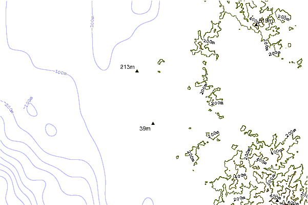
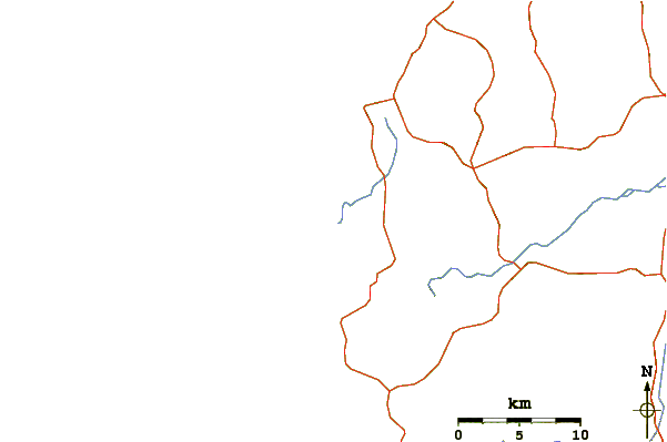
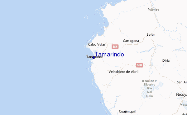
Gebruik deze reliëfkaart om naar de surfspots en de getijdenstations van Guanacaste toe te gaan, in de buurt van Tamarindo.
Andere Dichtbijzijnde Surflocaties van Tamarindo:
(klik op locatienaam voor meer informatie)- Closest Locatie1 mi
- Second closest Locatie1 mi
- Third closest Locatie1 mi
- Fourth closest Locatie1 mi
- Fifth closest Locatie2 mi
Dichtstbijzijnde golfboeien bij Tamarindo:
- Closest golfboei537 mi
- Second closest golfboei663 mi
- Third closest golfboei975 mi
- Fourth closest golfboei1074 mi
- Fifth closest golfboei1083 mi
Getijdenstations in de buurt van Tamarindo:
- Closest getijdenstationSan Juan del Sur65 mi
- Second closest getijdenstationPunta Arenas73 mi
- Third closest getijdenstationChacarita75 mi
- Fourth closest getijdenstationMasachapa112 mi
- Fifth closest getijdenstationSan Juan del Norte (Greytown)152 mi
Airports
- The closest passenger airport to Tamarindo is Nosara Airport (NOB) in Costa Rica, which is 42 km (26 miles) away (directly).
- The second nearest airport to Tamarindo is Daniel Oduber Quiros International (Liberia) Airport (LIR), also in Costa Rica, 45 km (28 miles) away.
- The third closest airport is Juan Santamaria International Airport (SJO), also in Costa Rica, 182 km (113 miles) away.
- /breaks/Tamarindo/forecasts/latest


 Nearest