
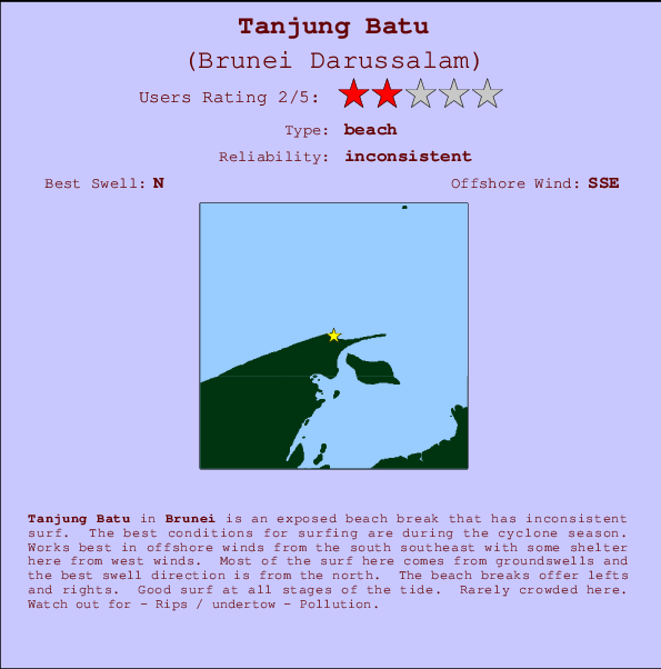
Tanjung Batu Surf Guide
Tanjung Batu in Brunei is an exposed river break that has unreliable waves. The best conditions for surfing are during the cyclone season. The best wind direction is from the south southeast with some shelter here from west winds. Waves just as likely from local windswells as from distant groundswells and the best swell direction is from the north. The river break offers both left and right hand waves. Good surf at all stages of the tide. Unlikely to be too crowded, even when the surf is up. Beware of - Rips / undertow - Pollution.
Tanjung Batu Spot Info
| Type: | Rating: | Reliability: | Todays Sea Temp*: |
|---|---|---|---|
| inconsistent | 31.0°C*ocean temperature recorded from satellite |
Surfing Tanjung Batu:
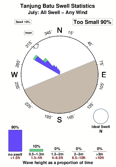
The best conditions reported for surf at Tanjung Batu occur when a North swell combines with an offshore wind direction from the South-southeast.
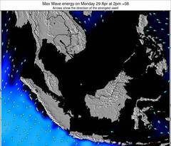
Voorspelde Golfenergie (Kracht): 12 uur
Tanjung Batu Surf:
Tuesday, 21 July 2026, 12:59 Local time| Tuesday 21 | ||||
| 11AM | 2PM | 5PM | 8PM | |
| Wave (m) | ||||
| Periode (s) | 6 | 6 | 5 | 5 |
| Wind (km/h) | ||||
| Wind | glass | cross- on |
cross- on |
cross- off |
- /breaks/Tanjung-Batu/forecasts/latest
Tanjung Batu Surf Guide
Tanjung Batu in Brunei is an exposed river break that has unreliable waves. The best conditions for surfing are during the cyclone season. The best wind direction is from the south southeast with some shelter here from west winds. Waves just as likely from local windswells as from distant groundswells and the best swell direction is from the north. The river break offers both left and right hand waves. Good surf at all stages of the tide. Unlikely to be too crowded, even when the surf is up. Beware of - Rips / undertow - Pollution.
Tanjung Batu Spot Info
Type: Rating: Reliability: Todays Sea Temp*:  River
River 2
2inconsistent 31.0°C*ocean temperature recorded from satelliteSurfing Tanjung Batu:
The best conditions reported for surf at Tanjung Batu occur when a North swell combines with an offshore wind direction from the South-southeast.
Voorspelde Golfenergie (Kracht): 12 uur
Gebruik de tabbladen hierboven om de zeewatertemperatuur bij Tanjung Batu te bekijken, foto's van Tanjung Batu, Tanjung Batu gedetailleerde golfvoorspellingen, wind- en weersvoorspellingen, Tanjung Batu webcams, actuele wind in Brunei live weerstations en Tanjung Batu getijdenvoorspellingen. De link van Brunei Darussalam golfkaarten opent een grote afbeelding van Brunei Darussalam en de omliggende zeeën. Deze golfkaarten kunnen worden dynamisch gemaakt worden met de verschillende golfcomponenten, golfenergie, golfperiode, golfhoogte, samen met de wind en weersvoorspellingen, het actuele weer en de zeetoestand volgens golfboeien uit Brunei Darussalam, langskomende schepen en weerstations op de kust. Elk voorspelling pagina's voor dit surfstrand zijn voorzien van een wereldwijde en regionale golfzoeker om de beste surfsomstandigheden in het gebied rond Tanjung Batu te vinden.
Tanjung Batu Surf:
Tuesday, 21 July 2026, 12:59 Local timeTuesday 21 11AM 2PM 5PM 8PM Wave (m) Periode (s) 6 6 5 5 Wind (km/h) Wind glass cross-
oncross-
oncross-
off- /breaks/Tanjung-Batu/forecasts/latest
- /breaks/Tanjung-Batu/forecasts/latest/six_day
Tanjung Batu Surf Guide
Tanjung Batu in Brunei is an exposed river break that has unreliable waves. The best conditions for surfing are during the cyclone season. The best wind direction is from the south southeast with some shelter here from west winds. Waves just as likely from local windswells as from distant groundswells and the best swell direction is from the north. The river break offers both left and right hand waves. Good surf at all stages of the tide. Unlikely to be too crowded, even when the surf is up. Beware of - Rips / undertow - Pollution.
Tanjung Batu Spot Info
Type: Rating: Reliability: Todays Sea Temp*: River2inconsistent 31.0°C*ocean temperature recorded from satelliteSurfing Tanjung Batu:
The best conditions reported for surf at Tanjung Batu occur when a North swell combines with an offshore wind direction from the South-southeast.
Voorspelde Golfenergie (Kracht): 12 uur
Gebruik de tabbladen hierboven om de zeewatertemperatuur bij Tanjung Batu te bekijken, foto's van Tanjung Batu, Tanjung Batu gedetailleerde golfvoorspellingen, wind- en weersvoorspellingen, Tanjung Batu webcams, actuele wind in Brunei live weerstations en Tanjung Batu getijdenvoorspellingen. De link van Brunei Darussalam golfkaarten opent een grote afbeelding van Brunei Darussalam en de omliggende zeeën. Deze golfkaarten kunnen worden dynamisch gemaakt worden met de verschillende golfcomponenten, golfenergie, golfperiode, golfhoogte, samen met de wind en weersvoorspellingen, het actuele weer en de zeetoestand volgens golfboeien uit Brunei Darussalam, langskomende schepen en weerstations op de kust. Elk voorspelling pagina's voor dit surfstrand zijn voorzien van een wereldwijde en regionale golfzoeker om de beste surfsomstandigheden in het gebied rond Tanjung Batu te vinden.
Tanjung Batu Surf:
Tuesday, 21 July 2026, 12:59 Local timeTuesday 21 11AM 2PM 5PM 8PM Wave (m) Periode (s) 6 6 5 5 Wind (km/h) Wind glass cross-
oncross-
oncross-
off- /breaks/Tanjung-Batu/forecasts/latest
Tanjung Batu Surf Guide
Tanjung Batu in Brunei is an exposed river break that has unreliable waves. The best conditions for surfing are during the cyclone season. The best wind direction is from the south southeast with some shelter here from west winds. Waves just as likely from local windswells as from distant groundswells and the best swell direction is from the north. The river break offers both left and right hand waves. Good surf at all stages of the tide. Unlikely to be too crowded, even when the surf is up. Beware of - Rips / undertow - Pollution.
Tanjung Batu Spot Info
Type: Rating: Reliability: Todays Sea Temp*: River2inconsistent 31.0°C*ocean temperature recorded from satelliteSurfing Tanjung Batu:
The best conditions reported for surf at Tanjung Batu occur when a North swell combines with an offshore wind direction from the South-southeast.
Voorspelde Golfenergie (Kracht): 12 uur
Gebruik de tabbladen hierboven om de zeewatertemperatuur bij Tanjung Batu te bekijken, foto's van Tanjung Batu, Tanjung Batu gedetailleerde golfvoorspellingen, wind- en weersvoorspellingen, Tanjung Batu webcams, actuele wind in Brunei live weerstations en Tanjung Batu getijdenvoorspellingen. De link van Brunei Darussalam golfkaarten opent een grote afbeelding van Brunei Darussalam en de omliggende zeeën. Deze golfkaarten kunnen worden dynamisch gemaakt worden met de verschillende golfcomponenten, golfenergie, golfperiode, golfhoogte, samen met de wind en weersvoorspellingen, het actuele weer en de zeetoestand volgens golfboeien uit Brunei Darussalam, langskomende schepen en weerstations op de kust. Elk voorspelling pagina's voor dit surfstrand zijn voorzien van een wereldwijde en regionale golfzoeker om de beste surfsomstandigheden in het gebied rond Tanjung Batu te vinden.
Tanjung Batu Surf:
Tuesday, 21 July 2026, 12:59 Local timeTuesday 21 11AM 2PM 5PM 8PM Wave (m) Periode (s) 6 6 5 5 Wind (km/h) Wind glass cross-
oncross-
oncross-
offTide Times:
Op Tanjung Batu (0 km).
VOLGENDE IS OM (lokale tijd) resterende tijd hoog water laag water Tanjung Batu Tide Times and Tide Chart
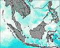
Live Weather:
At Brunei International Airport, 21 km from Tanjung Batu.
calm
(km/h)
Dry and partly cloudyAir temperature
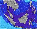
31°COverall Tanjung Batu Surf Consistency and Wind Distribution in July
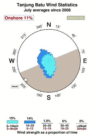


Wind stats for Tanjung Batu: see the variation in direction and stength by month.
surffoto's uit
de galerijContourlijnen: Wegen & Rivieren: Kies een surflokatie uit het menu 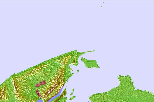
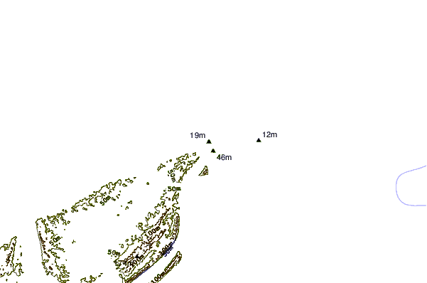
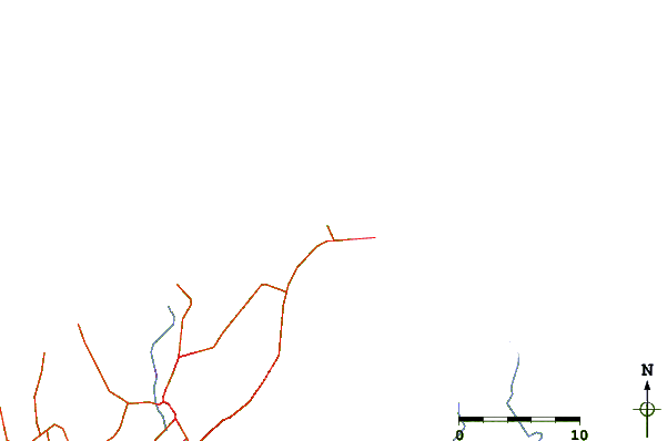
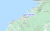
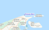
Gebruik deze reliëfkaart om naar de surfspots en de getijdenstations van Brunei toe te gaan, in de buurt van Tanjung Batu.
Andere Dichtbijzijnde Surflocaties van Tanjung Batu:
(klik op locatienaam voor meer informatie)- Closest Locatie10 mi
- Second closest Locatie14 mi
- Third closest Locatie91 mi
- Fourth closest Locatie91 mi
- Fifth closest Locatie103 mi
Dichtstbijzijnde golfboeien bij Tanjung Batu:
- Closest golfboei1465 mi
- Second closest golfboei1526 mi
- Third closest golfboei1686 mi
- Fourth closest golfboei1695 mi
- Fifth closest golfboei1768 mi
Getijdenstations in de buurt van Tanjung Batu:
- Closest getijdenstationBandar Seri Begawan10 mi
- Second closest getijdenstationVictoria (Labuan)20 mi
- Third closest getijdenstationTutong33 mi
- Fourth closest getijdenstationSeria62 mi
- Fifth closest getijdenstationKuala Belait68 mi
Airports
- The closest passenger airport to Tanjung Batu is Brunei International Airport (BWN) in Brunei, 18 km (11 miles) away (directly).
- The second nearest airport to Tanjung Batu is Labuan Airport (LBU) in Malaysia, 35 km (22 miles) away.
- Third is Marudi Airport (MUR) in Malaysia, 126 km (78 miles) away.
- Miri Airport (MYY) in Malaysia is 143 km (89 miles) away.
- Kota Kinabalu International Airport (BKI), also in Malaysia is the fifth nearest airport to Tanjung Batu and is 148 km (92 miles) away.
- /breaks/Tanjung-Batu/forecasts/latest

 Nearest