

The Cove Cape May Surf Guide
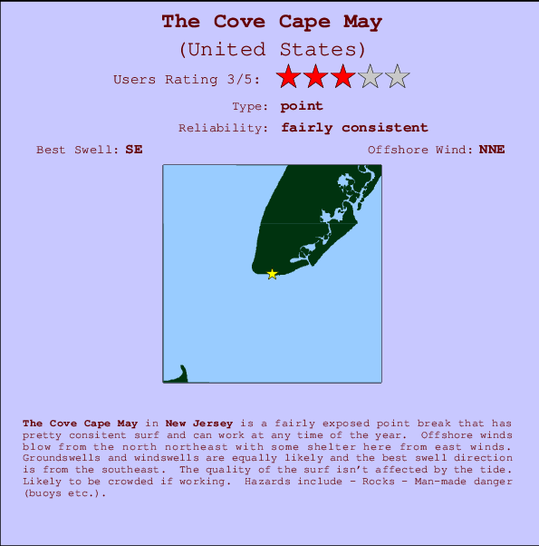
The Cove Cape May in New Jersey is a fairly exposed point break that has quite reliable surf and can work at any time of the year. Offshore winds blow from the north northeast with some shelter here from east winds. Windswells and groundswells in equal measure and the ideal swell direction is from the southeast. Good surf at all stages of the tide. Often Crowded. Watch out for - Rocks - Man-made danger (buoys etc.).
The Cove Cape May Spot Info
| Type: | Rating: | Reliability: | Todays Sea Temp*: |
|---|---|---|---|
| fairly consistent | 23.7°C*ocean temperature recorded from satellite |
Surfing The Cove Cape May:
The best conditions reported for surf at The Cove Cape May occur when a Southeast swell combines with an offshore wind direction from the North-northeast.

Voorspelde Golfenergie (Kracht): 12 uur


The Cove Cape May Surf:
Thursday, 16 July 2026, 16:44 Local time| Thursday 16 | Fri | |||
| 5PM | 8PM | 11PM | 2AM | |
| Wave (m) | ||||
| Periode (s) | 8 | 4 | 5 | 5 |
| Wind (km/h) | ||||
| Wind | cross- on |
cross- on |
cross- on |
off |
- /breaks/The-Cove-Cape-May/forecasts/latest
The Cove Cape May Surf Guide
The Cove Cape May in New Jersey is a fairly exposed point break that has quite reliable surf and can work at any time of the year. Offshore winds blow from the north northeast with some shelter here from east winds. Windswells and groundswells in equal measure and the ideal swell direction is from the southeast. Good surf at all stages of the tide. Often Crowded. Watch out for - Rocks - Man-made danger (buoys etc.).
The Cove Cape May Spot Info
Type: Rating: Reliability: Todays Sea Temp*:  Point
Point 3
3fairly consistent 23.7°C*ocean temperature recorded from satelliteSurfing The Cove Cape May:
The best conditions reported for surf at The Cove Cape May occur when a Southeast swell combines with an offshore wind direction from the North-northeast.
Voorspelde Golfenergie (Kracht): 12 uur
Gebruik de tabbladen hierboven om de zeewatertemperatuur bij The Cove Cape May te bekijken, foto's van The Cove Cape May, The Cove Cape May gedetailleerde golfvoorspellingen, wind- en weersvoorspellingen, The Cove Cape May webcams, actuele wind in New Jersey live weerstations en The Cove Cape May getijdenvoorspellingen. De link van United States golfkaarten opent een grote afbeelding van United States en de omliggende zeeën. Deze golfkaarten kunnen worden dynamisch gemaakt worden met de verschillende golfcomponenten, golfenergie, golfperiode, golfhoogte, samen met de wind en weersvoorspellingen, het actuele weer en de zeetoestand volgens golfboeien uit United States, langskomende schepen en weerstations op de kust. Elk voorspelling pagina's voor dit surfstrand zijn voorzien van een wereldwijde en regionale golfzoeker om de beste surfsomstandigheden in het gebied rond The Cove Cape May te vinden.
The Cove Cape May Surf:
Thursday, 16 July 2026, 16:44 Local timeThursday 16 Fri 5PM 8PM 11PM 2AM Wave (m) Periode (s) 8 4 5 5 Wind (km/h) Wind cross-
oncross-
oncross-
onoff - /breaks/The-Cove-Cape-May/forecasts/latest
- /breaks/The-Cove-Cape-May/forecasts/latest/six_day
The Cove Cape May Surf Guide
The Cove Cape May in New Jersey is a fairly exposed point break that has quite reliable surf and can work at any time of the year. Offshore winds blow from the north northeast with some shelter here from east winds. Windswells and groundswells in equal measure and the ideal swell direction is from the southeast. Good surf at all stages of the tide. Often Crowded. Watch out for - Rocks - Man-made danger (buoys etc.).
The Cove Cape May Spot Info
Type: Rating: Reliability: Todays Sea Temp*: Point3fairly consistent 23.7°C*ocean temperature recorded from satelliteSurfing The Cove Cape May:
The best conditions reported for surf at The Cove Cape May occur when a Southeast swell combines with an offshore wind direction from the North-northeast.
Voorspelde Golfenergie (Kracht): 12 uur
Gebruik de tabbladen hierboven om de zeewatertemperatuur bij The Cove Cape May te bekijken, foto's van The Cove Cape May, The Cove Cape May gedetailleerde golfvoorspellingen, wind- en weersvoorspellingen, The Cove Cape May webcams, actuele wind in New Jersey live weerstations en The Cove Cape May getijdenvoorspellingen. De link van United States golfkaarten opent een grote afbeelding van United States en de omliggende zeeën. Deze golfkaarten kunnen worden dynamisch gemaakt worden met de verschillende golfcomponenten, golfenergie, golfperiode, golfhoogte, samen met de wind en weersvoorspellingen, het actuele weer en de zeetoestand volgens golfboeien uit United States, langskomende schepen en weerstations op de kust. Elk voorspelling pagina's voor dit surfstrand zijn voorzien van een wereldwijde en regionale golfzoeker om de beste surfsomstandigheden in het gebied rond The Cove Cape May te vinden.
The Cove Cape May Surf:
Thursday, 16 July 2026, 16:44 Local timeThursday 16 Fri 5PM 8PM 11PM 2AM Wave (m) Periode (s) 8 4 5 5 Wind (km/h) Wind cross-
oncross-
oncross-
onoff - /breaks/The-Cove-Cape-May/forecasts/latest
The Cove Cape May Surf Guide
The Cove Cape May in New Jersey is a fairly exposed point break that has quite reliable surf and can work at any time of the year. Offshore winds blow from the north northeast with some shelter here from east winds. Windswells and groundswells in equal measure and the ideal swell direction is from the southeast. Good surf at all stages of the tide. Often Crowded. Watch out for - Rocks - Man-made danger (buoys etc.).
The Cove Cape May Spot Info
Type: Rating: Reliability: Todays Sea Temp*: Point3fairly consistent 23.7°C*ocean temperature recorded from satelliteSurfing The Cove Cape May:
The best conditions reported for surf at The Cove Cape May occur when a Southeast swell combines with an offshore wind direction from the North-northeast.
Voorspelde Golfenergie (Kracht): 12 uur
Gebruik de tabbladen hierboven om de zeewatertemperatuur bij The Cove Cape May te bekijken, foto's van The Cove Cape May, The Cove Cape May gedetailleerde golfvoorspellingen, wind- en weersvoorspellingen, The Cove Cape May webcams, actuele wind in New Jersey live weerstations en The Cove Cape May getijdenvoorspellingen. De link van United States golfkaarten opent een grote afbeelding van United States en de omliggende zeeën. Deze golfkaarten kunnen worden dynamisch gemaakt worden met de verschillende golfcomponenten, golfenergie, golfperiode, golfhoogte, samen met de wind en weersvoorspellingen, het actuele weer en de zeetoestand volgens golfboeien uit United States, langskomende schepen en weerstations op de kust. Elk voorspelling pagina's voor dit surfstrand zijn voorzien van een wereldwijde en regionale golfzoeker om de beste surfsomstandigheden in het gebied rond The Cove Cape May te vinden.
The Cove Cape May Surf:
Thursday, 16 July 2026, 16:44 Local timeThursday 16 Fri 5PM 8PM 11PM 2AM Wave (m) Periode (s) 8 4 5 5 Wind (km/h) Wind cross-
oncross-
oncross-
onoff Tide Times:
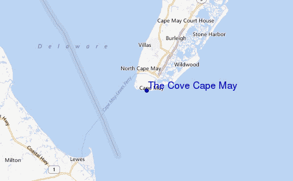
Op Cape May, Atlantic Ocean, New Jersey (0 km).
VOLGENDE IS OM (lokale tijd) resterende tijd hoog water laag water The Cove Cape May Tide Times and Tide Chart
Live Weather:
At BUOY-CMAN4, 5 km from The Cove Cape May.
light winds from the SSW
(km/h)Air temperature
31.6°COverall The Cove Cape May Surf Consistency and Wind Distribution in July
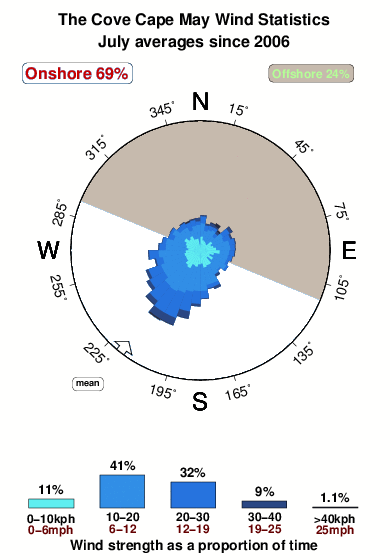


Wind stats for The Cove Cape May: see the variation in direction and stength by month.
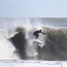
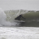
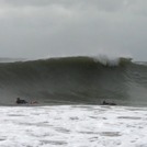
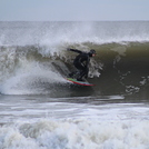
surffoto's uit
de galerijContourlijnen: Wegen & Rivieren: Kies een surflokatie uit het menu 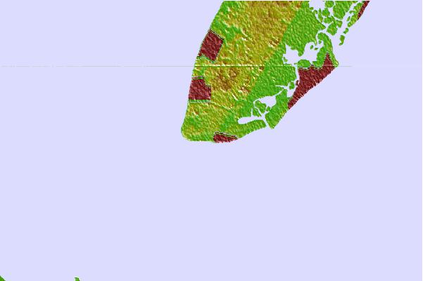

Gebruik deze reliëfkaart om naar de surfspots en de getijdenstations van New Jersey toe te gaan, in de buurt van The Cove Cape May.
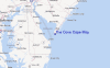
Andere Dichtbijzijnde Surflocaties van The Cove Cape May:
(klik op locatienaam voor meer informatie)- Closest Locatie0 mi
- Second closest Locatie1 mi
- Third closest Locatie2 mi
- Fourth closest Locatie3 mi
- Fifth closest Locatie4 mi
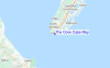
Dichtstbijzijnde golfboeien bij The Cove Cape May:
- Closest golfboei35 mi
- Second closest golfboei62 mi
- Third closest golfboei80 mi
- Fourth closest golfboei84 mi
- Fifth closest golfboei84 mi
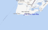
Getijdenstations in de buurt van The Cove Cape May:
- Closest getijdenstationCape May, Atlantic Ocean0 mi
- Second closest getijdenstationCape Island Creek, Cape May2 mi
- Third closest getijdenstationCape May Harbor2 mi
- Fourth closest getijdenstationCape May Point, Sunset Beach Bay2 mi
- Fifth closest getijdenstationCape May Canal, Cape May Bay3 mi
Airports
- The closest passenger airport to The Cove Cape May is Cape May Co (Wildwood) Airport (WWD) in USA, 9 km (6 miles) away (directly).
- The second nearest airport to The Cove Cape May is Millville Muni Airport (MIV), also in USA, 50 km (31 miles) away.
- Third is Dover Afb Airport (DOV) in USA, 51 km (32 miles) away.
- Atlantic City International Airport (ACY) in USA is 66 km (41 miles) away.
- Salisbury Ocean City Wicomico Rgnl Airport (SBY), also in USA is the fifth nearest airport to The Cove Cape May and is 82 km (51 miles) away.
- /breaks/The-Cove-Cape-May/forecasts/latest

 Nearest