

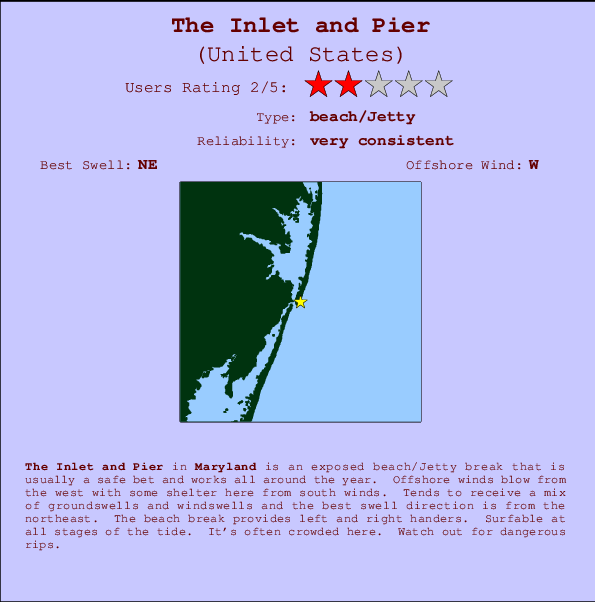
The Inlet and Pier Surf Guide
The Inlet and Pier in Maryland is an exposed beach/Jetty break that has very consistent waves and works all around the year. Works best in offshore winds from the west with some shelter here from south winds. Waves just as likely from local windswells as from distant groundswells and the ideal swell angle is from the northeast. Waves at the beach break both left and right. The quality of the surf isn't affected by the tide. Likely to be crowded if working. Take care of the strong rips here.
The Inlet and Pier Spot Info
| Type: | Rating: | Reliability: | Todays Sea Temp*: |
|---|---|---|---|
| very consistent | 23.9°C*ocean temperature recorded from satellite |
Surfing The Inlet and Pier:
The best conditions reported for surf at The Inlet and Pier occur when a Northeast swell combines with an offshore wind direction from the West.

Voorspelde Golfenergie (Kracht): 12 uur


The Inlet and Pier Surf:
Saturday, 1 August 2026, 11:47 Local time| Saturday 01 | ||||
| 11AM | 2PM | 5PM | 8PM | |
| Wave (m) | ||||
| Periode (s) | 9 | 9 | 8 | 8 |
| Wind (km/h) | ||||
| Wind | cross | cross | cross | cross |
- /breaks/The-Inlet-and-Pier/forecasts/latest
The Inlet and Pier Surf Guide
The Inlet and Pier in Maryland is an exposed beach/Jetty break that has very consistent waves and works all around the year. Works best in offshore winds from the west with some shelter here from south winds. Waves just as likely from local windswells as from distant groundswells and the ideal swell angle is from the northeast. Waves at the beach break both left and right. The quality of the surf isn't affected by the tide. Likely to be crowded if working. Take care of the strong rips here.
The Inlet and Pier Spot Info
Type: Rating: Reliability: Todays Sea Temp*:  Beach/jetty
 2
2very consistent 23.9°C*ocean temperature recorded from satelliteSurfing The Inlet and Pier:
The best conditions reported for surf at The Inlet and Pier occur when a Northeast swell combines with an offshore wind direction from the West.
Voorspelde Golfenergie (Kracht): 12 uur
Gebruik de tabbladen hierboven om de zeewatertemperatuur bij The Inlet and Pier te bekijken, foto's van The Inlet and Pier, The Inlet and Pier gedetailleerde golfvoorspellingen, wind- en weersvoorspellingen, The Inlet and Pier webcams, actuele wind in Maryland live weerstations en The Inlet and Pier getijdenvoorspellingen. De link van United States golfkaarten opent een grote afbeelding van United States en de omliggende zeeën. Deze golfkaarten kunnen worden dynamisch gemaakt worden met de verschillende golfcomponenten, golfenergie, golfperiode, golfhoogte, samen met de wind en weersvoorspellingen, het actuele weer en de zeetoestand volgens golfboeien uit United States, langskomende schepen en weerstations op de kust. Elk voorspelling pagina's voor dit surfstrand zijn voorzien van een wereldwijde en regionale golfzoeker om de beste surfsomstandigheden in het gebied rond The Inlet and Pier te vinden.
The Inlet and Pier Surf:
Saturday, 1 August 2026, 11:47 Local timeSaturday 01 11AM 2PM 5PM 8PM Wave (m) Periode (s) 9 9 8 8 Wind (km/h) Wind cross cross cross cross - /breaks/The-Inlet-and-Pier/forecasts/latest
- /breaks/The-Inlet-and-Pier/forecasts/latest/six_day
The Inlet and Pier Surf Guide
The Inlet and Pier in Maryland is an exposed beach/Jetty break that has very consistent waves and works all around the year. Works best in offshore winds from the west with some shelter here from south winds. Waves just as likely from local windswells as from distant groundswells and the ideal swell angle is from the northeast. Waves at the beach break both left and right. The quality of the surf isn't affected by the tide. Likely to be crowded if working. Take care of the strong rips here.
The Inlet and Pier Spot Info
Type: Rating: Reliability: Todays Sea Temp*: Beach/jetty2very consistent 23.9°C*ocean temperature recorded from satelliteSurfing The Inlet and Pier:
The best conditions reported for surf at The Inlet and Pier occur when a Northeast swell combines with an offshore wind direction from the West.
Voorspelde Golfenergie (Kracht): 12 uur
Gebruik de tabbladen hierboven om de zeewatertemperatuur bij The Inlet and Pier te bekijken, foto's van The Inlet and Pier, The Inlet and Pier gedetailleerde golfvoorspellingen, wind- en weersvoorspellingen, The Inlet and Pier webcams, actuele wind in Maryland live weerstations en The Inlet and Pier getijdenvoorspellingen. De link van United States golfkaarten opent een grote afbeelding van United States en de omliggende zeeën. Deze golfkaarten kunnen worden dynamisch gemaakt worden met de verschillende golfcomponenten, golfenergie, golfperiode, golfhoogte, samen met de wind en weersvoorspellingen, het actuele weer en de zeetoestand volgens golfboeien uit United States, langskomende schepen en weerstations op de kust. Elk voorspelling pagina's voor dit surfstrand zijn voorzien van een wereldwijde en regionale golfzoeker om de beste surfsomstandigheden in het gebied rond The Inlet and Pier te vinden.
The Inlet and Pier Surf:
Saturday, 1 August 2026, 11:47 Local timeSaturday 01 11AM 2PM 5PM 8PM Wave (m) Periode (s) 9 9 8 8 Wind (km/h) Wind cross cross cross cross - /breaks/The-Inlet-and-Pier/forecasts/latest
The Inlet and Pier Surf Guide
The Inlet and Pier in Maryland is an exposed beach/Jetty break that has very consistent waves and works all around the year. Works best in offshore winds from the west with some shelter here from south winds. Waves just as likely from local windswells as from distant groundswells and the ideal swell angle is from the northeast. Waves at the beach break both left and right. The quality of the surf isn't affected by the tide. Likely to be crowded if working. Take care of the strong rips here.
The Inlet and Pier Spot Info
Type: Rating: Reliability: Todays Sea Temp*: Beach/jetty2very consistent 23.9°C*ocean temperature recorded from satelliteSurfing The Inlet and Pier:
The best conditions reported for surf at The Inlet and Pier occur when a Northeast swell combines with an offshore wind direction from the West.
Voorspelde Golfenergie (Kracht): 12 uur
Gebruik de tabbladen hierboven om de zeewatertemperatuur bij The Inlet and Pier te bekijken, foto's van The Inlet and Pier, The Inlet and Pier gedetailleerde golfvoorspellingen, wind- en weersvoorspellingen, The Inlet and Pier webcams, actuele wind in Maryland live weerstations en The Inlet and Pier getijdenvoorspellingen. De link van United States golfkaarten opent een grote afbeelding van United States en de omliggende zeeën. Deze golfkaarten kunnen worden dynamisch gemaakt worden met de verschillende golfcomponenten, golfenergie, golfperiode, golfhoogte, samen met de wind en weersvoorspellingen, het actuele weer en de zeetoestand volgens golfboeien uit United States, langskomende schepen en weerstations op de kust. Elk voorspelling pagina's voor dit surfstrand zijn voorzien van een wereldwijde en regionale golfzoeker om de beste surfsomstandigheden in het gebied rond The Inlet and Pier te vinden.
The Inlet and Pier Surf:
Saturday, 1 August 2026, 11:47 Local timeSaturday 01 11AM 2PM 5PM 8PM Wave (m) Periode (s) 9 9 8 8 Wind (km/h) Wind cross cross cross cross Tide Times:
Op Ocean City (fishing pier), Maryland (0 km).
VOLGENDE IS OM (lokale tijd) resterende tijd hoog water laag water The Inlet and Pier Tide Times and Tide Chart
Live Weather:
At BUOY-OCIM2, 1 km from The Inlet and Pier.
light winds from the SSW
(km/h)Air temperature
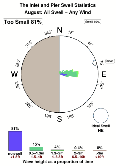
-°COverall The Inlet and Pier Surf Consistency and Wind Distribution in August
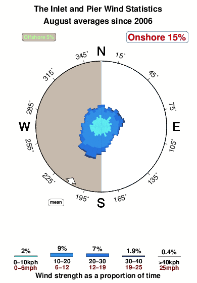


Wind stats for The Inlet and Pier: see the variation in direction and stength by month.
surffoto's uit
de galerijContourlijnen: Wegen & Rivieren: Kies een surflokatie uit het menu 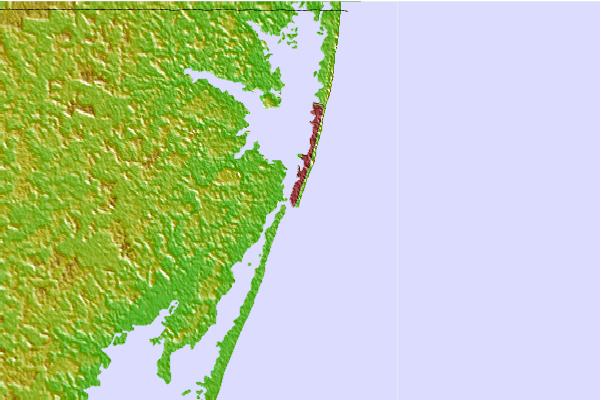
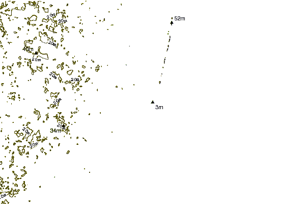
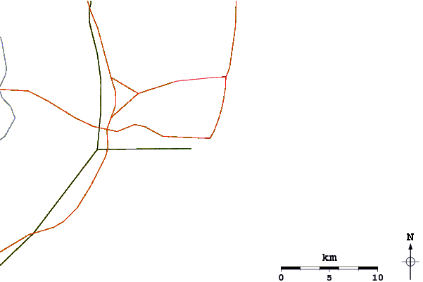
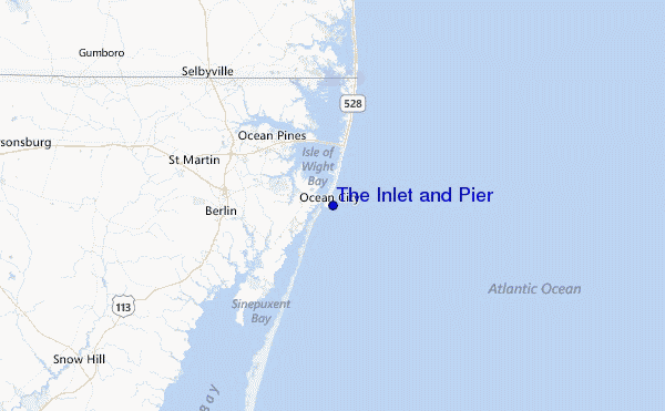
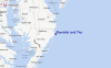
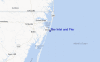
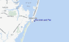
Gebruik deze reliëfkaart om naar de surfspots en de getijdenstations van Maryland toe te gaan, in de buurt van The Inlet and Pier.
Andere Dichtbijzijnde Surflocaties van The Inlet and Pier:
(klik op locatienaam voor meer informatie)- Closest Locatie1 mi
- Second closest Locatie2 mi
- Third closest Locatie2 mi
- Fourth closest Locatie5 mi
- Fifth closest Locatie6 mi
Dichtstbijzijnde golfboeien bij The Inlet and Pier:
- Closest golfboei22 mi
- Second closest golfboei42 mi
- Third closest golfboei71 mi
- Fourth closest golfboei74 mi
- Fifth closest golfboei83 mi
Getijdenstations in de buurt van The Inlet and Pier:
- Closest getijdenstationOcean City (fishing pier)0 mi
- Second closest getijdenstationOcean City Inlet1 mi
- Third closest getijdenstationOcean City, Isle of Wight Bay1 mi
- Fourth closest getijdenstationKeydash, Isle of Wight Bay1 mi
- Fifth closest getijdenstationOcean Pines6 mi
Airports
- The closest passenger airport to The Inlet and Pier is Salisbury Ocean City Wicomico Rgnl Airport (SBY) in USA, 37 km (23 miles) away (directly).
- The second nearest airport to The Inlet and Pier is Wallops Flight Facility Airport (WAL), also in USA, 55 km (34 miles) away.
- Third is Cape May Co (Wildwood) Airport (WWD) in USA, 77 km (48 miles) away.
- Dover Afb Airport (DOV) in USA is 95 km (59 miles) away.
- Millville Muni Airport (MIV), also in USA is the fifth nearest airport to The Inlet and Pier and is 116 km (72 miles) away.
- /breaks/The-Inlet-and-Pier/forecasts/latest


 Nearest