
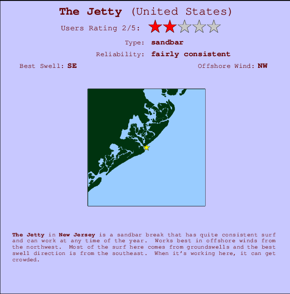
The Jetty Surf Guide
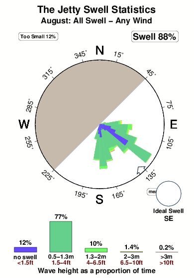
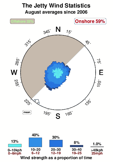
The Jetty in New Jersey is a fairly exposed sandbar break that has fairly consistent surf and can work at any time of the year. Ideal winds are from the northwest. Waves just as likely from local windswells as from distant groundswells and the best swell direction is from the southeast. When it's working here, it can get crowded.
The Jetty Spot Info
| Type: | Rating: | Reliability: | Todays Sea Temp*: |
|---|---|---|---|
| fairly consistent | 24.2°C*ocean temperature recorded from satellite |
Surfing The Jetty:
The best conditions reported for surf at The Jetty occur when a Southeast swell combines with an offshore wind direction from the Northwest.

Voorspelde Golfenergie (Kracht): 12 uur


The Jetty Surf:
Sunday, 2 August 2026, 14:35 Local time| Sunday 02 | ||||
| 11AM | 2PM | 5PM | 8PM | |
| Wave (m) | ||||
| Periode (s) | 4 | 4 | 5 | 5 |
| Wind (km/h) | ||||
| Wind | cross- on |
on | cross- on |
cross- on |
- /breaks/The-Jetty-1/forecasts/latest
The Jetty Surf Guide
The Jetty in New Jersey is a fairly exposed sandbar break that has fairly consistent surf and can work at any time of the year. Ideal winds are from the northwest. Waves just as likely from local windswells as from distant groundswells and the best swell direction is from the southeast. When it's working here, it can get crowded.
The Jetty Spot Info
Type: Rating: Reliability: Todays Sea Temp*:  Sandbar
 2
2fairly consistent 24.2°C*ocean temperature recorded from satelliteSurfing The Jetty:
The best conditions reported for surf at The Jetty occur when a Southeast swell combines with an offshore wind direction from the Northwest.
Voorspelde Golfenergie (Kracht): 12 uur
Gebruik de tabbladen hierboven om de zeewatertemperatuur bij The Jetty te bekijken, foto's van The Jetty, The Jetty gedetailleerde golfvoorspellingen, wind- en weersvoorspellingen, The Jetty webcams, actuele wind in New Jersey live weerstations en The Jetty getijdenvoorspellingen. De link van United States golfkaarten opent een grote afbeelding van United States en de omliggende zeeën. Deze golfkaarten kunnen worden dynamisch gemaakt worden met de verschillende golfcomponenten, golfenergie, golfperiode, golfhoogte, samen met de wind en weersvoorspellingen, het actuele weer en de zeetoestand volgens golfboeien uit United States, langskomende schepen en weerstations op de kust. Elk voorspelling pagina's voor dit surfstrand zijn voorzien van een wereldwijde en regionale golfzoeker om de beste surfsomstandigheden in het gebied rond The Jetty te vinden.
The Jetty Surf:
Sunday, 2 August 2026, 14:35 Local timeSunday 02 11AM 2PM 5PM 8PM Wave (m) Periode (s) 4 4 5 5 Wind (km/h) Wind cross-
onon cross-
oncross-
on- /breaks/The-Jetty-1/forecasts/latest
- /breaks/The-Jetty-1/forecasts/latest/six_day
The Jetty Surf Guide
The Jetty in New Jersey is a fairly exposed sandbar break that has fairly consistent surf and can work at any time of the year. Ideal winds are from the northwest. Waves just as likely from local windswells as from distant groundswells and the best swell direction is from the southeast. When it's working here, it can get crowded.
The Jetty Spot Info
Type: Rating: Reliability: Todays Sea Temp*: Sandbar2fairly consistent 24.2°C*ocean temperature recorded from satelliteSurfing The Jetty:
The best conditions reported for surf at The Jetty occur when a Southeast swell combines with an offshore wind direction from the Northwest.
Voorspelde Golfenergie (Kracht): 12 uur
Gebruik de tabbladen hierboven om de zeewatertemperatuur bij The Jetty te bekijken, foto's van The Jetty, The Jetty gedetailleerde golfvoorspellingen, wind- en weersvoorspellingen, The Jetty webcams, actuele wind in New Jersey live weerstations en The Jetty getijdenvoorspellingen. De link van United States golfkaarten opent een grote afbeelding van United States en de omliggende zeeën. Deze golfkaarten kunnen worden dynamisch gemaakt worden met de verschillende golfcomponenten, golfenergie, golfperiode, golfhoogte, samen met de wind en weersvoorspellingen, het actuele weer en de zeetoestand volgens golfboeien uit United States, langskomende schepen en weerstations op de kust. Elk voorspelling pagina's voor dit surfstrand zijn voorzien van een wereldwijde en regionale golfzoeker om de beste surfsomstandigheden in het gebied rond The Jetty te vinden.
The Jetty Surf:
Sunday, 2 August 2026, 14:35 Local timeSunday 02 11AM 2PM 5PM 8PM Wave (m) Periode (s) 4 4 5 5 Wind (km/h) Wind cross-
onon cross-
oncross-
on- /breaks/The-Jetty-1/forecasts/latest
The Jetty Surf Guide
The Jetty in New Jersey is a fairly exposed sandbar break that has fairly consistent surf and can work at any time of the year. Ideal winds are from the northwest. Waves just as likely from local windswells as from distant groundswells and the best swell direction is from the southeast. When it's working here, it can get crowded.
The Jetty Spot Info
Type: Rating: Reliability: Todays Sea Temp*: Sandbar2fairly consistent 24.2°C*ocean temperature recorded from satelliteSurfing The Jetty:
The best conditions reported for surf at The Jetty occur when a Southeast swell combines with an offshore wind direction from the Northwest.
Voorspelde Golfenergie (Kracht): 12 uur
Gebruik de tabbladen hierboven om de zeewatertemperatuur bij The Jetty te bekijken, foto's van The Jetty, The Jetty gedetailleerde golfvoorspellingen, wind- en weersvoorspellingen, The Jetty webcams, actuele wind in New Jersey live weerstations en The Jetty getijdenvoorspellingen. De link van United States golfkaarten opent een grote afbeelding van United States en de omliggende zeeën. Deze golfkaarten kunnen worden dynamisch gemaakt worden met de verschillende golfcomponenten, golfenergie, golfperiode, golfhoogte, samen met de wind en weersvoorspellingen, het actuele weer en de zeetoestand volgens golfboeien uit United States, langskomende schepen en weerstations op de kust. Elk voorspelling pagina's voor dit surfstrand zijn voorzien van een wereldwijde en regionale golfzoeker om de beste surfsomstandigheden in het gebied rond The Jetty te vinden.
The Jetty Surf:
Sunday, 2 August 2026, 14:35 Local timeSunday 02 11AM 2PM 5PM 8PM Wave (m) Periode (s) 4 4 5 5 Wind (km/h) Wind cross-
onon cross-
oncross-
onTide Times:
Voor Absecon Channel, State Route 87 bridge, New Jersey, %{dist} %{km} van %{location}.
VOLGENDE IS OM (lokale tijd) resterende tijd hoog water laag water The Jetty Tide Times and Tide Chart
Live Weather:
At BUOY-ACYN4, 2 km from The Jetty.
- Air temperature
25.1°COverall The Jetty Surf Consistency and Wind Distribution in August
surffoto's uit
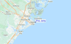
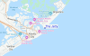
de galerijContourlijnen: Wegen & Rivieren: Kies een surflokatie uit het menu 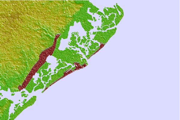
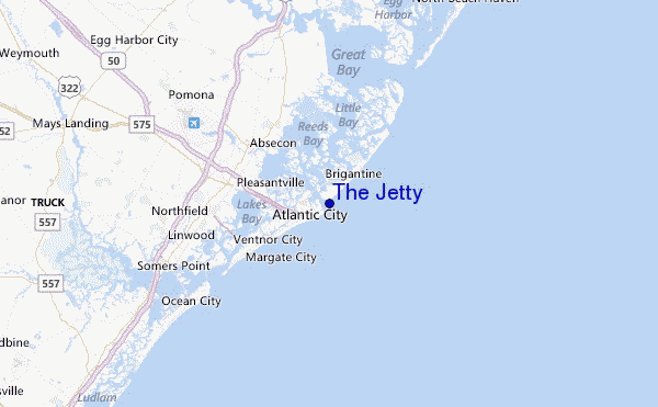
Gebruik deze reliëfkaart om naar de surfspots en de getijdenstations van New Jersey toe te gaan, in de buurt van The Jetty.
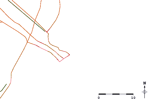
Andere Dichtbijzijnde Surflocaties van The Jetty:
(klik op locatienaam voor meer informatie)- Closest Locatie1 mi
- Second closest Locatie1 mi
- Third closest Locatie1 mi
- Fourth closest Locatie3 mi
- Fifth closest Locatie3 mi
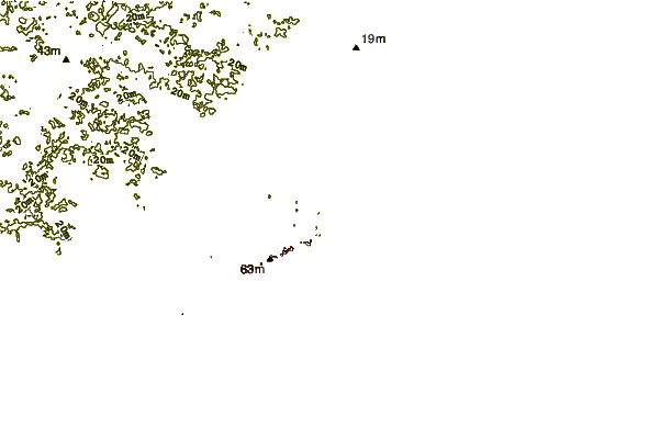
Dichtstbijzijnde golfboeien bij The Jetty:
- Closest golfboei20 mi
- Second closest golfboei44 mi
- Third closest golfboei65 mi
- Fourth closest golfboei78 mi
- Fifth closest golfboei89 mi
Getijdenstations in de buurt van The Jetty:
- Closest getijdenstationAbsecon Channel, State Route 87 bridge1 mi
- Second closest getijdenstationAtlantic City (Steel Pier)1 mi
- Third closest getijdenstationBrigantine Channel at Hoffman Thorofare5 mi
- Fourth closest getijdenstationVentnor City, ocean pier5 mi
- Fifth closest getijdenstationAbsecon, Absecon Creek, US Highway 30 bridge6 mi
Airports
- The closest passenger airport to The Jetty is Atlantic City International Airport (ACY) in USA, 18 km (11 miles) away (directly).
- The second nearest airport to The Jetty is Millville Muni Airport (MIV), also in USA, 58 km (36 miles) away.
- Third is Cape May Co (Wildwood) Airport (WWD) in USA, 60 km (37 miles) away.
- Lakehurst Naes Airport (NEL) in USA is 73 km (45 miles) away.
- Mc Guire Afb (Wrightstown) Airport (WRI), also in USA is the fifth nearest airport to The Jetty and is 73 km (45 miles) away.
- /breaks/The-Jetty-1/forecasts/latest


 Nearest