

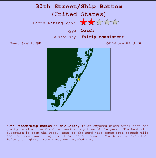
30th Street/Ship Bottom Surf Guide
30th Street/Ship Bottom in New Jersey is an exposed beach break that has fairly consistent surf and can work at any time of the year. Offshore winds are from the west. Most of the surf here comes from groundswells and the best swell direction is from the southeast. Waves at the beach break both left and right. When it's working here, it can get crowded.
30th Street/Ship Bottom Spot Info
| Type: | Rating: | Reliability: | Todays Sea Temp*: |
|---|---|---|---|
| fairly consistent | 25.0°C*ocean temperature recorded from satellite |
Surfing 30th Street/Ship Bottom:
The best conditions reported for surf at 30th Street/Ship Bottom occur when a Southeast swell combines with an offshore wind direction from the West.

Voorspelde Golfenergie (Kracht): 12 uur


30th Street/Ship Bottom Surf:
Saturday, 18 July 2026, 14:26 Local time| Saturday 18 | ||||
| 11AM | 2PM | 5PM | 8PM | |
| Wave (m) | ||||
| Periode (s) | 4 | 4 | 4 | 13 |
| Wind (km/h) | ||||
| Wind | cross- off |
cross- off |
cross | off |
- /breaks/Thirtith-Street/forecasts/latest
30th Street/Ship Bottom Surf Guide
30th Street/Ship Bottom in New Jersey is an exposed beach break that has fairly consistent surf and can work at any time of the year. Offshore winds are from the west. Most of the surf here comes from groundswells and the best swell direction is from the southeast. Waves at the beach break both left and right. When it's working here, it can get crowded.
30th Street/Ship Bottom Spot Info
Type: Rating: Reliability: Todays Sea Temp*:  Beach
Beach 2
2fairly consistent 25.0°C*ocean temperature recorded from satelliteSurfing 30th Street/Ship Bottom:
The best conditions reported for surf at 30th Street/Ship Bottom occur when a Southeast swell combines with an offshore wind direction from the West.
Voorspelde Golfenergie (Kracht): 12 uur
Gebruik de tabbladen hierboven om de zeewatertemperatuur bij 30th Street/Ship Bottom te bekijken, foto's van 30th Street/Ship Bottom, 30th Street/Ship Bottom gedetailleerde golfvoorspellingen, wind- en weersvoorspellingen, 30th Street/Ship Bottom webcams, actuele wind in New Jersey live weerstations en 30th Street/Ship Bottom getijdenvoorspellingen. De link van United States golfkaarten opent een grote afbeelding van United States en de omliggende zeeën. Deze golfkaarten kunnen worden dynamisch gemaakt worden met de verschillende golfcomponenten, golfenergie, golfperiode, golfhoogte, samen met de wind en weersvoorspellingen, het actuele weer en de zeetoestand volgens golfboeien uit United States, langskomende schepen en weerstations op de kust. Elk voorspelling pagina's voor dit surfstrand zijn voorzien van een wereldwijde en regionale golfzoeker om de beste surfsomstandigheden in het gebied rond 30th Street/Ship Bottom te vinden.
30th Street/Ship Bottom Surf:
Saturday, 18 July 2026, 14:26 Local timeSaturday 18 11AM 2PM 5PM 8PM Wave (m) Periode (s) 4 4 4 13 Wind (km/h) Wind cross-
offcross-
offcross off - /breaks/Thirtith-Street/forecasts/latest
- /breaks/Thirtith-Street/forecasts/latest/six_day
30th Street/Ship Bottom Surf Guide
30th Street/Ship Bottom in New Jersey is an exposed beach break that has fairly consistent surf and can work at any time of the year. Offshore winds are from the west. Most of the surf here comes from groundswells and the best swell direction is from the southeast. Waves at the beach break both left and right. When it's working here, it can get crowded.
30th Street/Ship Bottom Spot Info
Type: Rating: Reliability: Todays Sea Temp*: Beach2fairly consistent 25.0°C*ocean temperature recorded from satelliteSurfing 30th Street/Ship Bottom:
The best conditions reported for surf at 30th Street/Ship Bottom occur when a Southeast swell combines with an offshore wind direction from the West.
Voorspelde Golfenergie (Kracht): 12 uur
Gebruik de tabbladen hierboven om de zeewatertemperatuur bij 30th Street/Ship Bottom te bekijken, foto's van 30th Street/Ship Bottom, 30th Street/Ship Bottom gedetailleerde golfvoorspellingen, wind- en weersvoorspellingen, 30th Street/Ship Bottom webcams, actuele wind in New Jersey live weerstations en 30th Street/Ship Bottom getijdenvoorspellingen. De link van United States golfkaarten opent een grote afbeelding van United States en de omliggende zeeën. Deze golfkaarten kunnen worden dynamisch gemaakt worden met de verschillende golfcomponenten, golfenergie, golfperiode, golfhoogte, samen met de wind en weersvoorspellingen, het actuele weer en de zeetoestand volgens golfboeien uit United States, langskomende schepen en weerstations op de kust. Elk voorspelling pagina's voor dit surfstrand zijn voorzien van een wereldwijde en regionale golfzoeker om de beste surfsomstandigheden in het gebied rond 30th Street/Ship Bottom te vinden.
30th Street/Ship Bottom Surf:
Saturday, 18 July 2026, 14:26 Local timeSaturday 18 11AM 2PM 5PM 8PM Wave (m) Periode (s) 4 4 4 13 Wind (km/h) Wind cross-
offcross-
offcross off - /breaks/Thirtith-Street/forecasts/latest
30th Street/Ship Bottom Surf Guide
30th Street/Ship Bottom in New Jersey is an exposed beach break that has fairly consistent surf and can work at any time of the year. Offshore winds are from the west. Most of the surf here comes from groundswells and the best swell direction is from the southeast. Waves at the beach break both left and right. When it's working here, it can get crowded.
30th Street/Ship Bottom Spot Info
Type: Rating: Reliability: Todays Sea Temp*: Beach2fairly consistent 25.0°C*ocean temperature recorded from satelliteSurfing 30th Street/Ship Bottom:
The best conditions reported for surf at 30th Street/Ship Bottom occur when a Southeast swell combines with an offshore wind direction from the West.
Voorspelde Golfenergie (Kracht): 12 uur
Gebruik de tabbladen hierboven om de zeewatertemperatuur bij 30th Street/Ship Bottom te bekijken, foto's van 30th Street/Ship Bottom, 30th Street/Ship Bottom gedetailleerde golfvoorspellingen, wind- en weersvoorspellingen, 30th Street/Ship Bottom webcams, actuele wind in New Jersey live weerstations en 30th Street/Ship Bottom getijdenvoorspellingen. De link van United States golfkaarten opent een grote afbeelding van United States en de omliggende zeeën. Deze golfkaarten kunnen worden dynamisch gemaakt worden met de verschillende golfcomponenten, golfenergie, golfperiode, golfhoogte, samen met de wind en weersvoorspellingen, het actuele weer en de zeetoestand volgens golfboeien uit United States, langskomende schepen en weerstations op de kust. Elk voorspelling pagina's voor dit surfstrand zijn voorzien van een wereldwijde en regionale golfzoeker om de beste surfsomstandigheden in het gebied rond 30th Street/Ship Bottom te vinden.
30th Street/Ship Bottom Surf:
Saturday, 18 July 2026, 14:26 Local timeSaturday 18 11AM 2PM 5PM 8PM Wave (m) Periode (s) 4 4 4 13 Wind (km/h) Wind cross-
offcross-
offcross off Tide Times:
Voor Seaside Heights, ocean, New Jersey, %{dist} %{km} van %{location}.
VOLGENDE IS OM (lokale tijd) resterende tijd hoog water laag water 30th Street/Ship Bottom Tide Times and Tide Chart
Live Weather:
At BUOY-JCRN4, 26 km from 30th Street/Ship Bottom.
moderate winds from the SSE
(km/h)Air temperature
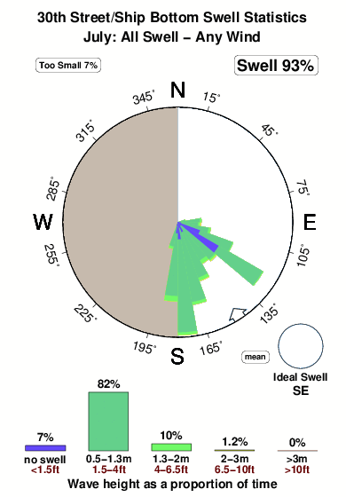
27.1°COverall 30th Street/Ship Bottom Surf Consistency and Wind Distribution in July
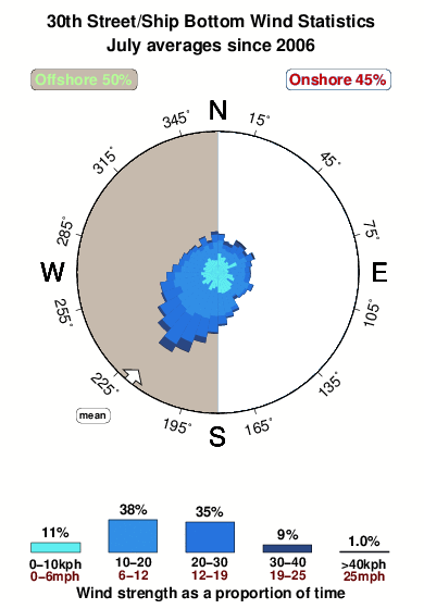


Wind stats for 30th Street/Ship Bottom: see the variation in direction and stength by month.
surffoto's uit
de galerijContourlijnen: Wegen & Rivieren: Kies een surflokatie uit het menu 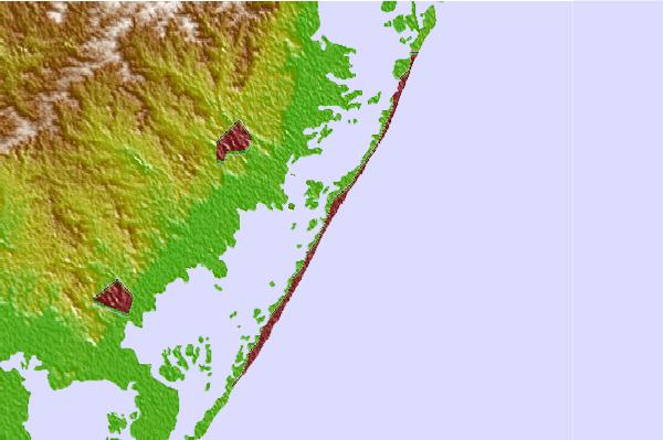
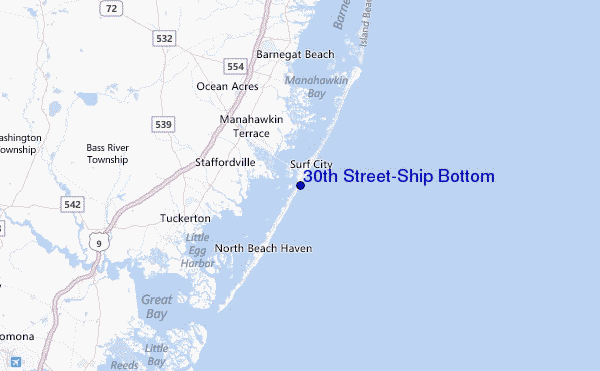
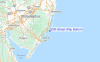
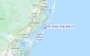
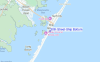
Gebruik deze reliëfkaart om naar de surfspots en de getijdenstations van New Jersey toe te gaan, in de buurt van 30th Street/Ship Bottom.
Andere Dichtbijzijnde Surflocaties van 30th Street/Ship Bottom:
(klik op locatienaam voor meer informatie)- Closest Locatie1 mi
- Second closest Locatie2 mi
- Third closest Locatie2 mi
- Fourth closest Locatie4 mi
- Fifth closest Locatie4 mi
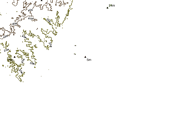
Dichtstbijzijnde golfboeien bij 30th Street/Ship Bottom:
- Closest golfboei2 mi
- Second closest golfboei24 mi
- Third closest golfboei57 mi
- Fourth closest golfboei68 mi
- Fifth closest golfboei85 mi
Getijdenstations in de buurt van 30th Street/Ship Bottom:
- Closest getijdenstationManahawkin Drawbridge, Manahawkin Bay1 mi
- Second closest getijdenstationBeach Haven Crest2 mi
- Third closest getijdenstationManahawkin Creek, Manahawkin Bay2 mi
- Fourth closest getijdenstationMill Creek, 1 nautical miles above entrance3 mi
- Fifth closest getijdenstationNorth Beach, Manahawkin Bay3 mi
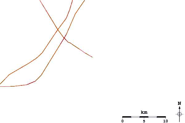
Airports
- The closest passenger airport to 30th Street/Ship Bottom is Atlantic City International Airport (ACY) in USA, 39 km (24 miles) away (directly).
- The second nearest airport to 30th Street/Ship Bottom is Lakehurst Naes Airport (NEL), also in USA, 46 km (29 miles) away.
- Third is Mc Guire Afb (Wrightstown) Airport (WRI) in USA, 55 km (34 miles) away.
- Millville Muni Airport (MIV) in USA is 82 km (51 miles) away.
- Northeast Philadelphia Airport (PNE), also in USA is the fifth nearest airport to 30th Street/Ship Bottom and is 86 km (53 miles) away.
- /breaks/Thirtith-Street/forecasts/latest
 Nearest