
Trearddur Bay (Holy Island) Surf Guide
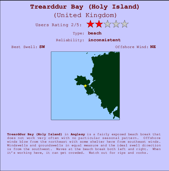
Trearddur Bay(Holy Island) in Anglesy is a quite exposed beach break that has unreliable waves with no particular seasonal pattern. Works best in offshore winds from the northeast with some shelter here from southeast winds. Windswells and groundswells in equal measure and the ideal swell angle is from the southwest. The beach breaks offer lefts and rights. When the surf is up, it can get quite busy in the water. Hazards include rips and rocks.
Trearddur Bay (Holy Island) Spot Info
| Type: | Rating: | Reliability: | Todays Sea Temp*: |
|---|---|---|---|
| inconsistent | 16.5°C*ocean temperature recorded from satellite |
Surfing Trearddur Bay (Holy Island):
The best conditions reported for surf at Trearddur Bay (Holy Island) occur when a Southwest swell combines with an offshore wind direction from the Northeast.
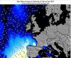
Voorspelde Golfenergie (Kracht): 12 uur


Trearddur Bay (Holy Island) Surf:
Thursday, 16 July 2026, 13:13 Local time| Thursday 16 | ||||
| 10AM | 1PM | 4PM | 7PM | |
| Wave (m) | ||||
| Periode (s) | 14 | 14 | 14 | 14 |
| Wind (km/h) | ||||
| Wind | glass | glass | off | cross- off |
- /breaks/Trearddur-Bay_Holy-Island/forecasts/latest
Trearddur Bay (Holy Island) Surf Guide
Trearddur Bay(Holy Island) in Anglesy is a quite exposed beach break that has unreliable waves with no particular seasonal pattern. Works best in offshore winds from the northeast with some shelter here from southeast winds. Windswells and groundswells in equal measure and the ideal swell angle is from the southwest. The beach breaks offer lefts and rights. When the surf is up, it can get quite busy in the water. Hazards include rips and rocks.
Trearddur Bay (Holy Island) Spot Info
Type: Rating: Reliability: Todays Sea Temp*:  Beach
Beach 2
2inconsistent 16.5°C*ocean temperature recorded from satelliteSurfing Trearddur Bay (Holy Island):
The best conditions reported for surf at Trearddur Bay (Holy Island) occur when a Southwest swell combines with an offshore wind direction from the Northeast.
Voorspelde Golfenergie (Kracht): 12 uur
Gebruik de tabbladen hierboven om de zeewatertemperatuur bij Trearddur Bay (Holy Island) te bekijken, foto's van Trearddur Bay (Holy Island), Trearddur Bay (Holy Island) gedetailleerde golfvoorspellingen, wind- en weersvoorspellingen, Trearddur Bay (Holy Island) webcams, actuele wind in Wales - Anglesy live weerstations en Trearddur Bay (Holy Island) getijdenvoorspellingen. De link van United Kingdom golfkaarten opent een grote afbeelding van United Kingdom en de omliggende zeeën. Deze golfkaarten kunnen worden dynamisch gemaakt worden met de verschillende golfcomponenten, golfenergie, golfperiode, golfhoogte, samen met de wind en weersvoorspellingen, het actuele weer en de zeetoestand volgens golfboeien uit United Kingdom, langskomende schepen en weerstations op de kust. Elk voorspelling pagina's voor dit surfstrand zijn voorzien van een wereldwijde en regionale golfzoeker om de beste surfsomstandigheden in het gebied rond Trearddur Bay (Holy Island) te vinden.
Trearddur Bay (Holy Island) Surf:
Thursday, 16 July 2026, 13:13 Local timeThursday 16 10AM 1PM 4PM 7PM Wave (m) Periode (s) 14 14 14 14 Wind (km/h) Wind glass glass off cross-
off- /breaks/Trearddur-Bay_Holy-Island/forecasts/latest
- /breaks/Trearddur-Bay_Holy-Island/forecasts/latest/six_day
Trearddur Bay (Holy Island) Surf Guide
Trearddur Bay(Holy Island) in Anglesy is a quite exposed beach break that has unreliable waves with no particular seasonal pattern. Works best in offshore winds from the northeast with some shelter here from southeast winds. Windswells and groundswells in equal measure and the ideal swell angle is from the southwest. The beach breaks offer lefts and rights. When the surf is up, it can get quite busy in the water. Hazards include rips and rocks.
Trearddur Bay (Holy Island) Spot Info
Type: Rating: Reliability: Todays Sea Temp*: Beach2inconsistent 16.5°C*ocean temperature recorded from satelliteSurfing Trearddur Bay (Holy Island):
The best conditions reported for surf at Trearddur Bay (Holy Island) occur when a Southwest swell combines with an offshore wind direction from the Northeast.
Voorspelde Golfenergie (Kracht): 12 uur
Gebruik de tabbladen hierboven om de zeewatertemperatuur bij Trearddur Bay (Holy Island) te bekijken, foto's van Trearddur Bay (Holy Island), Trearddur Bay (Holy Island) gedetailleerde golfvoorspellingen, wind- en weersvoorspellingen, Trearddur Bay (Holy Island) webcams, actuele wind in Wales - Anglesy live weerstations en Trearddur Bay (Holy Island) getijdenvoorspellingen. De link van United Kingdom golfkaarten opent een grote afbeelding van United Kingdom en de omliggende zeeën. Deze golfkaarten kunnen worden dynamisch gemaakt worden met de verschillende golfcomponenten, golfenergie, golfperiode, golfhoogte, samen met de wind en weersvoorspellingen, het actuele weer en de zeetoestand volgens golfboeien uit United Kingdom, langskomende schepen en weerstations op de kust. Elk voorspelling pagina's voor dit surfstrand zijn voorzien van een wereldwijde en regionale golfzoeker om de beste surfsomstandigheden in het gebied rond Trearddur Bay (Holy Island) te vinden.
Trearddur Bay (Holy Island) Surf:
Thursday, 16 July 2026, 13:13 Local timeThursday 16 10AM 1PM 4PM 7PM Wave (m) Periode (s) 14 14 14 14 Wind (km/h) Wind glass glass off cross-
off- /breaks/Trearddur-Bay_Holy-Island/forecasts/latest
Trearddur Bay (Holy Island) Surf Guide
Trearddur Bay(Holy Island) in Anglesy is a quite exposed beach break that has unreliable waves with no particular seasonal pattern. Works best in offshore winds from the northeast with some shelter here from southeast winds. Windswells and groundswells in equal measure and the ideal swell angle is from the southwest. The beach breaks offer lefts and rights. When the surf is up, it can get quite busy in the water. Hazards include rips and rocks.
Trearddur Bay (Holy Island) Spot Info
Type: Rating: Reliability: Todays Sea Temp*: Beach2inconsistent 16.5°C*ocean temperature recorded from satelliteSurfing Trearddur Bay (Holy Island):
The best conditions reported for surf at Trearddur Bay (Holy Island) occur when a Southwest swell combines with an offshore wind direction from the Northeast.
Voorspelde Golfenergie (Kracht): 12 uur
Gebruik de tabbladen hierboven om de zeewatertemperatuur bij Trearddur Bay (Holy Island) te bekijken, foto's van Trearddur Bay (Holy Island), Trearddur Bay (Holy Island) gedetailleerde golfvoorspellingen, wind- en weersvoorspellingen, Trearddur Bay (Holy Island) webcams, actuele wind in Wales - Anglesy live weerstations en Trearddur Bay (Holy Island) getijdenvoorspellingen. De link van United Kingdom golfkaarten opent een grote afbeelding van United Kingdom en de omliggende zeeën. Deze golfkaarten kunnen worden dynamisch gemaakt worden met de verschillende golfcomponenten, golfenergie, golfperiode, golfhoogte, samen met de wind en weersvoorspellingen, het actuele weer en de zeetoestand volgens golfboeien uit United Kingdom, langskomende schepen en weerstations op de kust. Elk voorspelling pagina's voor dit surfstrand zijn voorzien van een wereldwijde en regionale golfzoeker om de beste surfsomstandigheden in het gebied rond Trearddur Bay (Holy Island) te vinden.
Trearddur Bay (Holy Island) Surf:
Thursday, 16 July 2026, 13:13 Local timeThursday 16 10AM 1PM 4PM 7PM Wave (m) Periode (s) 14 14 14 14 Wind (km/h) Wind glass glass off cross-
offTide Times:
Voor Holyhead, Wales, %{dist} %{km} van %{location}.
VOLGENDE IS OM (lokale tijd) resterende tijd hoog water laag water Trearddur Bay (Holy Island) Tide Times and Tide Chart
Live Weather:
At Valley RAF Airport, 8 km from Trearddur Bay (Holy Island).
light winds from the SSW
(km/h)Air temperature
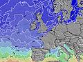
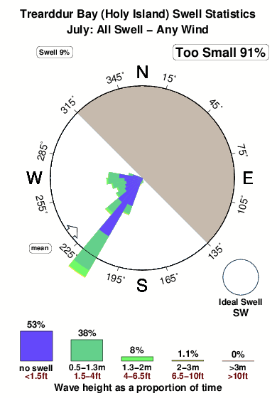
Q1022°COverall Trearddur Bay (Holy Island) Surf Consistency and Wind Distribution in July


Wind stats for Trearddur Bay (Holy Island): see the variation in direction and stength by month.
surffoto's uit
de galerijContourlijnen: Wegen & Rivieren: Kies een surflokatie uit het menu 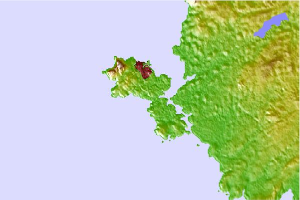

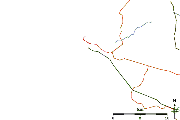
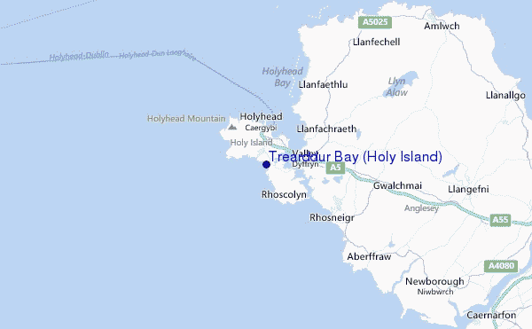
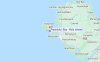
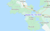
Gebruik deze reliëfkaart om naar de surfspots en de getijdenstations van Wales - Anglesy toe te gaan, in de buurt van Trearddur Bay (Holy Island).
Andere Dichtbijzijnde Surflocaties van Trearddur Bay (Holy Island):
(klik op locatienaam voor meer informatie)- Closest Locatie1 mi
- Second closest Locatie5 mi
- Third closest Locatie5 mi
- Fourth closest Locatie6 mi
- Fifth closest Locatie7 mi
Dichtstbijzijnde golfboeien bij Trearddur Bay (Holy Island):
- Closest golfboei35 mi
- Second closest golfboei35 mi
- Third closest golfboei55 mi
- Fourth closest golfboei55 mi
- Fifth closest golfboei58 mi
Getijdenstations in de buurt van Trearddur Bay (Holy Island):
- Closest getijdenstationHolyhead2 mi
- Second closest getijdenstationCaernarfon17 mi
- Third closest getijdenstationBangor21 mi
- Fourth closest getijdenstationLlandudno, Gwynedd33 mi
- Fifth closest getijdenstationDeganwy33 mi
Airports
- The closest passenger airport to Trearddur Bay (Holy Island) is Isle Of Man Airport (IOM) in England, 90 km (56 miles) away (directly).
- The second nearest airport to Trearddur Bay (Holy Island) is Hawarden Airport (CEG), also in England, 110 km (68 miles) away.
- Third is Dublin Airport (DUB) in Ireland, 110 km (68 miles) away.
- Liverpool Airport (LPL) in England is 118 km (73 miles) away.
- Blackpool Airport (BLK), also in England is the fifth nearest airport to Trearddur Bay (Holy Island) and is 119 km (74 miles) away.
- /breaks/Trearddur-Bay_Holy-Island/forecasts/latest
 Nearest