
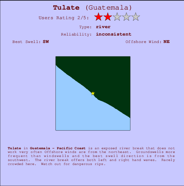
Tulate Surf Guide
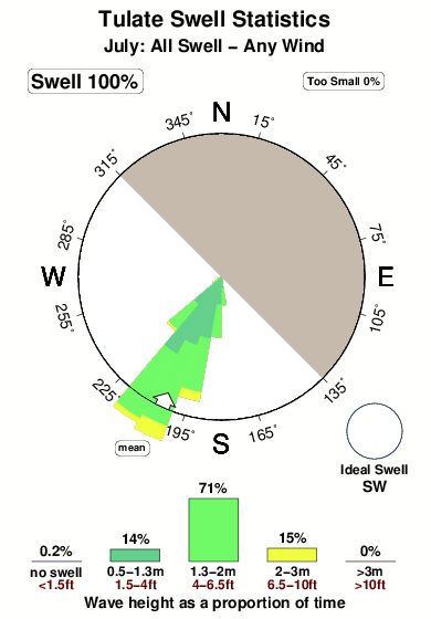
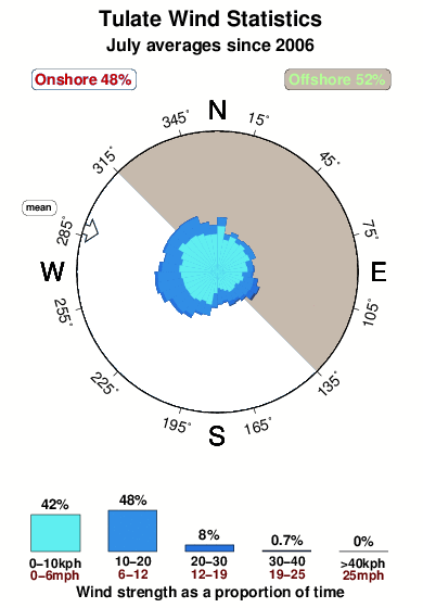
Tulate in Pacific Coast is an exposed river break that does not work very often Offshore winds are from the northeast. Groundswells are more common than windswells and the best swell direction is from the southwest. The river breaks offer lefts and rights. Even when there are waves, it's not likley to be crowded. Watch out for dangerous rips.
Tulate Spot Info
| Type: | Rating: | Reliability: | Todays Sea Temp*: |
|---|---|---|---|
| inconsistent | 30.5°C*ocean temperature recorded from satellite |
Surfing Tulate:
The best conditions reported for surf at Tulate occur when a Southwest swell combines with an offshore wind direction from the Northeast.

Voorspelde Golfenergie (Kracht): 12 uur


Tulate Surf:
Monday, 20 July 2026, 13:36 Local time| Monday 20 | ||||
| 9AM | 12PM | 3PM | 6PM | |
| Wave (m) | ||||
| Periode (s) | 16 | 16 | 16 | 16 |
| Wind (km/h) | ||||
| Wind | glass | cross- on |
on | cross- on |
- /breaks/Tulate/forecasts/latest
Tulate Surf Guide
Tulate in Pacific Coast is an exposed river break that does not work very often Offshore winds are from the northeast. Groundswells are more common than windswells and the best swell direction is from the southwest. The river breaks offer lefts and rights. Even when there are waves, it's not likley to be crowded. Watch out for dangerous rips.
Tulate Spot Info
Type: Rating: Reliability: Todays Sea Temp*:  River
River 2
2inconsistent 30.5°C*ocean temperature recorded from satelliteSurfing Tulate:
The best conditions reported for surf at Tulate occur when a Southwest swell combines with an offshore wind direction from the Northeast.
Voorspelde Golfenergie (Kracht): 12 uur
Gebruik de tabbladen hierboven om de zeewatertemperatuur bij Tulate te bekijken, foto's van Tulate, Tulate gedetailleerde golfvoorspellingen, wind- en weersvoorspellingen, Tulate webcams, actuele wind in Pacific Coast live weerstations en Tulate getijdenvoorspellingen. De link van Guatemala golfkaarten opent een grote afbeelding van Guatemala en de omliggende zeeën. Deze golfkaarten kunnen worden dynamisch gemaakt worden met de verschillende golfcomponenten, golfenergie, golfperiode, golfhoogte, samen met de wind en weersvoorspellingen, het actuele weer en de zeetoestand volgens golfboeien uit Guatemala, langskomende schepen en weerstations op de kust. Elk voorspelling pagina's voor dit surfstrand zijn voorzien van een wereldwijde en regionale golfzoeker om de beste surfsomstandigheden in het gebied rond Tulate te vinden.
Tulate Surf:
Monday, 20 July 2026, 13:36 Local timeMonday 20 9AM 12PM 3PM 6PM Wave (m) Periode (s) 16 16 16 16 Wind (km/h) Wind glass cross-
onon cross-
on- /breaks/Tulate/forecasts/latest
- /breaks/Tulate/forecasts/latest/six_day
Tulate Surf Guide
Tulate in Pacific Coast is an exposed river break that does not work very often Offshore winds are from the northeast. Groundswells are more common than windswells and the best swell direction is from the southwest. The river breaks offer lefts and rights. Even when there are waves, it's not likley to be crowded. Watch out for dangerous rips.
Tulate Spot Info
Type: Rating: Reliability: Todays Sea Temp*: River2inconsistent 30.5°C*ocean temperature recorded from satelliteSurfing Tulate:
The best conditions reported for surf at Tulate occur when a Southwest swell combines with an offshore wind direction from the Northeast.
Voorspelde Golfenergie (Kracht): 12 uur
Gebruik de tabbladen hierboven om de zeewatertemperatuur bij Tulate te bekijken, foto's van Tulate, Tulate gedetailleerde golfvoorspellingen, wind- en weersvoorspellingen, Tulate webcams, actuele wind in Pacific Coast live weerstations en Tulate getijdenvoorspellingen. De link van Guatemala golfkaarten opent een grote afbeelding van Guatemala en de omliggende zeeën. Deze golfkaarten kunnen worden dynamisch gemaakt worden met de verschillende golfcomponenten, golfenergie, golfperiode, golfhoogte, samen met de wind en weersvoorspellingen, het actuele weer en de zeetoestand volgens golfboeien uit Guatemala, langskomende schepen en weerstations op de kust. Elk voorspelling pagina's voor dit surfstrand zijn voorzien van een wereldwijde en regionale golfzoeker om de beste surfsomstandigheden in het gebied rond Tulate te vinden.
Tulate Surf:
Monday, 20 July 2026, 13:36 Local timeMonday 20 9AM 12PM 3PM 6PM Wave (m) Periode (s) 16 16 16 16 Wind (km/h) Wind glass cross-
onon cross-
on- /breaks/Tulate/forecasts/latest
Tulate Surf Guide
Tulate in Pacific Coast is an exposed river break that does not work very often Offshore winds are from the northeast. Groundswells are more common than windswells and the best swell direction is from the southwest. The river breaks offer lefts and rights. Even when there are waves, it's not likley to be crowded. Watch out for dangerous rips.
Tulate Spot Info
Type: Rating: Reliability: Todays Sea Temp*: River2inconsistent 30.5°C*ocean temperature recorded from satelliteSurfing Tulate:
The best conditions reported for surf at Tulate occur when a Southwest swell combines with an offshore wind direction from the Northeast.
Voorspelde Golfenergie (Kracht): 12 uur
Gebruik de tabbladen hierboven om de zeewatertemperatuur bij Tulate te bekijken, foto's van Tulate, Tulate gedetailleerde golfvoorspellingen, wind- en weersvoorspellingen, Tulate webcams, actuele wind in Pacific Coast live weerstations en Tulate getijdenvoorspellingen. De link van Guatemala golfkaarten opent een grote afbeelding van Guatemala en de omliggende zeeën. Deze golfkaarten kunnen worden dynamisch gemaakt worden met de verschillende golfcomponenten, golfenergie, golfperiode, golfhoogte, samen met de wind en weersvoorspellingen, het actuele weer en de zeetoestand volgens golfboeien uit Guatemala, langskomende schepen en weerstations op de kust. Elk voorspelling pagina's voor dit surfstrand zijn voorzien van een wereldwijde en regionale golfzoeker om de beste surfsomstandigheden in het gebied rond Tulate te vinden.
Tulate Surf:
Monday, 20 July 2026, 13:36 Local timeMonday 20 9AM 12PM 3PM 6PM Wave (m) Periode (s) 16 16 16 16 Wind (km/h) Wind glass cross-
onon cross-
onTide Times:
Op Tulate (0 km).
VOLGENDE IS OM (lokale tijd) resterende tijd hoog water laag water Tulate Tide Times and Tide Chart
Live Weather:
At Retalhuleu Airport/, 37 km from Tulate.
light winds from the SW
(km/h)
Dry and partly cloudyAir temperature
33°COverall Tulate Surf Consistency and Wind Distribution in July
surffoto's uit
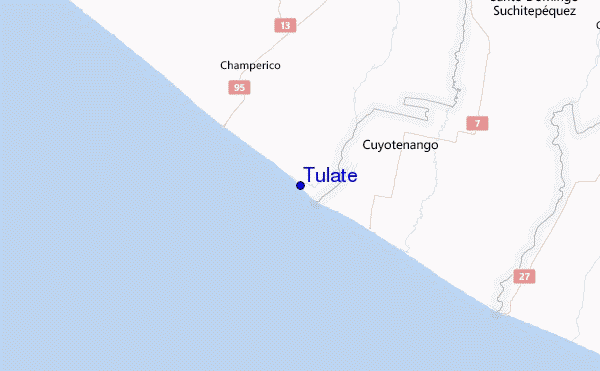
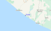
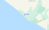
de galerijContourlijnen: Wegen & Rivieren: Kies een surflokatie uit het menu 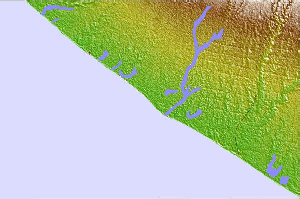
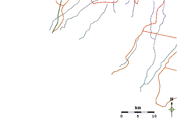
Gebruik deze reliëfkaart om naar de surfspots en de getijdenstations van Pacific Coast toe te gaan, in de buurt van Tulate.
Andere Dichtbijzijnde Surflocaties van Tulate:
(klik op locatienaam voor meer informatie)- Closest Locatie19 mi
- Second closest Locatie28 mi
- Third closest Locatie35 mi
- Fourth closest Locatie37 mi
- Fifth closest Locatie44 mi
Dichtstbijzijnde golfboeien bij Tulate:
- Closest golfboei559 mi
- Second closest golfboei593 mi
- Third closest golfboei710 mi
- Fourth closest golfboei809 mi
- Fifth closest golfboei820 mi
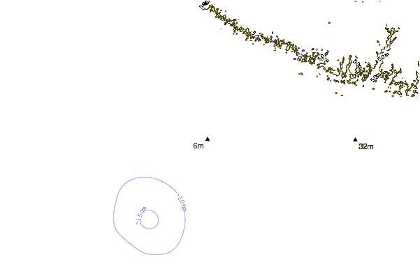
Getijdenstations in de buurt van Tulate:
- Closest getijdenstationChamperico9 mi
- Second closest getijdenstationOcos33 mi
- Third closest getijdenstationSuchiate36 mi
- Fourth closest getijdenstationPuerto Madero54 mi
- Fifth closest getijdenstationSan Jose70 mi
Airports
- The nearest passenger airport to Tulate is Tapachula International Airport (TAP) in Mexico, which is 88 km (55 miles) away (directly).
- The second closest airport to Tulate is La Aurora (Guatemala City) Airport (GUA) in Guatemala, 144 km (89 miles) away.
- /breaks/Tulate/forecasts/latest


 Nearest