

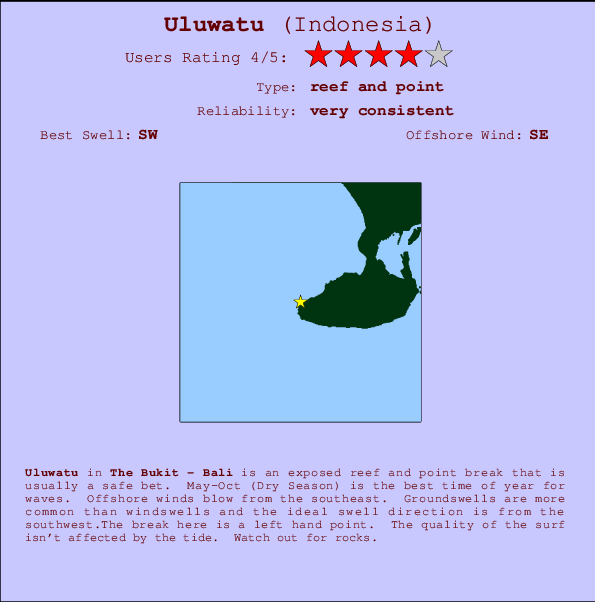
Uluwatu Surf Guide
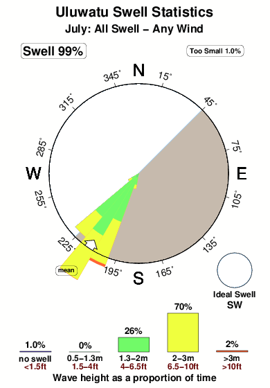
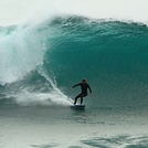
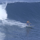
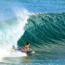
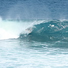
Uluwatu in Bali (The Bukit) is an exposed reef and point break that is often working. May-Oct (Dry Season) is the best time of year for waves. The best wind direction is from the southeast. Groundswells more frequent than windswells and the ideal swell direction is from the southwest.There is a left hand point break here. The quality of the surf isn't affected by the tide. Take care of rocks in the line up.
Uluwatu Spot Info
| Type: | Rating: | Reliability: | Todays Sea Temp*: |
|---|---|---|---|
| very consistent | 26.8°C*ocean temperature recorded from satellite |
Surfing Uluwatu:
The best conditions reported for surf at Uluwatu occur when a Southwest swell combines with an offshore wind direction from the Southeast.

Voorspelde Golfenergie (Kracht): 12 uur


Uluwatu Surf:
Saturday, 18 July 2026, 06:20 Local time| Saturday 18 | ||||
| 5AM | 8AM | 11AM | 2PM | |
| Wave (m) | ||||
| Periode (s) | 15 | 15 | 15 | 14 |
| Wind (km/h) | ||||
| Wind | cross- off |
off | off | off |
- /breaks/Uluwatu/forecasts/latest
Uluwatu Surf Guide
Uluwatu in Bali (The Bukit) is an exposed reef and point break that is often working. May-Oct (Dry Season) is the best time of year for waves. The best wind direction is from the southeast. Groundswells more frequent than windswells and the ideal swell direction is from the southwest.There is a left hand point break here. The quality of the surf isn't affected by the tide. Take care of rocks in the line up.
Uluwatu Spot Info
Type: Rating: Reliability: Todays Sea Temp*:  Reef and point
 4
4very consistent 26.8°C*ocean temperature recorded from satelliteSurfing Uluwatu:
The best conditions reported for surf at Uluwatu occur when a Southwest swell combines with an offshore wind direction from the Southeast.
Voorspelde Golfenergie (Kracht): 12 uur
Gebruik de tabbladen hierboven om de zeewatertemperatuur bij Uluwatu te bekijken, foto's van Uluwatu, Uluwatu gedetailleerde golfvoorspellingen, wind- en weersvoorspellingen, Uluwatu webcams, actuele wind in Bali - The Bukit live weerstations en Uluwatu getijdenvoorspellingen. De link van Indonesia golfkaarten opent een grote afbeelding van Indonesia en de omliggende zeeën. Deze golfkaarten kunnen worden dynamisch gemaakt worden met de verschillende golfcomponenten, golfenergie, golfperiode, golfhoogte, samen met de wind en weersvoorspellingen, het actuele weer en de zeetoestand volgens golfboeien uit Indonesia, langskomende schepen en weerstations op de kust. Elk voorspelling pagina's voor dit surfstrand zijn voorzien van een wereldwijde en regionale golfzoeker om de beste surfsomstandigheden in het gebied rond Uluwatu te vinden.
Uluwatu Surf:
Saturday, 18 July 2026, 06:20 Local timeSaturday 18 5AM 8AM 11AM 2PM Wave (m) Periode (s) 15 15 15 14 Wind (km/h) Wind cross-
offoff off off - /breaks/Uluwatu/forecasts/latest
- /breaks/Uluwatu/forecasts/latest/six_day
Uluwatu Surf Guide
Uluwatu in Bali (The Bukit) is an exposed reef and point break that is often working. May-Oct (Dry Season) is the best time of year for waves. The best wind direction is from the southeast. Groundswells more frequent than windswells and the ideal swell direction is from the southwest.There is a left hand point break here. The quality of the surf isn't affected by the tide. Take care of rocks in the line up.
Uluwatu Spot Info
Type: Rating: Reliability: Todays Sea Temp*: Reef and point4very consistent 26.8°C*ocean temperature recorded from satelliteSurfing Uluwatu:
The best conditions reported for surf at Uluwatu occur when a Southwest swell combines with an offshore wind direction from the Southeast.
Voorspelde Golfenergie (Kracht): 12 uur
Gebruik de tabbladen hierboven om de zeewatertemperatuur bij Uluwatu te bekijken, foto's van Uluwatu, Uluwatu gedetailleerde golfvoorspellingen, wind- en weersvoorspellingen, Uluwatu webcams, actuele wind in Bali - The Bukit live weerstations en Uluwatu getijdenvoorspellingen. De link van Indonesia golfkaarten opent een grote afbeelding van Indonesia en de omliggende zeeën. Deze golfkaarten kunnen worden dynamisch gemaakt worden met de verschillende golfcomponenten, golfenergie, golfperiode, golfhoogte, samen met de wind en weersvoorspellingen, het actuele weer en de zeetoestand volgens golfboeien uit Indonesia, langskomende schepen en weerstations op de kust. Elk voorspelling pagina's voor dit surfstrand zijn voorzien van een wereldwijde en regionale golfzoeker om de beste surfsomstandigheden in het gebied rond Uluwatu te vinden.
Uluwatu Surf:
Saturday, 18 July 2026, 06:20 Local timeSaturday 18 5AM 8AM 11AM 2PM Wave (m) Periode (s) 15 15 15 14 Wind (km/h) Wind cross-
offoff off off - /breaks/Uluwatu/forecasts/latest
Uluwatu Surf Guide
Uluwatu in Bali (The Bukit) is an exposed reef and point break that is often working. May-Oct (Dry Season) is the best time of year for waves. The best wind direction is from the southeast. Groundswells more frequent than windswells and the ideal swell direction is from the southwest.There is a left hand point break here. The quality of the surf isn't affected by the tide. Take care of rocks in the line up.
Uluwatu Spot Info
Type: Rating: Reliability: Todays Sea Temp*: Reef and point4very consistent 26.8°C*ocean temperature recorded from satelliteSurfing Uluwatu:
The best conditions reported for surf at Uluwatu occur when a Southwest swell combines with an offshore wind direction from the Southeast.
Voorspelde Golfenergie (Kracht): 12 uur
Gebruik de tabbladen hierboven om de zeewatertemperatuur bij Uluwatu te bekijken, foto's van Uluwatu, Uluwatu gedetailleerde golfvoorspellingen, wind- en weersvoorspellingen, Uluwatu webcams, actuele wind in Bali - The Bukit live weerstations en Uluwatu getijdenvoorspellingen. De link van Indonesia golfkaarten opent een grote afbeelding van Indonesia en de omliggende zeeën. Deze golfkaarten kunnen worden dynamisch gemaakt worden met de verschillende golfcomponenten, golfenergie, golfperiode, golfhoogte, samen met de wind en weersvoorspellingen, het actuele weer en de zeetoestand volgens golfboeien uit Indonesia, langskomende schepen en weerstations op de kust. Elk voorspelling pagina's voor dit surfstrand zijn voorzien van een wereldwijde en regionale golfzoeker om de beste surfsomstandigheden in het gebied rond Uluwatu te vinden.
Uluwatu Surf:
Saturday, 18 July 2026, 06:20 Local timeSaturday 18 5AM 8AM 11AM 2PM Wave (m) Periode (s) 15 15 15 14 Wind (km/h) Wind cross-
offoff off off Tide Times:
Op The Bombie (0 km).
VOLGENDE IS OM (lokale tijd) resterende tijd hoog water laag water Uluwatu Tide Times and Tide Chart
Live Weather:
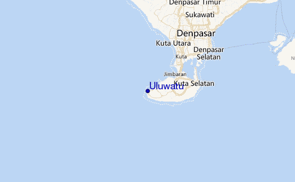
At Bali International Airport, 13 km from Uluwatu.
moderate winds from the ESE
(km/h)Air temperature
26°COverall Uluwatu Surf Consistency and Wind Distribution in July
surffoto's uit
de galerijContourlijnen: Wegen & Rivieren: Kies een surflokatie uit het menu 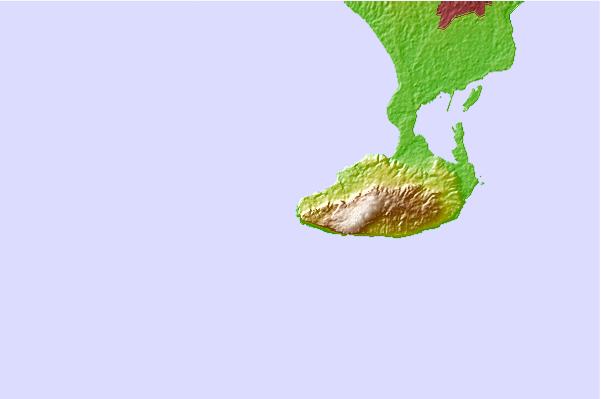
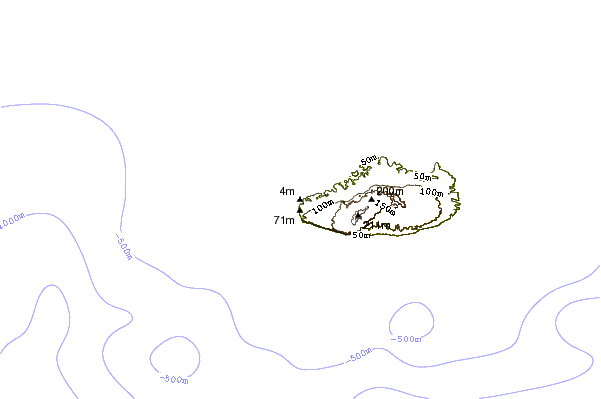
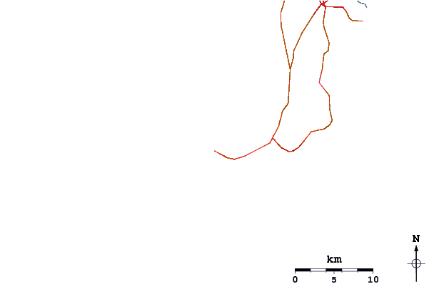
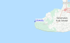
Gebruik deze reliëfkaart om naar de surfspots en de getijdenstations van Bali - The Bukit toe te gaan, in de buurt van Uluwatu.
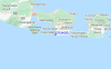
Andere Dichtbijzijnde Surflocaties van Uluwatu:
(klik op locatienaam voor meer informatie)- Closest Locatie0 mi
- Second closest Locatie0 mi
- Third closest Locatie1 mi
- Fourth closest Locatie1 mi
- Fifth closest Locatie1 mi
Dichtstbijzijnde golfboeien bij Uluwatu:
- Closest golfboei1825 mi
- Second closest golfboei2133 mi
- Third closest golfboei2256 mi
- Fourth closest golfboei2321 mi
- Fifth closest golfboei2334 mi
Getijdenstations in de buurt van Uluwatu:
- Closest getijdenstationDenpasar15 mi
- Second closest getijdenstationBanjar44 mi
- Third closest getijdenstationSingaraja50 mi
- Fourth closest getijdenstationMataram72 mi
- Fifth closest getijdenstationWongsorejo74 mi
Airports
- The nearest passenger airport to Uluwatu is Bali International (Denpasar) Airport (DPS) in Indonesia, which is 12 km (7 miles) away (directly).
- The second closest airport to Uluwatu is Selaparang (Mataram) Airport (AMI), also in Indonesia, 115 km (71 miles) away.
- /breaks/Uluwatu/forecasts/latest


 Nearest