
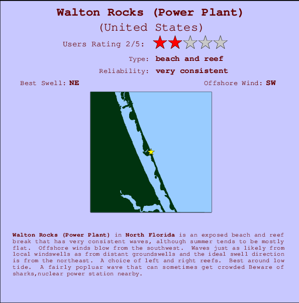
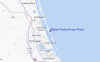
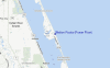
Walton Rocks (Power Plant) Surf Guide
Walton Rocks(Power Plant) in North Florida is an exposed beach and reef break that has very consistent surf, although summer tends to be mostly flat. Offshore winds blow from the southwest. Tends to receive a mix of groundswells and windswells and the best swell direction is from the northeast. Reef breaks provide lefts and rights. Best around low tide. It's sometimes crowded here. Hazards include sharks,nuclear power station nearby.
Walton Rocks (Power Plant) Spot Info
| Type: | Rating: | Reliability: | Todays Sea Temp*: |
|---|---|---|---|
| very consistent | 29.3°C*ocean temperature recorded from satellite |
Surfing Walton Rocks (Power Plant):
The best conditions reported for surf at Walton Rocks (Power Plant) occur when a Northeast swell combines with an offshore wind direction from the Southwest.
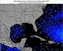
Voorspelde Golfenergie (Kracht): 12 uur

Walton Rocks (Power Plant) Surf:
Wednesday, 22 July 2026, 16:22 Local time| Wednesday 22 | Thu | |||
| 5PM | 8PM | 11PM | 2AM | |
| Wave (m) | ||||
| Periode (s) | 4 | 4 | 4 | 4 |
| Wind (km/h) | ||||
| Wind | cross | cross | cross | cross |
- /breaks/Walton-Rocks/forecasts/latest
Walton Rocks (Power Plant) Surf Guide
Walton Rocks(Power Plant) in North Florida is an exposed beach and reef break that has very consistent surf, although summer tends to be mostly flat. Offshore winds blow from the southwest. Tends to receive a mix of groundswells and windswells and the best swell direction is from the northeast. Reef breaks provide lefts and rights. Best around low tide. It's sometimes crowded here. Hazards include sharks,nuclear power station nearby.
Walton Rocks (Power Plant) Spot Info
Type: Rating: Reliability: Todays Sea Temp*:  Beach and reef
 2
2very consistent 29.3°C*ocean temperature recorded from satelliteSurfing Walton Rocks (Power Plant):
The best conditions reported for surf at Walton Rocks (Power Plant) occur when a Northeast swell combines with an offshore wind direction from the Southwest.
Voorspelde Golfenergie (Kracht): 12 uur
Gebruik de tabbladen hierboven om de zeewatertemperatuur bij Walton Rocks (Power Plant) te bekijken, foto's van Walton Rocks (Power Plant), Walton Rocks (Power Plant) gedetailleerde golfvoorspellingen, wind- en weersvoorspellingen, Walton Rocks (Power Plant) webcams, actuele wind in Florida - North live weerstations en Walton Rocks (Power Plant) getijdenvoorspellingen. De link van United States golfkaarten opent een grote afbeelding van United States en de omliggende zeeën. Deze golfkaarten kunnen worden dynamisch gemaakt worden met de verschillende golfcomponenten, golfenergie, golfperiode, golfhoogte, samen met de wind en weersvoorspellingen, het actuele weer en de zeetoestand volgens golfboeien uit United States, langskomende schepen en weerstations op de kust. Elk voorspelling pagina's voor dit surfstrand zijn voorzien van een wereldwijde en regionale golfzoeker om de beste surfsomstandigheden in het gebied rond Walton Rocks (Power Plant) te vinden.
Walton Rocks (Power Plant) Surf:
Wednesday, 22 July 2026, 16:22 Local timeWednesday 22 Thu 5PM 8PM 11PM 2AM Wave (m) Periode (s) 4 4 4 4 Wind (km/h) Wind cross cross cross cross - /breaks/Walton-Rocks/forecasts/latest
- /breaks/Walton-Rocks/forecasts/latest/six_day
Walton Rocks (Power Plant) Surf Guide
Walton Rocks(Power Plant) in North Florida is an exposed beach and reef break that has very consistent surf, although summer tends to be mostly flat. Offshore winds blow from the southwest. Tends to receive a mix of groundswells and windswells and the best swell direction is from the northeast. Reef breaks provide lefts and rights. Best around low tide. It's sometimes crowded here. Hazards include sharks,nuclear power station nearby.
Walton Rocks (Power Plant) Spot Info
Type: Rating: Reliability: Todays Sea Temp*: Beach and reef2very consistent 29.3°C*ocean temperature recorded from satelliteSurfing Walton Rocks (Power Plant):
The best conditions reported for surf at Walton Rocks (Power Plant) occur when a Northeast swell combines with an offshore wind direction from the Southwest.
Voorspelde Golfenergie (Kracht): 12 uur
Gebruik de tabbladen hierboven om de zeewatertemperatuur bij Walton Rocks (Power Plant) te bekijken, foto's van Walton Rocks (Power Plant), Walton Rocks (Power Plant) gedetailleerde golfvoorspellingen, wind- en weersvoorspellingen, Walton Rocks (Power Plant) webcams, actuele wind in Florida - North live weerstations en Walton Rocks (Power Plant) getijdenvoorspellingen. De link van United States golfkaarten opent een grote afbeelding van United States en de omliggende zeeën. Deze golfkaarten kunnen worden dynamisch gemaakt worden met de verschillende golfcomponenten, golfenergie, golfperiode, golfhoogte, samen met de wind en weersvoorspellingen, het actuele weer en de zeetoestand volgens golfboeien uit United States, langskomende schepen en weerstations op de kust. Elk voorspelling pagina's voor dit surfstrand zijn voorzien van een wereldwijde en regionale golfzoeker om de beste surfsomstandigheden in het gebied rond Walton Rocks (Power Plant) te vinden.
Walton Rocks (Power Plant) Surf:
Wednesday, 22 July 2026, 16:22 Local timeWednesday 22 Thu 5PM 8PM 11PM 2AM Wave (m) Periode (s) 4 4 4 4 Wind (km/h) Wind cross cross cross cross - /breaks/Walton-Rocks/forecasts/latest
Walton Rocks (Power Plant) Surf Guide
Walton Rocks(Power Plant) in North Florida is an exposed beach and reef break that has very consistent surf, although summer tends to be mostly flat. Offshore winds blow from the southwest. Tends to receive a mix of groundswells and windswells and the best swell direction is from the northeast. Reef breaks provide lefts and rights. Best around low tide. It's sometimes crowded here. Hazards include sharks,nuclear power station nearby.
Walton Rocks (Power Plant) Spot Info
Type: Rating: Reliability: Todays Sea Temp*: Beach and reef2very consistent 29.3°C*ocean temperature recorded from satelliteSurfing Walton Rocks (Power Plant):
The best conditions reported for surf at Walton Rocks (Power Plant) occur when a Northeast swell combines with an offshore wind direction from the Southwest.
Voorspelde Golfenergie (Kracht): 12 uur
Gebruik de tabbladen hierboven om de zeewatertemperatuur bij Walton Rocks (Power Plant) te bekijken, foto's van Walton Rocks (Power Plant), Walton Rocks (Power Plant) gedetailleerde golfvoorspellingen, wind- en weersvoorspellingen, Walton Rocks (Power Plant) webcams, actuele wind in Florida - North live weerstations en Walton Rocks (Power Plant) getijdenvoorspellingen. De link van United States golfkaarten opent een grote afbeelding van United States en de omliggende zeeën. Deze golfkaarten kunnen worden dynamisch gemaakt worden met de verschillende golfcomponenten, golfenergie, golfperiode, golfhoogte, samen met de wind en weersvoorspellingen, het actuele weer en de zeetoestand volgens golfboeien uit United States, langskomende schepen en weerstations op de kust. Elk voorspelling pagina's voor dit surfstrand zijn voorzien van een wereldwijde en regionale golfzoeker om de beste surfsomstandigheden in het gebied rond Walton Rocks (Power Plant) te vinden.
Walton Rocks (Power Plant) Surf:
Wednesday, 22 July 2026, 16:22 Local timeWednesday 22 Thu 5PM 8PM 11PM 2AM Wave (m) Periode (s) 4 4 4 4 Wind (km/h) Wind cross cross cross cross Tide Times:
Voor Fort Pierce Inlet, Florida, %{dist} %{km} van %{location}.
VOLGENDE IS OM (lokale tijd) resterende tijd hoog water laag water Walton Rocks (Power Plant) Tide Times and Tide Chart
Live Weather:
At Stuart/Witham Field Airport, 19 km from Walton Rocks (Power Plant).
moderate winds from the ESE
(km/h)
Shower - in the vicinityAir temperature
33°COverall Walton Rocks (Power Plant) Surf Consistency and Wind Distribution in July
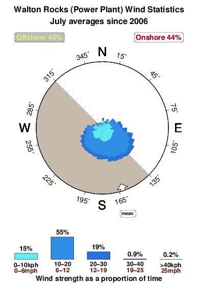


Wind stats for Walton Rocks (Power Plant): see the variation in direction and stength by month.
surffoto's uit
de galerijContourlijnen: Wegen & Rivieren: Kies een surflokatie uit het menu 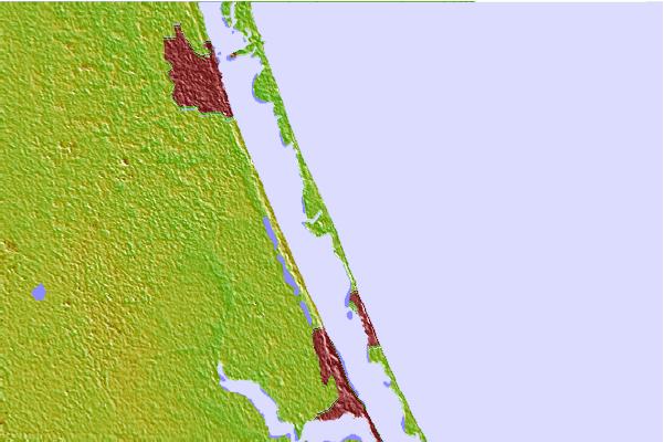

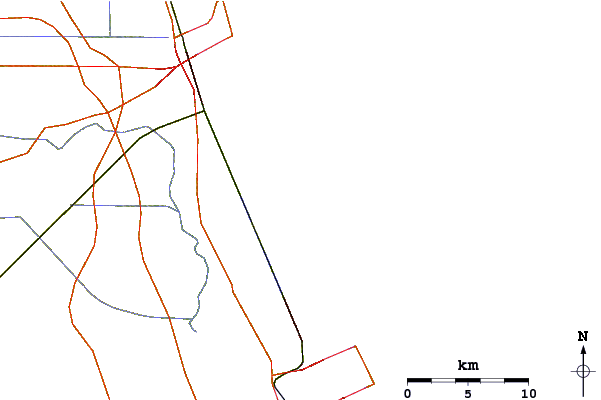
Gebruik deze reliëfkaart om naar de surfspots en de getijdenstations van Florida - North toe te gaan, in de buurt van Walton Rocks (Power Plant).
Andere Dichtbijzijnde Surflocaties van Walton Rocks (Power Plant):
(klik op locatienaam voor meer informatie)- Closest Locatie7 mi
- Second closest Locatie8 mi
- Third closest Locatie11 mi
- Fourth closest Locatie12 mi
- Fifth closest Locatie17 mi
Dichtstbijzijnde golfboeien bij Walton Rocks (Power Plant):
- Closest golfboei14 mi
- Second closest golfboei75 mi
- Third closest golfboei81 mi
- Fourth closest golfboei89 mi
- Fifth closest golfboei152 mi
Getijdenstations in de buurt van Walton Rocks (Power Plant):
- Closest getijdenstationAnkonan River2 mi
- Second closest getijdenstationEden, Nettles Islandn River4 mi
- Third closest getijdenstationIndian River Estates4 mi
- Fourth closest getijdenstationJensen Beachn River8 mi
- Fifth closest getijdenstationNorth Fork, Saint Lucie River9 mi
Airports
- The closest passenger airport to Walton Rocks (Power Plant) is Vero Beach Muni Airport (VRB) in USA, 38 km (24 miles) away (directly).
- The second nearest airport to Walton Rocks (Power Plant) is Palm Beach International (West Palm Beach) Airport (PBI), also in USA, 75 km (47 miles) away.
- Third is Palm Beach Co Park (West Palm Beach) Airport (LNA) in USA, 85 km (53 miles) away.
- Melbourne International Airport (MLB) in USA is 93 km (58 miles) away.
- Patrick Afb (Coco Beach) Airport (COF), also in USA is the fifth nearest airport to Walton Rocks (Power Plant) and is 105 km (65 miles) away.
- /breaks/Walton-Rocks/forecasts/latest


 Nearest