
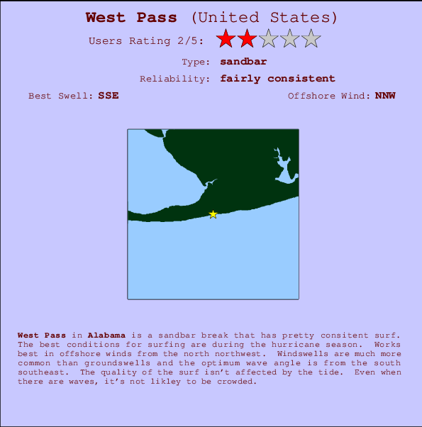
West Pass Surf Guide
West Pass in Alabama is an exposed sandbar break that has reasonably consistent surf. The favoured conditions for surfing are during the hurricane season. The best wind direction is from the north northwest. Most of the surf comes fis in the form of windswells and the best wave direction is from the south southeast. Good surf at all stages of the tide. Rarely crowded here.
West Pass Spot Info
| Type: | Rating: | Reliability: | Todays Sea Temp*: |
|---|---|---|---|
| fairly consistent | 29.8°C*ocean temperature recorded from satellite |
Surfing West Pass:
The best conditions reported for surf at West Pass occur when a South-southeast swell combines with an offshore wind direction from the North-northwest.
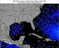
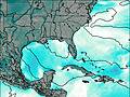
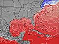
Voorspelde Golfenergie (Kracht): 12 uur

West Pass Surf:
Friday, 17 July 2026, 05:51 Local time| Friday 17 | ||||
| 4AM | 7AM | 10AM | 1PM | |
| Wave (m) | ||||
| Periode (s) | 6 | 6 | 6 | 5 |
| Wind (km/h) | ||||
| Wind | cross- off |
off | off | cross- off |
- /breaks/West-Pass/forecasts/latest
West Pass Surf Guide
West Pass in Alabama is an exposed sandbar break that has reasonably consistent surf. The favoured conditions for surfing are during the hurricane season. The best wind direction is from the north northwest. Most of the surf comes fis in the form of windswells and the best wave direction is from the south southeast. Good surf at all stages of the tide. Rarely crowded here.
West Pass Spot Info
Type: Rating: Reliability: Todays Sea Temp*:  Sandbar
 2
2fairly consistent 29.8°C*ocean temperature recorded from satelliteSurfing West Pass:
The best conditions reported for surf at West Pass occur when a South-southeast swell combines with an offshore wind direction from the North-northwest.
Voorspelde Golfenergie (Kracht): 12 uur
Gebruik de tabbladen hierboven om de zeewatertemperatuur bij West Pass te bekijken, foto's van West Pass, West Pass gedetailleerde golfvoorspellingen, wind- en weersvoorspellingen, West Pass webcams, actuele wind in Alabama live weerstations en West Pass getijdenvoorspellingen. De link van United States golfkaarten opent een grote afbeelding van United States en de omliggende zeeën. Deze golfkaarten kunnen worden dynamisch gemaakt worden met de verschillende golfcomponenten, golfenergie, golfperiode, golfhoogte, samen met de wind en weersvoorspellingen, het actuele weer en de zeetoestand volgens golfboeien uit United States, langskomende schepen en weerstations op de kust. Elk voorspelling pagina's voor dit surfstrand zijn voorzien van een wereldwijde en regionale golfzoeker om de beste surfsomstandigheden in het gebied rond West Pass te vinden.
West Pass Surf:
Friday, 17 July 2026, 05:51 Local timeFriday 17 4AM 7AM 10AM 1PM Wave (m) Periode (s) 6 6 6 5 Wind (km/h) Wind cross-
offoff off cross-
off- /breaks/West-Pass/forecasts/latest
- /breaks/West-Pass/forecasts/latest/six_day
West Pass Surf Guide
West Pass in Alabama is an exposed sandbar break that has reasonably consistent surf. The favoured conditions for surfing are during the hurricane season. The best wind direction is from the north northwest. Most of the surf comes fis in the form of windswells and the best wave direction is from the south southeast. Good surf at all stages of the tide. Rarely crowded here.
West Pass Spot Info
Type: Rating: Reliability: Todays Sea Temp*: Sandbar2fairly consistent 29.8°C*ocean temperature recorded from satelliteSurfing West Pass:
The best conditions reported for surf at West Pass occur when a South-southeast swell combines with an offshore wind direction from the North-northwest.
Voorspelde Golfenergie (Kracht): 12 uur
Gebruik de tabbladen hierboven om de zeewatertemperatuur bij West Pass te bekijken, foto's van West Pass, West Pass gedetailleerde golfvoorspellingen, wind- en weersvoorspellingen, West Pass webcams, actuele wind in Alabama live weerstations en West Pass getijdenvoorspellingen. De link van United States golfkaarten opent een grote afbeelding van United States en de omliggende zeeën. Deze golfkaarten kunnen worden dynamisch gemaakt worden met de verschillende golfcomponenten, golfenergie, golfperiode, golfhoogte, samen met de wind en weersvoorspellingen, het actuele weer en de zeetoestand volgens golfboeien uit United States, langskomende schepen en weerstations op de kust. Elk voorspelling pagina's voor dit surfstrand zijn voorzien van een wereldwijde en regionale golfzoeker om de beste surfsomstandigheden in het gebied rond West Pass te vinden.
West Pass Surf:
Friday, 17 July 2026, 05:51 Local timeFriday 17 4AM 7AM 10AM 1PM Wave (m) Periode (s) 6 6 6 5 Wind (km/h) Wind cross-
offoff off cross-
off- /breaks/West-Pass/forecasts/latest
West Pass Surf Guide
West Pass in Alabama is an exposed sandbar break that has reasonably consistent surf. The favoured conditions for surfing are during the hurricane season. The best wind direction is from the north northwest. Most of the surf comes fis in the form of windswells and the best wave direction is from the south southeast. Good surf at all stages of the tide. Rarely crowded here.
West Pass Spot Info
Type: Rating: Reliability: Todays Sea Temp*: Sandbar2fairly consistent 29.8°C*ocean temperature recorded from satelliteSurfing West Pass:
The best conditions reported for surf at West Pass occur when a South-southeast swell combines with an offshore wind direction from the North-northwest.
Voorspelde Golfenergie (Kracht): 12 uur
Gebruik de tabbladen hierboven om de zeewatertemperatuur bij West Pass te bekijken, foto's van West Pass, West Pass gedetailleerde golfvoorspellingen, wind- en weersvoorspellingen, West Pass webcams, actuele wind in Alabama live weerstations en West Pass getijdenvoorspellingen. De link van United States golfkaarten opent een grote afbeelding van United States en de omliggende zeeën. Deze golfkaarten kunnen worden dynamisch gemaakt worden met de verschillende golfcomponenten, golfenergie, golfperiode, golfhoogte, samen met de wind en weersvoorspellingen, het actuele weer en de zeetoestand volgens golfboeien uit United States, langskomende schepen en weerstations op de kust. Elk voorspelling pagina's voor dit surfstrand zijn voorzien van een wereldwijde en regionale golfzoeker om de beste surfsomstandigheden in het gebied rond West Pass te vinden.
West Pass Surf:
Friday, 17 July 2026, 05:51 Local timeFriday 17 4AM 7AM 10AM 1PM Wave (m) Periode (s) 6 6 6 5 Wind (km/h) Wind cross-
offoff off cross-
offTide Times:
Voor Bon Secour, Bon Secour River, Alabama, %{dist} %{km} van %{location}.
VOLGENDE IS OM (lokale tijd) resterende tijd hoog water laag water West Pass Tide Times and Tide Chart
Live Weather:
At Jack Edwards National Airport Gulf Shores (Alabama), 8 km from West Pass.
light winds from the WNW
(km/h)
ClearAir temperature
27°CCurrent weather near West Pass
Buoy Data:
At Orange Beach Buoy, 16 miles from West Pass.
12AM 1AM 2AM 3AM Gegevens Leeftijd 4 hr 3 hr 2 hr 1 hr Golfhoogte (m) 


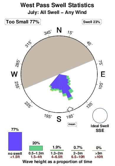
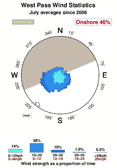
Overall West Pass Surf Consistency and Wind Distribution in July
surffoto's uit
de galerijContourlijnen: Wegen & Rivieren: Kies een surflokatie uit het menu 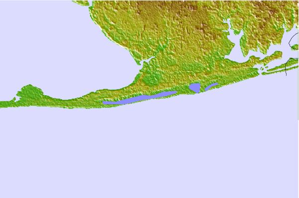

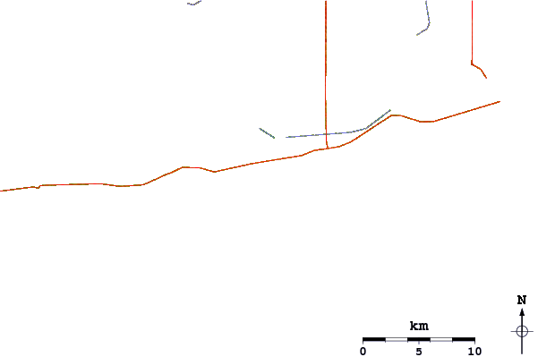
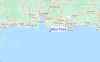
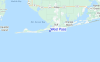
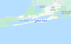
Gebruik deze reliëfkaart om naar de surfspots en de getijdenstations van Alabama toe te gaan, in de buurt van West Pass.
Andere Dichtbijzijnde Surflocaties van West Pass:
(klik op locatienaam voor meer informatie)- Closest Locatie10 mi
- Second closest Locatie11 mi
- Third closest Locatie12 mi
- Fourth closest Locatie20 mi
- Fifth closest Locatie27 mi
Dichtstbijzijnde golfboeien bij West Pass:
- Closest golfboei16 mi
- Second closest golfboei63 mi
- Third closest golfboei144 mi
- Fourth closest golfboei149 mi
- Fifth closest golfboei167 mi
Getijdenstations in de buurt van West Pass:
- Closest getijdenstationBon Secour, Bon Secour River4 mi
- Second closest getijdenstationGulf Shores, ICWW4 mi
- Third closest getijdenstationAlabama Point, Perdido Pass11 mi
- Fourth closest getijdenstationWeeks Bay, Vermilion Bay13 mi
- Fifth closest getijdenstationMobile Point (Fort Morgan)17 mi
Airports
- The closest passenger airport to West Pass is Pensacola Nas Airport (NPA) in USA, 42 km (26 miles) away (directly).
- The second nearest airport to West Pass is Mobile Downtown Airport (BFM), also in USA, 53 km (33 miles) away.
- Third is Pensacola Rgnl Airport (PNS) in USA, 59 km (37 miles) away.
- Mobile Rgnl Airport (MOB) in USA is 70 km (43 miles) away.
- Whiting Fld Nas North (Milton) Airport (NSE), also in USA is the fifth nearest airport to West Pass and is 87 km (54 miles) away.
- /breaks/West-Pass/forecasts/latest


 Nearest