
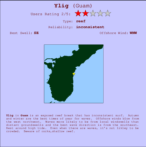
Ylig Surf Guide
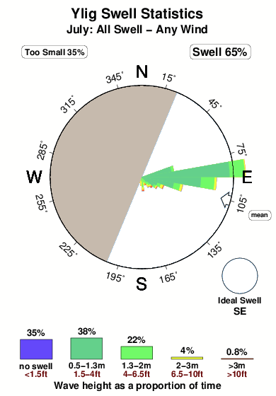
Ylig in - is an exposed reef break that has unreliable waves. Autumn and winter are the best times of year for waves. The best wind direction is from the west northwest. Usually gets local windswells, but groundswells do happen and the best wave direction is from the southeast. There is a left hand reef break. Best around high tide. Unlikely to be too crowded, even when the surf is up. Beware of rocks,shallow reef.
Ylig Spot Info
| Type: | Rating: | Reliability: | Todays Sea Temp*: |
|---|---|---|---|
| inconsistent | 28.8°C*ocean temperature recorded from satellite |
Surfing Ylig:
The best conditions reported for surf at Ylig occur when a Southeast swell combines with an offshore wind direction from the West-northwest.
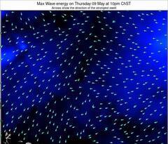
Voorspelde Golfenergie (Kracht): 12 uur
Ylig Surf:
Thursday, 16 July 2026, 02:39 Local time| Thursday 16 | ||||
| 1AM | 4AM | 7AM | 10AM | |
| Wave (m) | ||||
| Periode (s) | 8 | 8 | 8 | 8 |
| Wind (km/h) | ||||
| Wind | cross- off |
cross- off |
cross- off |
cross- off |
- /breaks/Ylig/forecasts/latest
Ylig Surf Guide
Ylig in - is an exposed reef break that has unreliable waves. Autumn and winter are the best times of year for waves. The best wind direction is from the west northwest. Usually gets local windswells, but groundswells do happen and the best wave direction is from the southeast. There is a left hand reef break. Best around high tide. Unlikely to be too crowded, even when the surf is up. Beware of rocks,shallow reef.
Ylig Spot Info
Type: Rating: Reliability: Todays Sea Temp*:  Reef
Reef 2
2inconsistent 28.8°C*ocean temperature recorded from satelliteSurfing Ylig:
The best conditions reported for surf at Ylig occur when a Southeast swell combines with an offshore wind direction from the West-northwest.
Voorspelde Golfenergie (Kracht): 12 uur
Gebruik de tabbladen hierboven om de zeewatertemperatuur bij Ylig te bekijken, foto's van Ylig, Ylig gedetailleerde golfvoorspellingen, wind- en weersvoorspellingen, Ylig webcams, actuele wind in Guam live weerstations en Ylig getijdenvoorspellingen. De link van Guam golfkaarten opent een grote afbeelding van Guam en de omliggende zeeën. Deze golfkaarten kunnen worden dynamisch gemaakt worden met de verschillende golfcomponenten, golfenergie, golfperiode, golfhoogte, samen met de wind en weersvoorspellingen, het actuele weer en de zeetoestand volgens golfboeien uit Guam, langskomende schepen en weerstations op de kust. Elk voorspelling pagina's voor dit surfstrand zijn voorzien van een wereldwijde en regionale golfzoeker om de beste surfsomstandigheden in het gebied rond Ylig te vinden.
Ylig Surf:
Thursday, 16 July 2026, 02:39 Local timeThursday 16 1AM 4AM 7AM 10AM Wave (m) Periode (s) 8 8 8 8 Wind (km/h) Wind cross-
offcross-
offcross-
offcross-
off- /breaks/Ylig/forecasts/latest
- /breaks/Ylig/forecasts/latest/six_day
Ylig Surf Guide
Ylig in - is an exposed reef break that has unreliable waves. Autumn and winter are the best times of year for waves. The best wind direction is from the west northwest. Usually gets local windswells, but groundswells do happen and the best wave direction is from the southeast. There is a left hand reef break. Best around high tide. Unlikely to be too crowded, even when the surf is up. Beware of rocks,shallow reef.
Ylig Spot Info
Type: Rating: Reliability: Todays Sea Temp*: Reef2inconsistent 28.8°C*ocean temperature recorded from satelliteSurfing Ylig:
The best conditions reported for surf at Ylig occur when a Southeast swell combines with an offshore wind direction from the West-northwest.
Voorspelde Golfenergie (Kracht): 12 uur
Gebruik de tabbladen hierboven om de zeewatertemperatuur bij Ylig te bekijken, foto's van Ylig, Ylig gedetailleerde golfvoorspellingen, wind- en weersvoorspellingen, Ylig webcams, actuele wind in Guam live weerstations en Ylig getijdenvoorspellingen. De link van Guam golfkaarten opent een grote afbeelding van Guam en de omliggende zeeën. Deze golfkaarten kunnen worden dynamisch gemaakt worden met de verschillende golfcomponenten, golfenergie, golfperiode, golfhoogte, samen met de wind en weersvoorspellingen, het actuele weer en de zeetoestand volgens golfboeien uit Guam, langskomende schepen en weerstations op de kust. Elk voorspelling pagina's voor dit surfstrand zijn voorzien van een wereldwijde en regionale golfzoeker om de beste surfsomstandigheden in het gebied rond Ylig te vinden.
Ylig Surf:
Thursday, 16 July 2026, 02:39 Local timeThursday 16 1AM 4AM 7AM 10AM Wave (m) Periode (s) 8 8 8 8 Wind (km/h) Wind cross-
offcross-
offcross-
offcross-
off- /breaks/Ylig/forecasts/latest
Ylig Surf Guide
Ylig in - is an exposed reef break that has unreliable waves. Autumn and winter are the best times of year for waves. The best wind direction is from the west northwest. Usually gets local windswells, but groundswells do happen and the best wave direction is from the southeast. There is a left hand reef break. Best around high tide. Unlikely to be too crowded, even when the surf is up. Beware of rocks,shallow reef.
Ylig Spot Info
Type: Rating: Reliability: Todays Sea Temp*: Reef2inconsistent 28.8°C*ocean temperature recorded from satelliteSurfing Ylig:
The best conditions reported for surf at Ylig occur when a Southeast swell combines with an offshore wind direction from the West-northwest.
Voorspelde Golfenergie (Kracht): 12 uur
Gebruik de tabbladen hierboven om de zeewatertemperatuur bij Ylig te bekijken, foto's van Ylig, Ylig gedetailleerde golfvoorspellingen, wind- en weersvoorspellingen, Ylig webcams, actuele wind in Guam live weerstations en Ylig getijdenvoorspellingen. De link van Guam golfkaarten opent een grote afbeelding van Guam en de omliggende zeeën. Deze golfkaarten kunnen worden dynamisch gemaakt worden met de verschillende golfcomponenten, golfenergie, golfperiode, golfhoogte, samen met de wind en weersvoorspellingen, het actuele weer en de zeetoestand volgens golfboeien uit Guam, langskomende schepen en weerstations op de kust. Elk voorspelling pagina's voor dit surfstrand zijn voorzien van een wereldwijde en regionale golfzoeker om de beste surfsomstandigheden in het gebied rond Ylig te vinden.
Ylig Surf:
Thursday, 16 July 2026, 02:39 Local timeThursday 16 1AM 4AM 7AM 10AM Wave (m) Periode (s) 8 8 8 8 Wind (km/h) Wind cross-
offcross-
offcross-
offcross-
offTide Times:
Voor Pago Bay, Guam, %{dist} %{km} van %{location}.
VOLGENDE IS OM (lokale tijd) resterende tijd hoog water laag water Ylig Tide Times and Tide Chart
Live Weather:
At Windward Hills wx, 4 km from Ylig.
calm
(km/h)
dryAir temperature
27°COverall Ylig Surf Consistency and Wind Distribution in July
surffoto's uit
de galerijContourlijnen: Wegen & Rivieren: Kies een surflokatie uit het menu 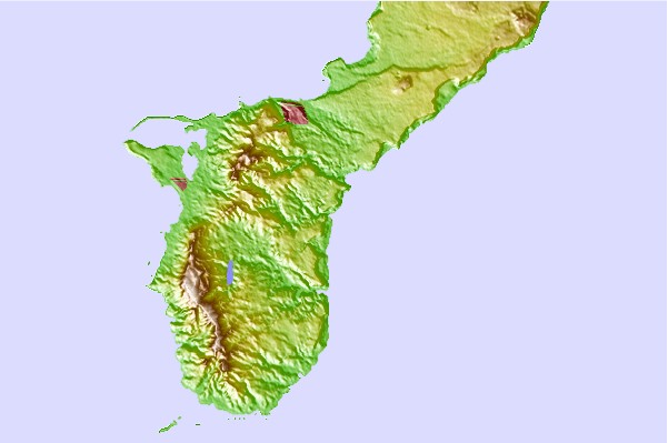
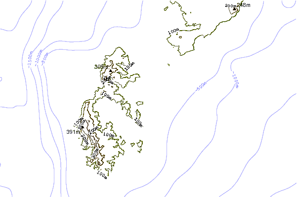
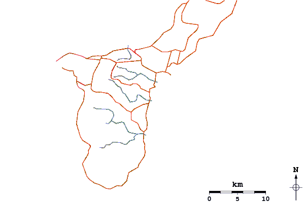
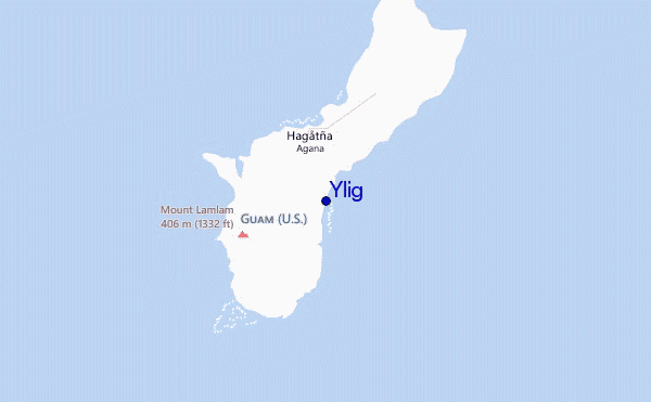
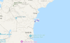
Gebruik deze reliëfkaart om naar de surfspots en de getijdenstations van Guam toe te gaan, in de buurt van Ylig.
Andere Dichtbijzijnde Surflocaties van Ylig:
(klik op locatienaam voor meer informatie)- Closest Locatie3 mi
- Second closest Locatie4 mi
- Third closest Locatie7 mi
- Fourth closest Locatie7 mi
- Fifth closest Locatie7 mi
Dichtstbijzijnde golfboeien bij Ylig:
- Closest golfboei2 mi
- Second closest golfboei21 mi
- Third closest golfboei143 mi
- Fourth closest golfboei751 mi
- Fifth closest golfboei1406 mi
Getijdenstations in de buurt van Ylig:
- Closest getijdenstationPago Bay3 mi
- Second closest getijdenstationTamuning7 mi
- Third closest getijdenstationApra Harbor9 mi
- Fourth closest getijdenstationGuam9 mi
- Fifth closest getijdenstationDededo10 mi
Airports
- The closest passenger airport to Ylig is Guam International (Agana) Airport (GUM) in Mariana Islands, which is 11 km (7 miles) away (directly).
- The second nearest airport to Ylig is Andersen Afb Airport (UAM), also in Mariana Islands, 28 km (17 miles) away.
- The third closest airport is Rota International Airport (ROP), also in Mariana Islands, 101 km (63 miles) away.
- /breaks/Ylig/forecasts/latest


 Nearest