

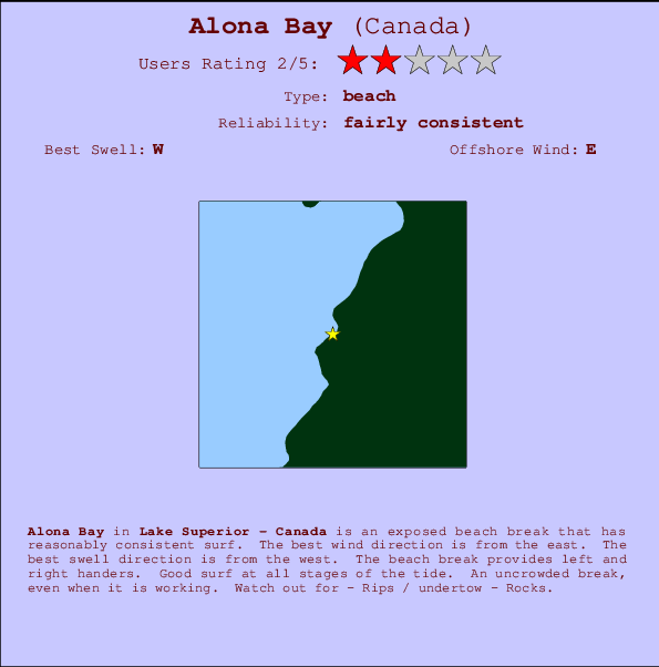
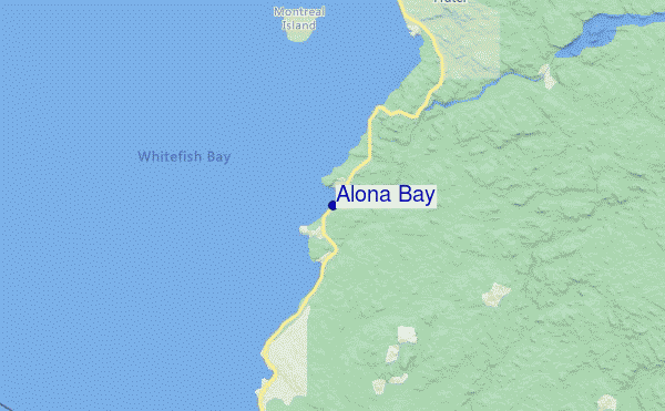
Alona Bay Surf Guide
Alona Bay in Lake Superior - Canada is an exposed beach break that has fairly consistent surf. Offshore winds are from the east. The ideal swell angle is from the west. Waves at the beach are both lefts and rights. Good surf at all stages of the tide. An uncrowded break, even when it is working. Take care of - Rips / undertow - Rocks.
Alona Bay Spot Info
| Type: | Rating: | Reliability: | Todays Sea Temp*: |
|---|---|---|---|
| fairly consistent | 11.3°C*ocean temperature recorded from satellite |
Surfing Alona Bay:
The best conditions reported for surf at Alona Bay occur when a West swell combines with an offshore wind direction from the East.
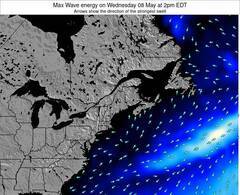
Voorspelde Golfenergie (Kracht): 12 uur
Alona Bay Surf:
Wednesday, 15 July 2026, 10:51 Local time| Wednesday 15 | ||||
| 11AM | 2PM | 5PM | 8PM | |
| Wave (m) | ||||
| Periode (s) | 6 | 4 | 5 | 5 |
| Wind (km/h) | ||||
| Wind | on | on | on | glass |
- /breaks/Alona-Bay/forecasts/latest
Alona Bay Surf Guide
Alona Bay in Lake Superior - Canada is an exposed beach break that has fairly consistent surf. Offshore winds are from the east. The ideal swell angle is from the west. Waves at the beach are both lefts and rights. Good surf at all stages of the tide. An uncrowded break, even when it is working. Take care of - Rips / undertow - Rocks.
Alona Bay Spot Info
Type: Rating: Reliability: Todays Sea Temp*:  Beach
Beach 2
2fairly consistent 11.3°C*ocean temperature recorded from satelliteSurfing Alona Bay:
The best conditions reported for surf at Alona Bay occur when a West swell combines with an offshore wind direction from the East.
Voorspelde Golfenergie (Kracht): 12 uur
Gebruik de tabbladen hierboven om de zeewatertemperatuur bij Alona Bay te bekijken, foto's van Alona Bay, Alona Bay gedetailleerde golfvoorspellingen, wind- en weersvoorspellingen, Alona Bay webcams, actuele wind in Lake Superior live weerstations en Alona Bay getijdenvoorspellingen. De link van Canada golfkaarten opent een grote afbeelding van Canada en de omliggende zeeën. Deze golfkaarten kunnen worden dynamisch gemaakt worden met de verschillende golfcomponenten, golfenergie, golfperiode, golfhoogte, samen met de wind en weersvoorspellingen, het actuele weer en de zeetoestand volgens golfboeien uit Canada, langskomende schepen en weerstations op de kust. Elk voorspelling pagina's voor dit surfstrand zijn voorzien van een wereldwijde en regionale golfzoeker om de beste surfsomstandigheden in het gebied rond Alona Bay te vinden.
Alona Bay Surf:
Wednesday, 15 July 2026, 10:51 Local timeWednesday 15 11AM 2PM 5PM 8PM Wave (m) Periode (s) 6 4 5 5 Wind (km/h) Wind on on on glass - /breaks/Alona-Bay/forecasts/latest
- /breaks/Alona-Bay/forecasts/latest/six_day
Alona Bay Surf Guide
Alona Bay in Lake Superior - Canada is an exposed beach break that has fairly consistent surf. Offshore winds are from the east. The ideal swell angle is from the west. Waves at the beach are both lefts and rights. Good surf at all stages of the tide. An uncrowded break, even when it is working. Take care of - Rips / undertow - Rocks.
Alona Bay Spot Info
Type: Rating: Reliability: Todays Sea Temp*: Beach2fairly consistent 11.3°C*ocean temperature recorded from satelliteSurfing Alona Bay:
The best conditions reported for surf at Alona Bay occur when a West swell combines with an offshore wind direction from the East.
Voorspelde Golfenergie (Kracht): 12 uur
Gebruik de tabbladen hierboven om de zeewatertemperatuur bij Alona Bay te bekijken, foto's van Alona Bay, Alona Bay gedetailleerde golfvoorspellingen, wind- en weersvoorspellingen, Alona Bay webcams, actuele wind in Lake Superior live weerstations en Alona Bay getijdenvoorspellingen. De link van Canada golfkaarten opent een grote afbeelding van Canada en de omliggende zeeën. Deze golfkaarten kunnen worden dynamisch gemaakt worden met de verschillende golfcomponenten, golfenergie, golfperiode, golfhoogte, samen met de wind en weersvoorspellingen, het actuele weer en de zeetoestand volgens golfboeien uit Canada, langskomende schepen en weerstations op de kust. Elk voorspelling pagina's voor dit surfstrand zijn voorzien van een wereldwijde en regionale golfzoeker om de beste surfsomstandigheden in het gebied rond Alona Bay te vinden.
Alona Bay Surf:
Wednesday, 15 July 2026, 10:51 Local timeWednesday 15 11AM 2PM 5PM 8PM Wave (m) Periode (s) 6 4 5 5 Wind (km/h) Wind on on on glass - /breaks/Alona-Bay/forecasts/latest
Alona Bay Surf Guide
Alona Bay in Lake Superior - Canada is an exposed beach break that has fairly consistent surf. Offshore winds are from the east. The ideal swell angle is from the west. Waves at the beach are both lefts and rights. Good surf at all stages of the tide. An uncrowded break, even when it is working. Take care of - Rips / undertow - Rocks.
Alona Bay Spot Info
Type: Rating: Reliability: Todays Sea Temp*: Beach2fairly consistent 11.3°C*ocean temperature recorded from satelliteSurfing Alona Bay:
The best conditions reported for surf at Alona Bay occur when a West swell combines with an offshore wind direction from the East.
Voorspelde Golfenergie (Kracht): 12 uur
Gebruik de tabbladen hierboven om de zeewatertemperatuur bij Alona Bay te bekijken, foto's van Alona Bay, Alona Bay gedetailleerde golfvoorspellingen, wind- en weersvoorspellingen, Alona Bay webcams, actuele wind in Lake Superior live weerstations en Alona Bay getijdenvoorspellingen. De link van Canada golfkaarten opent een grote afbeelding van Canada en de omliggende zeeën. Deze golfkaarten kunnen worden dynamisch gemaakt worden met de verschillende golfcomponenten, golfenergie, golfperiode, golfhoogte, samen met de wind en weersvoorspellingen, het actuele weer en de zeetoestand volgens golfboeien uit Canada, langskomende schepen en weerstations op de kust. Elk voorspelling pagina's voor dit surfstrand zijn voorzien van een wereldwijde en regionale golfzoeker om de beste surfsomstandigheden in het gebied rond Alona Bay te vinden.
Alona Bay Surf:
Wednesday, 15 July 2026, 10:51 Local timeWednesday 15 11AM 2PM 5PM 8PM Wave (m) Periode (s) 6 4 5 5 Wind (km/h) Wind on on on glass Tide Times:
Voor Ship Sands Island, Nunavut, %{dist} %{km} van %{location}.
VOLGENDE IS OM (lokale tijd) resterende tijd hoog water laag water Alona Bay Tide Times and Tide Chart
Live Weather:
At SHIP1019, 54 km from Alona Bay.
light winds from the WNW
(km/h)Air temperature
-°CCurrent weather near Alona Bay
Buoy Data:
At Mackinac Straits West Buoy, 92 miles from Alona Bay.
4AM 5AM 6AM 7AM Gegevens Leeftijd 5 hr 4 hr 3 hr 2 hr Golfhoogte (m) 


surffoto's uit
de galerijContourlijnen: Wegen & Rivieren: Kies een surflokatie uit het menu 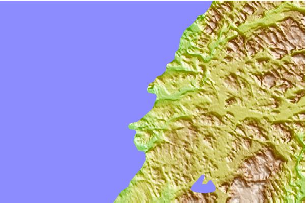
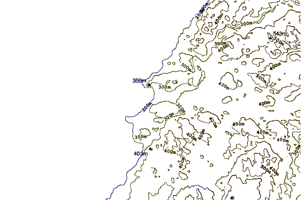
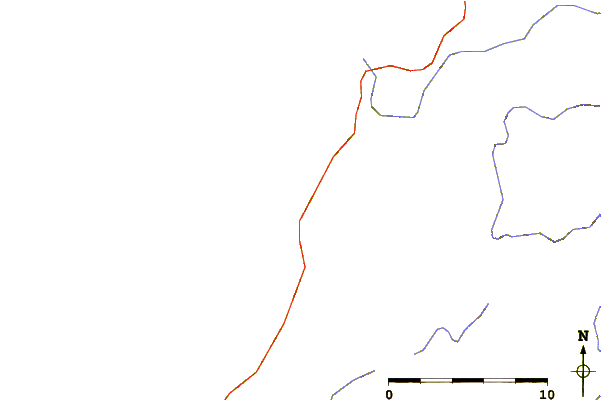
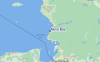
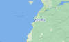
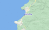
Gebruik deze reliëfkaart om naar de surfspots en de getijdenstations van Lake Superior toe te gaan, in de buurt van Alona Bay.
Andere Dichtbijzijnde Surflocaties van Alona Bay:
(klik op locatienaam voor meer informatie)- Closest Locatie75 mi
- Second closest Locatie76 mi
- Third closest Locatie98 mi
- Fourth closest Locatie138 mi
- Fifth closest Locatie142 mi
Dichtstbijzijnde golfboeien bij Alona Bay:
- Closest golfboei92 mi
- Second closest golfboei93 mi
- Third closest golfboei98 mi
- Fourth closest golfboei123 mi
- Fifth closest golfboei124 mi
Getijdenstations in de buurt van Alona Bay:
- Closest getijdenstationShip Sands Island330 mi
- Second closest getijdenstationMoosonee339 mi
- Third closest getijdenstationRevillon Wharf339 mi
- Fourth closest getijdenstationNicholson Creek341 mi
- Fifth closest getijdenstationSand Head354 mi
Airports
- The nearest passenger airport to Alona Bay is Sault Ste Marie Airport (YAM) in Canada, which is 77 km (48 miles) away (directly).
- The second closest airport to Alona Bay is Chapleau Airport (YLD), also in Canada, 125 km (78 miles) away.
- /breaks/Alona-Bay/forecasts/latest
 Nearest