
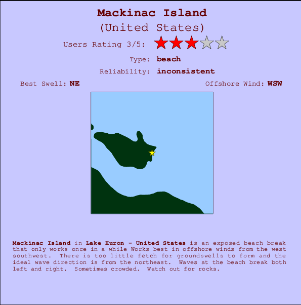
Mackinac Island Surf Guide
Mackinac Island in Lake Huron is an exposed beach break that has unreliable waves Works best in offshore winds from the west southwest. Short period wind swells are the rule and the best wave direction is from the northeast. Waves at the beach are both lefts and rights. A fairly popluar wave that can sometimes get crowded Take care to avoid the rocks.
Mackinac Island Spot Info
| Type: | Rating: | Reliability: | Todays Sea Temp*: |
|---|---|---|---|
| inconsistent | 17.0°C*ocean temperature recorded from satellite |
Surfing Mackinac Island:
The best conditions reported for surf at Mackinac Island occur when a Northeast swell combines with an offshore wind direction from the West-southwest.
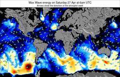
Voorspelde Golfenergie (Kracht): 12 uur

Mackinac Island Surf:
Saturday, 1 August 2026, 20:34 Local time| Saturday 01 | Sun | |||
| 5PM | 8PM | 11PM | 2AM | |
| Wave (m) | ||||
| Periode (s) | - | - | - | - |
| Wind (km/h) | ||||
| Wind | on | on | on | on |
- /breaks/Mackinac-Island/forecasts/latest
Mackinac Island Surf Guide
Mackinac Island in Lake Huron is an exposed beach break that has unreliable waves Works best in offshore winds from the west southwest. Short period wind swells are the rule and the best wave direction is from the northeast. Waves at the beach are both lefts and rights. A fairly popluar wave that can sometimes get crowded Take care to avoid the rocks.
Mackinac Island Spot Info
Type: Rating: Reliability: Todays Sea Temp*:  Beach
Beach 3
3inconsistent 17.0°C*ocean temperature recorded from satelliteSurfing Mackinac Island:
The best conditions reported for surf at Mackinac Island occur when a Northeast swell combines with an offshore wind direction from the West-southwest.
Voorspelde Golfenergie (Kracht): 12 uur
Gebruik de tabbladen hierboven om de zeewatertemperatuur bij Mackinac Island te bekijken, foto's van Mackinac Island, Mackinac Island gedetailleerde golfvoorspellingen, wind- en weersvoorspellingen, Mackinac Island webcams, actuele wind in Lake Huron live weerstations en Mackinac Island getijdenvoorspellingen. De link van United States golfkaarten opent een grote afbeelding van United States en de omliggende zeeën. Deze golfkaarten kunnen worden dynamisch gemaakt worden met de verschillende golfcomponenten, golfenergie, golfperiode, golfhoogte, samen met de wind en weersvoorspellingen, het actuele weer en de zeetoestand volgens golfboeien uit United States, langskomende schepen en weerstations op de kust. Elk voorspelling pagina's voor dit surfstrand zijn voorzien van een wereldwijde en regionale golfzoeker om de beste surfsomstandigheden in het gebied rond Mackinac Island te vinden.
Mackinac Island Surf:
Saturday, 1 August 2026, 20:34 Local timeSaturday 01 Sun 5PM 8PM 11PM 2AM Wave (m) Periode (s) - - - - Wind (km/h) Wind on on on on - /breaks/Mackinac-Island/forecasts/latest
- /breaks/Mackinac-Island/forecasts/latest/six_day
Mackinac Island Surf Guide
Mackinac Island in Lake Huron is an exposed beach break that has unreliable waves Works best in offshore winds from the west southwest. Short period wind swells are the rule and the best wave direction is from the northeast. Waves at the beach are both lefts and rights. A fairly popluar wave that can sometimes get crowded Take care to avoid the rocks.
Mackinac Island Spot Info
Type: Rating: Reliability: Todays Sea Temp*: Beach3inconsistent 17.0°C*ocean temperature recorded from satelliteSurfing Mackinac Island:
The best conditions reported for surf at Mackinac Island occur when a Northeast swell combines with an offshore wind direction from the West-southwest.
Voorspelde Golfenergie (Kracht): 12 uur
Gebruik de tabbladen hierboven om de zeewatertemperatuur bij Mackinac Island te bekijken, foto's van Mackinac Island, Mackinac Island gedetailleerde golfvoorspellingen, wind- en weersvoorspellingen, Mackinac Island webcams, actuele wind in Lake Huron live weerstations en Mackinac Island getijdenvoorspellingen. De link van United States golfkaarten opent een grote afbeelding van United States en de omliggende zeeën. Deze golfkaarten kunnen worden dynamisch gemaakt worden met de verschillende golfcomponenten, golfenergie, golfperiode, golfhoogte, samen met de wind en weersvoorspellingen, het actuele weer en de zeetoestand volgens golfboeien uit United States, langskomende schepen en weerstations op de kust. Elk voorspelling pagina's voor dit surfstrand zijn voorzien van een wereldwijde en regionale golfzoeker om de beste surfsomstandigheden in het gebied rond Mackinac Island te vinden.
Mackinac Island Surf:
Saturday, 1 August 2026, 20:34 Local timeSaturday 01 Sun 5PM 8PM 11PM 2AM Wave (m) Periode (s) - - - - Wind (km/h) Wind on on on on - /breaks/Mackinac-Island/forecasts/latest
Mackinac Island Surf Guide
Mackinac Island in Lake Huron is an exposed beach break that has unreliable waves Works best in offshore winds from the west southwest. Short period wind swells are the rule and the best wave direction is from the northeast. Waves at the beach are both lefts and rights. A fairly popluar wave that can sometimes get crowded Take care to avoid the rocks.
Mackinac Island Spot Info
Type: Rating: Reliability: Todays Sea Temp*: Beach3inconsistent 17.0°C*ocean temperature recorded from satelliteSurfing Mackinac Island:
The best conditions reported for surf at Mackinac Island occur when a Northeast swell combines with an offshore wind direction from the West-southwest.
Voorspelde Golfenergie (Kracht): 12 uur
Gebruik de tabbladen hierboven om de zeewatertemperatuur bij Mackinac Island te bekijken, foto's van Mackinac Island, Mackinac Island gedetailleerde golfvoorspellingen, wind- en weersvoorspellingen, Mackinac Island webcams, actuele wind in Lake Huron live weerstations en Mackinac Island getijdenvoorspellingen. De link van United States golfkaarten opent een grote afbeelding van United States en de omliggende zeeën. Deze golfkaarten kunnen worden dynamisch gemaakt worden met de verschillende golfcomponenten, golfenergie, golfperiode, golfhoogte, samen met de wind en weersvoorspellingen, het actuele weer en de zeetoestand volgens golfboeien uit United States, langskomende schepen en weerstations op de kust. Elk voorspelling pagina's voor dit surfstrand zijn voorzien van een wereldwijde en regionale golfzoeker om de beste surfsomstandigheden in het gebied rond Mackinac Island te vinden.
Mackinac Island Surf:
Saturday, 1 August 2026, 20:34 Local timeSaturday 01 Sun 5PM 8PM 11PM 2AM Wave (m) Periode (s) - - - - Wind (km/h) Wind on on on on Tide Times:
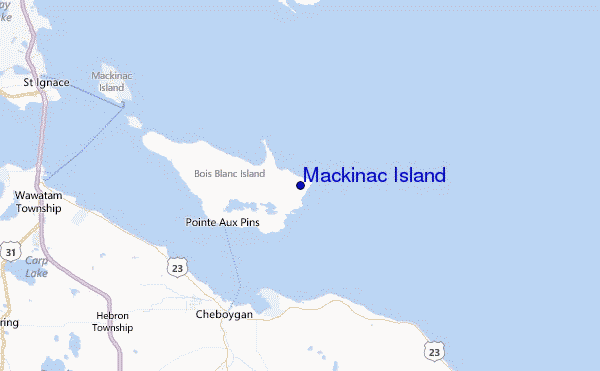
Voor Ship Sands Island, Nunavut, %{dist} %{km} van %{location}.
VOLGENDE IS OM (lokale tijd) resterende tijd hoog water laag water Mackinac Island Tide Times and Tide Chart
Live Weather:
At SHIP600, 8 km from Mackinac Island.
calm
(km/h)
Air temperature
21.6°CCurrent weather near Mackinac Island
Buoy Data:
At Mackinac Straits West Buoy, 20 miles from Mackinac Island.
2PM 3PM 4PM 5PM Gegevens Leeftijd 5 hr 4 hr 3 hr 2 hr Golfhoogte (m) 


surffoto's uit
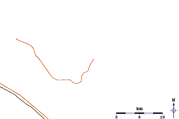
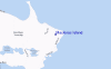
de galerijContourlijnen: Wegen & Rivieren: Kies een surflokatie uit het menu 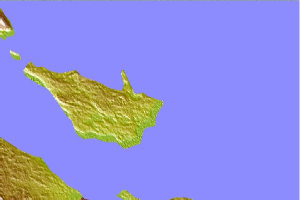
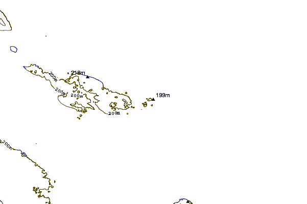
Gebruik deze reliëfkaart om naar de surfspots en de getijdenstations van Lake Huron toe te gaan, in de buurt van Mackinac Island.
Andere Dichtbijzijnde Surflocaties van Mackinac Island:
(klik op locatienaam voor meer informatie)- Closest Locatie88 mi
- Second closest Locatie98 mi
- Third closest Locatie104 mi
- Fourth closest Locatie106 mi
- Fifth closest Locatie136 mi
Dichtstbijzijnde golfboeien bij Mackinac Island:
- Closest golfboei20 mi
- Second closest golfboei43 mi
- Third closest golfboei76 mi
- Fourth closest golfboei80 mi
- Fifth closest golfboei86 mi
Getijdenstations in de buurt van Mackinac Island:
- Closest getijdenstationShip Sands Island406 mi
- Second closest getijdenstationMoosonee418 mi
- Third closest getijdenstationRevillon Wharf418 mi
- Fourth closest getijdenstationNicholson Creek420 mi
- Fifth closest getijdenstationSand Head431 mi
Airports
- The closest passenger airport to Mackinac Island is Sault Ste Marie Airport (YAM) in Canada, which is 80 km (50 miles) away (directly).
- The second nearest airport to Mackinac Island is Gore Bay Manitoulin Airport (YZE), also in Canada, 141 km (88 miles) away.
- The third closest airport is Roscommon Co (Houghton Lake) Airport (HTL) in USA, 158 km (98 miles) away.
- /breaks/Mackinac-Island/forecasts/latest

 Nearest