
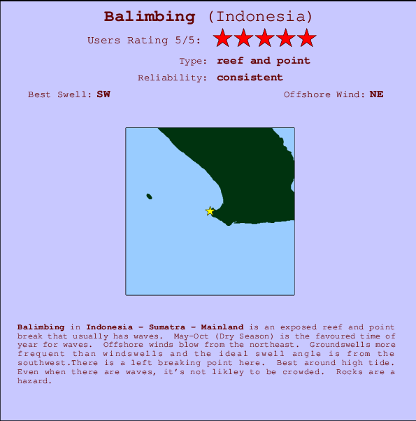
Balimbing Surf Guide
Balimbing in Sumatra is an exposed reef and point break that usually has waves. May-Oct (Dry Season) is the favoured time of year for waves. The best wind direction is from the northeast. Tends to receive distant groundswells and the ideal swell direction is from the southwest.There is a left hand point break here. Best around high tide. Unlikely to be too crowded, even when the surf is up. Rocks are a hazard.
Balimbing Spot Info
| Type: | Rating: | Reliability: | Todays Sea Temp*: |
|---|---|---|---|
| consistent | 28.4°C*ocean temperature recorded from satellite |
Surfing Balimbing:
The best conditions reported for surf at Balimbing occur when a Southwest swell combines with an offshore wind direction from the Northeast.

Voorspelde Golfenergie (Kracht): 12 uur


Balimbing Surf:
Tuesday, 28 July 2026, 12:42 Local time| Tuesday 28 | ||||
| 10AM | 1PM | 4PM | 7PM | |
| Wave (m) | ||||
| Periode (s) | 9 | 15 | 15 | 9 |
| Wind (km/h) | ||||
| Wind | cross- off |
cross | cross | cross |
- /breaks/Balimbing/forecasts/latest
Balimbing Surf Guide
Balimbing in Sumatra is an exposed reef and point break that usually has waves. May-Oct (Dry Season) is the favoured time of year for waves. The best wind direction is from the northeast. Tends to receive distant groundswells and the ideal swell direction is from the southwest.There is a left hand point break here. Best around high tide. Unlikely to be too crowded, even when the surf is up. Rocks are a hazard.
Balimbing Spot Info
Type: Rating: Reliability: Todays Sea Temp*:  Reef and point
 5
5consistent 28.4°C*ocean temperature recorded from satelliteSurfing Balimbing:
The best conditions reported for surf at Balimbing occur when a Southwest swell combines with an offshore wind direction from the Northeast.
Voorspelde Golfenergie (Kracht): 12 uur
Gebruik de tabbladen hierboven om de zeewatertemperatuur bij Balimbing te bekijken, foto's van Balimbing, Balimbing gedetailleerde golfvoorspellingen, wind- en weersvoorspellingen, Balimbing webcams, actuele wind in Sumatra - Mainland live weerstations en Balimbing getijdenvoorspellingen. De link van Indonesia golfkaarten opent een grote afbeelding van Indonesia en de omliggende zeeën. Deze golfkaarten kunnen worden dynamisch gemaakt worden met de verschillende golfcomponenten, golfenergie, golfperiode, golfhoogte, samen met de wind en weersvoorspellingen, het actuele weer en de zeetoestand volgens golfboeien uit Indonesia, langskomende schepen en weerstations op de kust. Elk voorspelling pagina's voor dit surfstrand zijn voorzien van een wereldwijde en regionale golfzoeker om de beste surfsomstandigheden in het gebied rond Balimbing te vinden.
Balimbing Surf:
Tuesday, 28 July 2026, 12:42 Local timeTuesday 28 10AM 1PM 4PM 7PM Wave (m) Periode (s) 9 15 15 9 Wind (km/h) Wind cross-
offcross cross cross - /breaks/Balimbing/forecasts/latest
- /breaks/Balimbing/forecasts/latest/six_day
Balimbing Surf Guide
Balimbing in Sumatra is an exposed reef and point break that usually has waves. May-Oct (Dry Season) is the favoured time of year for waves. The best wind direction is from the northeast. Tends to receive distant groundswells and the ideal swell direction is from the southwest.There is a left hand point break here. Best around high tide. Unlikely to be too crowded, even when the surf is up. Rocks are a hazard.
Balimbing Spot Info
Type: Rating: Reliability: Todays Sea Temp*: Reef and point5consistent 28.4°C*ocean temperature recorded from satelliteSurfing Balimbing:
The best conditions reported for surf at Balimbing occur when a Southwest swell combines with an offshore wind direction from the Northeast.
Voorspelde Golfenergie (Kracht): 12 uur
Gebruik de tabbladen hierboven om de zeewatertemperatuur bij Balimbing te bekijken, foto's van Balimbing, Balimbing gedetailleerde golfvoorspellingen, wind- en weersvoorspellingen, Balimbing webcams, actuele wind in Sumatra - Mainland live weerstations en Balimbing getijdenvoorspellingen. De link van Indonesia golfkaarten opent een grote afbeelding van Indonesia en de omliggende zeeën. Deze golfkaarten kunnen worden dynamisch gemaakt worden met de verschillende golfcomponenten, golfenergie, golfperiode, golfhoogte, samen met de wind en weersvoorspellingen, het actuele weer en de zeetoestand volgens golfboeien uit Indonesia, langskomende schepen en weerstations op de kust. Elk voorspelling pagina's voor dit surfstrand zijn voorzien van een wereldwijde en regionale golfzoeker om de beste surfsomstandigheden in het gebied rond Balimbing te vinden.
Balimbing Surf:
Tuesday, 28 July 2026, 12:42 Local timeTuesday 28 10AM 1PM 4PM 7PM Wave (m) Periode (s) 9 15 15 9 Wind (km/h) Wind cross-
offcross cross cross - /breaks/Balimbing/forecasts/latest
Balimbing Surf Guide
Balimbing in Sumatra is an exposed reef and point break that usually has waves. May-Oct (Dry Season) is the favoured time of year for waves. The best wind direction is from the northeast. Tends to receive distant groundswells and the ideal swell direction is from the southwest.There is a left hand point break here. Best around high tide. Unlikely to be too crowded, even when the surf is up. Rocks are a hazard.
Balimbing Spot Info
Type: Rating: Reliability: Todays Sea Temp*: Reef and point5consistent 28.4°C*ocean temperature recorded from satelliteSurfing Balimbing:
The best conditions reported for surf at Balimbing occur when a Southwest swell combines with an offshore wind direction from the Northeast.
Voorspelde Golfenergie (Kracht): 12 uur
Gebruik de tabbladen hierboven om de zeewatertemperatuur bij Balimbing te bekijken, foto's van Balimbing, Balimbing gedetailleerde golfvoorspellingen, wind- en weersvoorspellingen, Balimbing webcams, actuele wind in Sumatra - Mainland live weerstations en Balimbing getijdenvoorspellingen. De link van Indonesia golfkaarten opent een grote afbeelding van Indonesia en de omliggende zeeën. Deze golfkaarten kunnen worden dynamisch gemaakt worden met de verschillende golfcomponenten, golfenergie, golfperiode, golfhoogte, samen met de wind en weersvoorspellingen, het actuele weer en de zeetoestand volgens golfboeien uit Indonesia, langskomende schepen en weerstations op de kust. Elk voorspelling pagina's voor dit surfstrand zijn voorzien van een wereldwijde en regionale golfzoeker om de beste surfsomstandigheden in het gebied rond Balimbing te vinden.
Balimbing Surf:
Tuesday, 28 July 2026, 12:42 Local timeTuesday 28 10AM 1PM 4PM 7PM Wave (m) Periode (s) 9 15 15 9 Wind (km/h) Wind cross-
offcross cross cross Tide Times:
Op Balimbing (0 km).
VOLGENDE IS OM (lokale tijd) resterende tijd hoog water laag water Balimbing Tide Times and Tide Chart
Live Weather:
At Soekarno-Hatta International Airport, 234 km from Balimbing.
moderate winds from the E.(Wind varies from 040 to 130 degs)
(km/h)
Haze -Air temperature
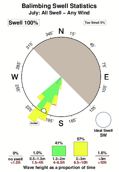
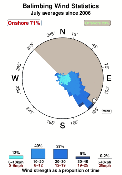
31°COverall Balimbing Surf Consistency and Wind Distribution in July
surffoto's uit
de galerijContourlijnen: Wegen & Rivieren: Kies een surflokatie uit het menu 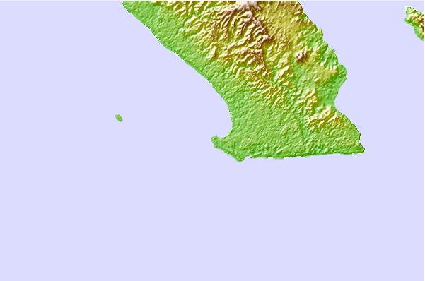
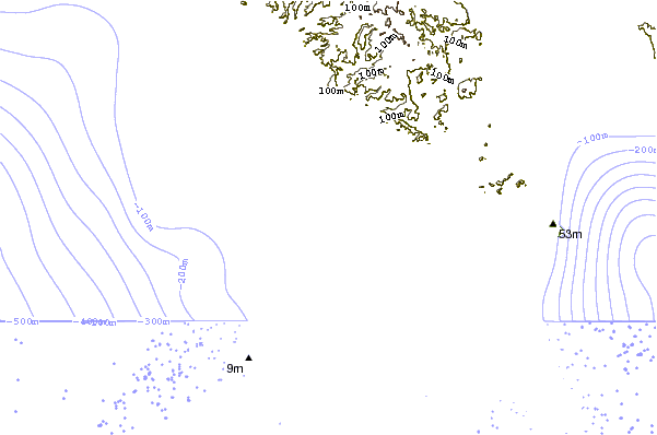
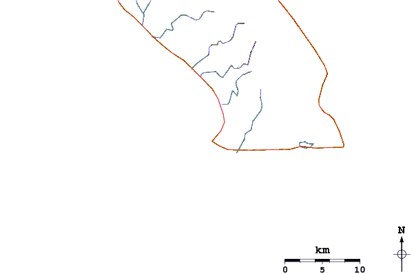
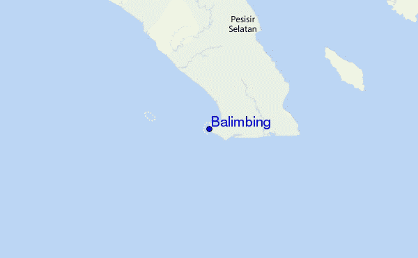
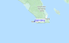
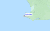
Gebruik deze reliëfkaart om naar de surfspots en de getijdenstations van Sumatra - Mainland toe te gaan, in de buurt van Balimbing.
Andere Dichtbijzijnde Surflocaties van Balimbing:
(klik op locatienaam voor meer informatie)- Closest Locatie26 mi
- Second closest Locatie36 mi
- Third closest Locatie51 mi
- Fourth closest Locatie53 mi
- Fifth closest Locatie57 mi
Dichtstbijzijnde golfboeien bij Balimbing:
- Closest golfboei2474 mi
- Second closest golfboei2542 mi
- Third closest golfboei2574 mi
- Fourth closest golfboei2711 mi
- Fifth closest golfboei2722 mi
Getijdenstations in de buurt van Balimbing:
- Closest getijdenstationBandar Lampung61 mi
- Second closest getijdenstationLabuhan93 mi
- Third closest getijdenstationJakarta152 mi
- Fourth closest getijdenstationPelabuhanratu156 mi
- Fifth closest getijdenstationTanjung Priok160 mi
Airports
- The nearest passenger airport to Balimbing is Soekarno Hatta International (Jakarta) Airport (CGK) in Indonesia, which is 234 km (145 miles) away (directly).
- The second closest airport to Balimbing is Pondok Cabe (Jakarta) Airport (PCB), also in Indonesia, 249 km (155 miles) away.
- /breaks/Balimbing/forecasts/latest


 Nearest