
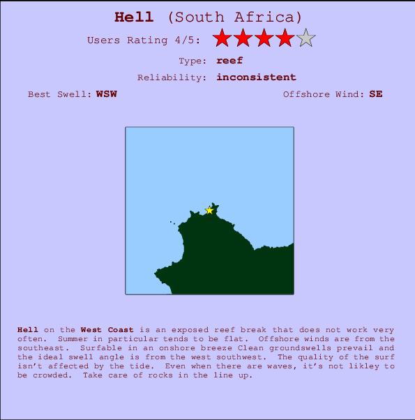
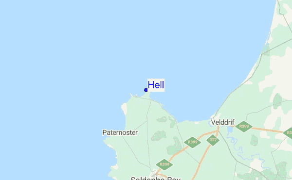
Hell Surf Guide
Hell in Western Cape is an exposed reef break that has inconsistent surf. Summer in particular tends to be flat. The best wind direction is from the southeast. Able to handle light onshore wind Most of the surf here comes from groundswells and the ideal swell direction is from the west southwest.. The quality of the surf isn't affected by the tide. Even when there are waves, it's not likley to be crowded. Watch out for rocks.
Hell Spot Info
| Type: | Rating: | Reliability: | Todays Sea Temp*: |
|---|---|---|---|
| inconsistent | 13.4°C*ocean temperature recorded from satellite |
Surfing Hell:
The best conditions reported for surf at Hell occur when a West-southwest swell combines with an offshore wind direction from the Southeast.
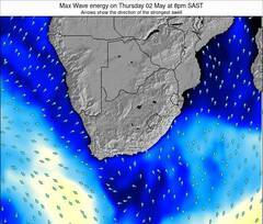
Voorspelde Golfenergie (Kracht): 12 uur
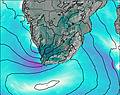

Hell Surf:
Wednesday, 15 July 2026, 21:56 Local time| Wed | Thursday 16 | |||
| 11PM | 2AM | 5AM | 8AM | |
| Wave (m) | ||||
| Periode (s) | 14 | 14 | 14 | 13 |
| Wind (km/h) | ||||
| Wind | off | cross- off |
off | cross- off |
- /breaks/Hell/forecasts/latest
Hell Surf Guide
Hell in Western Cape is an exposed reef break that has inconsistent surf. Summer in particular tends to be flat. The best wind direction is from the southeast. Able to handle light onshore wind Most of the surf here comes from groundswells and the ideal swell direction is from the west southwest.. The quality of the surf isn't affected by the tide. Even when there are waves, it's not likley to be crowded. Watch out for rocks.
Hell Spot Info
Type: Rating: Reliability: Todays Sea Temp*:  Reef
Reef 4
4inconsistent 13.4°C*ocean temperature recorded from satelliteSurfing Hell:
The best conditions reported for surf at Hell occur when a West-southwest swell combines with an offshore wind direction from the Southeast.
Voorspelde Golfenergie (Kracht): 12 uur
Gebruik de tabbladen hierboven om de zeewatertemperatuur bij Hell te bekijken, foto's van Hell, Hell gedetailleerde golfvoorspellingen, wind- en weersvoorspellingen, Hell webcams, actuele wind in West Coast live weerstations en Hell getijdenvoorspellingen. De link van South Africa golfkaarten opent een grote afbeelding van South Africa en de omliggende zeeën. Deze golfkaarten kunnen worden dynamisch gemaakt worden met de verschillende golfcomponenten, golfenergie, golfperiode, golfhoogte, samen met de wind en weersvoorspellingen, het actuele weer en de zeetoestand volgens golfboeien uit South Africa, langskomende schepen en weerstations op de kust. Elk voorspelling pagina's voor dit surfstrand zijn voorzien van een wereldwijde en regionale golfzoeker om de beste surfsomstandigheden in het gebied rond Hell te vinden.
Hell Surf:
Wednesday, 15 July 2026, 21:56 Local timeWed Thursday 16 11PM 2AM 5AM 8AM Wave (m) Periode (s) 14 14 14 13 Wind (km/h) Wind off cross-
offoff cross-
off- /breaks/Hell/forecasts/latest
- /breaks/Hell/forecasts/latest/six_day
Hell Surf Guide
Hell in Western Cape is an exposed reef break that has inconsistent surf. Summer in particular tends to be flat. The best wind direction is from the southeast. Able to handle light onshore wind Most of the surf here comes from groundswells and the ideal swell direction is from the west southwest.. The quality of the surf isn't affected by the tide. Even when there are waves, it's not likley to be crowded. Watch out for rocks.
Hell Spot Info
Type: Rating: Reliability: Todays Sea Temp*: Reef4inconsistent 13.4°C*ocean temperature recorded from satelliteSurfing Hell:
The best conditions reported for surf at Hell occur when a West-southwest swell combines with an offshore wind direction from the Southeast.
Voorspelde Golfenergie (Kracht): 12 uur
Gebruik de tabbladen hierboven om de zeewatertemperatuur bij Hell te bekijken, foto's van Hell, Hell gedetailleerde golfvoorspellingen, wind- en weersvoorspellingen, Hell webcams, actuele wind in West Coast live weerstations en Hell getijdenvoorspellingen. De link van South Africa golfkaarten opent een grote afbeelding van South Africa en de omliggende zeeën. Deze golfkaarten kunnen worden dynamisch gemaakt worden met de verschillende golfcomponenten, golfenergie, golfperiode, golfhoogte, samen met de wind en weersvoorspellingen, het actuele weer en de zeetoestand volgens golfboeien uit South Africa, langskomende schepen en weerstations op de kust. Elk voorspelling pagina's voor dit surfstrand zijn voorzien van een wereldwijde en regionale golfzoeker om de beste surfsomstandigheden in het gebied rond Hell te vinden.
Hell Surf:
Wednesday, 15 July 2026, 21:56 Local timeWed Thursday 16 11PM 2AM 5AM 8AM Wave (m) Periode (s) 14 14 14 13 Wind (km/h) Wind off cross-
offoff cross-
off- /breaks/Hell/forecasts/latest
Hell Surf Guide
Hell in Western Cape is an exposed reef break that has inconsistent surf. Summer in particular tends to be flat. The best wind direction is from the southeast. Able to handle light onshore wind Most of the surf here comes from groundswells and the ideal swell direction is from the west southwest.. The quality of the surf isn't affected by the tide. Even when there are waves, it's not likley to be crowded. Watch out for rocks.
Hell Spot Info
Type: Rating: Reliability: Todays Sea Temp*: Reef4inconsistent 13.4°C*ocean temperature recorded from satelliteSurfing Hell:
The best conditions reported for surf at Hell occur when a West-southwest swell combines with an offshore wind direction from the Southeast.
Voorspelde Golfenergie (Kracht): 12 uur
Gebruik de tabbladen hierboven om de zeewatertemperatuur bij Hell te bekijken, foto's van Hell, Hell gedetailleerde golfvoorspellingen, wind- en weersvoorspellingen, Hell webcams, actuele wind in West Coast live weerstations en Hell getijdenvoorspellingen. De link van South Africa golfkaarten opent een grote afbeelding van South Africa en de omliggende zeeën. Deze golfkaarten kunnen worden dynamisch gemaakt worden met de verschillende golfcomponenten, golfenergie, golfperiode, golfhoogte, samen met de wind en weersvoorspellingen, het actuele weer en de zeetoestand volgens golfboeien uit South Africa, langskomende schepen en weerstations op de kust. Elk voorspelling pagina's voor dit surfstrand zijn voorzien van een wereldwijde en regionale golfzoeker om de beste surfsomstandigheden in het gebied rond Hell te vinden.
Hell Surf:
Wednesday, 15 July 2026, 21:56 Local timeWed Thursday 16 11PM 2AM 5AM 8AM Wave (m) Periode (s) 14 14 14 13 Wind (km/h) Wind off cross-
offoff cross-
offTide Times:
Voor Cape St Martin, %{dist} %{km} van %{location}.
VOLGENDE IS OM (lokale tijd) resterende tijd hoog water laag water Hell Tide Times and Tide Chart
Live Weather:
At Cape Columbine, 17 km from Hell.
wind obs. (20 kph from 110 degs) was rejected
(km/h)
no reportAir temperature
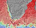
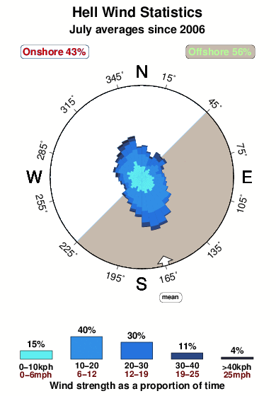
17.9°COverall Hell Surf Consistency and Wind Distribution in July
surffoto's uit
de galerijContourlijnen: Wegen & Rivieren: Kies een surflokatie uit het menu 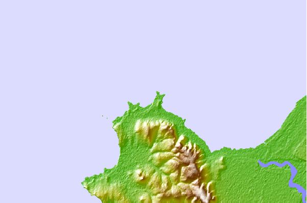
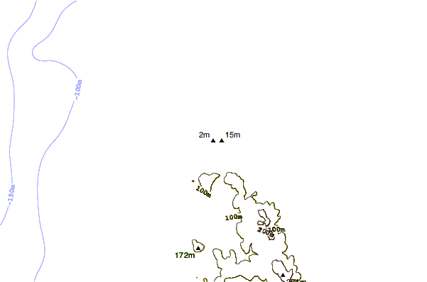
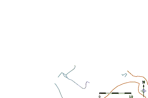
Gebruik deze reliëfkaart om naar de surfspots en de getijdenstations van West Coast toe te gaan, in de buurt van Hell.
Andere Dichtbijzijnde Surflocaties van Hell:
(klik op locatienaam voor meer informatie)- Closest Locatie1 mi
- Second closest Locatie1 mi
- Third closest Locatie1 mi
- Fourth closest Locatie2 mi
- Fifth closest Locatie9 mi
Dichtstbijzijnde golfboeien bij Hell:
- Closest golfboei2546 mi
- Second closest golfboei3911 mi
- Third closest golfboei5029 mi
- Fourth closest golfboei5069 mi
- Fifth closest golfboei5100 mi
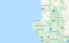
Getijdenstations in de buurt van Hell:
- Closest getijdenstationSaldanha21 mi
- Second closest getijdenstationCape Town86 mi
- Third closest getijdenstationKhayelitsha101 mi
- Fourth closest getijdenstationHermanus139 mi
- Fifth closest getijdenstationMosselbaai262 mi
Airports
- The nearest passenger airport to Hell is Cape Town International Airport (CPT) in South Africa, which is 152 km (94 miles) away (directly).
- The second closest airport to Hell is Springbok Airport (SBU), also in South Africa, 336 km (209 miles) away.
- /breaks/Hell/forecasts/latest


 Nearest